


May 4 Chilly And Wet Weekend: Live Radar
Saturday May 4 Morning Report May the 4th Be With You! There is a definite change in the Force we all will notice this morning. A band of rain has…
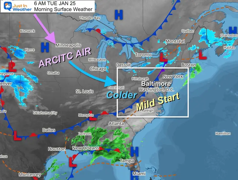
Tuesday January 25 – Morning Report
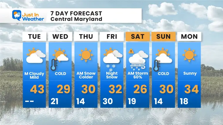
The mildest air of the week will be with us for part of today. The next cold front will arrive around lunchtime and then allow the return of arctic air.
Then we set up yet another Coastal Storm. There will be a Nor’easter developing Friday night into Saturday. Again, it has not formed yet and will not until Friday morning. So plotting how close and the impact for us is still tough. I have the latest info and my notes below.
The story today is the cold front. This will be the 4th arctic boundary this month! Each prior one pushed a low temperature of 15ºF at BWI on January 4, 16, and 22. There will be two more chances to drop even lower this week.
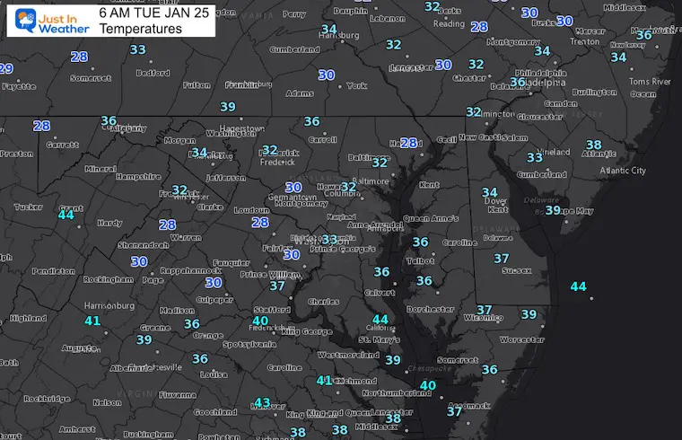
While we begin in the 30s, check out the large pool of Below Zero numbers across the Northern Plains. That is heading our way, but will modify a little when it arrives tomorrow.
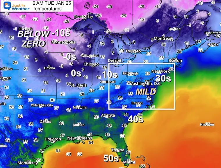
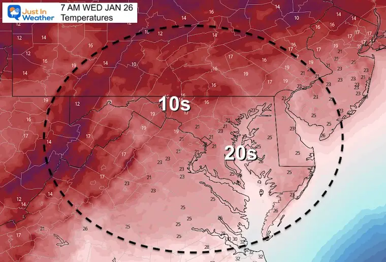
Temps this morning are mild and are higher than they will be by tomorrow afternoon (hint-hint).
Temp shroud reach the max for the day around lunchtime in Central Maryland and Delmarva.
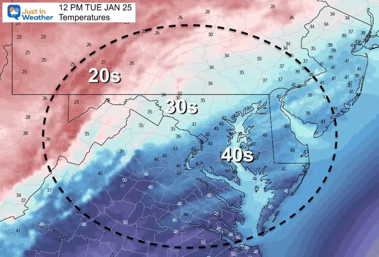
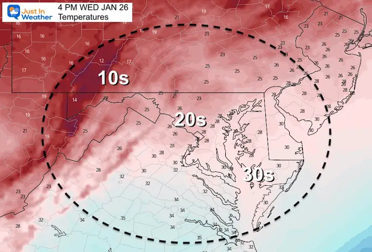
Winds will pick up in the afternoon as temps fall quickly through the 30s. Then bottom out in the teens and lower 20s by tomorrow morning.
TODAY January 25
Normal Low in Baltimore: 25ºF
Record 0ºF in 1897
Normal High in Baltimore: 42ºF
Record 75ºF 1967
Here is a look at the European ECWMF and American GFS Models. There are many more models, but these are the two bog ones!
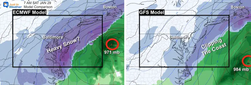
Compare the development
This model was farther out to sea with a weaker Low Pressure just one day ago. Now it has pulled back west with a much stronger storm. The rapid intensification is shown with a closed Low that ‘retrogrades’ or pulls west and nearly stalls south of Long Island on Saturday. IF this verifies, it would bring more snow to our Mid Atlantic Cities AND pound New England with double-digit snow totals.
This model was the stronger and closer one just one day ago. It has flipped a bit, and is less consistent now with this solution. Here is shows the developing Low farther off the coast and not as deep with the central Low Pressure.
We still see some light snow for inland Mid Atlantic. This is with the smaller part that will reach the coast and help ‘phase’ to feed into that new coastal Low.
There reason this is less impressive is due to timing. It speeds up the initial piece by 6 to 10 hours. That would lead to development farther east. However, it still brings a strong storm to eastern New England on Saturday.
I will have a closer look with the latest info in my afternoon report.
Faith in the Flakes…


Last Winter Recap: My Old Outlook And Your Grades Of My Storm Forecasts


