Tuesday January 25 2022
12 PM Update
We are still in a longer range time frame for the potential weaken snow storm on the US East Coast. At this point, we trust the physics of the atmosphere to develop a storm that has not formed yet. The Computer Models do that, with a varied approach to how it may evolved, which is why the solutions are not always the same.
With a little more than three days to go, the best approach now is with caution and simply watching for subtle trends. We still have to give proper attention to the arctic air settling in Wednesday, and how that might impact the next storm.
This report leans a little stronger and closer to the coast, slightly increasing the snow potential.
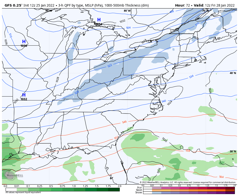
This brief update is about the American GFS Model. This has performed well with prior events this month, but has fluctuated quite a bit with this storm. It has shown an underwhelming outlook farther offshore than the European Model (see below).
Timing: Friday night to Saturday morning.
If You Want More Snow, This Is For You
Here’s a comparison to the prior model run from overnight.
We get a model update every six hours. The most recent one Tuesday morning brings the Low Pressure a little closer to the coast, with a slightly stronger central Low Pressure. The image on the left shows the expansion of moderate to heavy snow on Delmarva, with more snow expanding west of the Bay.

Storm Animation:
7 AM Friday to 7 PM Saturday
This is NOT showing a major event for us, and keeps the steady snow on Delmarva. But the trend is increasing the snow potential.
The impact on New England remains high.
EVENING UPDATE
Last Comparison Of European To GFS
This is form last night, and we can see the ECMWF was much more robust for a Mid Atlantic storm to impact the cities, while the GFS was farther away. The new Euro will be available this afternoon.
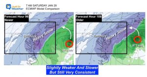
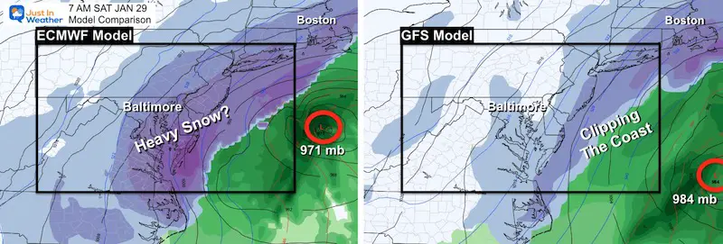
Saturday Morning Model Comparison
Here is the prior look at the European ECWMF and American GFS Models. There are many more models, but these are the two bog ones!
- They have flipped with impact for us, with the Euro now the big hitter, while the GFS is farther east and not as strong.
- Both bring snow Friday night, but the full impact splits when the storm hits full swing.
- The GFS had outperformed two big events this month, but has been less consistent with this event given this new info. Up until yesterday it has been showing more snow inland…
Here’s how I view this:
Confident:
- Storm will form (Friday)
- Light Snow (for us) Friday Night
- Big Snowstorm for New England Saturday.
Still Question:
- How close to the coast?
- Saturday Morning: If storm is closer, then how much more snow may fall?
- IT IS TOO EARLY TO TAKE ANY SNOW TOTAL MAOP SERIOUSLY.
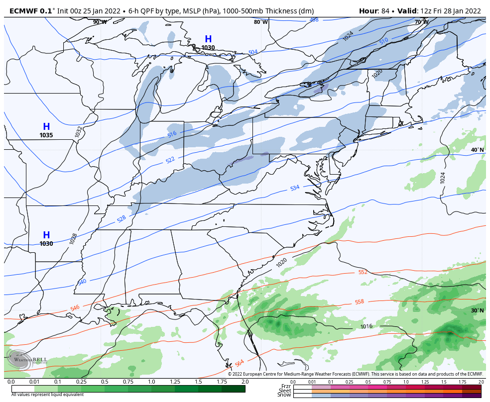
European Model:
Last Night’s Run- Most Aggressive With Snow
This model was farther out to sea with a weaker Low Pressure just one day ago. Now it has pulled back west with a much stronger storm. The rapid intensification is shown with a closed Low that ‘retrogrades’ or pulls west and nearly stalls south of Long Island on Saturday. IF this verifies, it would bring more snow to our Mid Atlantic Cities AND pound New England with double-digit snow totals.
It is too early to make any adjustments, so I am keeping my odds of an impact on the cities at 60%.
This afternoon we can see if the European Model is holding firm or shows any trend to consider.
Optimally, I would like to see more agreement with the solutions.
Starting tomorrow, I will add in looks at other models to compare. I just don’t want to overwhelm you with too much too soon as it can get quite busy with all the maps.
ALSO SEE
ALL FITF GEAR

FITF THUNDERSNOW


Winter Outlook Series:
My Call For Snowfall

Last Winter Recap: My Old Outlook And Your Grades Of My Storm Forecasts


Please share your thoughts, best weather pics/video, or just keep in touch via social media


