Thursday May 2
Morning Report
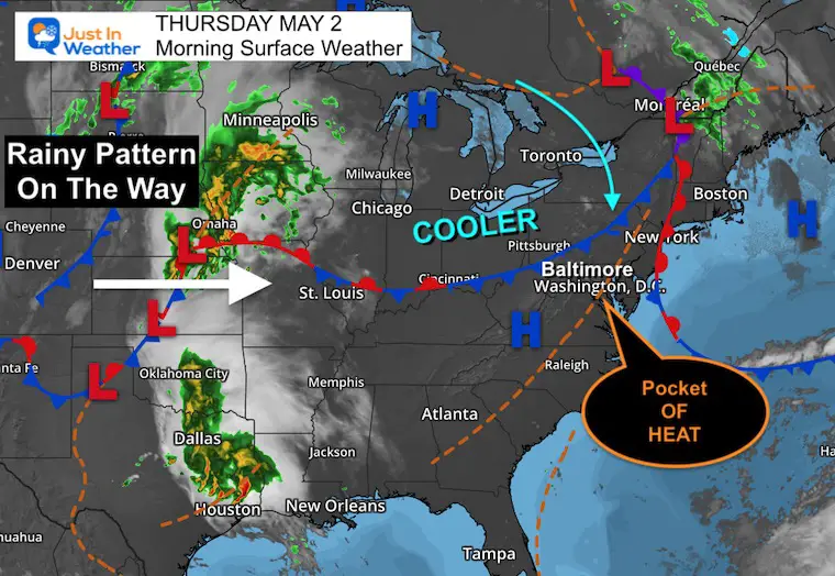
This is one of those days where we get a little surprise. The old air mass is holding strong and will allow one more hot day! So some will get back close to 90ºF.
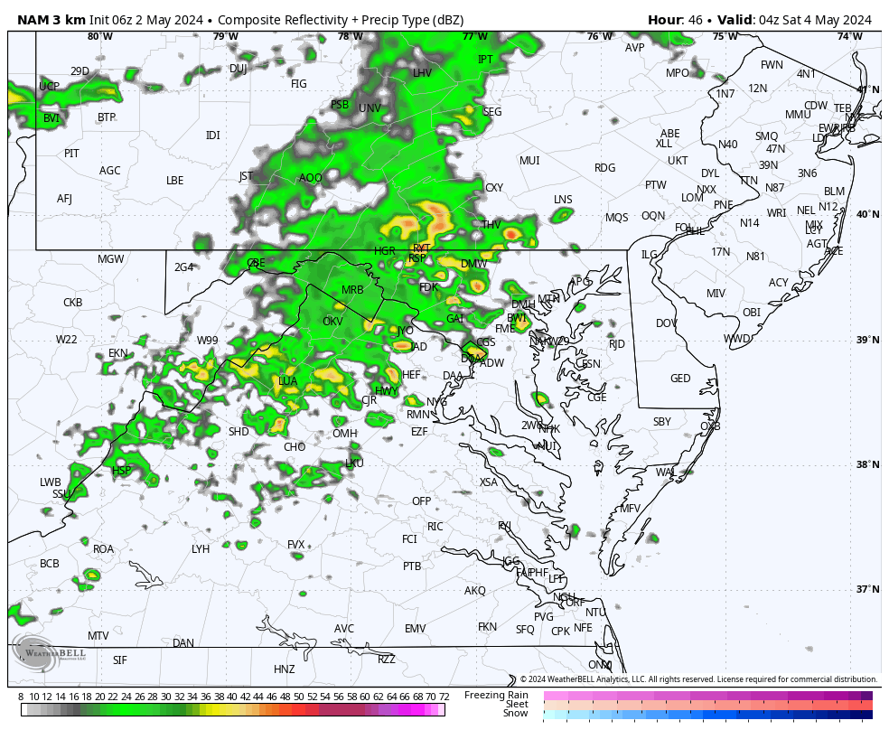
Showers and storms reach the western mountains Friday night, and rain will spread in before sunrise on Saturday. This will mark the cool down and more showers into the weekend.
At this point: Saturday will have showers but won’t be a full washout. I expect more rain on Sunday, especially for the first part of the day.
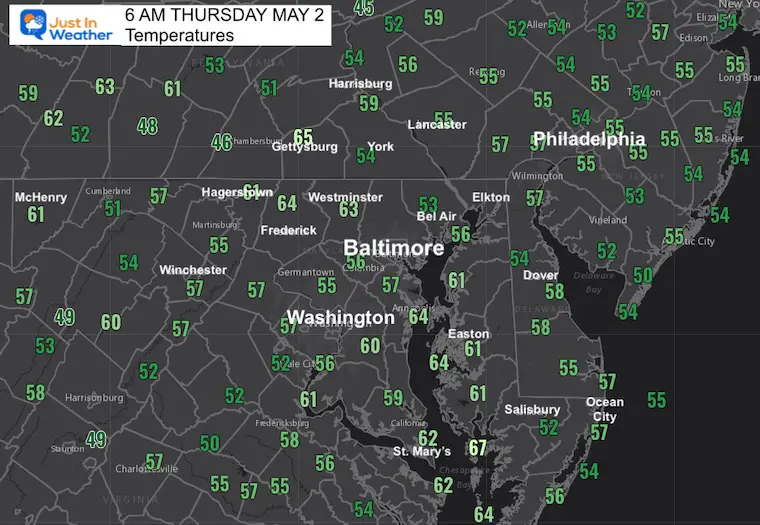
Morning Temperatures
Still mild!
Morning Surface Weather
We will end up with a hotter day than first thought. There has been one more surge of this old air mass, allowing some to get back to near 90ºF. The new cooler Canadian air mass will arrive tonight and lead into the expected cool down and rain into the weekend.
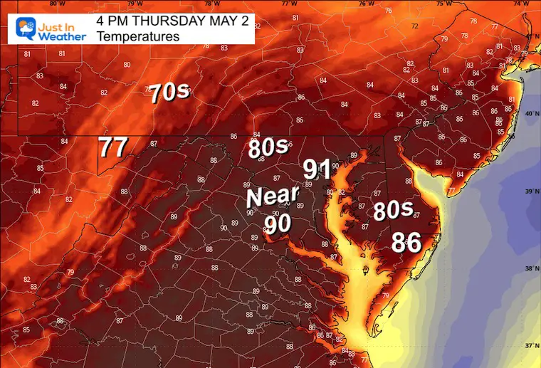
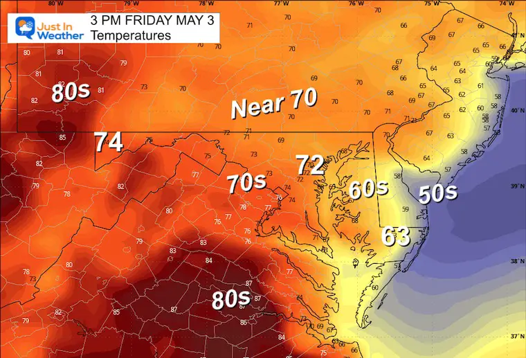
Afternoon Temperatures
Yes, this is much warmer than originally thought. It is all based on the warm air mass surging back north ahead of the next weather system.
CLIMATE DATA: Baltimore
TODAY May 2
Sunrise at 6:06 AM
Sunset at 8:01 PM
Normal Low in Baltimore: 49ºF
Record 36ºF in 1978
Normal High in Baltimore: 72ºF
Record 90ºF 2018
Friday Weather:
The winds will shift as the Canadian Air Mass builds in from the North.
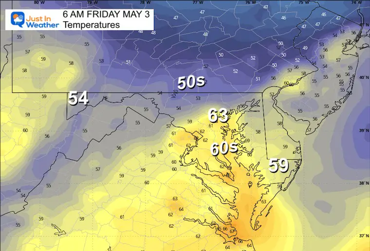
Morning Temperatures
Afternoon Temperatures
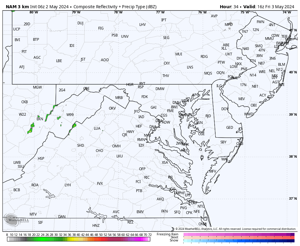
Radar Simulation: Noon to 11 PM
SNAPSHOTS
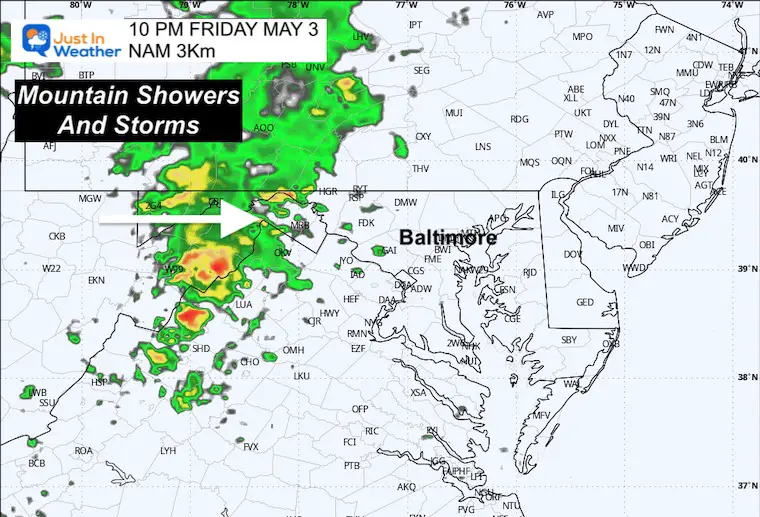
Friday Night
Showers and Thunderstorms reach the mountains.
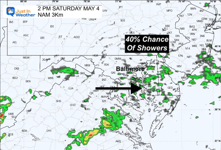
Saturday
Radar Simulation: Midnight to 2 PM
Saturday Afternoon
Morning rain, then leftover showers into the afternoon. This is NOT a washout, but it will feel damp and cooler, with more showers popping up at any time.
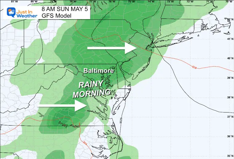
Sunday
The morning is likely to start wet and last into the middle of the day, perhaps the afternoon. This is subject to change, but it will be the ‘wetter’ day of the weekend.
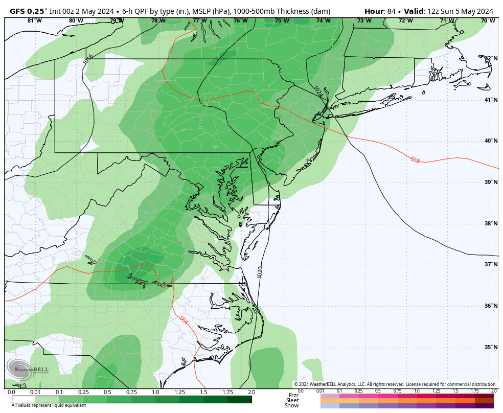
Storm Simulation: Sunday to Wednesday
The next weather system will bring late-day storms to the mountains on Friday and then spread showers on Saturday. At this point, if we can consider a ‘washout,’ it will be Sunday, which will affect outdoor plans.
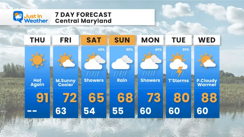
7 Day Forecast
The gradual cooling will bottom out this weekend. While we see showers both days, Saturday will bring scattered showers. On Sunday, we can expect more steady rain and perhaps what could be considered a washout for outdoor plans.
STEM Assemblies/In School Fields Trips Are Back
Click to see more and ‘Book’ a visit to your school

Please share your thoughts and best weather pics/videos, or just keep in touch via social media
RESTATING MY MESSAGE ABOUT DYSLEXIA
I am aware there are some spelling and grammar typos and occasional other glitches. I take responsibility for my mistakes and even the computer glitches I may miss. I have made a few public statements over the years, but if you are new here, you may have missed it: I have dyslexia and found out during my second year at Cornell University. It didn’t stop me from getting my meteorology degree and being the first to get the AMS CBM in the Baltimore/Washington region.
One of my professors told me that I had made it that far without knowing and to not let it be a crutch going forward. That was Mark Wysocki, and he was absolutely correct! I do miss my mistakes in my own proofreading. The autocorrect spell check on my computer sometimes does an injustice to make it worse. I also can make mistakes in forecasting. No one is perfect at predicting the future. All of the maps and information are accurate. The ‘wordy’ stuff can get sticky.
There has been no editor who can check my work while writing and to have it ready to send out in a newsworthy timeline. Barbara Werner is a member of the web team that helps me maintain this site. She has taken it upon herself to edit typos when she is available. That could be AFTER you read this. I accept this and perhaps proves what you read is really from me… It’s part of my charm. #FITF


