


April 24 Weather: Some Showers Then Another Push Of Cold Air Followed By Summer Heat Sunday
Wednesday, April 24 Morning Report A milder start today with most areas in the 50s to near 60ºF along parts of the Bay. There is a push of colder air…
Monday January 24 2022
2 PM Update
We continue in a very cold and active winter pattern across the Eastern US. Freezing temperatures reached into Florida this morning and another arctic blast is on the way later this week. This is the coldest we have been in at least 3 years.
The other part of the pattern is about the storm track. I have long held my position in not trust in computer model guidance one week away, as it has routinely shown storms that do not materialize. I call those phantom storms.
Last week we had one for this past weekend. That ended up barely clipping Delmarva and hitting the Carolinas hard with snow and ice.
The next event set for next weekend was yet another I have been skeptical of. My Atmosphere Memory Theory would support a repeat. But something told me to keep this one close. So, I have been showing with caution in my morning reports for a few days.
The reason I have not jumped on this, but also have held it with some cautious attention is this: The storm last weekend did shift northwest at the very last moment. This was evident by the late addition of an ‘advisory’ and verified snow into Delaware.
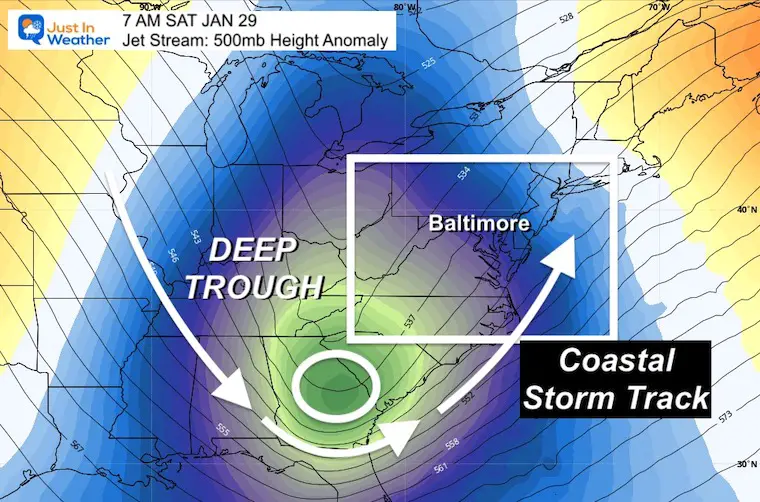
That suggested to me that we could see the next arctic blast verify the jet stream trough and storm track a little west, and closer to the coast as well.
It is a thin line to make or break this event… long before it actual forms.
For now, I am putting my odds of this happening (to affect the cities) at 60%. This is an increase from the 40% chance I gave in my morning forecast.
Let’s take a look.
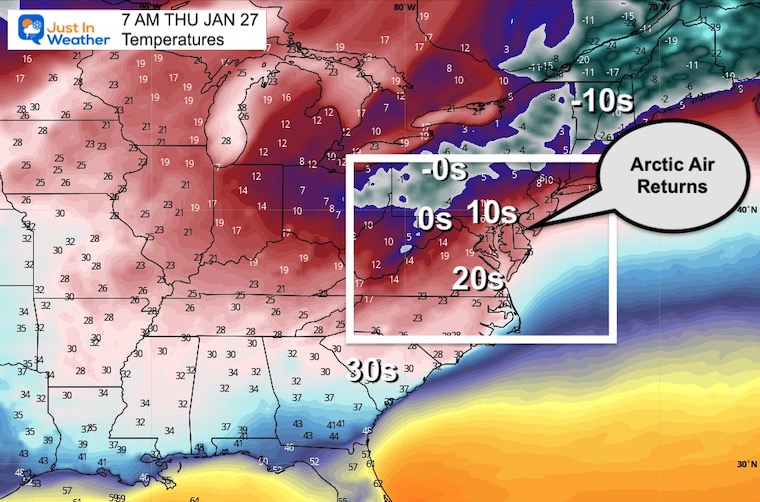
Thursday Morning:
Temps will range for the 0s (single digits), 10s (teens) and 20s across Maryland.
Thursday Morning to Sunday Morning
This animation shows the depending trough in the jet stream between Thursday morning and the weekend. That allows the cold air aloft to tap in southern moisture, and turn up the US East Coast.
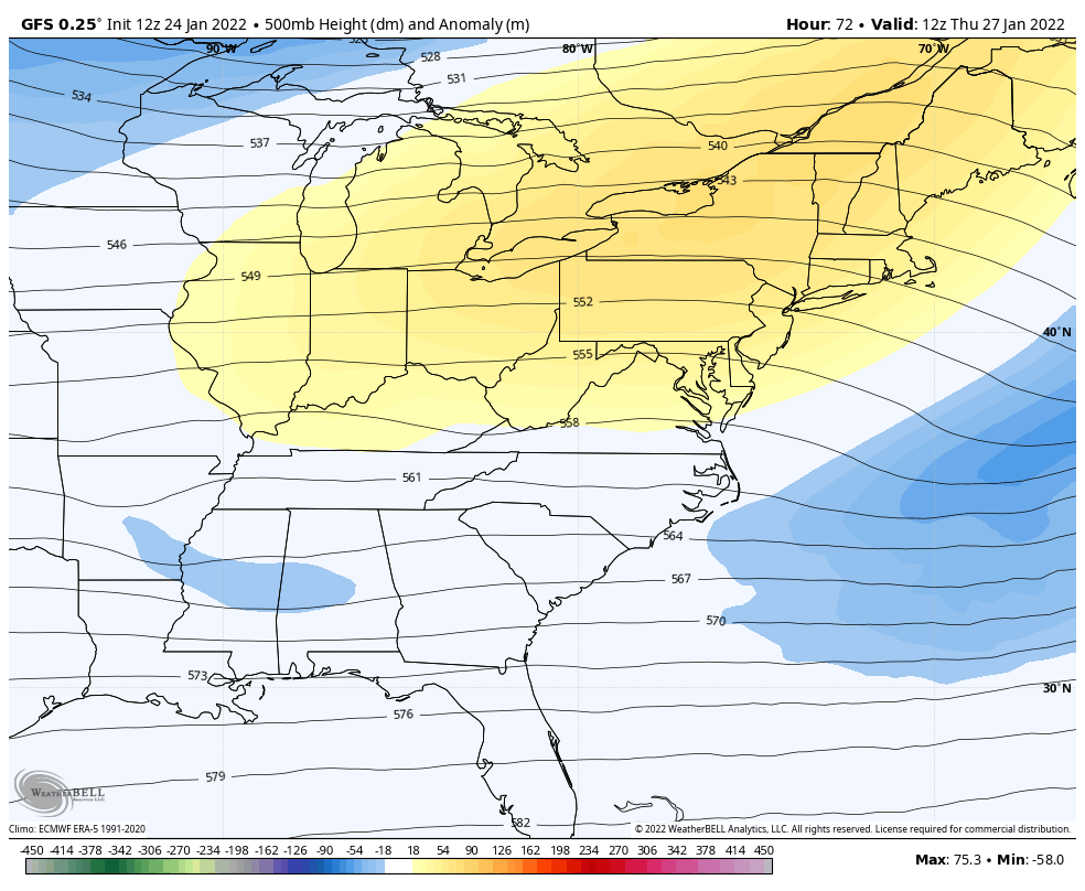
Here we see the very deep trough, or pocket of cold air all the way into Georgia. The return flow rides up the eat coast, giving rise to a phasing storm along the coast.
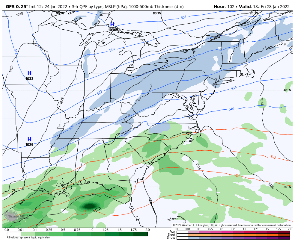
Here are the European (left) ECWMF and American (right) GFS models
The GFS has shown marked improvement this month. Perhaps the expensive upgrades have paid off, as it has out performed the Euro.
That is anther reason I it is time to watch this closer.
They BOTH show the storm, but the GFS is more west/closer to the coast. This would bring more snow Friday night into Saturday. This is actually the aspect it showed last week that performed better.
The difference is about 100 miles, for a storm that has not formed yet. Too close to split hairs at this time.
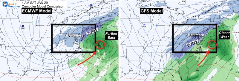
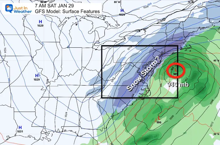
Here we see a very deep 985 mb Low. That is actually substantial and signified a classic impactful coastal Nor’easter… IF THE TRACK SETS UP.
1 PM Friday to 7 PM Saturday
This is how the storm may form… According to this one model.


Last Winter Recap: My Old Outlook And Your Grades Of My Storm Forecasts


