


Soggy Saturday Update: Rain Timeline Through Preakness In Baltimore
Friday, May 17, 2024 As we approach another weekend, we have yet another weather system bringing us rain. This will make 16 of 20 weekends this year with some wet…
Saturday May 4
Morning Report
May the 4th Be With You! There is a definite change in the Force we all will notice this morning. A band of rain has moved into parts of the region overnight. This is part of the cool and damp air mass with a wind from the Atlantic. The result will keep our temperatures cool and periods of rain in place.
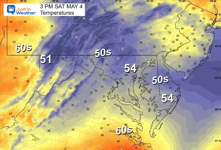
After two days with record highs this past week, thermometers today will remain lower all day than some of the morning lows this last week. That will add to the chilly feel!
So, if you are planning to visit the Towson Festival or another event, dress to stay dry and warm.
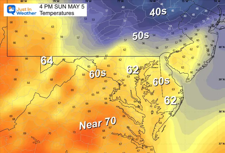
Most of the region is in the 50s, with cooler 40s along the New Jersey coast. This is a signal of the damp east wind, which should keep our temperatures nearly steady most of the day.
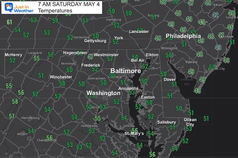
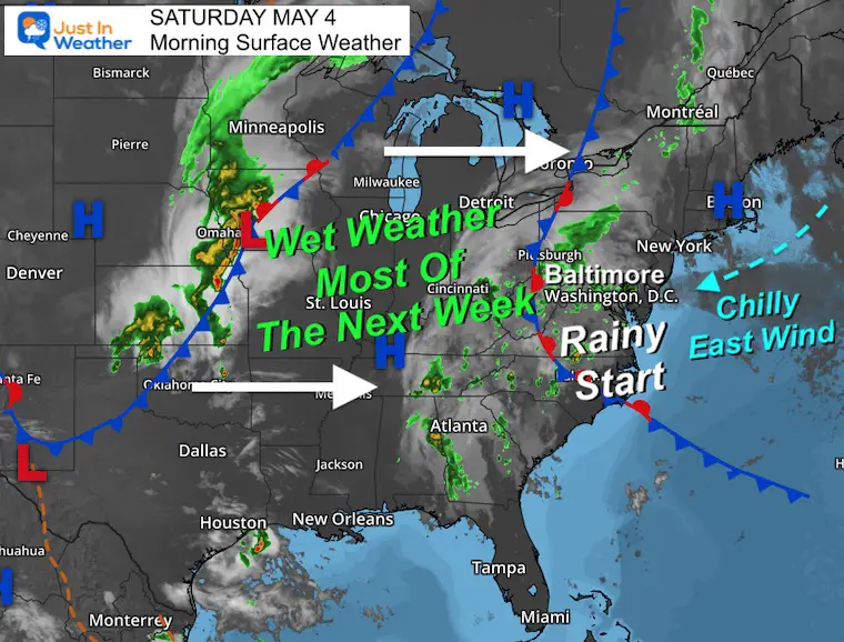
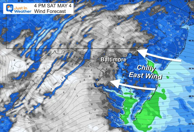
The band of rain today is across a boundary between two stubborn areas of High Pressure. Today, the air mass centered in New England has brought in an East Wind… This is why we are chilly and damp.
The pattern may remain stuck most of the week ahead with more impulses of rain, even with a little warming each day.
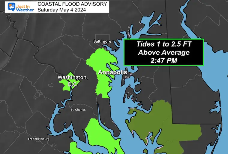
The EAST WIND has again raised the water level in the Chesapeake Bay. At high tide this afternoon and again overnight, the most prone flooding areas are near Annapolis.
Annapolis High Tides:
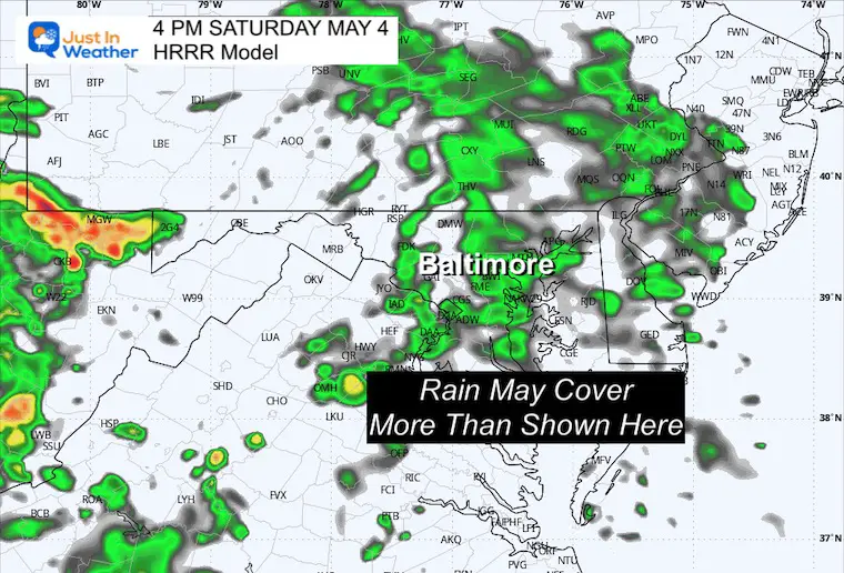
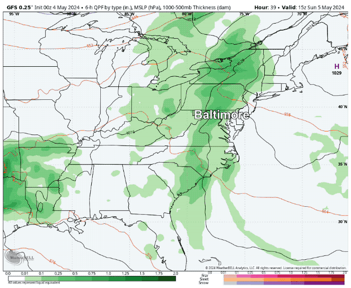
NOTE: This is UNDER-REPRESENTING! We will likely see more rain on radar than shown here.
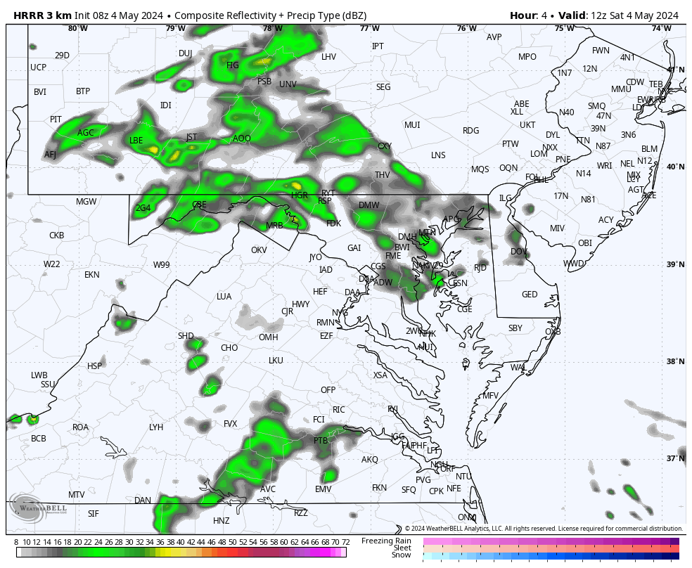
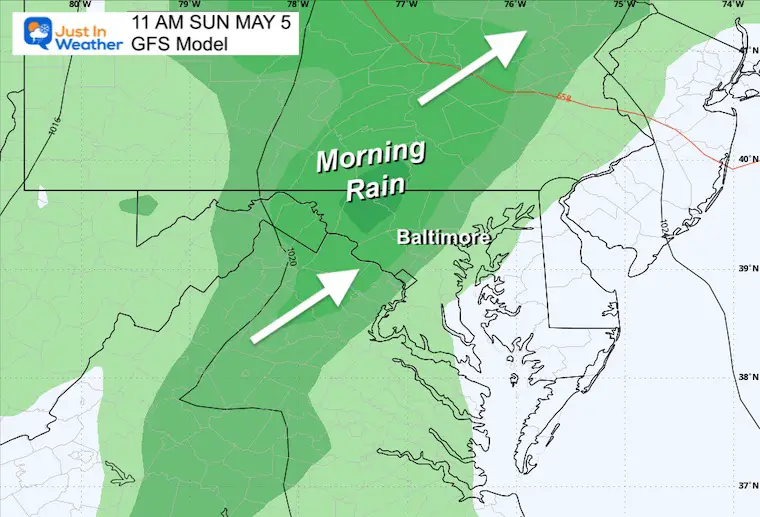
Periods of rain will continue much of the day.
The east wind of 5 to 15 mph will keep the cool and damp air from the Atlantic flowing in.
Remaining Chilly
Sunrise at 6:04 AM
Sunset at 8:03 PM
Normal Low in Baltimore: 50ºF
Record 34ºF in 1957
Normal High in Baltimore: 73ºF
Record 91ºF 2018
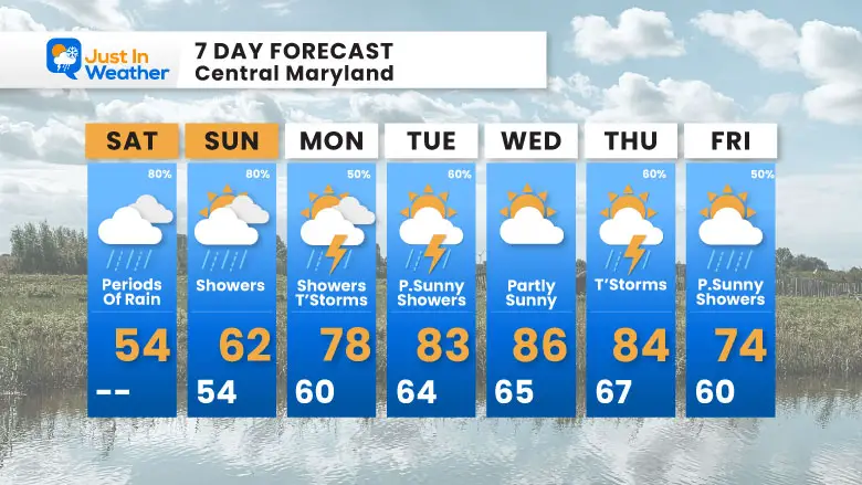
The rainy pattern continues. Sunday may end up more wet west of the Bay, but we can’t rule out showers at any time of the day.
Most of next week will have a chance of rain almost every day.
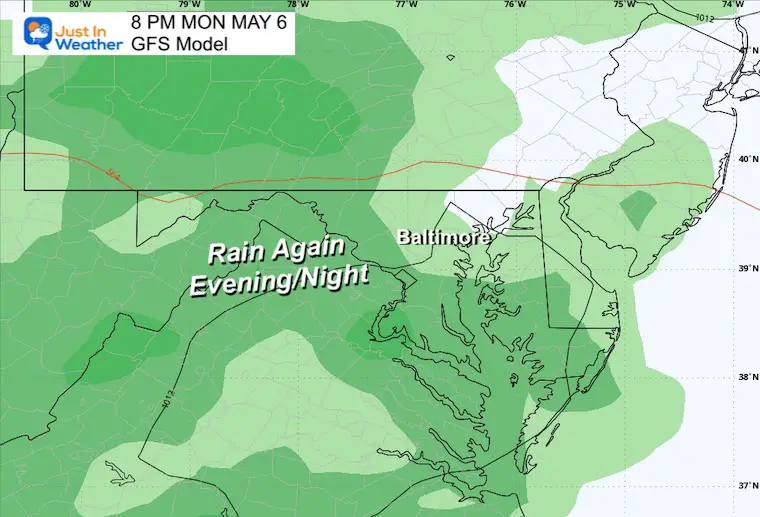
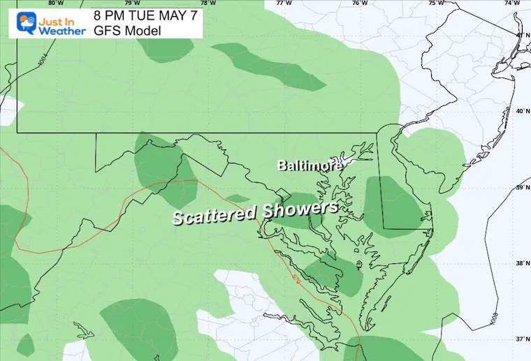
This pattern is still looking wet!
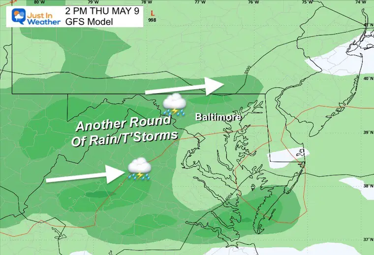
There will be warming next week, which will shift us to more afternoon and evening thunderstorms.
Click to see more and ‘Book’ a visit to your school

I am aware there are some spelling and grammar typos and occasional other glitches. I take responsibility for my mistakes and even the computer glitches I may miss. I have made a few public statements over the years, but if you are new here, you may have missed it: I have dyslexia and found out during my second year at Cornell University. It didn’t stop me from getting my meteorology degree and being the first to get the AMS CBM in the Baltimore/Washington region.
One of my professors told me that I had made it that far without knowing and to not let it be a crutch going forward. That was Mark Wysocki, and he was absolutely correct! I do miss my mistakes in my own proofreading. The autocorrect spell check on my computer sometimes does an injustice to make it worse. I also can make mistakes in forecasting. No one is perfect at predicting the future. All of the maps and information are accurate. The ‘wordy’ stuff can get sticky.
There has been no editor who can check my work while writing and to have it ready to send out in a newsworthy timeline. Barbara Werner is a member of the web team that helps me maintain this site. She has taken it upon herself to edit typos when she is available. That could be AFTER you read this. I accept this and perhaps proves what you read is really from me… It’s part of my charm. #FITF