


May 9 Cooler With Rain And Severe Storm Risk Tonight South
Thursday May 9 Morning Report Today is the first day of the year with sunrise before 6 AM in Baltimore, but we won’t see it. After a high temperature of…
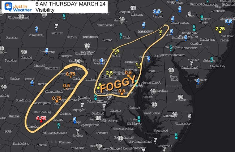
Thursday March 24
Morning Report
The rain last night was heavy in spots. If you had downpours pound on your home and wake you up, there is a chance there is this fog nearby on your ride this morning. The prime areas are around I-95 and I-81, where travel may be extra slow.
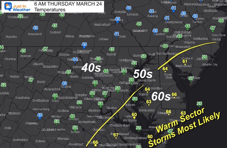
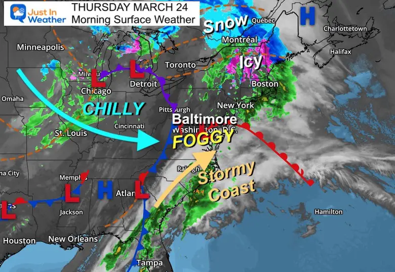
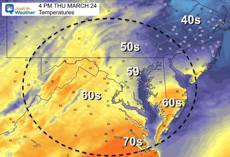
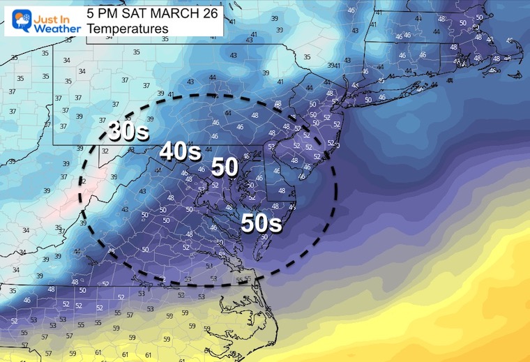
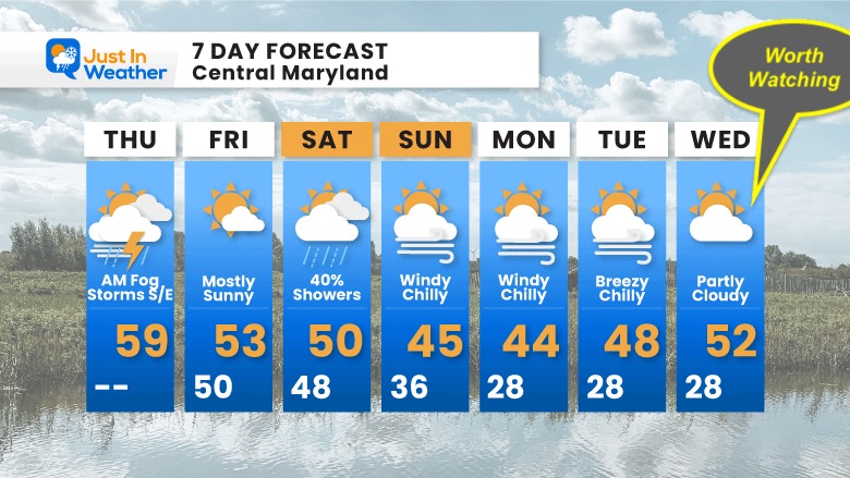
The last push of this storm will bring the best chance of storms today to southern Maryland and Delmarva. We can see the more likely spots where the warmer 60s prevail on thermometers. The start of the Maryland Plunge in Annapolis is on the edge, but I think most of the rough weather will remain south and east of here.
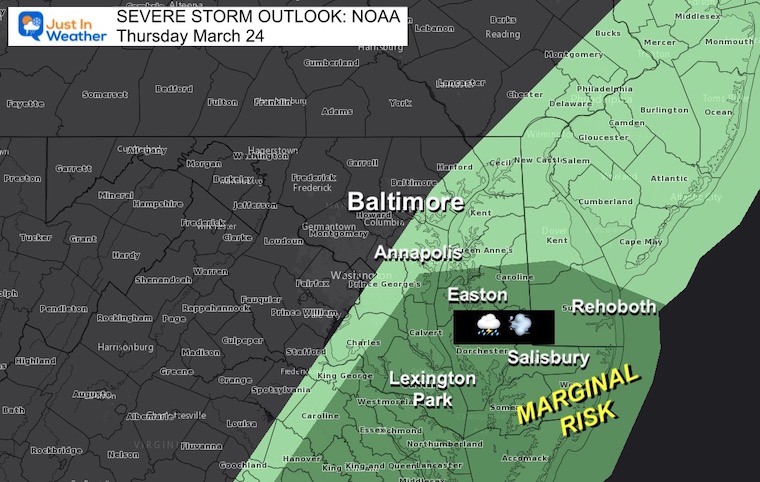
The Marginal Risk (Level 1 of 5) is in place for Southern Maryland and Lower Delmarva)


It looks like the warm air will not fully reach central Maryland. This is what will restrict the storms today, but the result is that it remains on the cooler side.
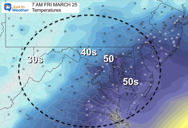
There may be one more push of heavier rain showers this evening and tonight. This will be the cold front marking a distinct change in our weather on the way.
Seasonal Snow: 14.4”
Normal Low in Baltimore: 36ºF
Record 18º F in 1896
Normal High in Baltimore: 56ºF
Record 83ºF 1929
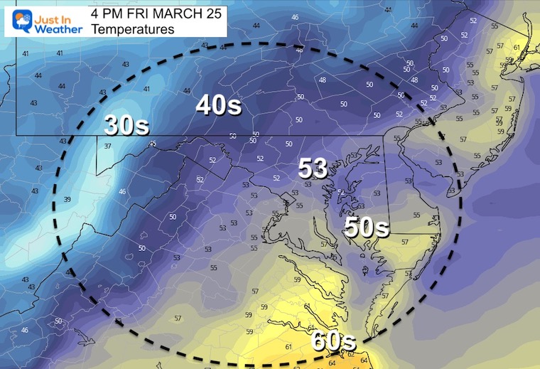
We will see more sunshine and a break in the action…
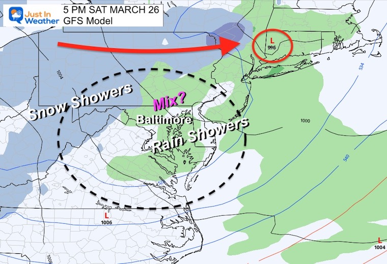
A clipper will be passing through northern PA. This will increase instability showers in the afternoon…
Surface Temperatures will be in the 40s to lower 50s..
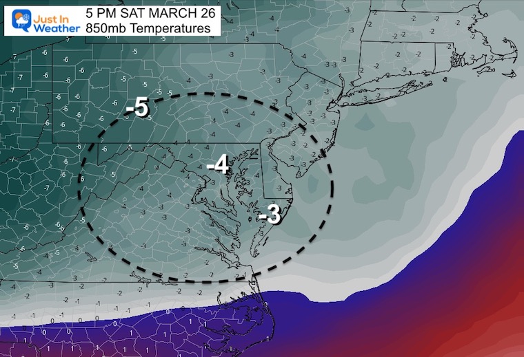
Temperatures Aloft At Cloud Level will be below freezing.
Temperatures here measured in ºC
It may be possible for low based convection to produce some mixed snow, graupel, or small ice pellets.
Still watching Wednesday for a potential ribbon of wintry mix on the edge of that polar impact as it may get pushed out.


Last Winter Recap: My Old Outlook And Your Grades Of My Storm Forecasts


*Disclaimer due to frequent questions:
I am aware there are some spelling and grammar typos. I have made a few public statements over the years, but if you are new here you may have missed it:
I have dyslexia, and found out at my second year at Cornell. I didn’t stop me from getting my meteorology degree, and being first to get the AMS CBM in the Baltimore/Washington region.
I do miss my mistakes in my own proofreading. The autocorrect spell check on my computer sometimes does an injustice to make it worse.
All of the maps and information are accurate. The ‘wordy’ stuff can get sticky.
There is no editor that can check my work when I need it and have it ready to send out in a newsworthy timeline.
I accept this and perhaps proves what you read is really from me…
It’s part of my charm.
#FITF