


Soggy Saturday Update: Rain Timeline Through Preakness In Baltimore
Friday, May 17, 2024 As we approach another weekend, we have yet another weather system bringing us rain. This will make 16 of 20 weekends this year with some wet…
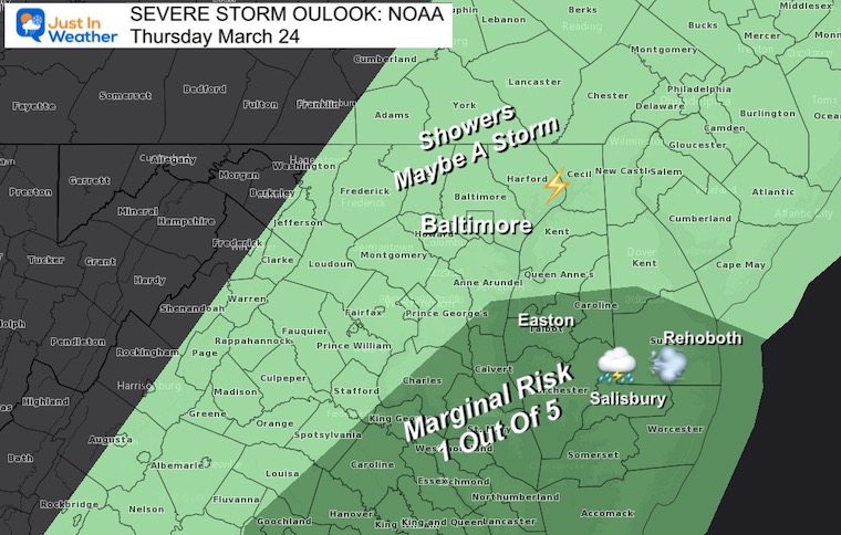
Wednesday March 23 2022
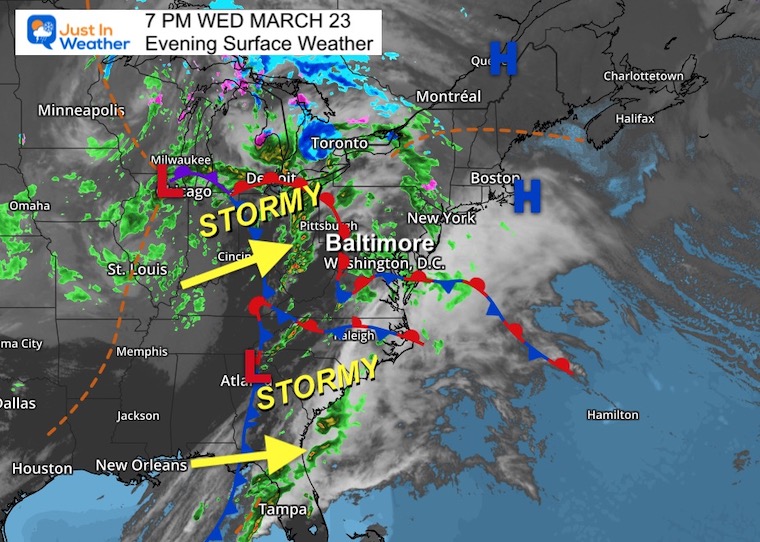
Evening Report
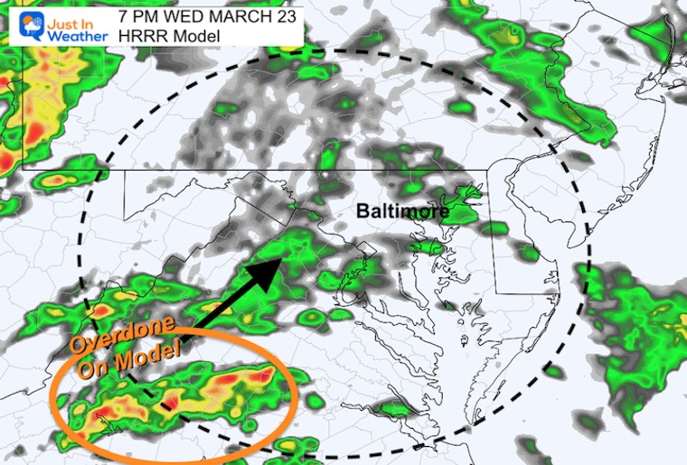
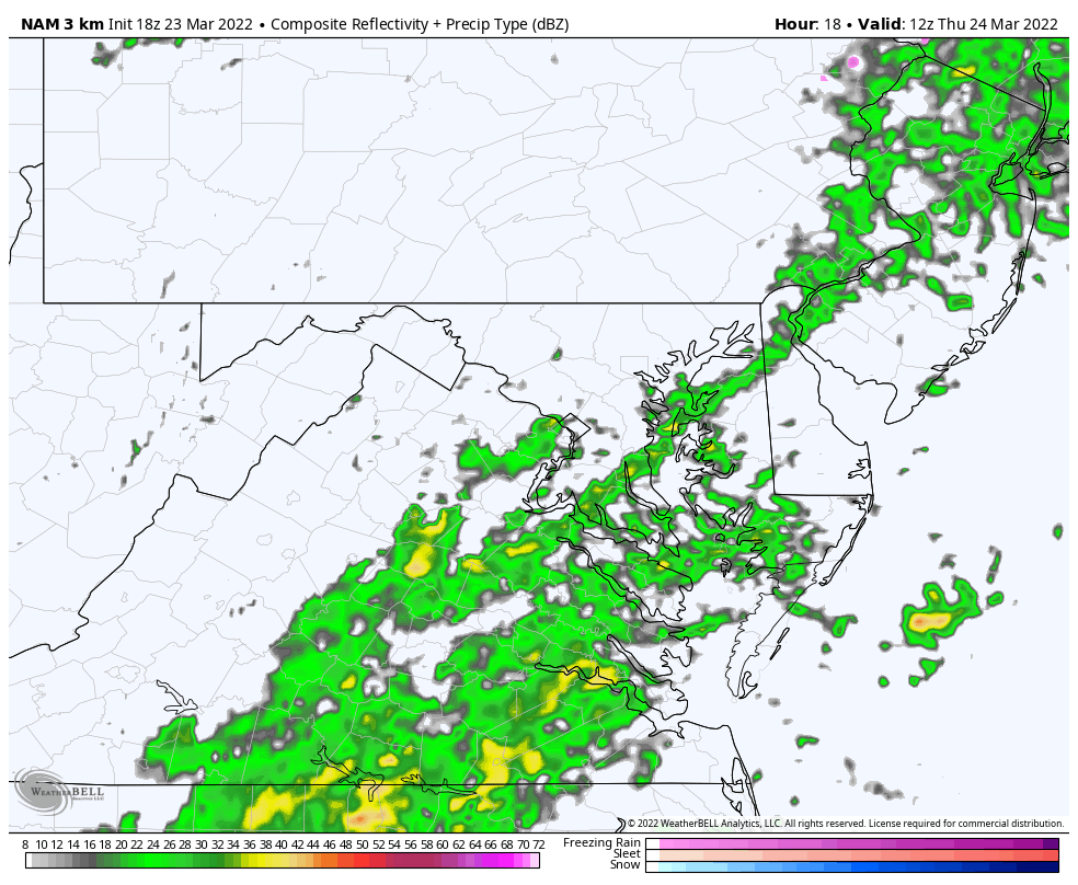
At 7 PM, I compared the actual radar to the plot from the short range HRRR Model. This is one of the simulation I showed in my last report. This process is called nowcasting, to see if the model initialized well and is tracking the new term plot. This helps determine how it may perform farther out in time.
In this case, we want to see if the cluster of storms with downpours and some thunder are possible.
I want to be clear letting you know I DO NOT expect severe weather here. I know there is heightened anxiety with the destructive tornadoes in the Southern US, even in Ohio and western PA today. The energy from this system has been split, but still is still very complex. I am showing this so if we get boomers, you will not be surprised or alarmed.
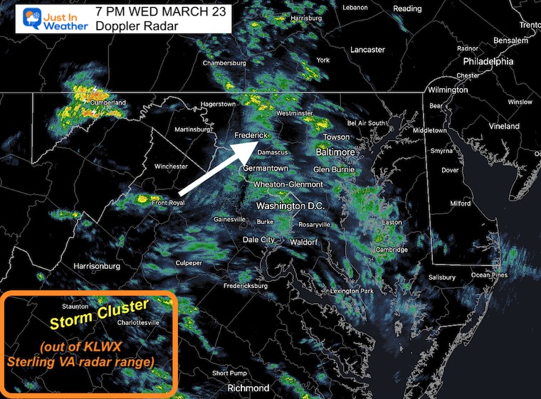
LWX is located in Sterling, Virginia.
At that time, there was lightning in a storm cell passing through Cumberland in Western Maryland.
The region south of Charlottesville is on the edge to out of range… This is where a storm cluster was expected to develop and head our way by midnight…
This wider view does show once stronger cell, south of Lynchburg. This is NOT severe, and as you will see compared to the HRRR Model forecast below… May be underwhelming.
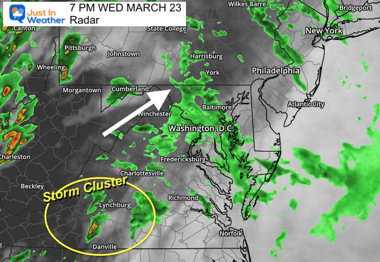
I highlighted that region the was expected to show a large display of storms…
It appears to have been overdone.
If you are up overnight, compare the HRRR Model Timeline To Live Doppler Radar (shown below)
8 PM to 4 AM Thursday


Tomorrow we may track the best chance for storms into Southern Maryland.
NAM 3 Km Model: 8 AM to 8 PM
March 23, storm, radar, rain forecast
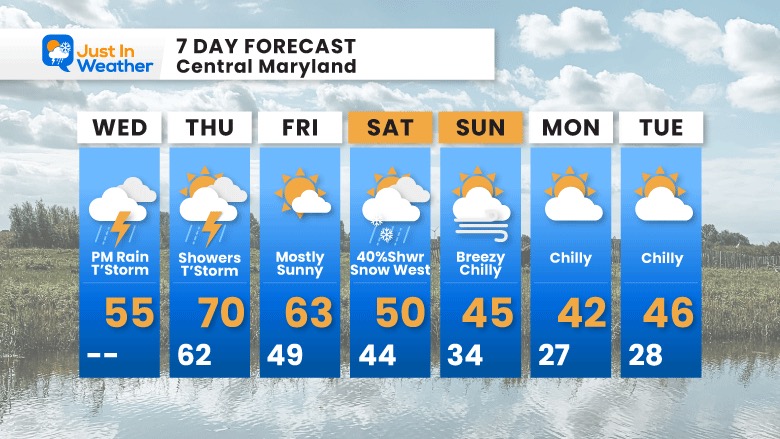
Reminder, it will be warmer tomorrow and then we may actual have snow mixed with rain showers on Saturday. I will have more about that in my morning report.


Last Winter Recap: My Old Outlook And Your Grades Of My Storm Forecasts


*Disclaimer due to frequent questions:
I am aware there are some spelling and grammar typos. I have made a few public statements over the years, but if you are new here you may have missed it:
I have dyslexia, and found out at my second year at Cornell. I didn’t stop me from getting my meteorology degree, and being first to get the AMS CBM in the Baltimore/Washington region.
I do miss my mistakes in my own proofreading. The autocorrect spell check on my computer sometimes does an injustice to make it worse.
All of the maps and information are accurate. The ‘wordy’ stuff can get sticky.
There is no editor that can check my work when I need it and have it ready to send out in a newsworthy timeline.
I accept this and perhaps proves what you read is really from me…
It’s part of my charm.
#FITF