


Soggy Saturday Update: Rain Timeline Through Preakness In Baltimore
Friday, May 17, 2024 As we approach another weekend, we have yet another weather system bringing us rain. This will make 16 of 20 weekends this year with some wet…
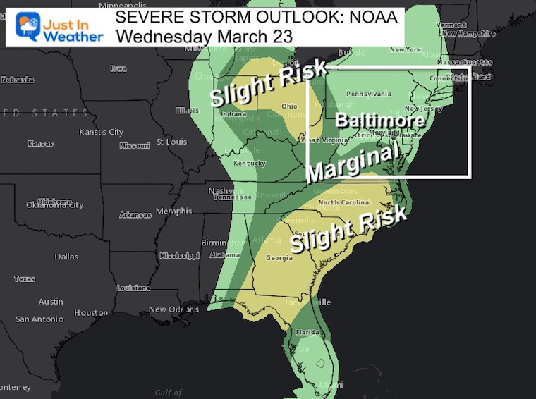
Wednesday March 23 2022
Mid-Day Report
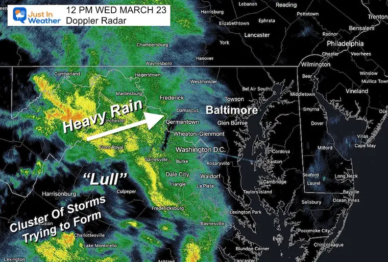
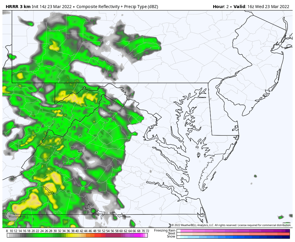
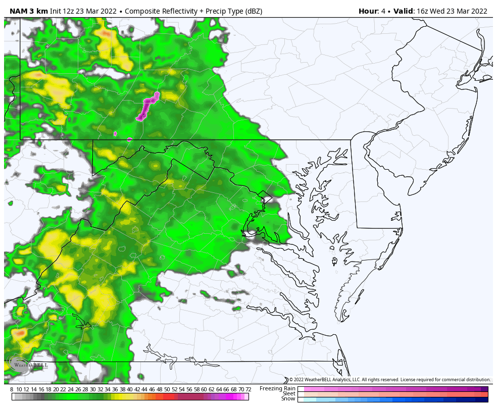
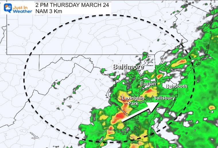
At Noon the rain is moving in close to the schedule. The radar appears to show a line of heavy downpours in the mountains. As we enter this new season, I like to compare the real time weather with short range models to see which has the best handle of development. Below you can see the timeline simulations from the HRRR and NAM 3 Km Models.
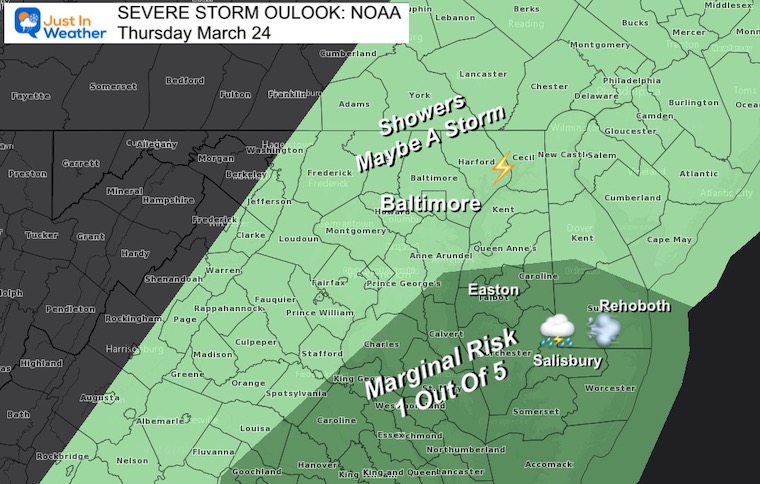
While the main risk of severe weather should remain to our south, some thunderstorms could move into central Maryland tonight. Then a better chance around the Bay and Delmarva tomorrow. I will have a full update later today.
Rain is spreading northeast across the Potomac River…
There will be a band of heavy downpours, then a lull. There may be a few hours with little to no rain late afternoon, them followed by a cluster of heavier rain and thunderstorms tonight. See the timeline slider below.
Rain Timeline —> HRRR Model
12 PM to 12 AM (Noon to Midnight)
Here we see the “Lull” followed by that possible storm cluster tonight after 9 PM. This is not expected to be severe, but could produce gusty winds and loud thunder.
Pardon the typo for WEDNESDAY


12 PM to 12 AM (Noon to Midnight)
12 PM to 12 AM (Noon to Midnight)
This model is less impressive with that potential storm cluster tonight. Se we will find out which has a better handle on things.


Last Winter Recap: My Old Outlook And Your Grades Of My Storm Forecasts


*Disclaimer due to frequent questions:
I am aware there are some spelling and grammar typos. I have made a few public statements over the years, but if you are new here you may have missed it:
I have dyslexia, and found out at my second year at Cornell. I didn’t stop me from getting my meteorology degree, and being first to get the AMS CBM in the Baltimore/Washington region.
I do miss my mistakes in my own proofreading. The autocorrect spell check on my computer sometimes does an injustice to make it worse.
All of the maps and information are accurate. The ‘wordy’ stuff can get sticky.
There is no editor that can check my work when I need it and have it ready to send out in a newsworthy timeline.
I accept this and perhaps proves what you read is really from me…
It’s part of my charm.
#FITF