


Soggy Saturday Update: Rain Timeline Through Preakness In Baltimore
Friday, May 17, 2024 As we approach another weekend, we have yet another weather system bringing us rain. This will make 16 of 20 weekends this year with some wet…
Wednesday March 23
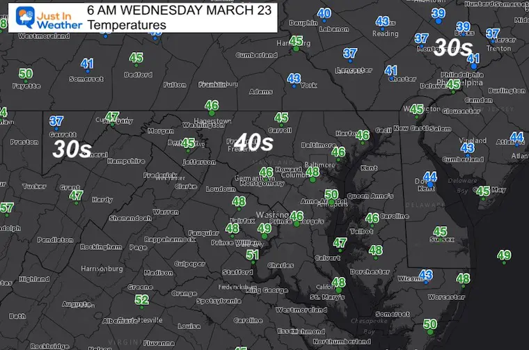
Morning Report
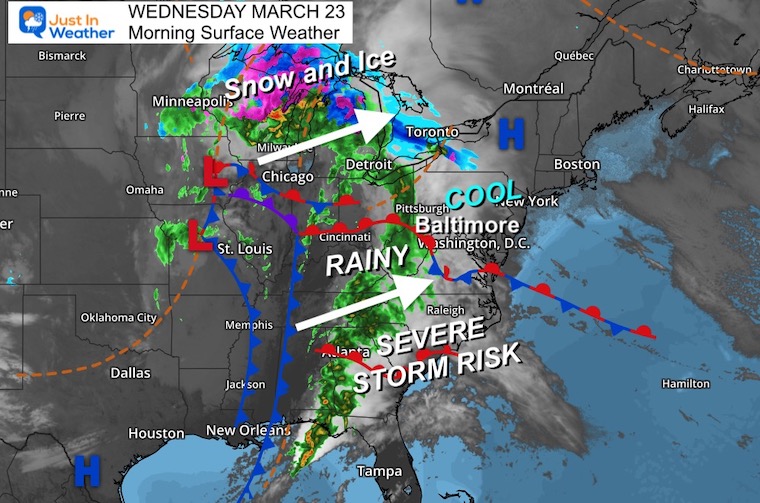
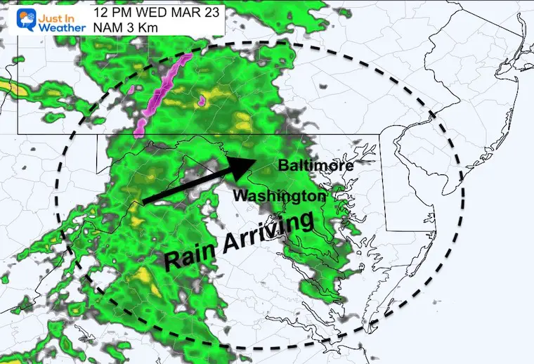
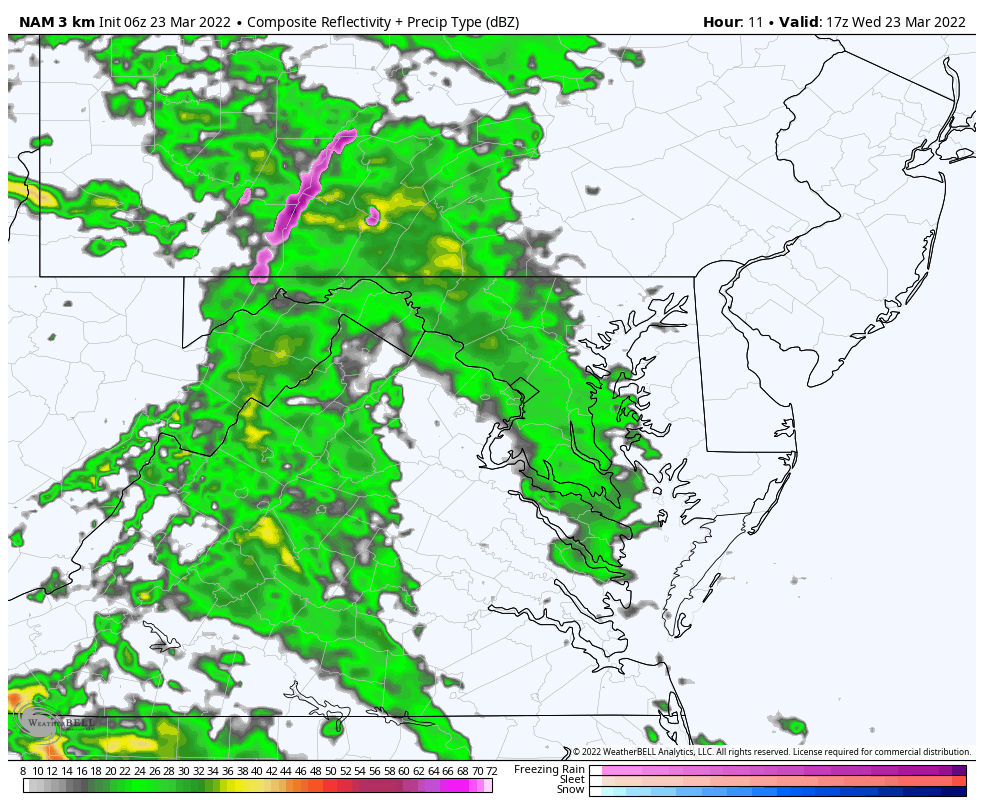
Today we get stuck with an easterly wind. That will lock in cooler and damp air with rain developing by mid day and through the afternoon. It will be heavier later in the day, so after school sports may be impacted. A chance for thunderstorms farther south, and may push north tomorow with depending on wind flow.
Colder air this weekend and next week a hint of wintry weather.
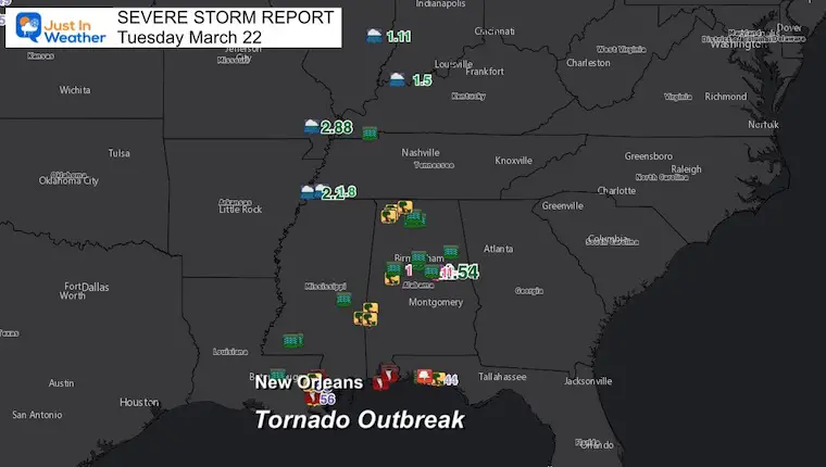
Before we get started, check this out from the severe storm outbreak on Tuesday In New Orleans
WATCH: Video shows large tornado ravaging through New Orleans, destroying homes and causing injuries pic.twitter.com/MeblX9UJwS
— BNO News (@BNONews) March 23, 2022
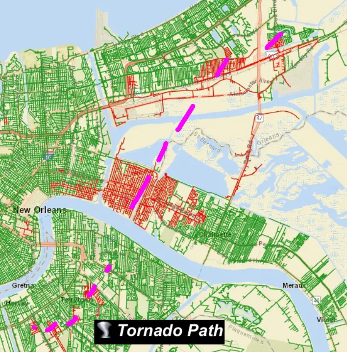
Large Pipe Funnel In Downtown New Orleans
WATCH: Video shows large tornado ravaging through New Orleans, destroying homes and causing injuries pic.twitter.com/MeblX9UJwS
— BNO News (@BNONews) March 23, 2022
🌪️ WOW. Incredible view of the tornado near New Orleans earlier as seen from the Mississippi River while a cruise ship passed by.
Video from a @WGNOtv viewer via @PeytonLocicero. pic.twitter.com/picbXCWzDN
— Brantly Keiek (@BrantlyWx) March 23, 2022
Storm Reports:
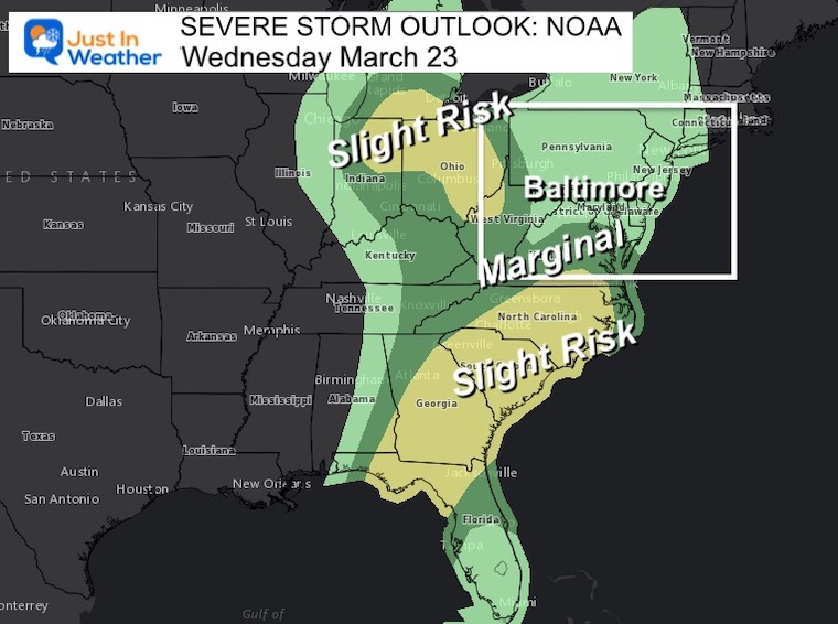
Severe Weather Outlook From NOAA
This will shift east, and while we may miss the worst of it, there will be a chance for thunderstorms on Thursday.
12 PM to 10 PM
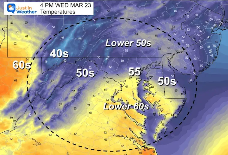
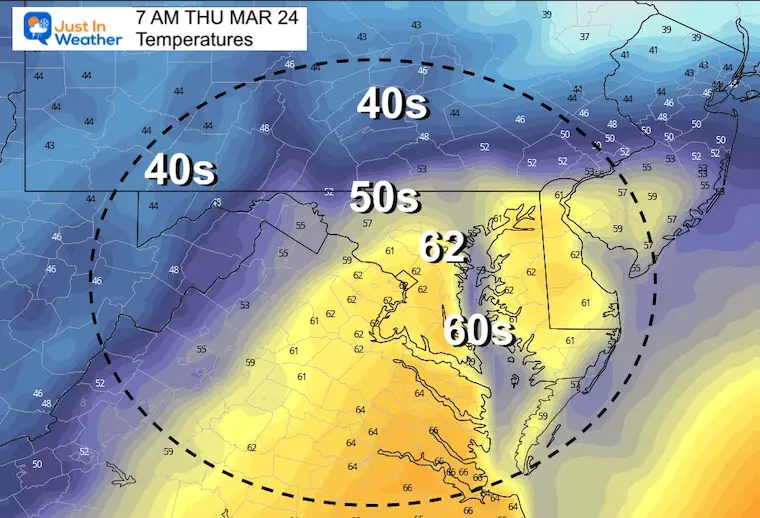
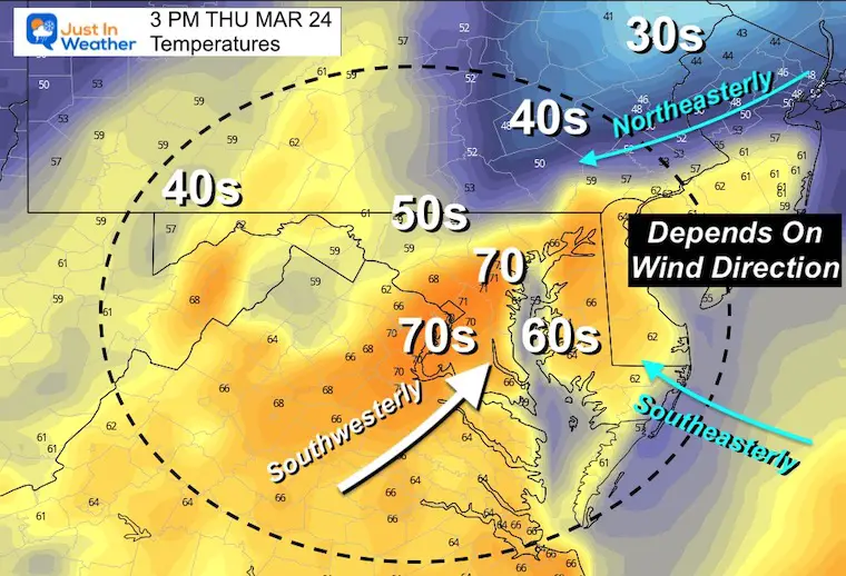
Afternoon Temperatures
Remaining Chilly
Seasonal Snow: 14.4”
Normal Low in Baltimore: 36ºF
Record 16º F in 1934
Normal High in Baltimore: 56ºF
Record 82ºF 1907
Thursday Temperatures
The wind direction will determine how far north the warm air may reach…
Inland may remain chilly.. The warmer temp will try to get close to Baltimore.
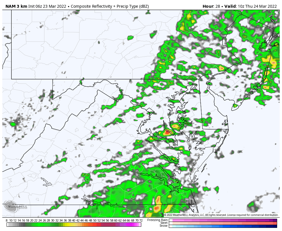
Radar Simulation
6AM to 10 PM
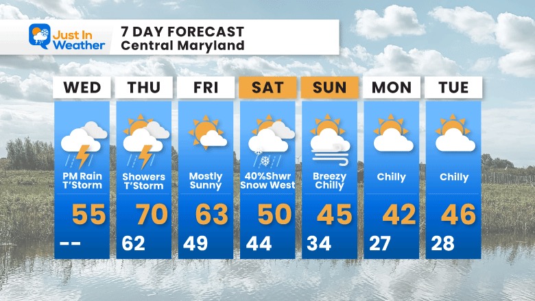
More rain and some thunderstorms
A chance for rain or snow showers in the afternoon, then the cold air arrives with overnight freeze into Sunday morning.
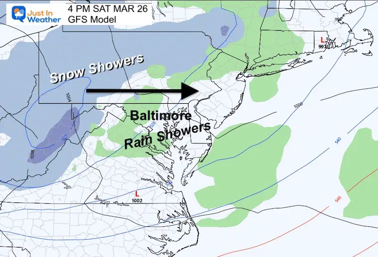
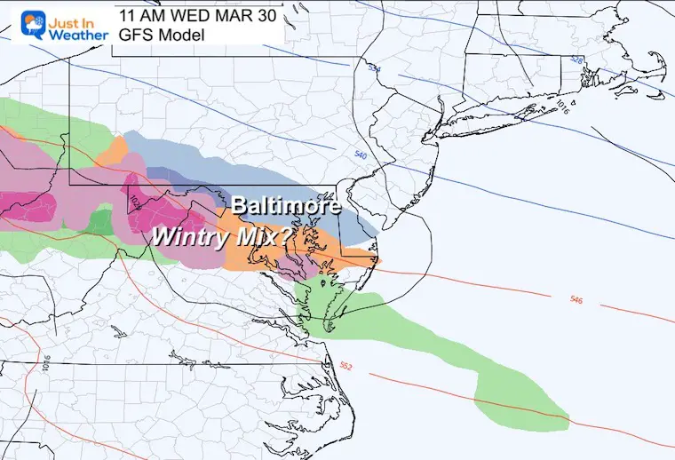
Still watching Wednesday for a potential ribbon of wintry mix on the edge of that polar impact as it may get pushed out.


Last Winter Recap: My Old Outlook And Your Grades Of My Storm Forecasts


*Disclaimer due to frequent questions:
I am aware there are some spelling and grammar typos. I have made a few public statements over the years, but if you are new here you may have missed it:
I have dyslexia, and found out at my second year at Cornell. I didn’t stop me from getting my meteorology degree, and being first to get the AMS CBM in the Baltimore/Washington region.
I do miss my mistakes in my own proofreading. The autocorrect spell check on my computer sometimes does an injustice to make it worse.
All of the maps and information are accurate. The ‘wordy’ stuff can get sticky.
There is no editor that can check my work when I need it and have it ready to send out in a newsworthy timeline.
I accept this and perhaps proves what you read is really from me…
It’s part of my charm.
#FITF