


May 10 Chilly With More Rain Showers Today And Into Mothers Day Weekend
Friday May 10 Morning Report Today is the second day of the year, with sunrise before 6 AM in Baltimore, but like yesterday, we won’t see it. After a high…
Tuesday February 8- Morning Report
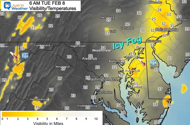
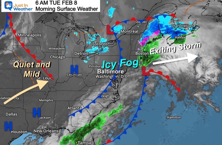
The issue this morning is spotty ice. The rain and mix yesterday was followed by temps dropping to freezing. Now there are also areas of patchy fog. So this is a matter of if the dampness on ground either froze or evaporated first.
Plus Morning Temperatures
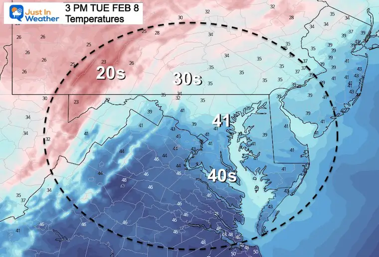
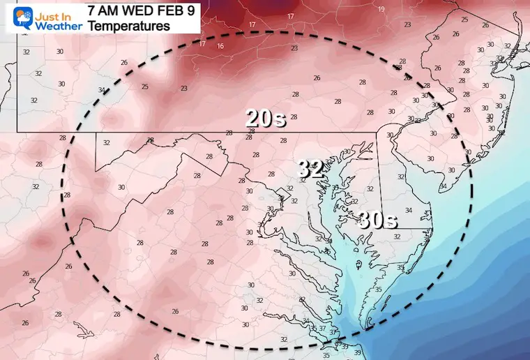
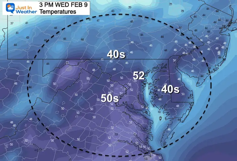
Widespread readings below 32ºF
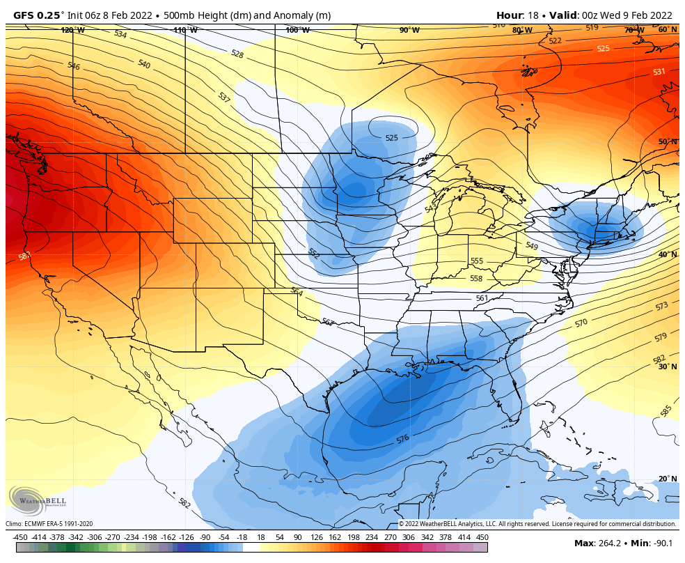
That pesky storm is moving off of the East Coast. What will follow is a quiet and mild weather pattern for much of the week ahead.
Seasonal Snow: 13.3”;
+4.7″ ABOVE AVERAGE
Normal Low in Baltimore: 26ºF
Record -1ºF in 1967
Normal High in Baltimore: 43ºF
Record 72ºF 2017
Morning
Afternoon
Jet Stream:
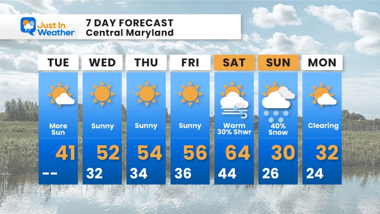
Mild weather develops this week, followed by a trough of cold air this weekend. We will get that push Sunday and Monday, which sets up the next chance for wintry weather.
4 PM Fri to 4 PM Sun
As winter makes a return, the cold front may be a dry passage on Saturday. It will kick up warm winds and push us to the 60s!
What follows on Sunday is an attempt for a new storm, but the energy is not fully liking up or ‘phasing’ yet. However, we do see some snow on Lower Delmarva.
NOTE: Because this model is NOT showing a big flare up is why I actually think there is a chance it happens…
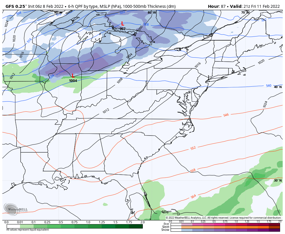
We have seen the tendency for coastal systems to verify west of the initial look. If that happens again we have a game plan for a developing storm. I mentioned this in my Winter Outlook, and it is what we saw in early January… The real winter hits may be what shows up late in modeling… It’s worth watching. Many of the long range storms have been fall apart as we got closer because of the same bias.
It will feel like ‘Pre-Spring’ with 50s much of this week, topping out on Saturday in the 60s (at least in metro areas).


Last Winter Recap: My Old Outlook And Your Grades Of My Storm Forecasts


*Disclaimer due to frequent questions:
I am aware there are some spelling and grammar typos. I have made a few public statements over the years, but if you are new here you may have missed it:
I have dyslexia, and found out at my second year at Cornell. I didn’t stop me from getting my meteorology degree, and being first to get the AMS CBM in the Baltimore/Washington region.
I do miss my mistakes in my own proofreading. The autocorrect spell check on my computer sometimes does an injustice to make it worse.
All of the maps and information are accurate. The ‘wordy’ stuff can get sticky.
There is no editor that can check my work when I need it and have it ready to send out in a newsworthy timeline.
I accept this and perhaps proves what you read is really from me…
It’s part of my charm.
#FITF