Can we just have one simple thing falling from the sky. It would be nice to just have all snow, or let it be simple rain.But no! This pesky coastal Low is buckling back again to throw in rain this afternoon, that may mix with sleet Ron snow inland.
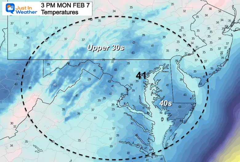
The good news is that temps should remain above freezing inland. That is until it ends.
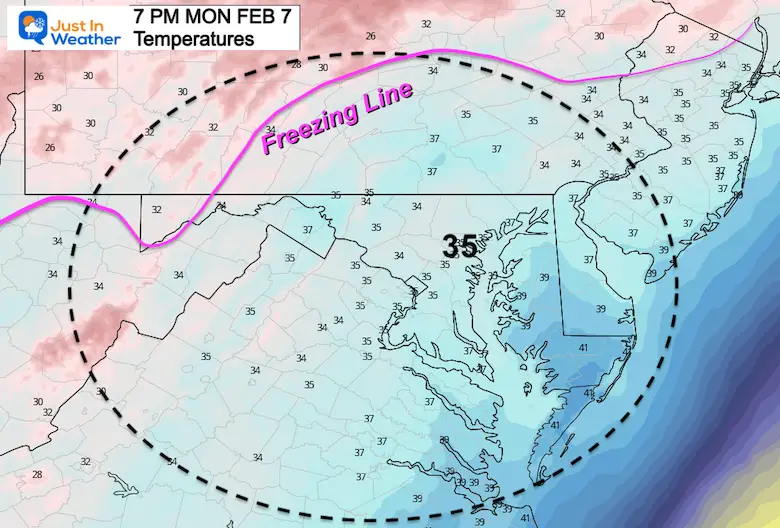
So once again we need to watch out for wet pavement that may ice up overnight.If you have the materials, a simple toss of sal before bed should help.
Look, I really don’t want to do this. After the late icing last Friday and the limited icy drizzle in northeastern Maryland this morning, I am tired of hearing this.Plus, I have an activity with my son this evening. But if this helps, we will be out, so that is not the concern.
Refreezing tonight may be.
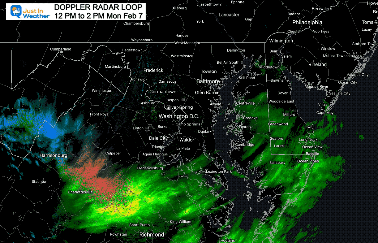
Radar Loop
12 PM to 2 PM
Steady, even heavy rain moving in to Southern Maryland. Some snow has mixed in across the wester Maryland Mountains.
Monday Afternoon Surface Weather
Low Pressure located along the South Carolina Coast is really energizing this afternoon. Moderate to heavy rain is spreading north into Maryland.
The cold air has produce snow and freezing rain interior North Carolina and Virginia. That is a signal that this system is stronger that the models gave credit.
*This has been a pain since last week. It was wet was initially thought to become a Sunday snowmaker, then suppressed within a day. Now it is back and tryin to prove itself.
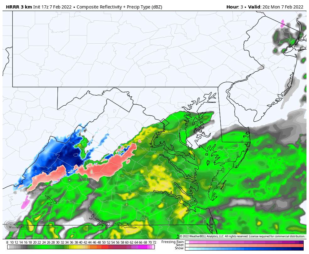
Radar Simulation Animation
HRRR Model 3 PM to 11 PM (slider images below)
Here we see the rain expanding this afternoon, with some sleet (pink) and snow (blue) mixing in across interior sections west of Washington and Baltimore.
However, surface temperatures have warmed just enough, that we should remain above freezing until after this ends.
Not freezing yet, but some icing in Garrett County.
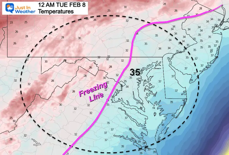
Midnight
Just as the rain or mix ends, the colder air will catch up to our western suburbs.
Sine the ground will be wet, there is a good chance for icing to develop.
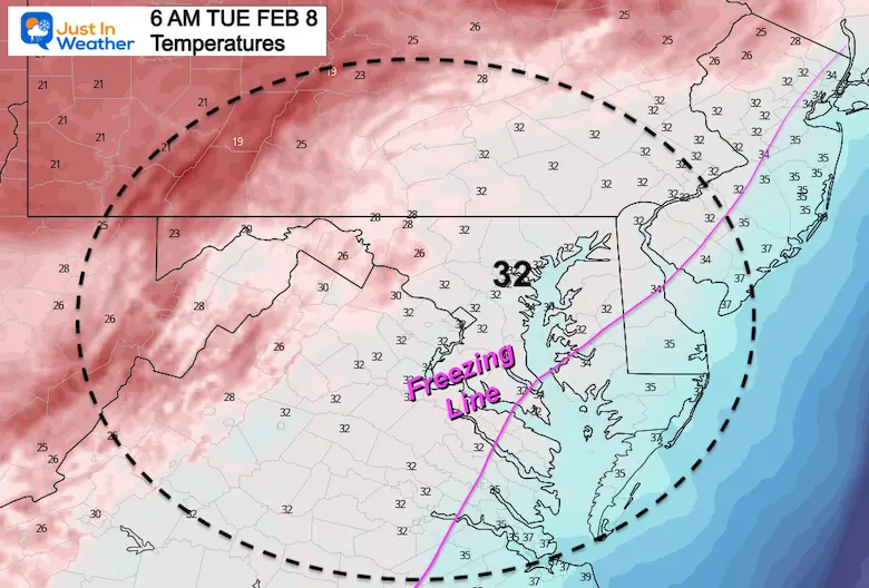
Tuesday Morning
Freezing temps should reach Baltimore and south of Annapolis to Easton. Will the ground dry out in time, or have a chance to ice over? This region will be in the ‘possible but not promised’ qualifier.
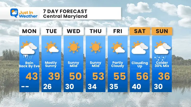
Reminder: We have a mild week ahead. I and definitely looking forward to a break. Wintry temps will return Sunday into next week.
I am aware there are some spelling and grammar typos. I have made a few public statements over the years, but if you are new here you may have missed it:
I have dyslexia, and found out at my second year at Cornell. I didn’t stop me from getting my meteorology degree, and being first to get the AMS CBM in the Baltimore/Washington region.
I do miss my mistakes in my own proofreading. The autocorrect spell check on my computer sometimes does an injustice to make it worse.
All of the maps and information are accurate. The ‘wordy’ stuff can get sticky.
There is no editor that can check my work when I need it and have it ready to send out in a newsworthy timeline.
I accept this and perhaps proves what you read is really from me…