Monday February 7- Morning Report
This is on of the more difficult weather events to follow. Yesterday I made mention of the potential for light freezing rain this morning. I relay should have called it ‘drizzle’. I’ve seen way too many events that didn’t even show on radar, but led to a thin glaze and a lot of accidents.
It may still be happening even if it is not outside your door.
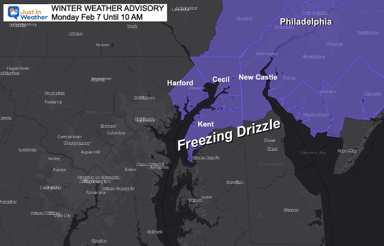
This morning, The National Weather Service issued A Winter Weather Advisory for freezing drizzle in Northeastern Maryland to metro Philadelphia. The radar is not showing much, but there may still be some on your travels.
This is when we can get a bad ‘rap’ but it just can’t be ignored.
I’d rather it not happen and you be aware than you be surprised and end up with a problem.
WINTER WEATHER ADVISORY
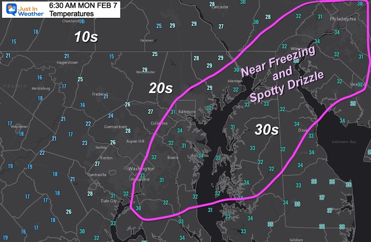
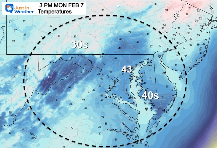
Morning Temperatures at 6:30 AM
A slight push up on the thermometers.
Headlines
- Morning: Spotty Freezing Drizzle
- Afternoon Evening: Rain returns. May have snow wet snow/sleet inland.
- Most Of This Week: Quiet and Mild
- Next Weekend: Colder air returns by Sunday
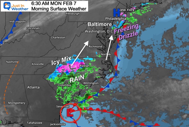
Morning Set Up- Close
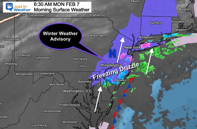
I’ve highlighted (in purple) The Winter Weather Advisory through Philadelphia and metro New York into New England.
The radar at 6:30 AM is superimpose, and blatantly NOT covering the entire region.
Even up north the expectation for ‘freezing drizzle’ not seen on radar will be a challenging thing to spot.
If you are traveling north on I-95, please just be careful on bridges and overpasses.
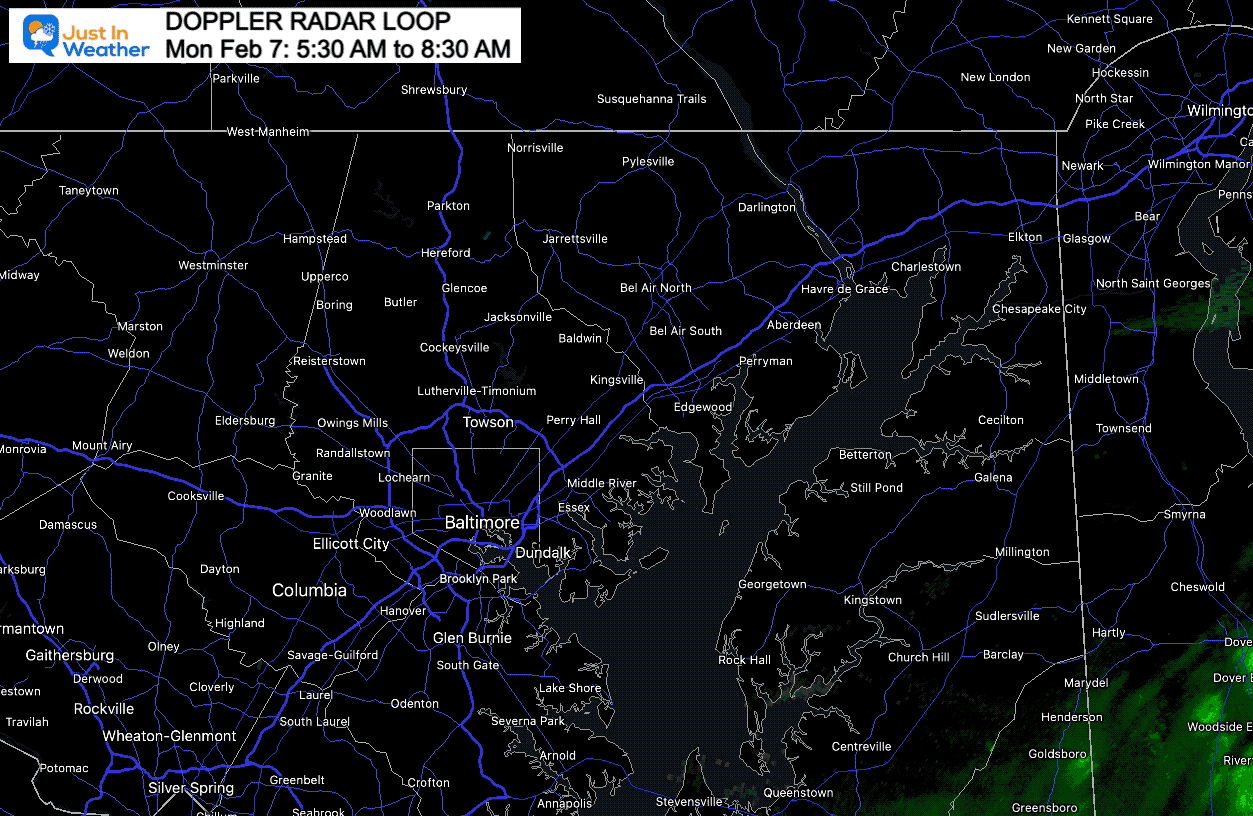
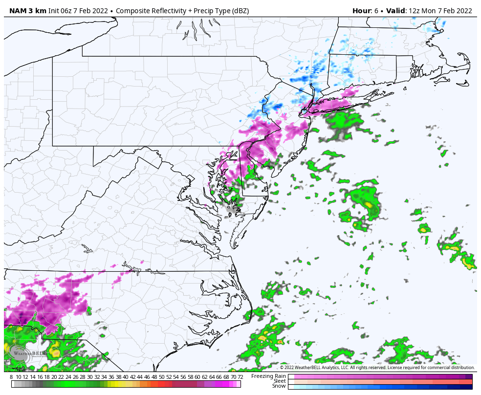
UPDATED RADAR LOOP
Doppler Radar Loop 5:30 AM to 8:30 AM
Freezing Rain or snow Mix in Cecil County… Freezing Drizzle close to coastal Harford, Baltimore, and AACo.
Wide View
There are two main regions of moisture: Delmarva to metro New York, and The Carolinas.
Low Pressure is located just east of Savanah, GA and moving up the coast.
The moisture in The Carolinas to Virginia is more robust and should reach us later today.
Afternoon Temperatures
Radar Simulation Today
NAM 3 Km 7 AM to 7 PM
Rain will move in, and we need to watch the temps on the back side again again after sunset.
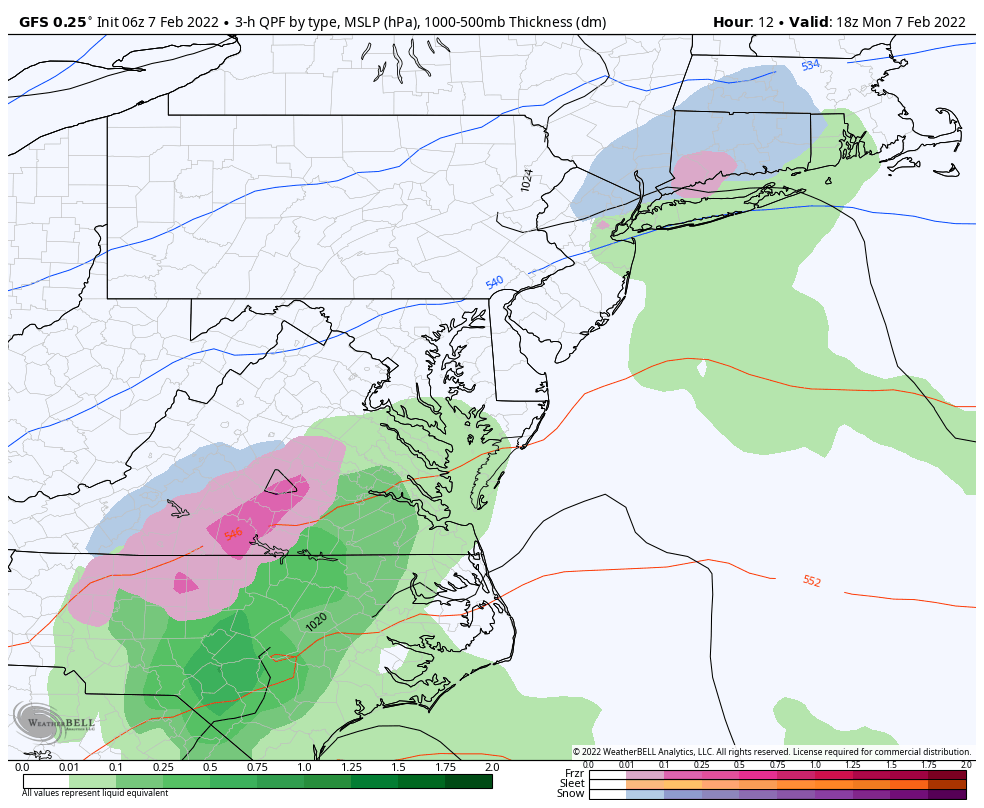
Radar Simulation
GFS Model 1 PM Mon to 7 AM Tue
Rain will reach central Maryland later this afternoon, with temps closer to 40ºF. However, there maybe some mix of snow or sleet on the north edge for interior areas. Temps should be safely above freezing up there, but just a heads up.
Weather Almanac: Climate Data at BWI
TODAY February 7
Seasonal Snow: 13.3”;
+4.7″ ABOVE AVERAGE
Normal Low in Baltimore: 25ºF
Record 6ºF in 1895
Normal High in Baltimore: 43ºF
Record 72ºF 2017
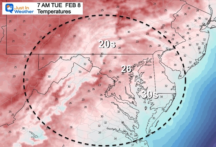
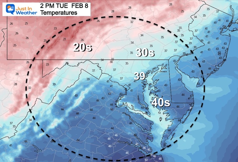
Tuesday Temperatures
Morning
Afternoon
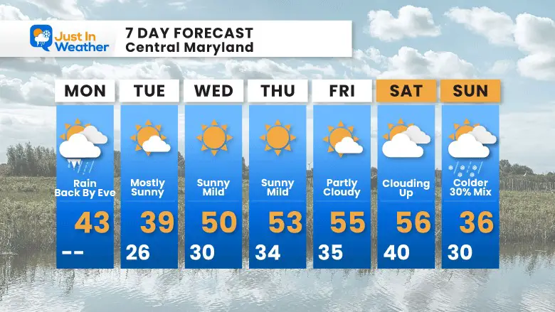
7 Day Forecast
This will be a quiet week, with temps pushing into the 50s.
The next push of cold air will arrive next weekend. It may arrive with a rain/snow mix on Sunday.
Next week will be colder, and yes there will be ample opportunities for more winter weather. I’m OK with a breather for a week.
ALSO SEE
ALL FITF GEAR

FITF THUNDERSNOW


Winter Outlook Series:
My Call For Snowfall

Last Winter Recap: My Old Outlook And Your Grades Of My Storm Forecasts


Please share your thoughts, best weather pics/video, or just keep in touch via social media
*Disclaimer due to frequent questions:
I am aware there are some spelling and grammar typos. I have made a few public statements over the years, but if you are new here you may have missed it:
I have dyslexia, and found out at my second year at Cornell. I didn’t stop me from getting my meteorology degree, and being first to get the AMS CBM in the Baltimore/Washington region.
I do miss my mistakes in my own proofreading. The autocorrect spell check on my computer sometimes does an injustice to make it worse.
All of the maps and information are accurate. The ‘wordy’ stuff can get sticky.
There is no editor that can check my work when I need it and have it ready to send out in a newsworthy timeline.
I accept this and perhaps proves what you read is really from me…
It’s part of my charm.
#FITF


