


May 19 Weather Sunday Starts Foggy The Warming With Sun And Summer Heat On The Way
Sunday May 19 Morning Report The aftermath of the rainy Saturday is plenty of leftover moisture. This has left us with a bit of humidity and areas of thick fog…
February 6 2022
Early Morning Update
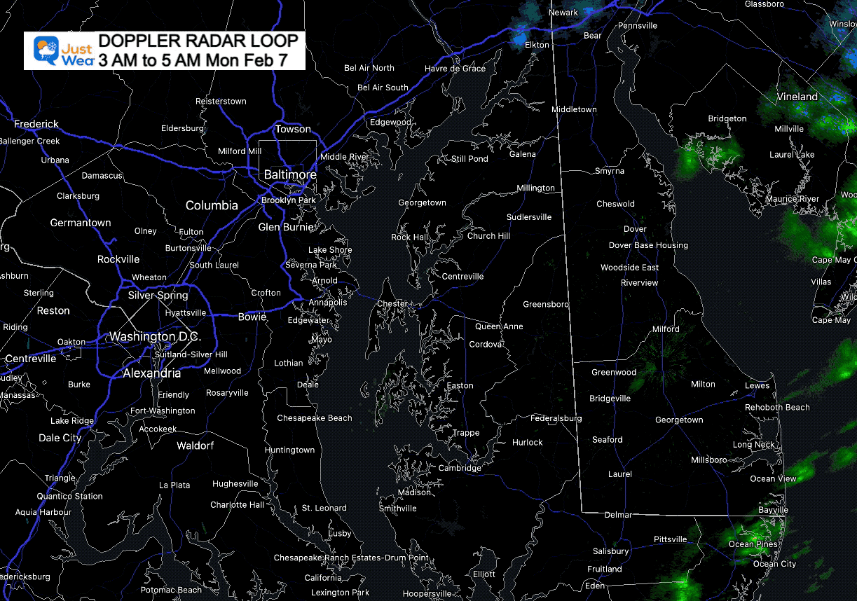
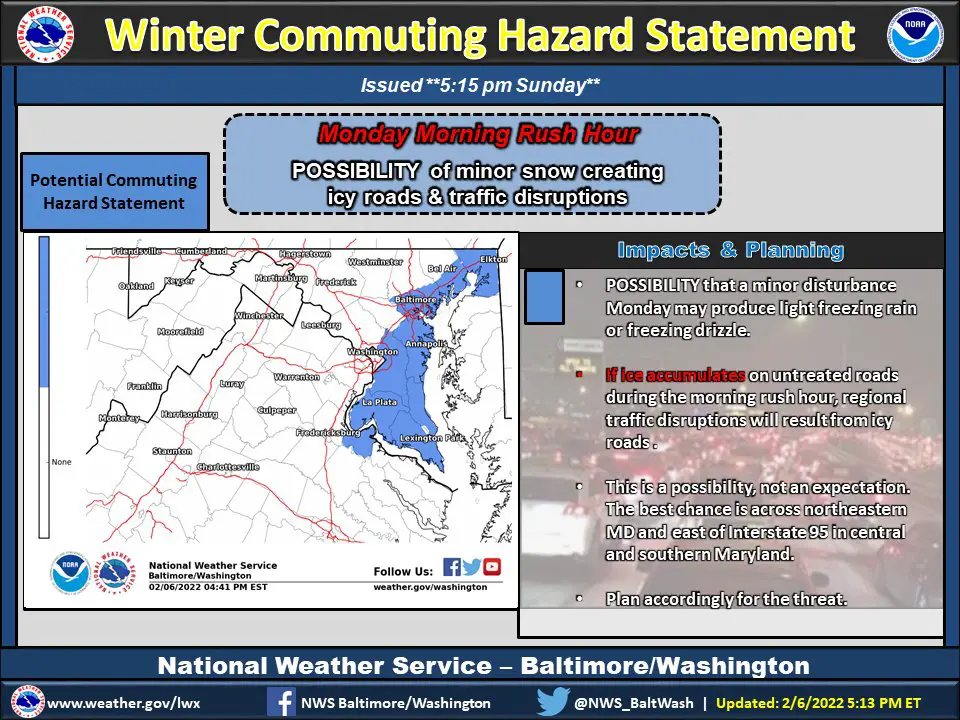
This is really difficult to pin down. potential icing event is really light and really hard to view on radar. The mistake I made last night was saying light freezing rain, when I should have kept it classified as ‘drizzle’. The concern has been that just a little can be enough to from a slick gaze on the ground.
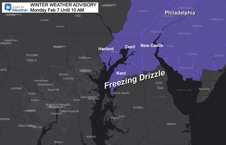
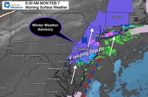
The National Weather Service has doubled down on the Upper Eastern Shore into metro Philadelphia.
The hard part of this forecast: Temps within a degree or two of freezing AND trying to identify where the drizzle is falling.

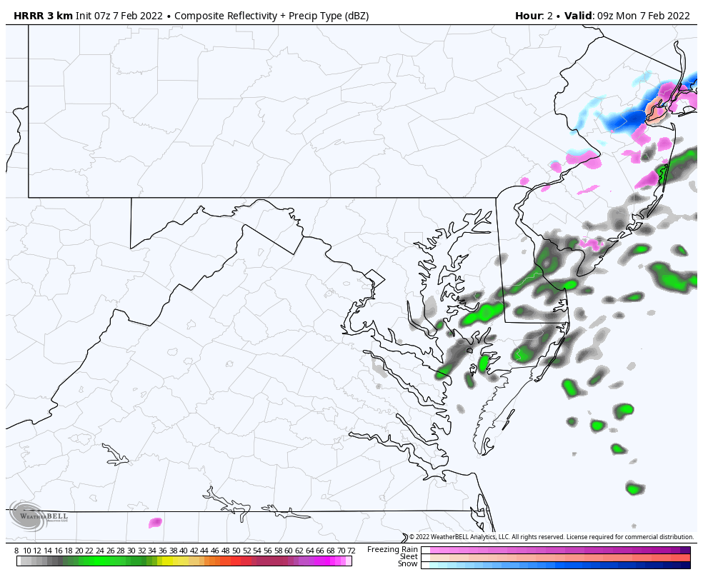
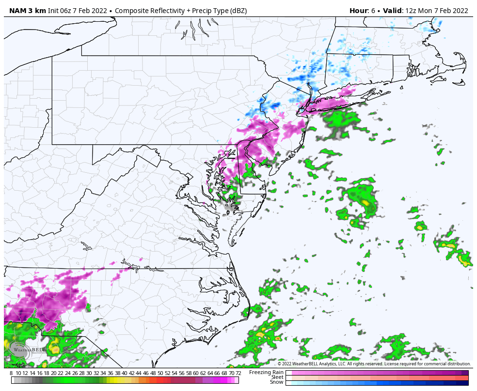
Look closely and you can see some light prenup showed up just east of Annapolis and over Kent Island.
The problem with ‘drizzle’ is that it is not often seen on radar.
Freezing Rain or snow Mix in Cecil County… Freezing Drizzle close to coastal Harford, Baltimore, and AACo.
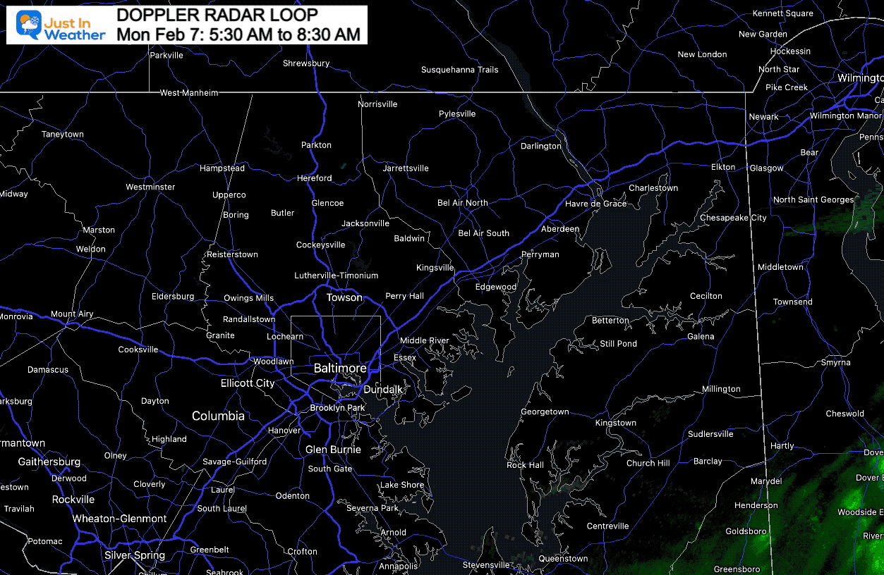
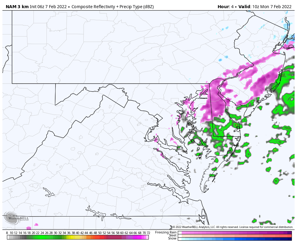
The NAM 3 Km continues to show this development over the next few hours. I’ve compared this to the HRRR Model, which is much lighter… and the edge near and just east of Baltimore.
5 AM to 12 PM
5 AM to 12 PM
This model is lighter around central Maryland with more focus just east.
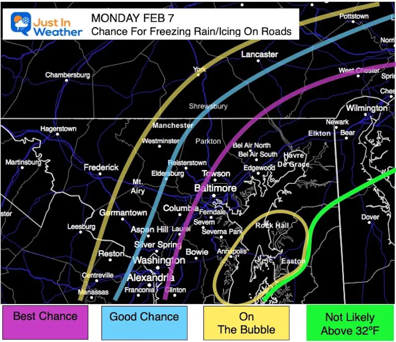
This is why I made this map yesterday
Monday Morning Surface Weather
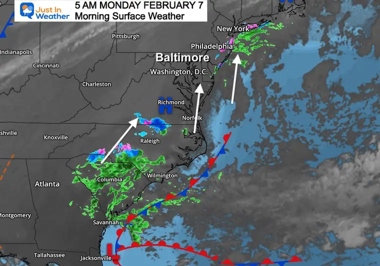
There is a light flow off the Atlantic, causing more problems from metro Philadelphia to New York.
Low Pressure is still located just east of Jacksonville, FL. There is a lot of moisture expanding through The Carolinas and into southern Virginia. That moisture will reach us by this evening, so it still needs to be watched.
NAM 3 Km 7 AM to 7 PM
Rain will move in, and we need to watch the temps on the back again again after sunset.
I will have anther update after 6:30 AM
I hope you can read the fine print. They seem to be watching the same model I am and highlight the same general areas… but have more of Southern Maryland in play.
I will issue another update and my full morning report after 6:30 AM


Last Winter Recap: My Old Outlook And Your Grades Of My Storm Forecasts


*Disclaimer due to frequent questions:
I am aware there are some spelling and grammar typos. I have made a few public statements over the years, but if you are new here you may have missed it:
I have dyslexia, and found out at my second year at Cornell. I didn’t stop me from getting my meteorology degree, and being first to get the AMS CBM in the Baltimore/Washington region.
I do miss my mistakes in my own proofreading. The autocorrect spell check on my computer sometimes does an injustice to make it worse.
All of the maps and information are accurate. The ‘wordy’ stuff can get sticky.
There is no editor that can check my work when I need it and have it ready to send out in a newsworthy timeline.
I accept this and perhaps proves what you read is really from me…
It’s part of my charm.
#FITF