


May 19 Weather Sunday Starts Foggy The Warming With Sun And Summer Heat On The Way
Sunday May 19 Morning Report The aftermath of the rainy Saturday is plenty of leftover moisture. This has left us with a bit of humidity and areas of thick fog…
February 6 2022
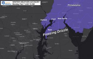
Sunday Night Update
This is the follow up to my evening report on the light freezing rain event. Do you remember last week there was expected to be first the Friday ice, then Sunday snow? Within a day that snow chance to removed and suppressed by our model guidance. Well, this is THAT system that seems to be toying with us.
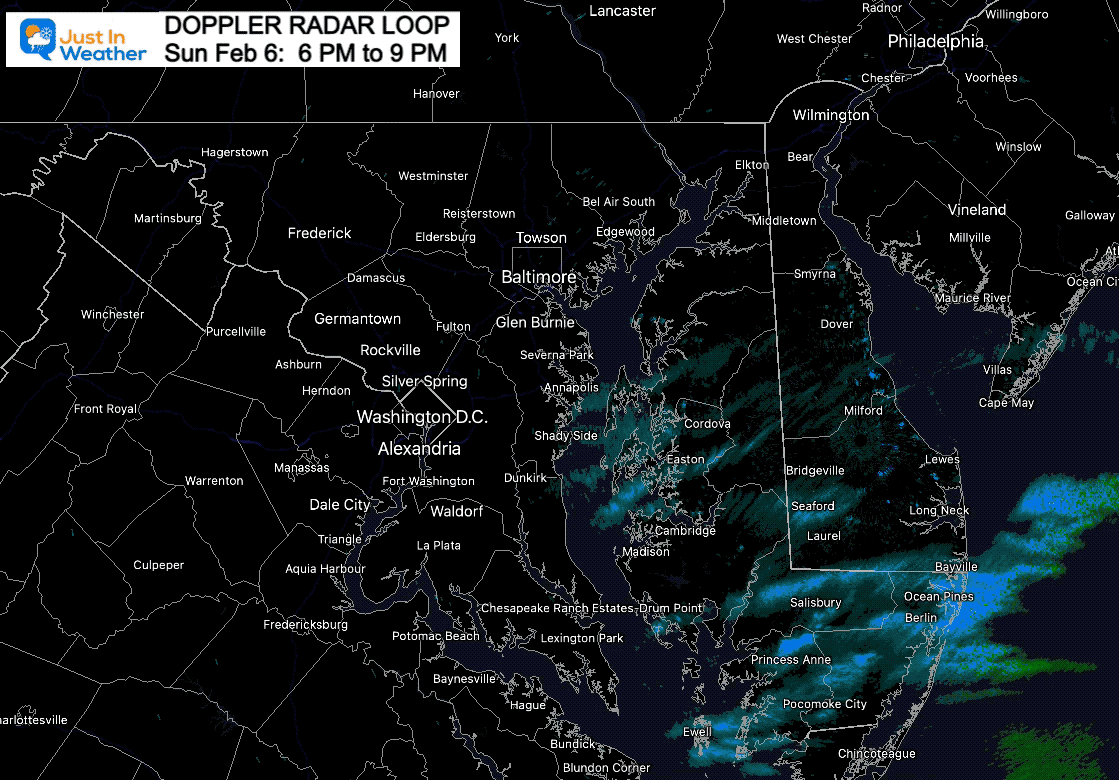
After my prior report, I got a few messages about snow flurries in Delmarva. There is definitely something trying to expand there. Check out this evening radar loop.
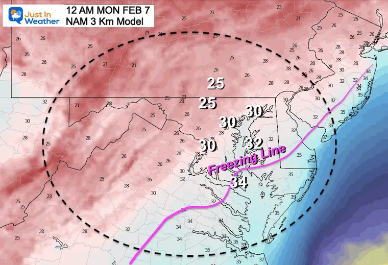
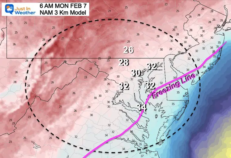
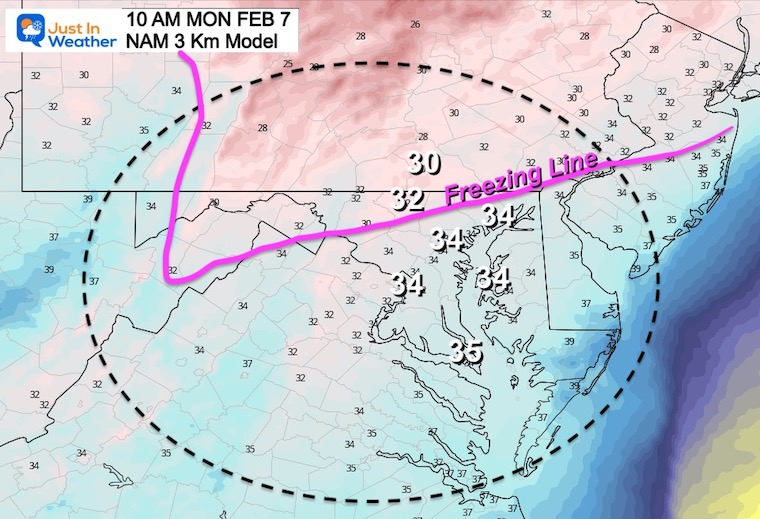
It is definitely getting a little more active on the radar, and this has been shown best on the NAM 3 Km Model.
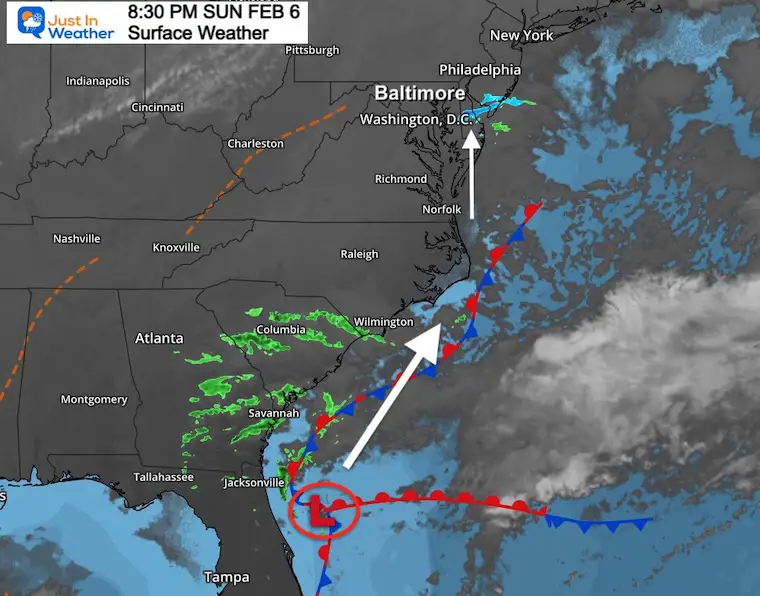
Low Pressure is located just east of Jacksonville, FL. This appears to be following the trend of the last few storms and tacking a track a little farther west. In this case, that will hug the coast a little closer.
Light precipitation will continue to try and expand northward tonight. Warmer air aloft will travel at cloud level, but surface temps will remain nearly steady. so if you are at freezing, you should stay there until morning. Some place like Annapolis and Easton are on the bubble and could still drop another notch or two to get below freezing again. This will be a close call, which is why I have those place ‘on the bubble’ in my map below.
It is not well organized now, but it will be trying on Monday.
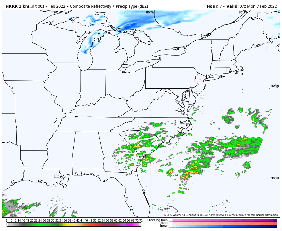
HRRR Model: Midnight to 5 PM
Watch this flare up from South and North Carolina during the day. WE will be ahead of that in the morning, but that is when temps should be near freeing.
By the tine the main event arrives later in the day, temps should be just warm enough for plain rain… I believe the models are playing catch up here, and are may need to watch that closely….
11 PM Sunday to 11 AM Monday
This is NOT a promise, but a suggestion for who this may develop. Here we see this evolve AFTER MIDNIGHT… and continue to spread north even after sunrise into southern PA.
This NAM 3 Km model was most accurate last Friday delaying the old air, and is the one leading the way this time.


This is my suggestion for where the timing and temps work out to put the best chance for some icing.
See the Temperature forecast below.
This is NOT a promise, just a suggestion based on the reliable NAM 3 Km Model and I want you to be aware.
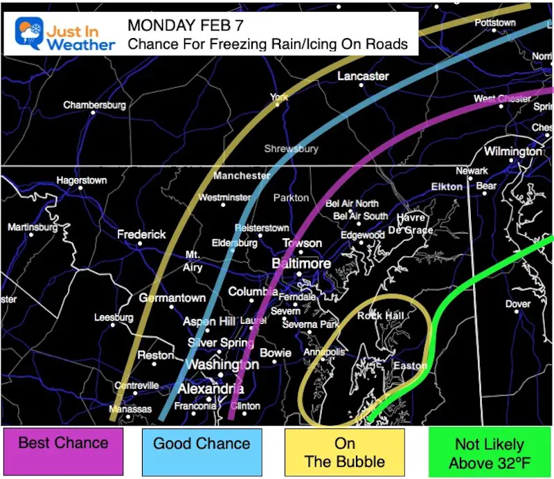
Freezing line from near Easton, MD. All points south should be just warm enough to thaw.
Freezing line close to Easton, MD, but metro Baltimore and Washington at or below 32ºF.
I get it! To some this may seem like crying wolf. But this is different.
This is the NAM 3 Km Model. It is the one that accurately called the delay of cold air and held off the icing last Friday.
This is a different set up. It is not Rain turning to Ice. It is starting off that way, overnight on cold and dry ground. That is more optimal for ice to develop on the roads.
Also: Do you recall last Friday and two weeks ago had a delay of the freeze? That was due to a last moment ‘shift west’. Do you recall the coastal Blizzard? That expanded the heavy snow across Delmarva due to a late ‘shift west’. It just wasn’t enough for metro areas.
This event is ALSO based on the ‘farther west’ track….
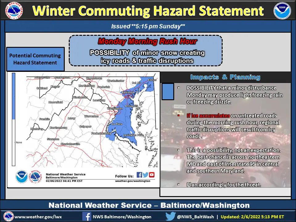
I hope you can read the fine print. They seem to be watching the same model I am and highlight the same general areas… but have more of Southern Maryland in play.
I will also be up early Monday morning to work the event for my clients and update you.


Last Winter Recap: My Old Outlook And Your Grades Of My Storm Forecasts


*Disclaimer due to frequent questions:
I am aware there are some spelling and grammar typos. I have made a few public statements over the years, but if you are new here you may have missed it:
I have dyslexia, and found out at my second year at Cornell. I didn’t stop me from getting my meteorology degree, and being first to get the AMS CBM in the Baltimore/Washington region.
I do miss my mistakes in my own proofreading. The autocorrect spell check on my computer sometimes does an injustice to make it worse.
All of the maps and information are accurate. The ‘wordy’ stuff can get sticky.
There is no editor that can check my work when I need it and have it ready to send out in a newsworthy timeline.
I accept this and perhaps proves what you read is really from me…
It’s part of my charm.
#FITF