


May 5 Soggy And Chilly Start With More Rain During The Week Ahead
Sunday May 5 Morning Report We are stuck in this muck! The wet weather pattern continues with a soggy start this Sunday morning. The rain will try to break up…
February 6 2022
Sunday Evening Update
Here we go again, right? We have yet ‘another’ freezing rain event to bookend this weekend. This one is different that the Friday event because instead of waiting for a warmer rain to cool wet ground, we have cold air and dry ground in place already, while light rain attempt to develop overnight.
I need to stress that this will be a ‘light event’, and there is not a lot of model agreement. But sometimes a little bit can cause big problems. The set up is here to optimize a light glaze of ice on untreated surfaces just in time for the Monday morning commute.
Also: The NAM 3 Km model was most accurate last Friday delaying the old air. It is the one leading the way this time, and why I am highlighting it here. But, it does not have a lot of support. Perhaps why your phone weather app may not be shown this.
This is a brief update to show you the model simulation and my map of ‘best chance’ areas highlighted.
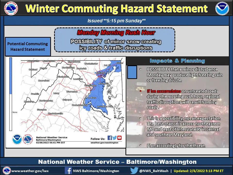
I also want to show you that I am not alone as the National Weather Service put out a Special Statement on this.
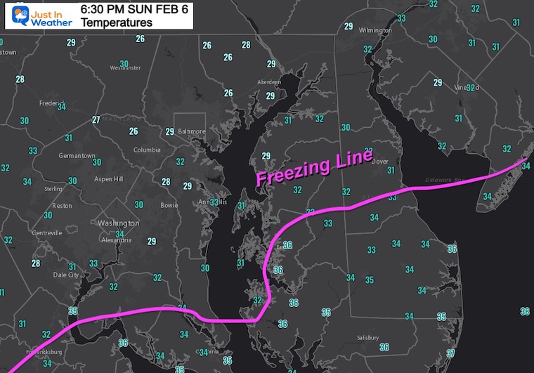
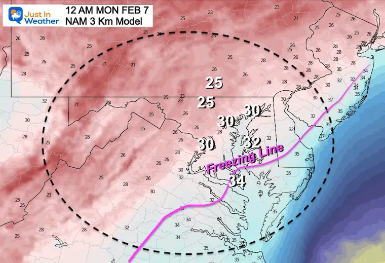
The Freezing Line is already across far Southern Maryland and ‘near’ Easton to Dover on Delmarva. This region may drop another degree tonight and be on the bubble. But farther north, already in the 20s near Baltimore and north.
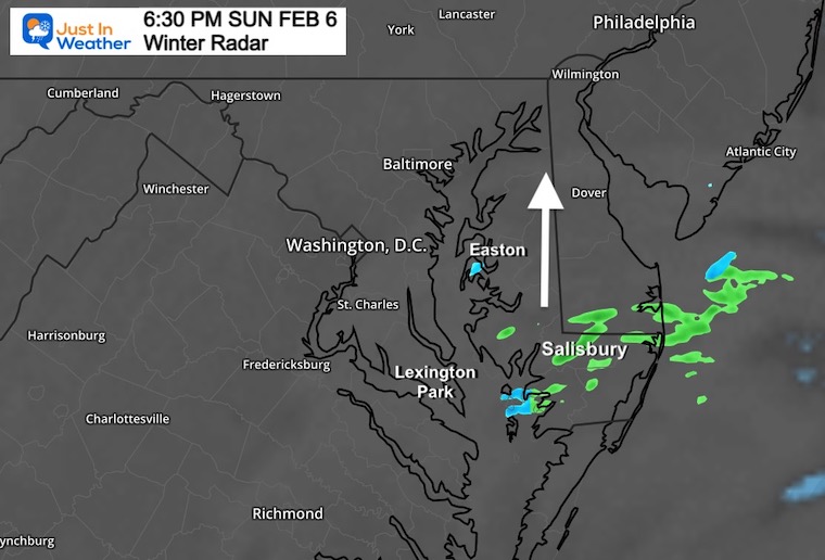
Scattered showers are showing up on Delmarva. Most are rain with temps abce freezing. This is spreading up to the north.
I know this does not look like much, but you will see the radar simulation below enhance this overnight.
11 PM Sunday to 10 AM Monday
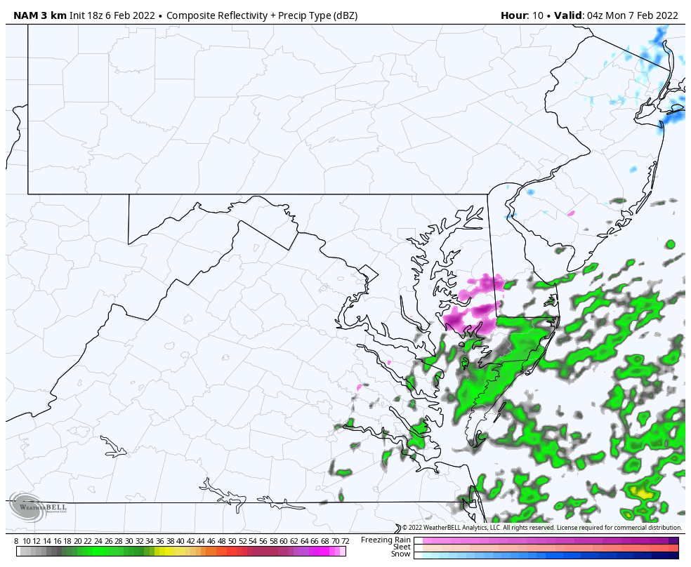
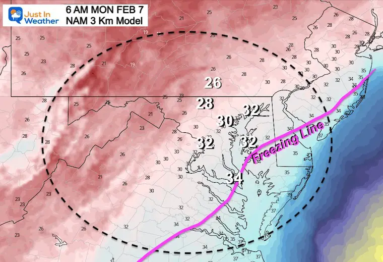
Here we see the enhancement of the precipitation near Easton and then spreading west/northwest overnight until morning.
*I was in a rush to share this. I will have the hourly breakdown slider in my next update.
Freezing line from near Easton, MD. All points south should be just warm enough to thaw.
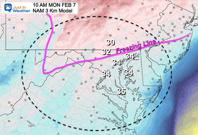
Freezing line close to Easton, MD, but metro Baltimore and Washington at or below 32ºF.
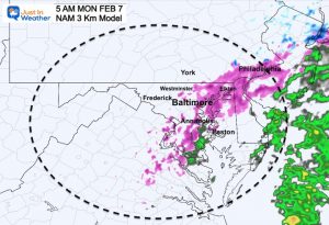
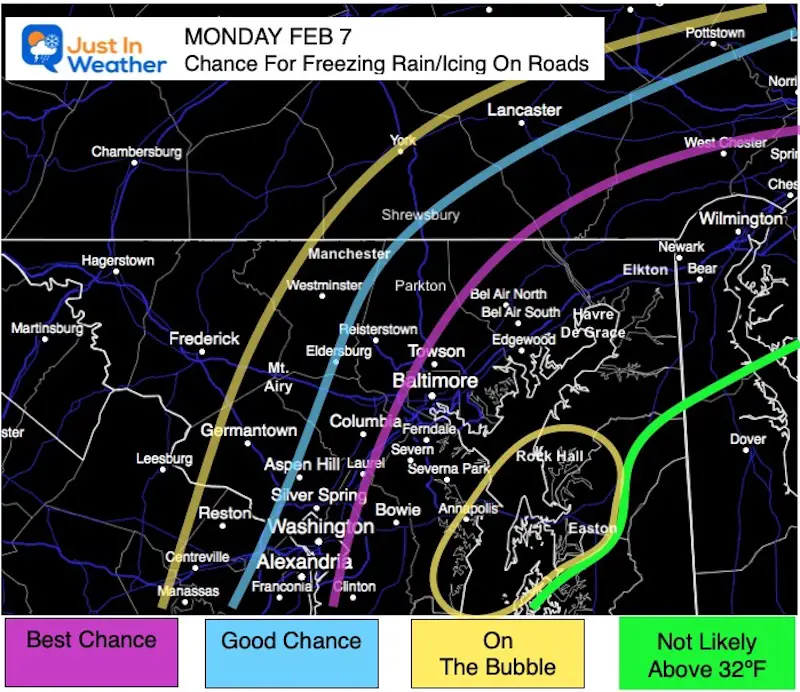
This is my suggestion for where the timing and temps work out to put the best chance for some icing. This is NOT a promise, just a suggestion based on the reliable NAM 3 Km Model and I want you to be aware.
On The Bubble: West near Westminster is due to where the light precipitation edge may set up.
On the Bay (Annapolis to Easton) is based on the temperatures near 32ºF, and influence from the water.
The Purple Line shows the best chance along the I-95 Corridor including Elkton, Bel Air, Baltimore, near Columbia and Severe Park.
I get it! To some this may seem like crying wolf. But this is different.
This is the NAM 3 Km Model. It is the one that accurately called the delay of cold air and held off the icing last Friday.
This is a different set up. It is not Rain turning to Ice. It is starting off that way, overnight on cold and dry ground. That is more optimal for ice to develop on the roads.
Also: Do you recall last Friday and two weeks ago had a delay of the freeze? That was due to a last moment ‘shift west’. Do you recall the coastal Blizzard? That expanded the heavy snow across Delmarva due to a late ‘shift west’. It just wasn’t enough for metro areas.
This event is ALSO based on the ‘farther west’ track….
I hope you can read the fine print. They seem to be watching the same model I am and highlight the same general areas… but have more of Southern Maryland in play.
Please Check Back Around 9 PM:
I am aiming to get the hourly timeline simulation prepared for you in my next report. I will also be up early Monday morning to work the event for my clients and update you.


Last Winter Recap: My Old Outlook And Your Grades Of My Storm Forecasts


*Disclaimer due to frequent questions:
I am aware there are some spelling and grammar typos. I have made a few public statements over the years, but if you are new here you may have missed it:
I have dyslexia, and found out at my second year at Cornell. I didn’t stop me from getting my meteorology degree, and being first to get the AMS CBM in the Baltimore/Washington region.
I do miss my mistakes in my own proofreading. The autocorrect spell check on my computer sometimes does an injustice to make it worse.
All of the maps and information are accurate. The ‘wordy’ stuff can get sticky.
There is no editor that can check my work when I need it and have it ready to send out in a newsworthy timeline.
I accept this and perhaps proves what you read is really from me…
It’s part of my charm.
#FITF