


May 4 Chilly And Wet Weekend: Live Radar
Saturday May 4 Morning Report May the 4th Be With You! There is a definite change in the Force we all will notice this morning. A band of rain has…
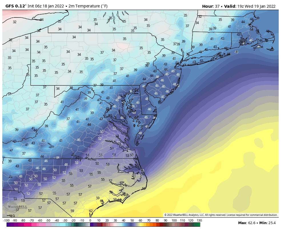
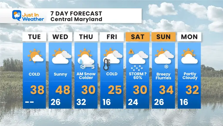
Tuesday January 18 2022
Wee are get a little breather with some quiet and somewhat mid air today and tomorrow. Then, the active weather pattern kicks back into high gear.
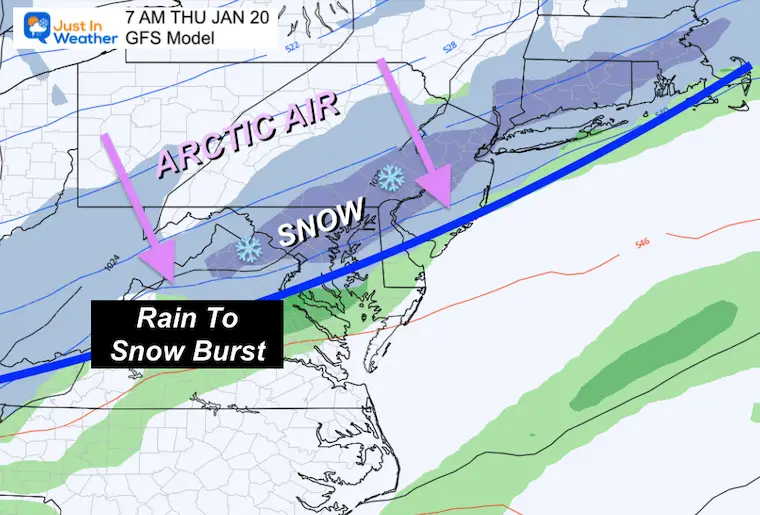
High Confidence Thursday morning with an arctic front. This will bring rain changing to a burst of snow right around sunrise. It may be just enough to impact travel and schools. This brings back more arctic air.
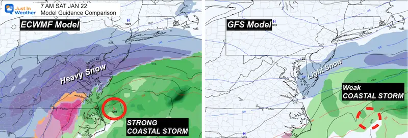
Lower Confidence Saturday with a costal storm. There is less agreement on the impact, but the reliable European does fit the pattern potential with a strong snow maker, this time for the big cities.
Quiet weather for two days. Still breezy today. Mild air spreads in tomorrow.
Then that clipper to our north will drag down arctic air for us Thursday morning.
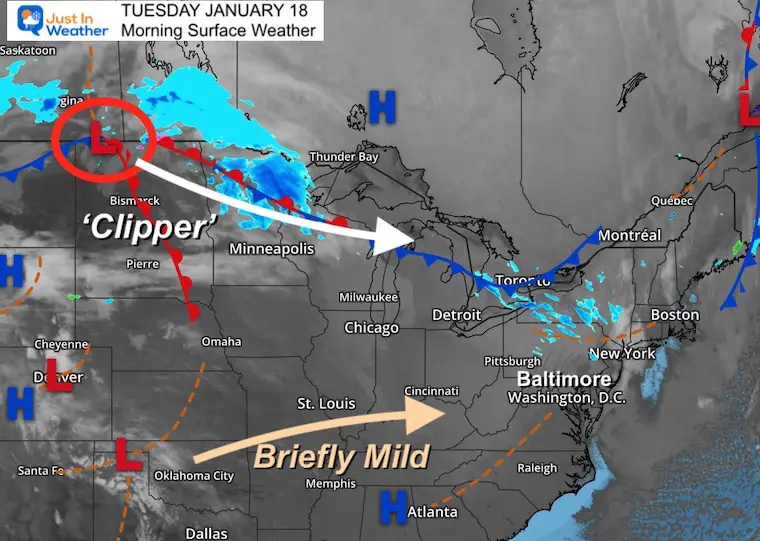
It’s cold, but relatively mild for mid January. We only get two days of this, so make the most of it.
Normal Low in Baltimore: 24ºF
Record -4ºF in 1957
Normal High in Baltimore: 41ºF
Record 68ºF 1990
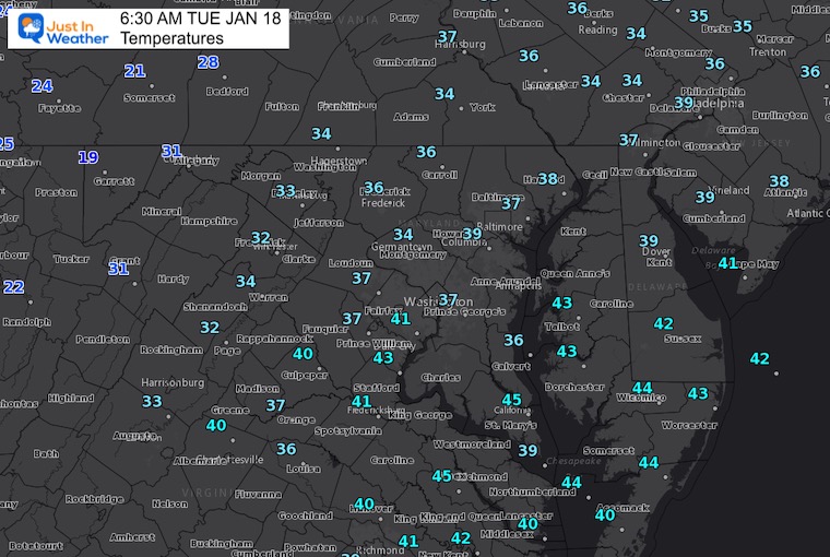
Morning- Not too cold
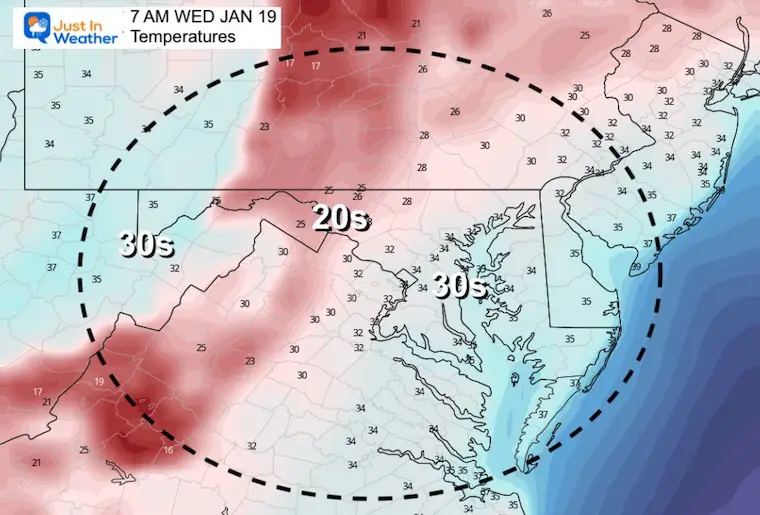
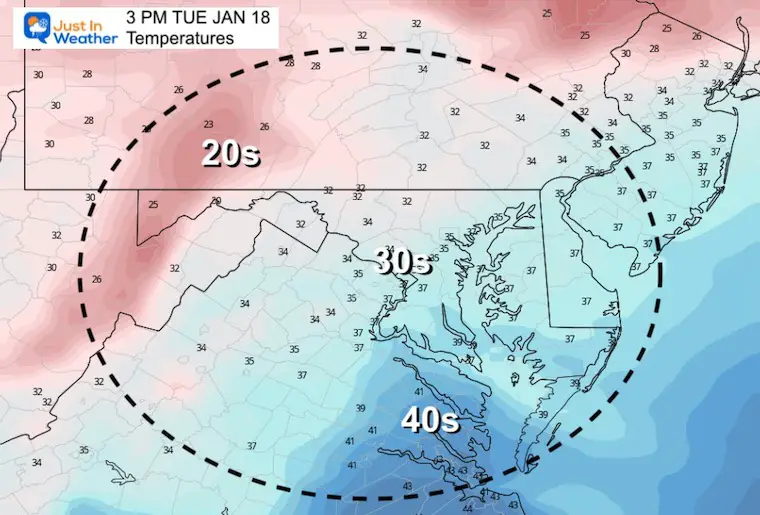
After highs in the mid to upper 40s, watch the collapse of very cold air returning… fully in place again Thursday and Friday.
That is with the arctic front, and set up for the next storm.
This is called an Ana Front, with most of the precipitation behind the boundary in the cold air. That will allow a start of rain to change to a burst of snow.
Potential ‘up to’ 2 inches. Temps will be falling to near freezing, so a wet stat can turn slushy and icy in a hurry during the morning commute. Yes, this may impact travel and schools.
Less agreement with this development.
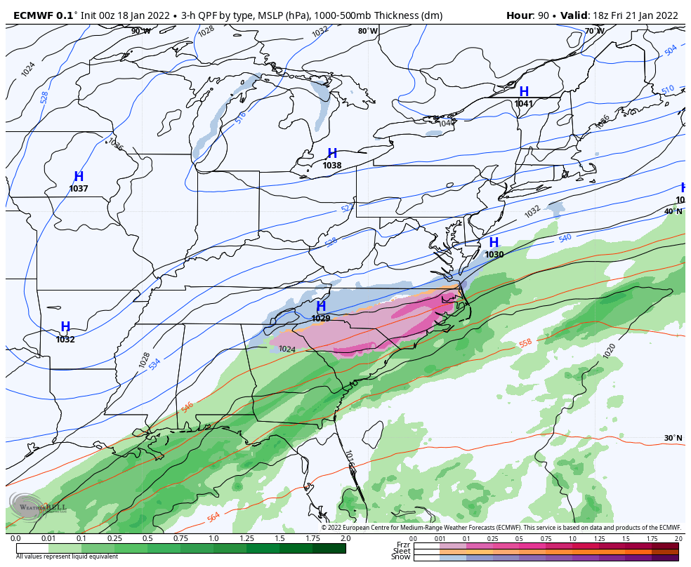
The reliable European Model has been consistently showing a strong coastal storm riding up the trough in the jet stream.
The GFS for some reason does not develop this much, and shifts it farther east. Note: The last storm was NOT in agreement either until about 5 days prior. I do expect more alignment over the next day or so…
ECMWF Model Animation
1 PM Fri to 7 PM Sat
Since this model has the best reputation AND has the most impressive development, let’s check this out.
This is not the same but similar to our last storm… Here we see Low Pressure rising up north along the trough in the jet stream, interacting with the arctic air.
The bulk of the snow will hit most of the day Saturday.
This time, the track will be farther east… The heavy snow may set up for the big cities. Still some wiggle room, and we need to establish the arctic air first to help set this track.
High Confidence:
Lower Confidence:
Saturday Coastal Storm… But it’s worth watching and having a plan B for your schedule.


Last Winter Recap: My Old Outlook And Your Grades Of My Storm Forecasts


