


May 4 Chilly And Wet Weekend: Live Radar
Saturday May 4 Morning Report May the 4th Be With You! There is a definite change in the Force we all will notice this morning. A band of rain has…
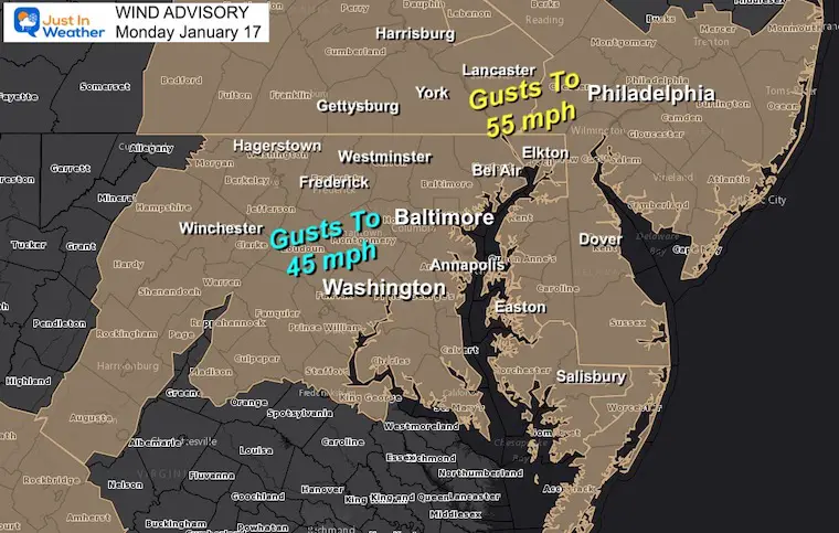
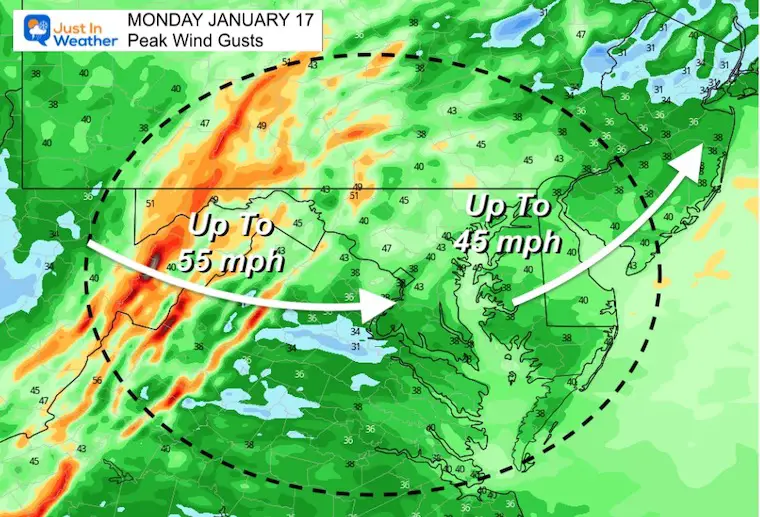
The storm is still influencing our region as it slowly pulls to our north. Cold air has wrapped around the center, and funneling in to The Mid Atlantic with stronger gusts this afternoon. The Wind Advisory remains in place until this evening.
These winds may still gusts well over 40 mph, which can still lead to some tree or power problems. The good news is that the wind direction has switched FROM the West, which will help lower the water levels in the western Chesapeake Bay, but may still slosh to the Eastern Shore.
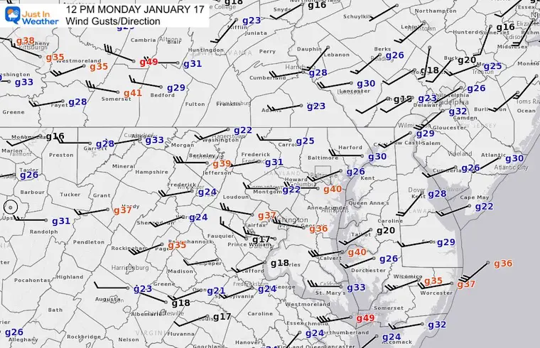
Baltimore’s BWI reached a peak wind of 40 mph. It may still get stronger.
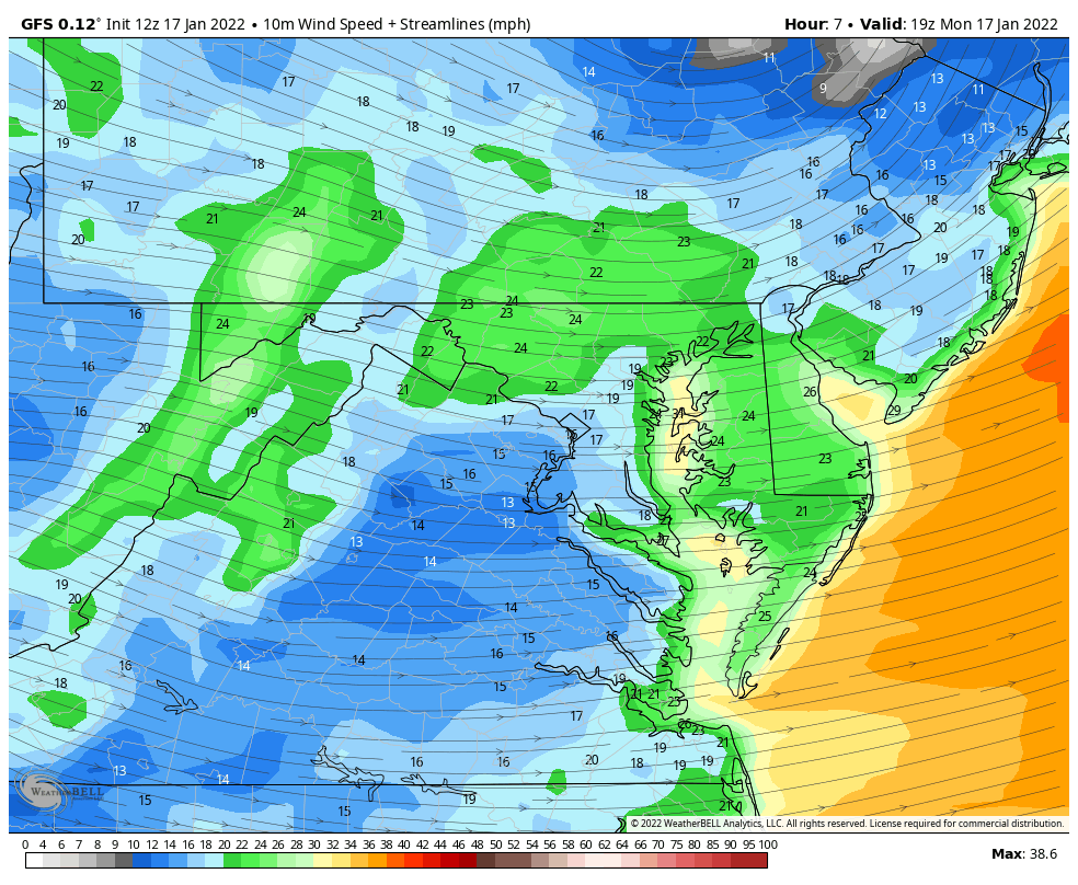
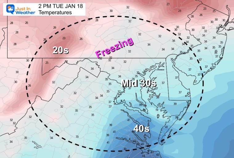
Notice the flow FROM the west, helping to shift the high water on the Chesapeake Bay… and bring in colder air.
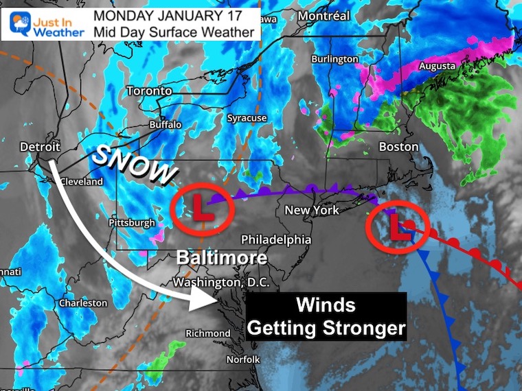
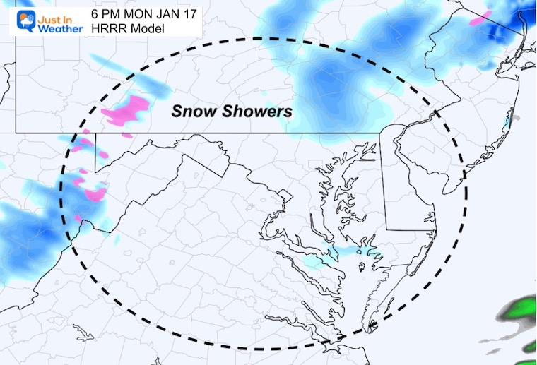
Low Pressure located in central Pennsylvania, with snow still falling from the Great Lakes to the mountains.
Upper Level Energy may still produce snow showers into the evening.
The spin aloft will send one more piece of energy our way that may spark a fee more snow showers or squalls.
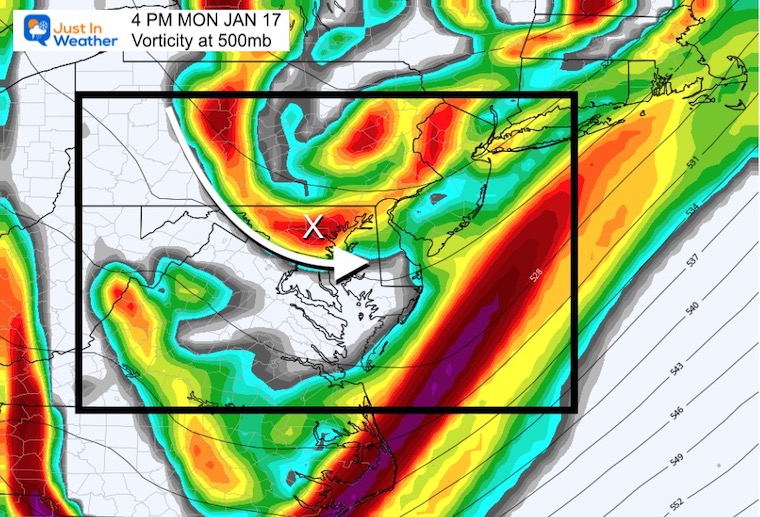
I may be more like across the line into PA, but I except there will be more snow showers into central Maryland between 3 PM and 8 PM.
Wind Forecast Animation
Through Tuesday Morning
Morning
Afternoon
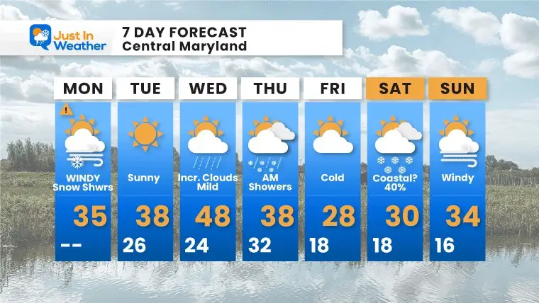
Looking Ahead:
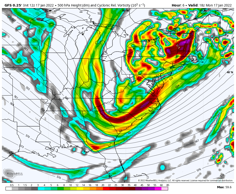
Vorticity through 10 PM Friday
I have chosen to show the Jet Stream Vorticity again to highlight the energy flow.
The next arctic front will arrive on Thursday with showers. The weekend still is not certain with another coastal storm. The GFS does NOT have it while the European does.
But here we see the upper level dynamics support something may develop.


Last Winter Recap: My Old Outlook And Your Grades Of My Storm Forecasts


