


May 4 Chilly And Wet Weekend: Live Radar
Saturday May 4 Morning Report May the 4th Be With You! There is a definite change in the Force we all will notice this morning. A band of rain has…
Wednesday January 5 2022
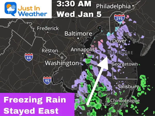
The freezing rain event early this morning did pass over Delmarva and clipped southern Maryland. This was a sharp line on the edge, and it looks like it missed Annapolis and Baltimore. The ‘western shore’ Advisory has been cancelled.
This was the worst of it locally, at 3:30 AM
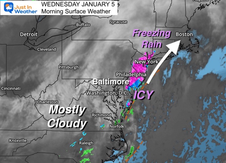
If you are traveling up I-95 to Philadelphia and New York, there may be continued travel problems with ice along the path.
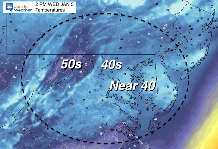
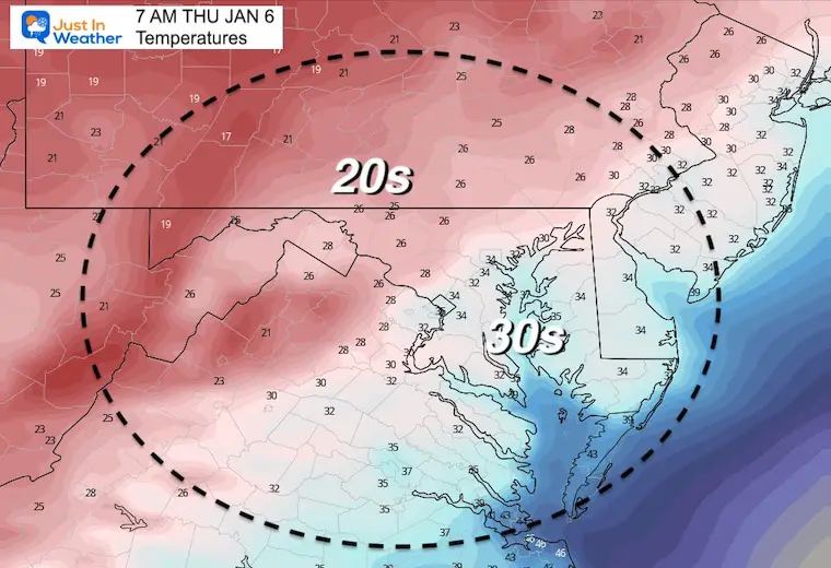
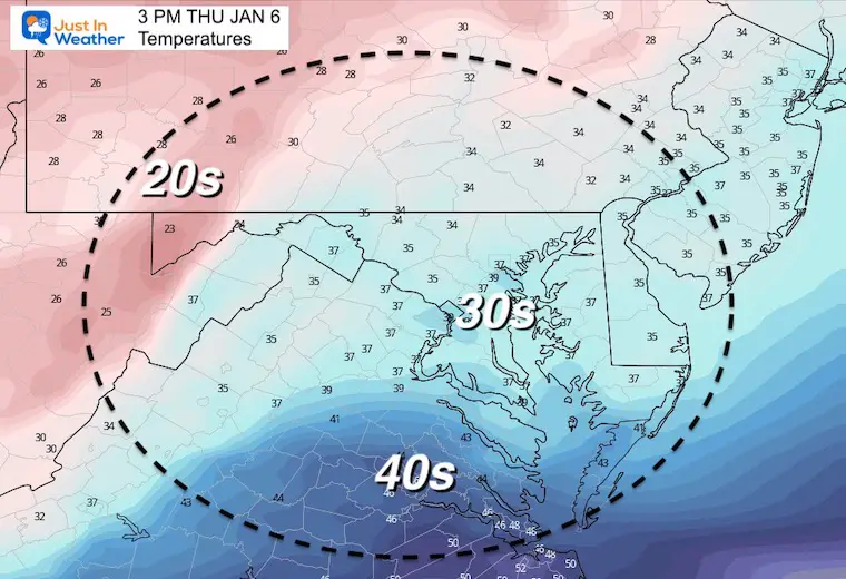
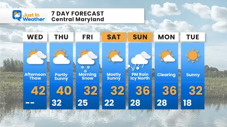
Afternoon thaw with temps into the 40s.
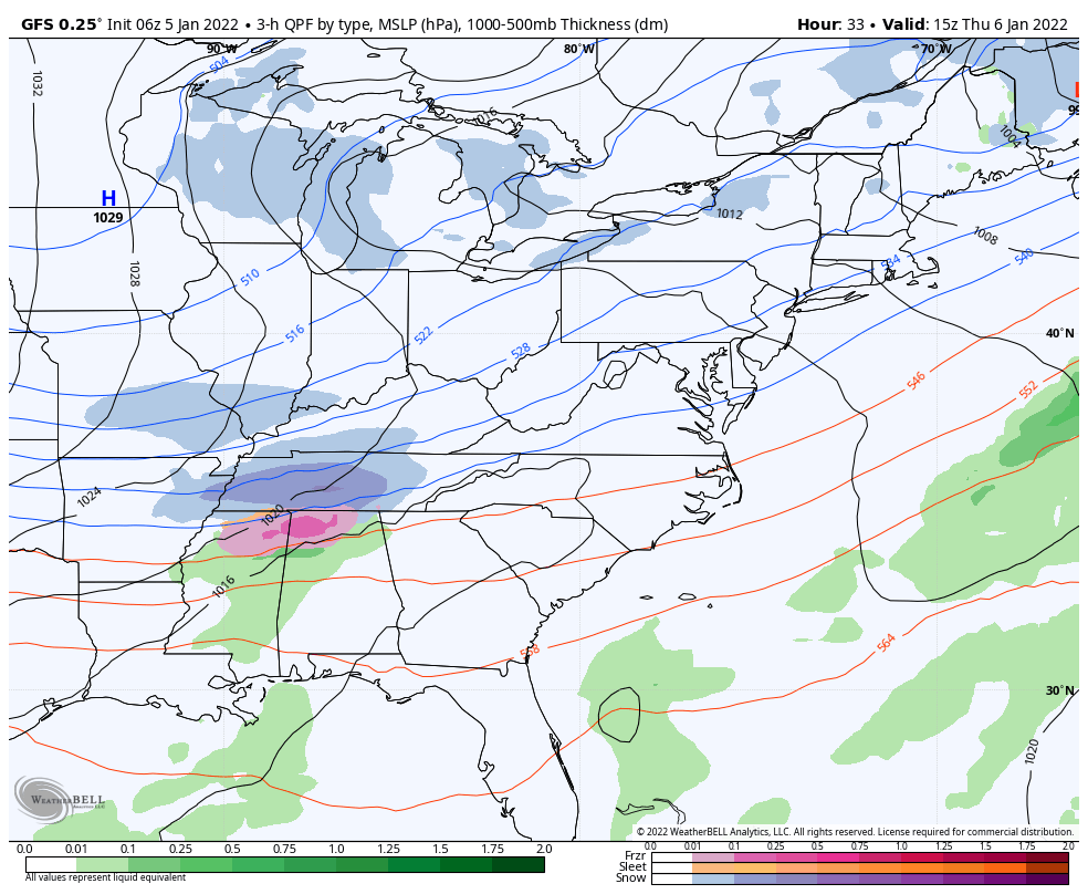
Snow: Next up is the event Thursday Night to Friday morning. It is shaping up to be impactful with the heaviest over the same hard hit areas from Monday.
Icy travel on Delmarva, but the band of freezing rain has moved up the New Jersey and metro New York. If you are traveling north on I-95 please consider a delay.
The sky will remain mostly cloudy for the day.
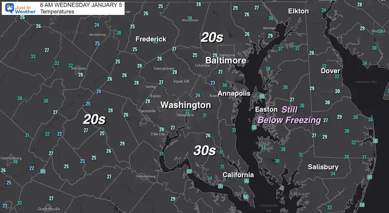
The main concern for ‘new’ icing is on Maryland’s Eastern Shore and Delaware. Temps remain in the 20s to near 30ºF.
The beaches are just over the freezing mark.
Normal Low in Baltimore: 25ºF
Record 1ºF in 1877
Normal High in Baltimore: 42ºF
Record 69ºF 1997
Another refreeze and icy spots in the snow zone.
It will be cooler than today, but still a chance for a thaw.
Still giving this model a chance to prove itself. The system will be a quick mover. Less moisture than the last event, but enough to impact travel. This should be ending in the morning.
10 AM Thursday to 10 AM Friday (GFS)
It does once again appear to bring the heaviest snow to the same southern areas. But light snow may expand farther north this time.
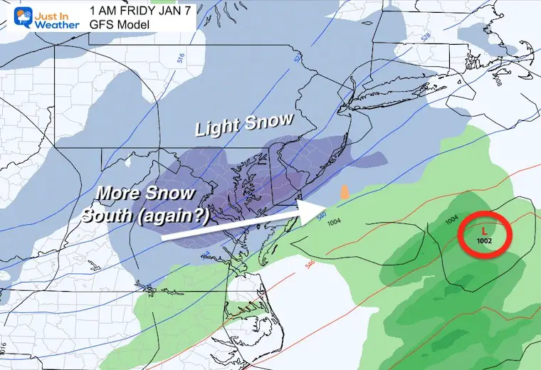
This is in line with the GFS, still showing a little less snow, but also expanding the north end more than the last event.
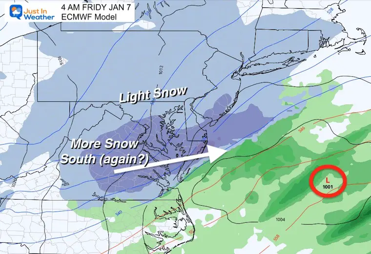
Friday: Whatever falls should be ending during the morning.
Sunday: This looks like a chilly rain in the afternoon, but could have some inland icing


Last Winter Recap: My Old Outlook And Your Grades Of My Storm Forecasts


