Conditions: Baltimore, Maryland, 05/08/2024 11:20:04 am
Temperature

77°

Mostly Cloudy

67°

Dew Point
Relative Humidity

71%

Feels Like

77°

Wind (WSW)

8mph

Air Pressure

29.65

Sun
Sun Rise

05:59 AM

Sun Set

08:06 PM

Day Length

14:07 Hours

Difference

2 min 0 sec gain

Moon
Moon Rise

06:01 AM

Moon Set

09:15 PM

Next: First Quarter

May 15,2024

Moon Phase

New Moon

Climate
Average Low

49°

72°

Average High
Record Low

33°


(1997)

93°


(1930)
Record High
Conditions

Next Snow Arrives Thursday Night Impacts More Areas But Less Intense

Outlook
Winter Weather
Forecast

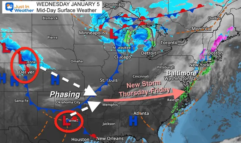
Wednesday January 5 2022

Mid Day Update 

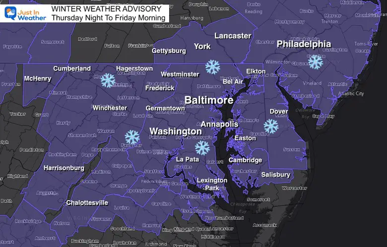
Now that we are in the time frame of less than two days before the next event, the trend is better to zero in on.  My perspective is that this will once again target the same areas that got the most in the last event. 

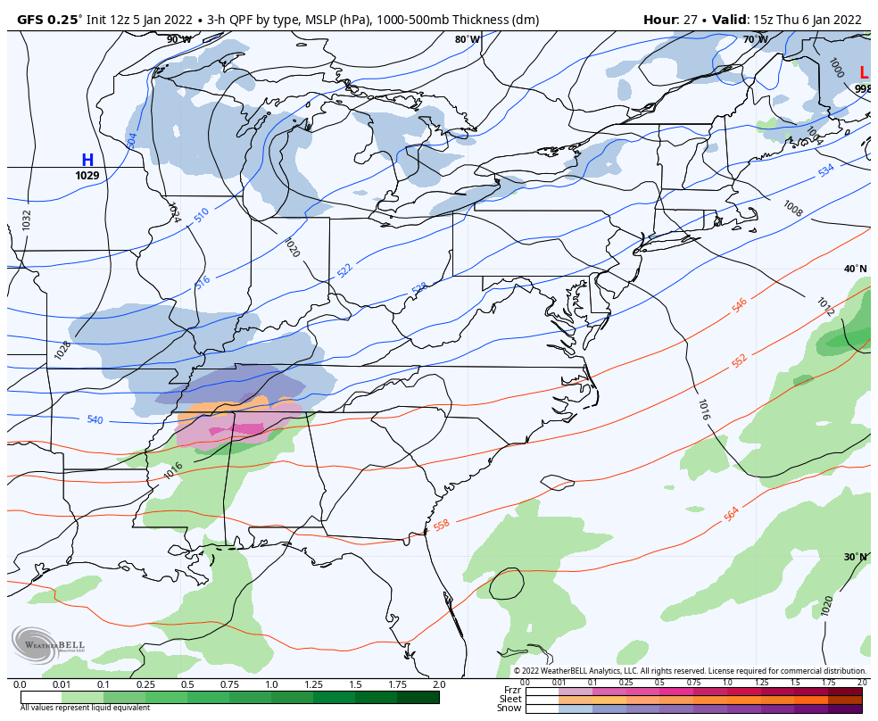
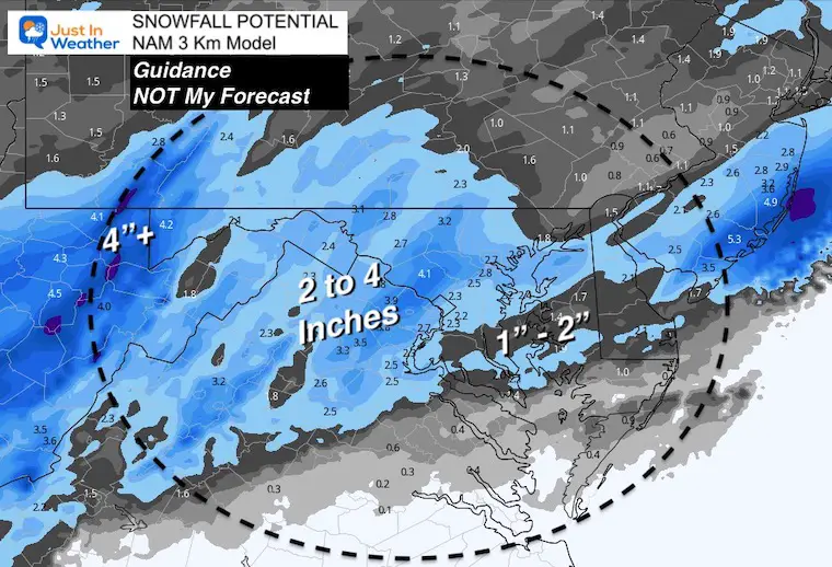
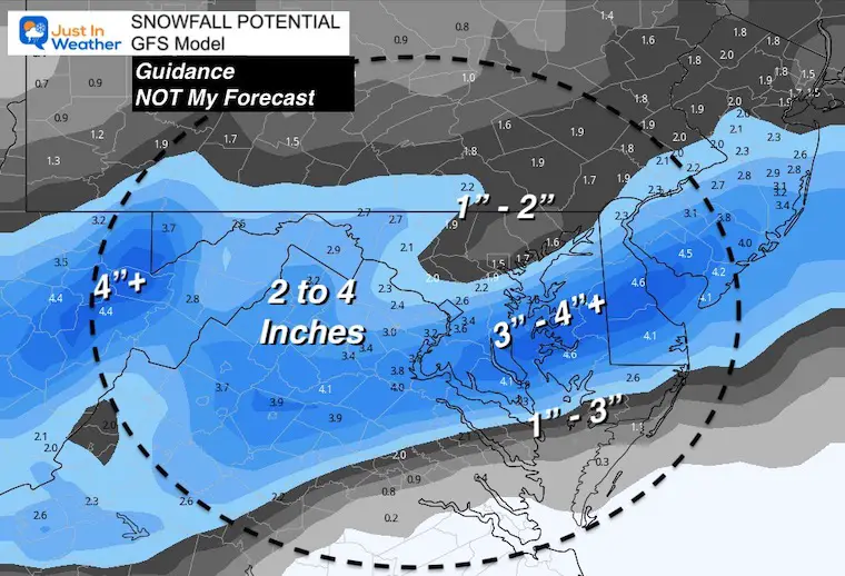
Below is a look at some latest models, and I’ve included products to compare snow ‘potential’.

My Expectations:

  • This will arrive AFTER 8 PM Thursday. 
  • Heaviest around midnight to early morning Friday.
  • Ending for most of us by sunrise Friday. 
  • Enough snow to shovel or plow.
  • Not nearly as intense as the last event. 
  • More areas on the north end of Maryland into PA will be included this time.


Set Up: Wednesday 

What to watch: A little phasing expected between the system North of Denver and southern branch energy seen near Dallas/Oklahoma City.


Animation: GFS Model

Wide View Thursday 10 AM to Friday 1 PM

January-5-snow-storm-forecast-gfs


UPDATE

Click to see:

Winter Weather Advisory Issued For Thursday Night-Friday


Closer Look: NAM 3 Km

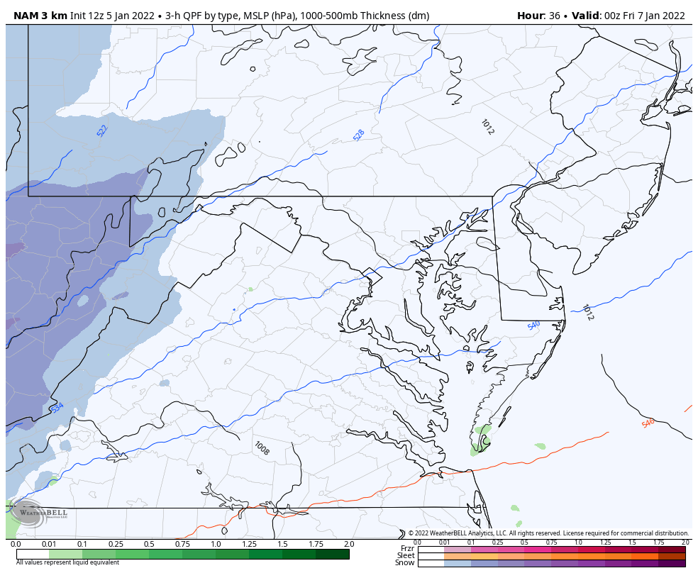
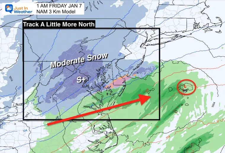
This higher resolution model is trying to shift the even a little farther north.

That would spread the wealth of snow through central Maryland and into southern PA. 

11 PM Thu to 4 AM Fri: Most snow activity shown in metro areas.


January-5-snow-storm-forecast-nam


Snapshot at 1 AM Friday

Temperatures

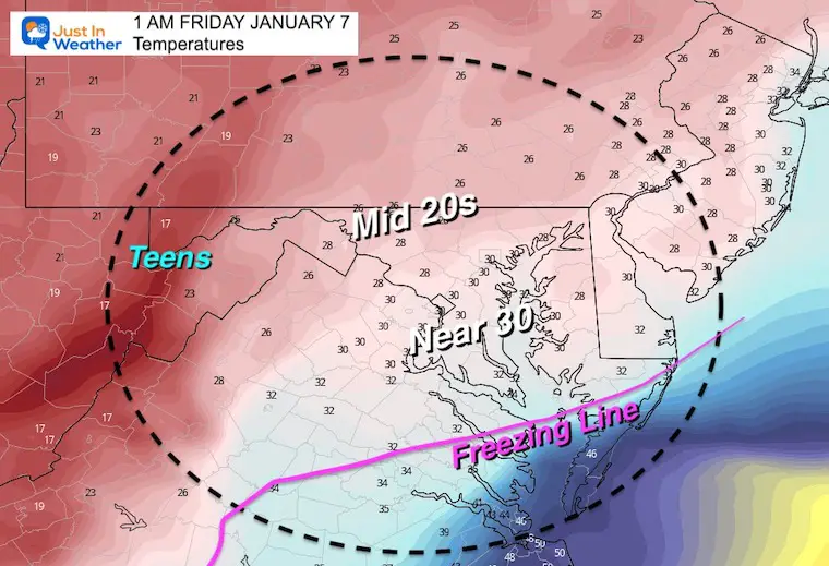
It will be cold enough for stickage. The ground is suffering to support it as well as the air, so more of what falls can be considered to the total results.


NAM 3 Km Model

The track of the Low on this solution is a little farther north. A simple adjustment of 30 to 50 miles (before the storm forms) can make or break the impact on the north AND south end.


COMPARE TO

GFS Model

 There is still a target of the most in the same snow zones that needs to be considered. 


Snowfall Potential

  • These are guides but NOT PERFECT and should not be considered absolute.
  • Models often over estimate how much will be measured on the ground. 
  • There are more models to consider, along with dry air on north side. 


NAM 3 Km Model

More snow on north side, but shaves off the southern Maryland results.


COMPARE TO


GFS Model 

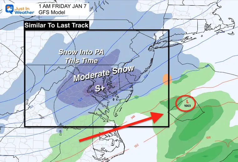
Similar layout for the top zone to last time.

There is more spread on the norther suburbs of Baltimore into southern PA.

*Still the influence of dry air to be considered for less to accumulate on north side., and where that may set up.


Notes: 

  • This looks like a general 2 to 4 inch event.
  • The NAM is tracking NORTH… Which will include more that missed out last time, but also brings warmer air to the southern zones. 
  • GFS is right on with a near repeat or Atmospheric Memory in the top snow zone, but limits impact in Baltimore’s northern ‘burbs.
  • I am sharing models, which I know many other outlets now do as well. 
  • I hope this helps to give you and idea of what to expect.
  • Now I get to work on more specifics, and will post my First Call Map later today.


Weather posts straight to your inbox

Sign up and be the first to know!


ALSO SEE


What is Faith in the Flakes: History of December 5th Snow


ALL FITF GEAR


Winter Outlook Series:

My Call For Snowfall


Last Winter Recap: My Old Outlook And Your Grades Of My Storm Forecasts

Winter Weather Page – Lots of resources


Solar Cycle Increasing Sunspots Suggests More Snow


Comparing 4 Different Farmer’s Almanacs: Majority colder winter outlook than NOAA


NOAA Winter Outlook- But Read The Fine Print


Signals For Early Start To Winter In November


Winter Outlook Series: La Nina Double Dip


Nor’easters May Give Hint For Winter La Nina Pattern


Winter Folklore Checklist


Please share your thoughts, best weather pics/video, or just keep in touch via social media

Facebook: Justin Berk, Meteorologist

Twitter: @JustinWeather

Instagram: justinweather