


May 9 Cooler With Rain And Severe Storm Risk Tonight South
Thursday May 9 Morning Report Today is the first day of the year with sunrise before 6 AM in Baltimore, but we won’t see it. After a high temperature of…
Tuesday December 21
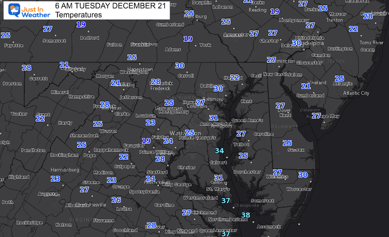
Today is the Winter Solstice. At 10:58 AM, the sun will reach the Tropic of Capricorn, the farthest south of the year. That will mark our lowest sun angle and shortest daylight… The start of astronomical winter.
While the days will slowly get longer, the coldest air is usually mid January, so plenty of season ahead.
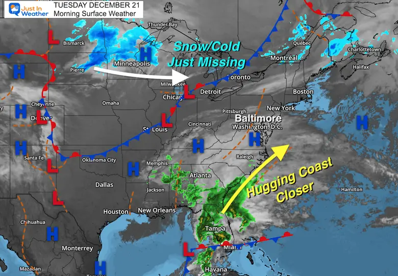
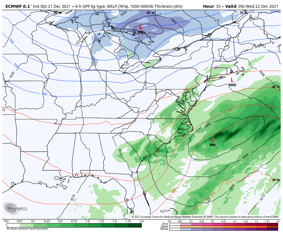
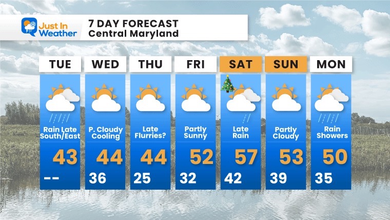
Today we watch the second close call storm and it will actually be reaching part of our region. This was the event that last week looked like a winter event, that vanished. I wrote a full post about the poor computer guidance, however it did identify a storm a week away.
This ‘miss’ now looks like a hit with a potent storm out of the Gulf of Mexico. Severe weather is possible near Tampa, and that Low will move up the coast.
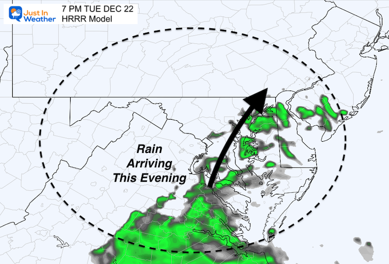
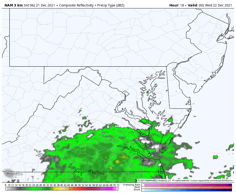
Rain will reach Maryland this evening, with the back end now possible into Annapolis and Baltimore tonight. There may be cold enough air to mix in some sleet.
The northern snow is the second part that was needed to time out and ‘phase’ to allow that storm to become a significant winter event. The timing is off… But does appear closer… That is why the coastal will be pulled closer/west.
Seasonally cold!
It looks like rain showers will be spreading north by evening.
Watch the timing… as this is the model that has been slow by 1 to 3 hours.
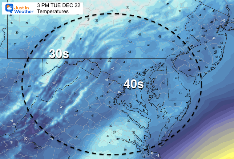
Evening through Wednesday morning
There is a hint of sleet shown here, but I believe it may be possible in interior Maryland and southern PA tonight.
I do not expect stickage or road issues at this time.
It will be done by morning, then snow showers will develop in western Maryland.
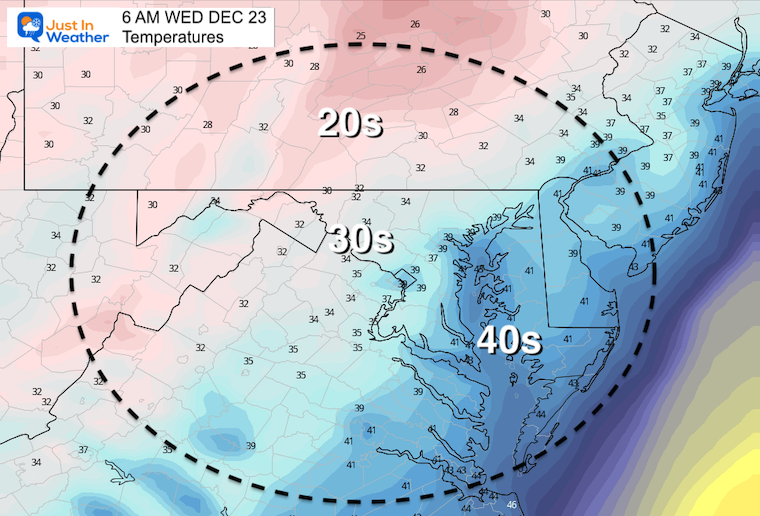
Normal Low in Baltimore: 27ºF
Record 5ºF in 1942
Normal High in Baltimore: 44ºF
Record 71ºF 2013
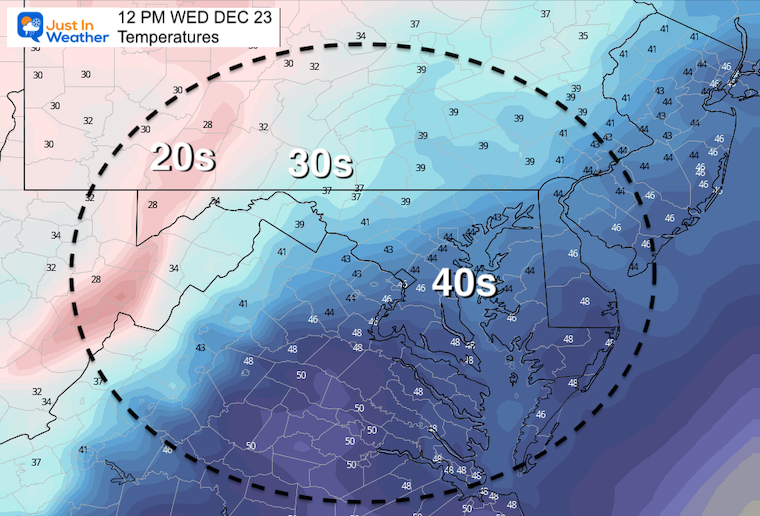
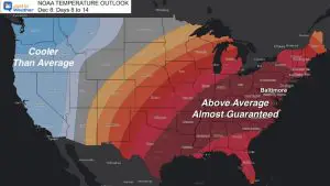
Wednesday Morning To Monday Morning
This round of cold air may seem like a ‘waste’ to winter lovers… The jet stream will lift north and bring in warmer temps with rain Christmas weekend.
It may seem disappointing, but there is more cold air that will return and gradually shift the pattern. We just need to continue and wait for the course correction.

Last Winter Recap: My Old Outlook And Your Grades Of My Storm Forecasts


