


May 9 Cooler With Rain And Severe Storm Risk Tonight South
Thursday May 9 Morning Report Today is the first day of the year with sunrise before 6 AM in Baltimore, but we won’t see it. After a high temperature of…
Monday December 20
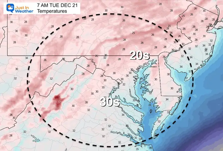
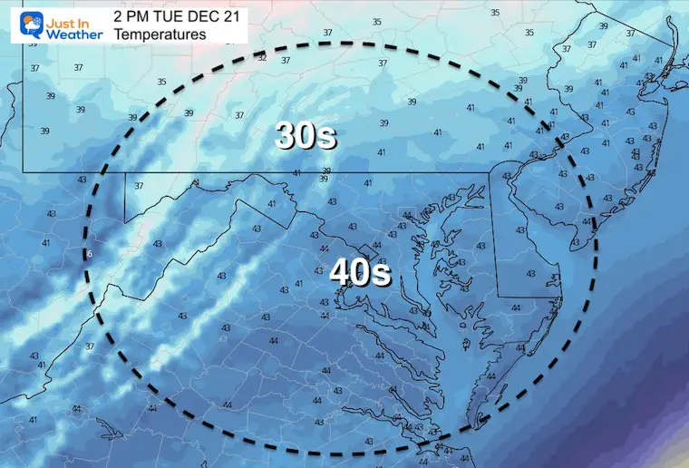
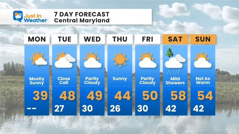
This morning you will feel it for sure! The advertised END of the warm spell has come with cold winter air back in place. Most temps this morning are back in the 20s and teens.
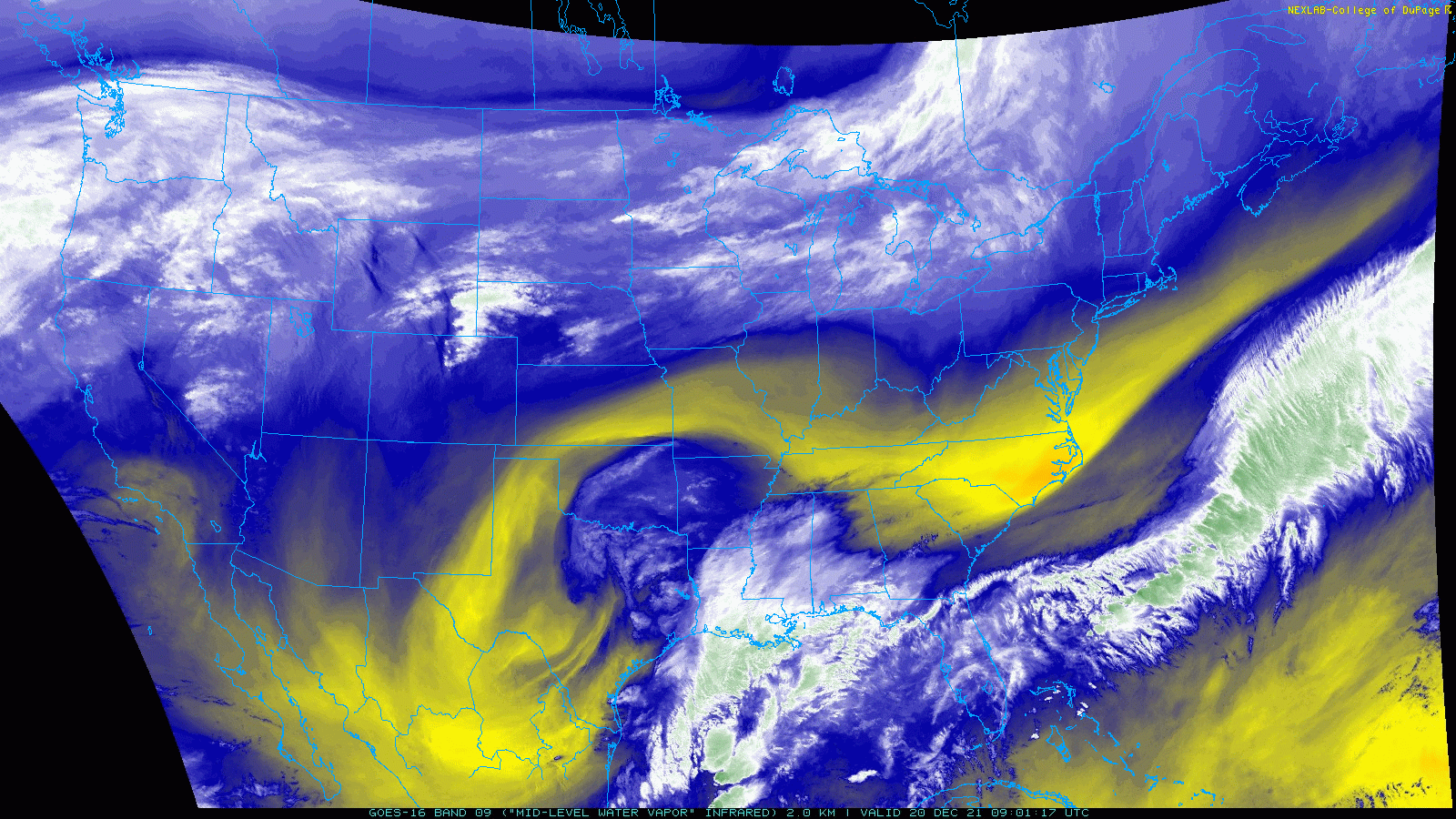
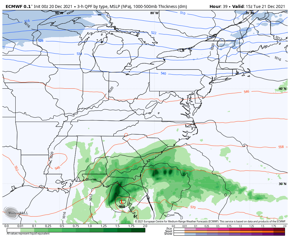
Do you recall that ‘potential’ storm this week that I wrote about last week? The computer guidance had it, then lost it within a day. That was the crux of my article about the unreliability beyond 5 days. Well, now we watch the first of two ‘close calls’ off the coast, which I will show below.
The pattern is there, but the ingredients are just off. This does leave the door open to more when real winter does settle in.
Note: Winter Solstice is tomorrow December 21 at 10:58 AM. That will be the lowest the sun angel of any day all year. It will mark astronomical winter and the days will slowly begin to get warmer. However, our coldest temps usually occur in the 3rd week of January. That is known as the temperature lag.
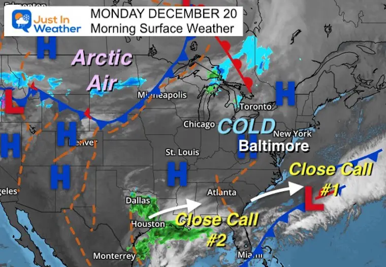
It looks like a growing storm in the Gulf Coast region… Which in many cases would be a storm for us. In this case, the northern branch of energy needed to phase and bring it to the Mid Atlantic does not appear to time out well..
A hint of arctic air has returned with teens in the inland suburbs, and 20s for most of the metro are and Delmarva away from the water.
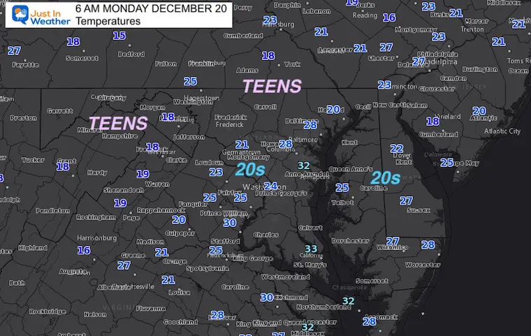
Normal Low in Baltimore: 27ºF
Record 6ºF in 1942
Normal High in Baltimore: 44ºF
Record 67ºF 1877
The pattern once again brings a coastal storm to the Southeast US and just misses the cold air and our region. I do believe may nudge north a little, but is doubtful for a bump enough for a big surprise.
The issue is that the pattern is showing us potential, we just need the timing with the cold air to shift the track and results. I believe we will see that happen this winter.
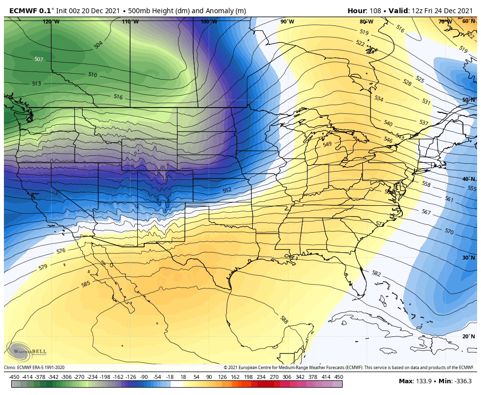
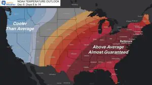
Jet Stream Dec 24 to Dec 29
After the mild push ahead Christmas, we can see the ridge get pushed out and the return of colder air (blue/green) next week.
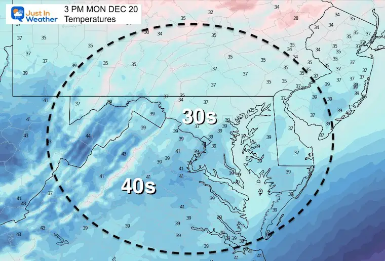
We have near normal winter chill this week! But the chance for a White Christmas is not going to be here. In fact, the next system will pass north and bring us rain showers with mild temps.
Then the next shift back to cold air before the new year.

Last Winter Recap: My Old Outlook And Your Grades Of My Storm Forecasts


