


May 10 Chilly With More Rain Showers Today And Into Mothers Day Weekend
Friday May 10 Morning Report Today is the second day of the year, with sunrise before 6 AM in Baltimore, but like yesterday, we won’t see it. After a high…
Wednesday December 8 2021
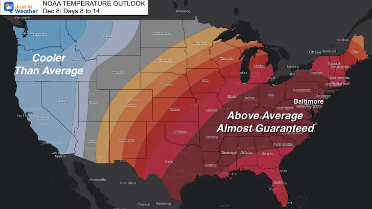
There is a lot of buzz about the warm weather pattern on the way since NOAA released their outlook. I have heard a lot of things, including some expecting to be wearing shorts on Christmas – again.
That was reference to the ‘blow torch’ wrath we had in 2015, when Baltimore had a high of 69ºF on Christmas Day. I’d like to remind you that the following month, BWI recorded 29.2 inches of snow in the largest snowstorm on record for the region. Extremes do breed extremes on both ends.
I am not suggesting that will repeat now, but I do believe that any warming we get this month will allow the arctic air locked up to the north to build and and eventually break loose. I am not alone in that thinking.
Note: Alaska just had one of its tip 5 coldest Novembers on record. It’s still quite cold and will eventually try to move somewhere.
Looking ahead to the mid month, the odds are high enough to promise the eastern US will be above average. This does not say how warm, just that it will be warm. More on the temps below.
Before we get to the warmth, whether you want it or not, don’t you want more snow for this guy? Jack was really excited about the little snow this morning in northern Maryland.
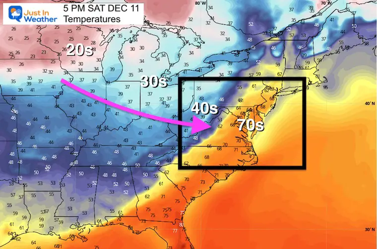
The warmth is not here yet! Thursday will be chilly. And then we get a warm up on Saturday, only to be met with a line of rain, and more cold air Sunday.
I cringe as I write this considering the headache computer models gave us with the little snow event today. There is a little more reliability (to some extent) with patterns as a whole going out 1 to 2 weeks. It is more broad based rather than an individual storm. Still, it gets less trustworthy farther out.
This animation shows the troughs of colder air (blue and green) and the ridges of warmer air (orange and red).
During the outlook period, there will be surges of warm air, but it will to be al all out blow torch. However, a few days will spike with warm air that may challenge record high temperatures.
It will be about 2 weeks, but we should see the pattern break down. A large Ridge in the north Pacific should enter Alaska and help dislodge the arctic air.
We will see a series of troughs with progressively colder air.

Here’s our friend Dr. Judah Cohen’s thoughts. He has been promoting a warm winter, however is coming around to this notion of shaking up the Polar Vortex Christmas Week.
The power of the sweater. I’ve been Debbie Downer about #winter weather prospects but the risk of a change to more widespread colder weather is increasing. GFS prediction of Alaskan-Scandi ridge-bridge could be a harbinger of a stretched #PolarVortex & colder weather for Asia, US pic.twitter.com/F9Ft5Zf2BH
— Judah Cohen (@judah47) December 8, 2021
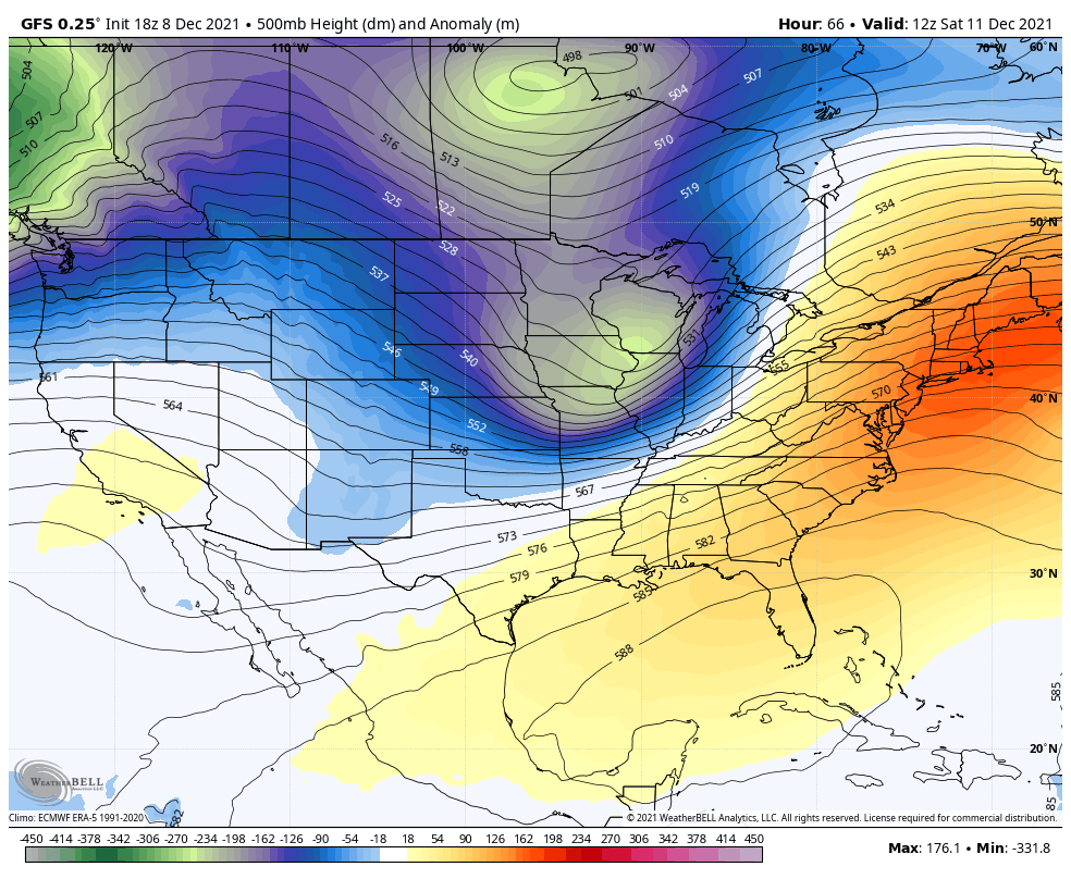
The GFS Deterministic Model shows the spikes of warm air I mentioned.

Larry Cosgrove is a friend and well respected forecaster. Here are a few quotes from his latest discussion.
“But this being December, and much of the Northern Hemisphere and Canada dealing with a deep snowpack and less (or no) sunlight, it is justifiable to ask, how long can this last? A Siberian cold dome will beget an Arctic vortex, which in turn will favor a slow build of ridging in and near the North Pole. So on the flip side, after a nice spell of low heating bills, another deep 500MB cAk gyre will be favored to take shape. Before the end of 2021.”
“But when all is said and done, a large cold motherlode should be centered over James Bay. This transition will probably be accompanied by a storm moving out of the Intermountain Region toward the St. Lawrence Valley December 23-26. At that time, maybe Santa will reward you with a week or so of bitter cold and frozen precipitation in the Midwest and Northeast.”
Well, I am not the only one. There are even more that will be watching for winter to return for us Christmas week. I hope Larry is right with a gift of a winter storm… But that would depend on the trough axis (negative) for us to get in on that action.
Hang in there. Rather than being frustrated, I will embrace this. Besides, I have other work to catch up on. But will be not loose my Faith in the Flakes.

Last Winter Recap: My Old Outlook And Your Grades Of My Storm Forecasts


