


May 3 Cooler Today Then More Rain Expected This Weekend
Friday May 3 Morning Report Another record high of 90ºF was reached yesterday at BWI. This tied the mark set in 2018. Today, a cooler wind will bring us closer…
Wednesday December 8
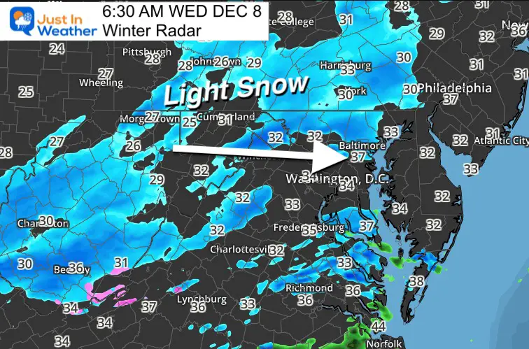
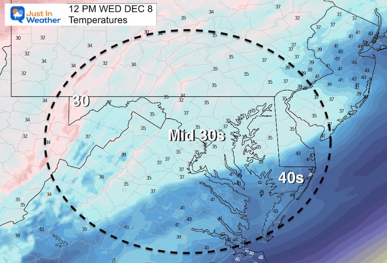
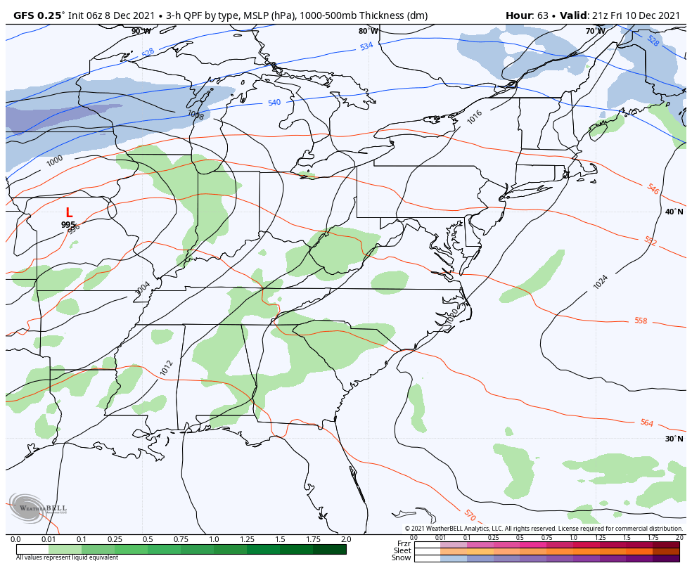
I woke up this morning to look a the radar, and it appeared like the original forecast. I don’t want to get ahead of my skis here. I still believe this will be more for show, but you have a good chance to see snow falling today. Perhaps getting a coating on the grass. But pavement for most areas will not be an issue. However, I will watch falling temps near the MD/PA line with the early morning setting just in case.
Well, we have light snow spread on radar. It is still disorganized, and some virga (not reaching the ground) but still trying to push out flakes. The standard winter set up applies waiting for air to saturate and watching ground temps for stickage.
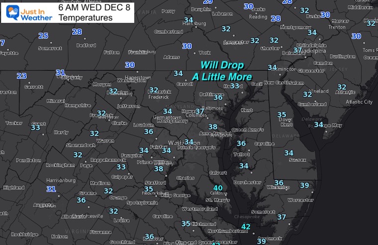
Temps may still drop a few degrees, putting the normal colder inland areas at the freezing mark as originally expected. Also metro areas should remain just above 32ºF, so no road impact expected.
What if Lucy took away the football… But what IF SHE PUT IT BACK?
The HRRR Model is our best guidance in short term, but NOT perfect!
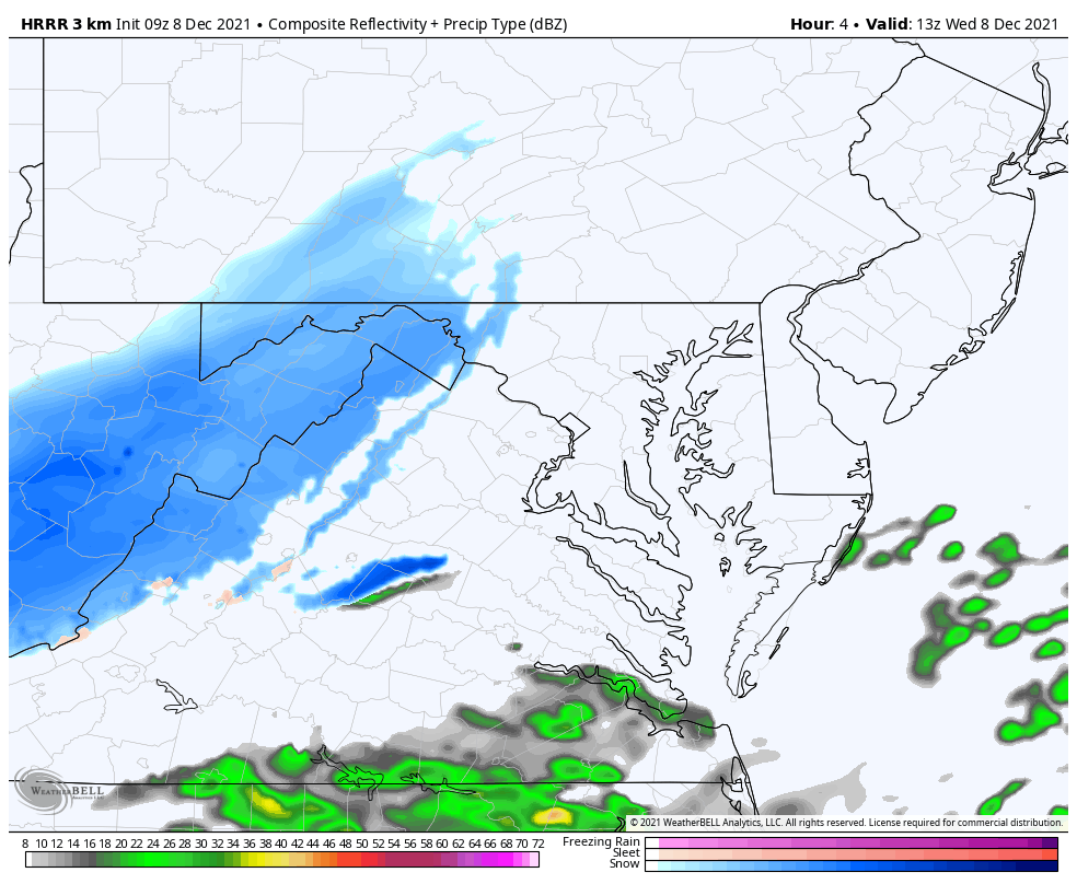
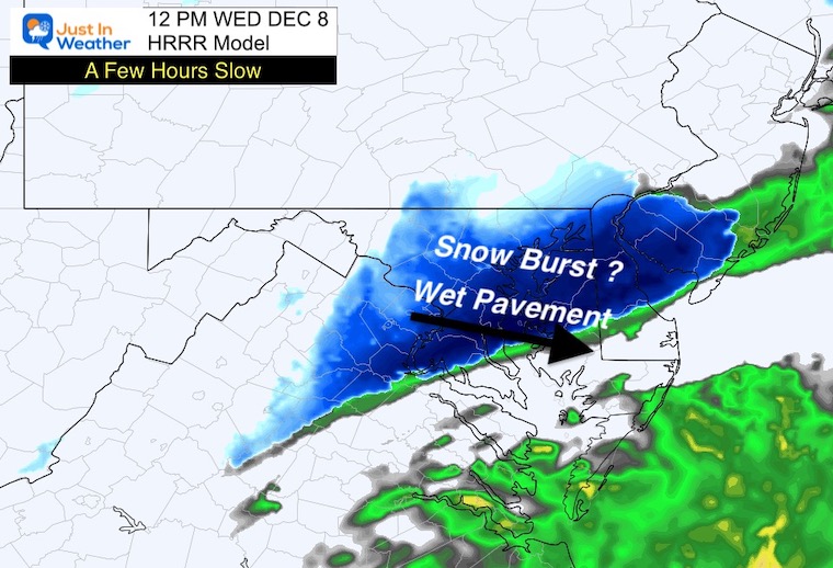
A PULSE or BURST of snow is possible in central Maryland, but temps will keep roads wet – following the original forecast.
When this reaches southern Maryland and lower Eastern Shore, the roads will also be wet there.
Also, a coating on the grass is back in play.
TODAY December 8
Normal Low in Baltimore: 30ºF
Record 10ºF in 1882
Normal High in Baltimore: 47ºF
Record 74ºF 1980
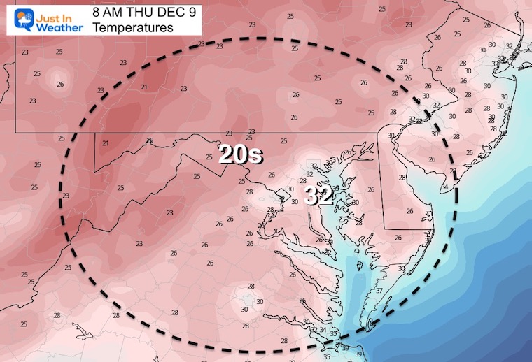
Colder air will spill behind this little storm system, for a day.
Saturday Temperatures
The region will surge back the 60s to near 70ºF, before a cold front brings in anthem sharp cool down.
The timing of this will determine how warm we can get. Considering that systems arrive sooner than shown, w could see the rain by noon, cutting off the warming earlier.
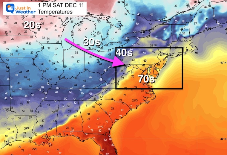
The next Low Pressure will pass through the Great Lakes. This will pump in that warm air, then rain Saturday, followed by the colder air.
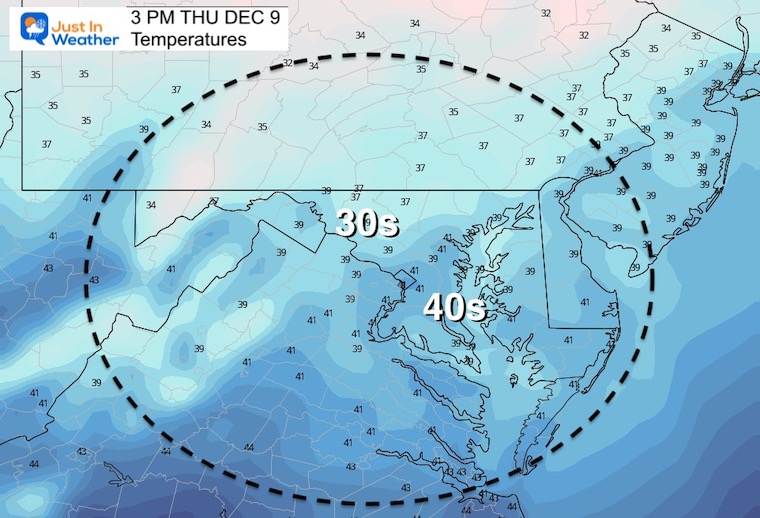
Light snow today, then colder tomorrow. We warm again ahead of the next storm on Saturday. Only to cool down with a windy Sunday.
Next week we will enter a warm period again. 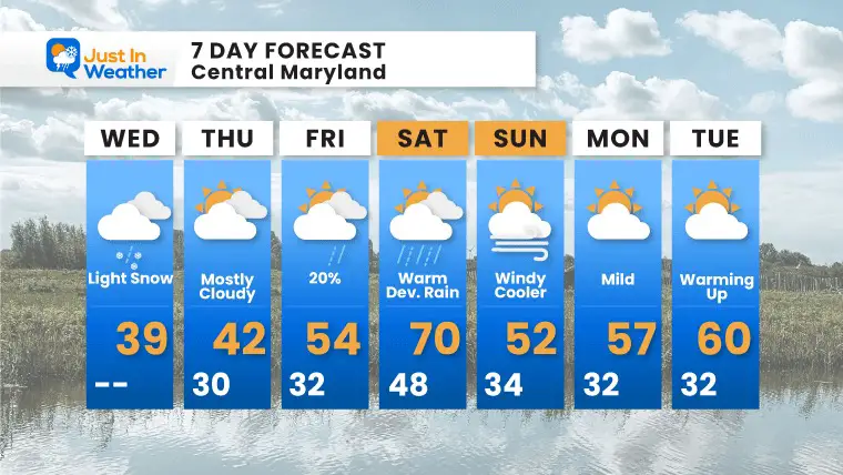

Last Winter Recap: My Old Outlook And Your Grades Of My Storm Forecasts


