


May 6 Morning Fog Then Rain Returns Tonight
Monday May 6 Morning Report The pattern remains soggy with dense fog this morning. The next round of rain will return tonight into Tuesday morning. Then it should break up…
Thursday December 9
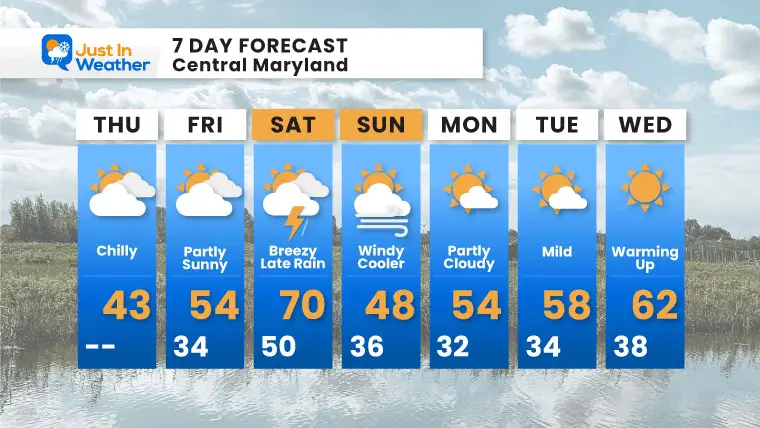
Back to the cold this morning. The majority of the last 3 weeks has been below average but that may get lost with the lack of snow, and bump of warm days. We will get one of them this weekend, followed by another strong cold front.
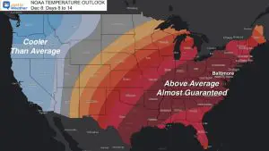
Last night I wrote about the NOAA Outlook for warm pattern mid month. We will be above ‘average’ but only a handful of days will feature those bumps, which may challenge a record high.
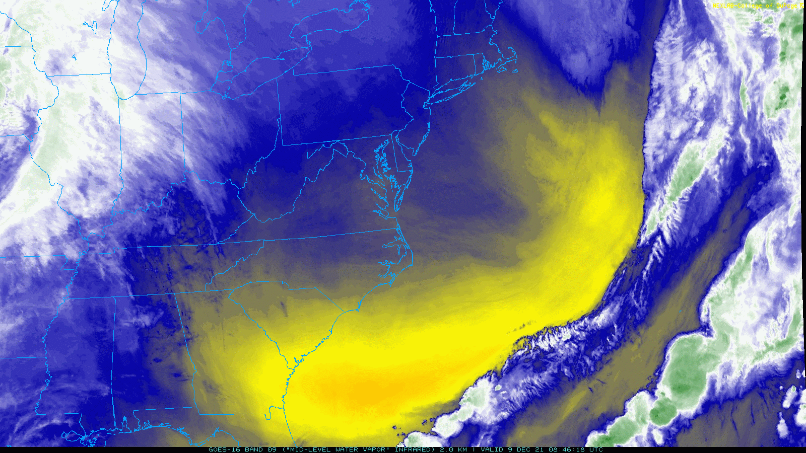
High Pressure is overhead, but fast moving air aloft will carry high clouds to dim the sun during the day. We can see that on the satellite loop below.
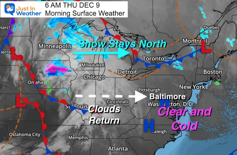
It is cold! We still need winter apparel.

This may make for a beautiful sunrise.
—-> Check the time in the “Current Conditions” tab on the right.—->
These cirrus clouds may dim the sun and help produce a solar halo and or sun dog this afternoon.
Remaining ‘below’ average, and with diming sunshine will feel chilly.
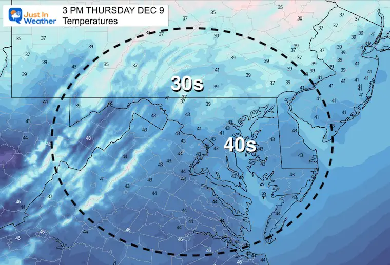
Normal Low in Baltimore: 30ºF
Record 4ºF in 1876
Normal High in Baltimore: 47ºF
Record 73ºF 1966


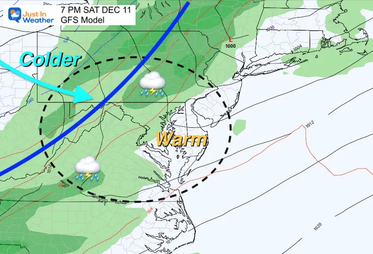
The region will surge back the 60s to near 70ºF, before a cold front brings in anthem sharp cool down.
The timing of this will determine how warm we can get.

The next Low Pressure will pass through the Great Lakes. This will pump in that warm air, then rain Saturday, followed by the colder air.
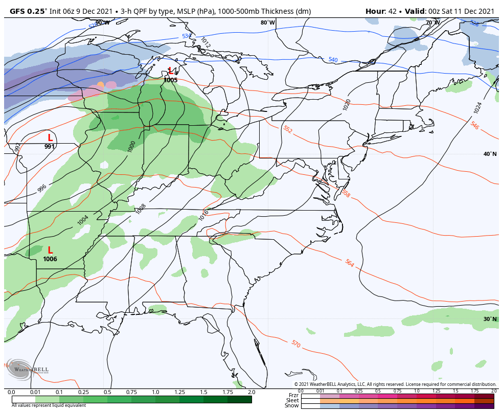
We will trend above average, with a few ‘spikes’ of warm days. Already next week’s temps are a challenge. In my NOAA Outlook report last night, we saw temps near 70ºF for next Wednesday. However the overnight model package dropped that. The guidance is poor beyond 5 days. We can see trends, but specifics can not be fully accepted. I will be tampering down on extreme projections that far out.

Last Winter Recap: My Old Outlook And Your Grades Of My Storm Forecasts


