


Average Last Frost or Freeze Dates And Map For Maryland
There is a good reason why many gardeners suggest NOT to plan tomatoes until after Mother’s Day. Early surges of warm air in spring can be deceiving. Just because the…
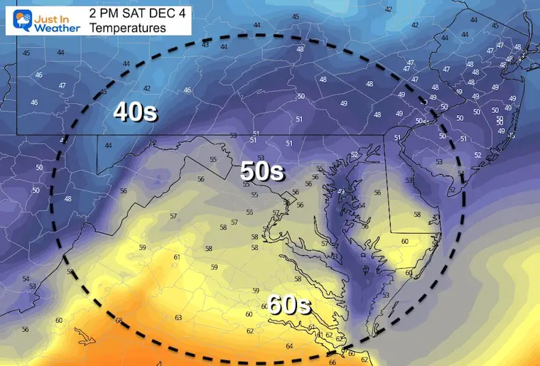
Saturday December 4
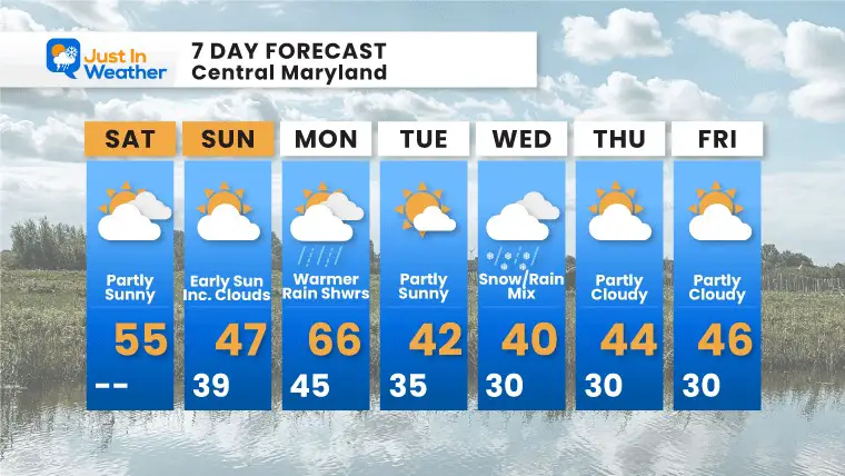
We are in for another roller coaster ride of sorts. Variably weather on the edge of the jet stream will allow a bump up in temps, then just cold enough to bring in a snow and rain mix within a few days.
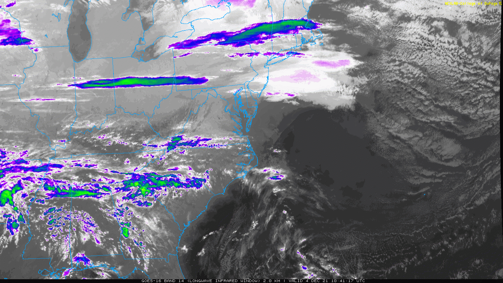
The current storm track appears split to our north and south. While High Pressure is off of the Mid Atlantic coast, upper level winds keep streaming in bands of clouds.
Today will be mild, then cooler tomorrow. This will be followed by a warmer Today, with rain. Then a chance for a wintry mix on Wednesday.

Still watching bands of clouds racing in from the Northwest.
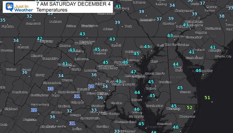
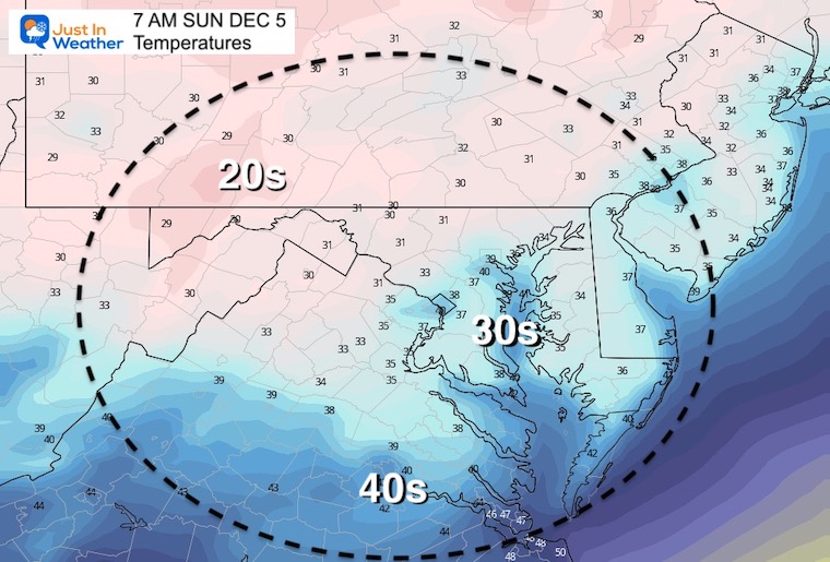
Normal Low in Baltimore: 31ºF
Record 13ºF in 1966
Normal High in Baltimore: 49ºF
Record 74ºF 1982
Wear you FITF gear to show off your love of snow!
The start of FITF is woven in with my oldest son and the decade with the first date of snow in our region almost every day. I will have more on that later today.
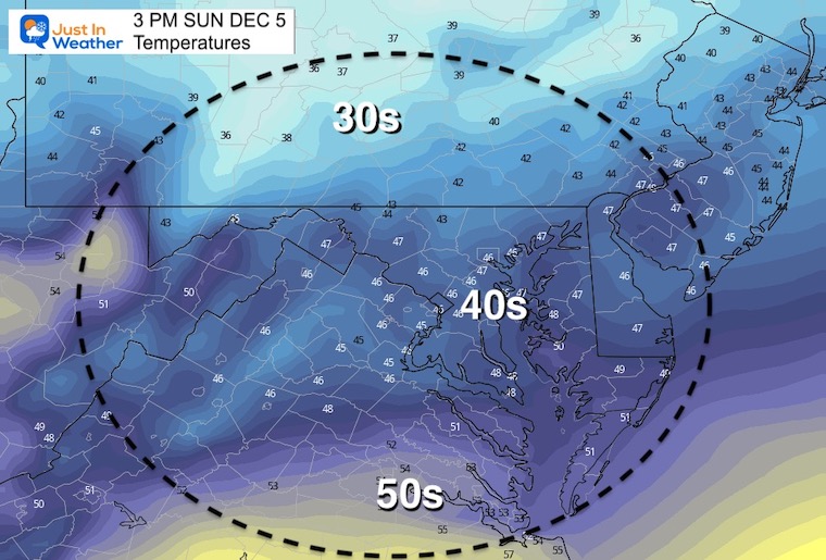
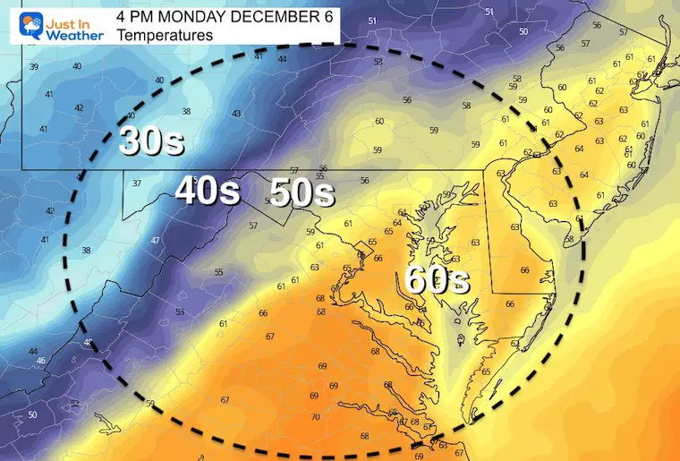
Rain shower may begin late Sunday night. Rain on Monday is more likely in the afternoon, but the timing of the rain with this cold front, plus the cloud cover will make the difference in how warm temps may get.
The push on the thermometers will depend on the amount of cloud cover and timing the arrival of the cold front later in the day. If that arrives sooner, then temps will be cooler.
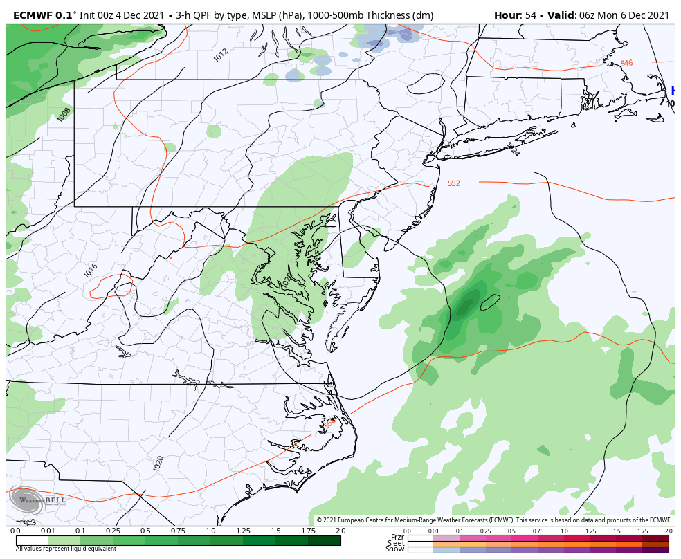
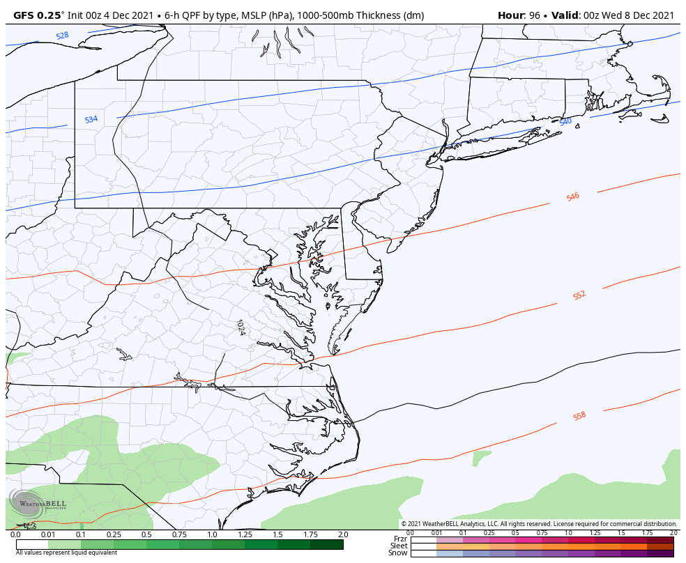
For the past few days I have been showing the Euro model with this event. The American GFS Model was too warm. Here we see that model tending colder showing a wintry mix (pink), then going to rain (green). We still need to watch this for timing and temps.
Up to this point, the trend I identified has been shown to push this farther south and colder. Now we watch for any more adjustments with all of the model guidance package.


Last Winter Recap: My Old Outlook And Your Grades Of My Storm Forecasts


