Wednesday December 22
This is a brief report with a focus on this morning and the rest of today. I will follow with a complete forecast later this morning.
The system that clipped us with light rain and some sleet pellets last night has moved out. Some clearing has allowed two things of some concern this morning. Nothing major, but worth attention:
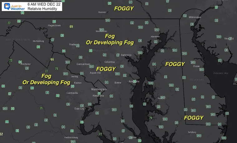
- Fog is forming
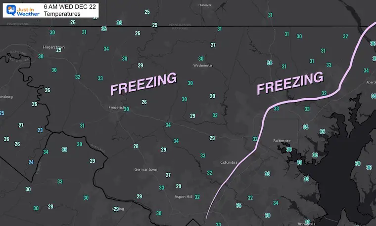
- Temps inland have dropped below freeing.
The result may be some icing by daybreak in spots. Most sensitive are elevated bridged and ramps, so please pay close attention.
6 AM Conditions
Temperatures
Relative Humidity:
Closer to 100% is where FOG has or will be forming.
Note: I will update conditions all morning on the Live Weather Page
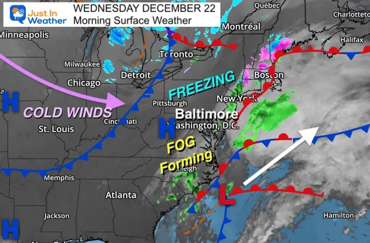
Morning Surface Weather
Low Pressure is off of North Carolina, with light rain extending up I-95 to metro NY and mix into New England.
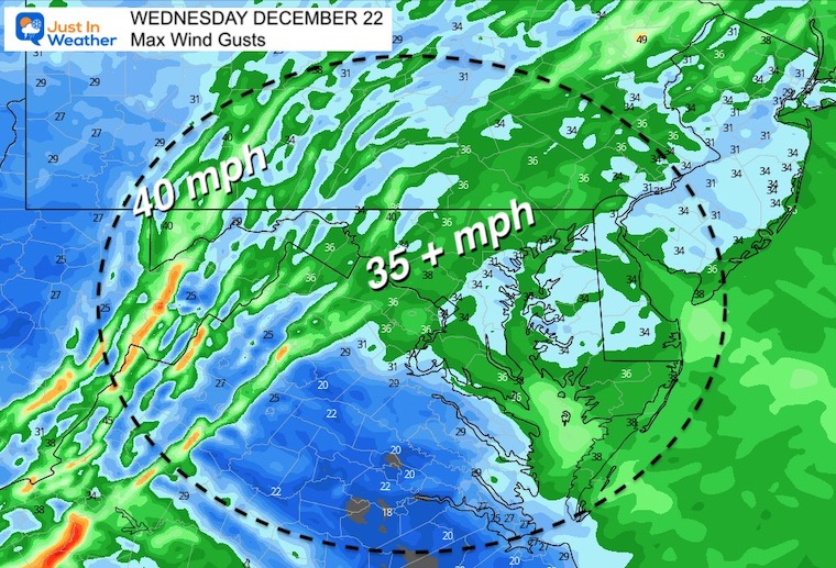
To the west is a Cold Front that will arrive by noon. THEN strong winds will force temps to fall during the afternoon.
Wind Forecast Animation
7 AM to 7 PM
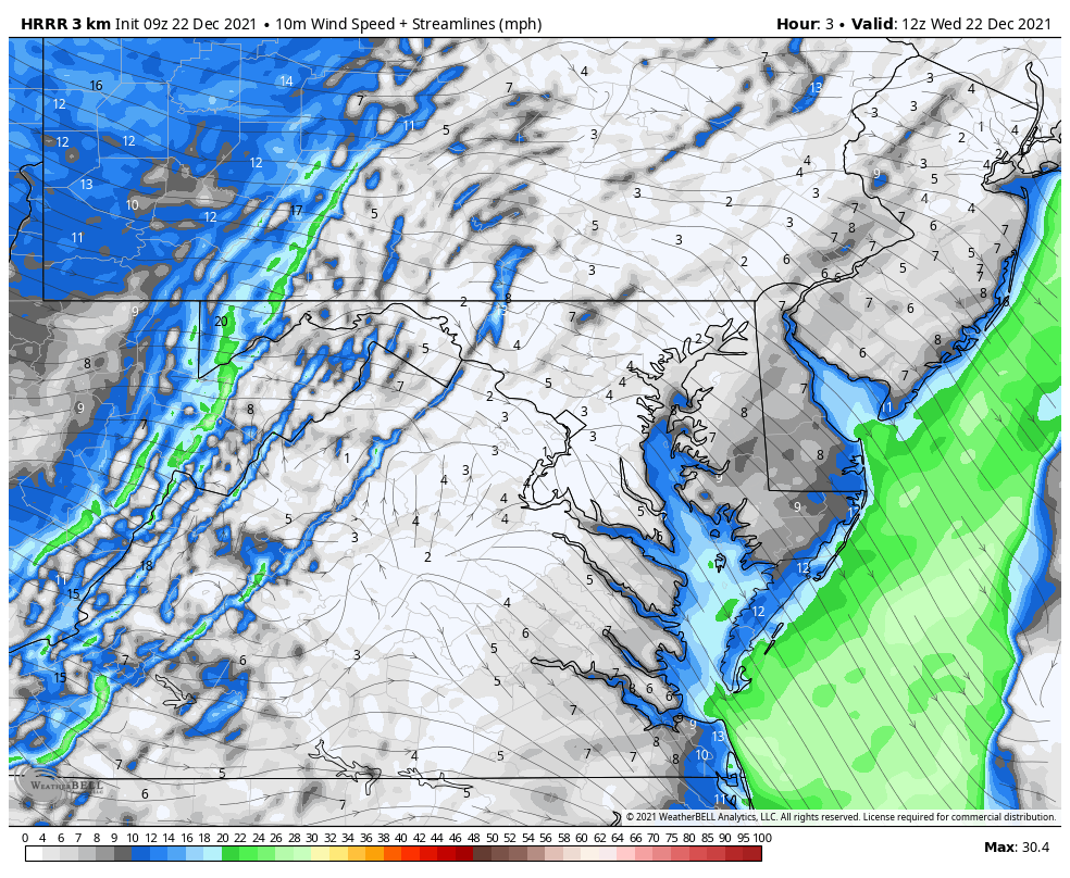
Peak Wind Gusts- mph
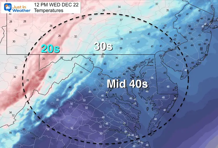
Temperatures at Noon
This is when the max should be for the day.
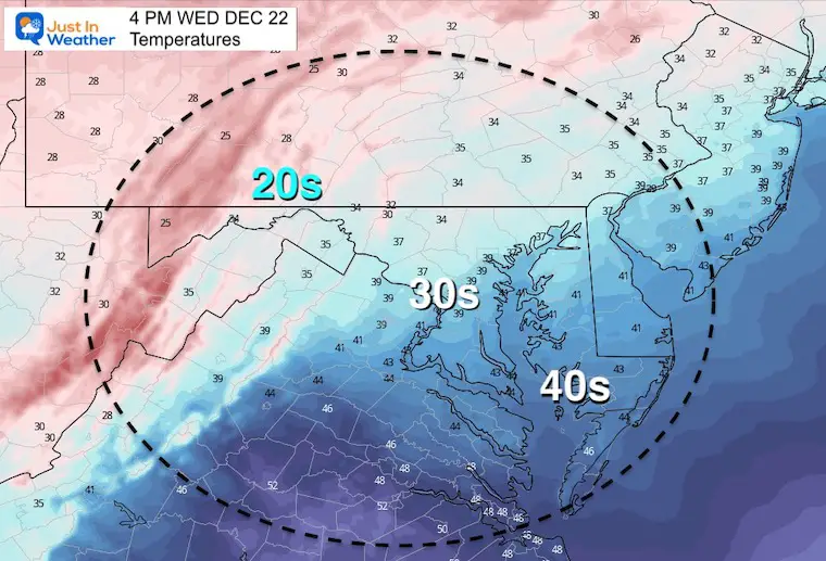
Temperatures at 4 PM
It will be turning colder for your trip home.
Weather Almanac: Climate Data
TODAY December 22
Normal Low in Baltimore: 27ºF
Record 4ºF in 1989
Normal High in Baltimore: 43ºF
Record 71ºF 2013
I will have the complete forecast in my next report later this morning.
ALSO SEE
Winter Outlook Series:
My Call For Snowfall

Last Winter Recap: My Old Outlook And Your Grades Of My Storm Forecasts


Please share your thoughts, best weather pics/video, or just keep in touch via social media


