


May 19 Weather Sunday Starts Foggy The Warming With Sun And Summer Heat On The Way
Sunday May 19 Morning Report The aftermath of the rainy Saturday is plenty of leftover moisture. This has left us with a bit of humidity and areas of thick fog…
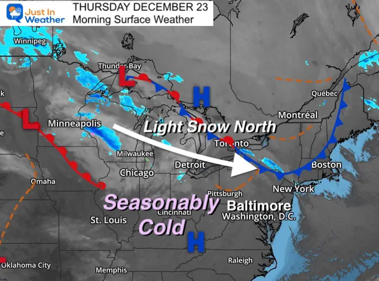
Thursday December 23
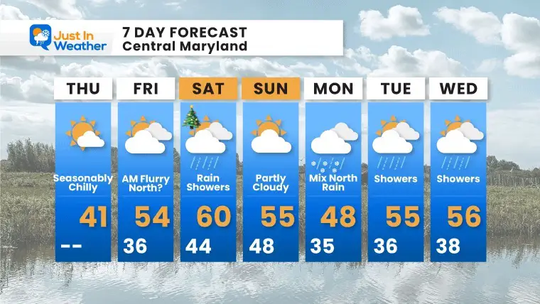
The reality of our weather pattern is that we are legitimately back in a seasonably cold air mass. But that will be erased when warmer air arrives for Christmas. So the pattern did turn, it is just not holding… yet!
I have been hearing a lot of frustration about the weather, which may match the feelings about this Covid surge. If you missed my Facebook post, I now have Covid despite all precautions. The only thing I can do it deal with it and look ahead to getting better. I know I will. Perhaps we can apply that to the weather: Looking forward to it getting colder again, because it will. Just that it will be after the Christmas holiday. Eventually, we will get snow back as well. FITF
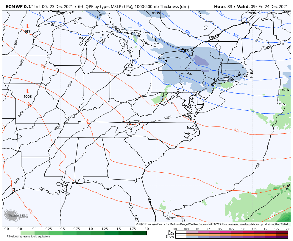
We are in a cold air mass, with the faint storm track across the Northern US. That is brining light snow through the Great Lakes and into New York and New England.
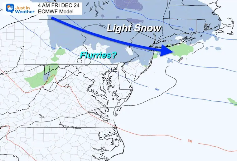
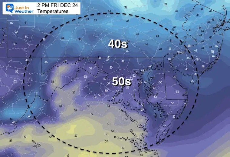
We may have some flurries as close as the PA line overnight. That is the closest any snow will get for the holiday.

Sun will mix with high clouds, as temps generally will be near ‘normal’.
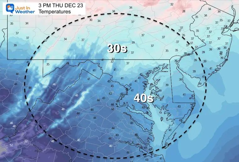
Normal Low in Baltimore: 26ºF
Record 0ºF in 1960
Normal High in Baltimore: 43ºF
Record 69ºF 1990
Long before sunrise, there may be some flurries clipping southern PA and northern Maryland. I mention this while the map is not showing it because this plot is not sensitive enough to pick up on flurries. Also, if there is a chance at this time of year I want to mention it.
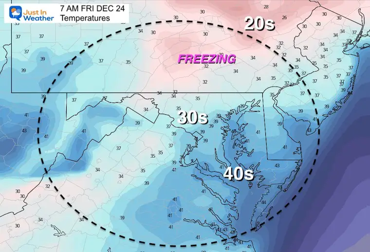
During the day, we shift the winds and begin the return of mild weather.
Friday morning to Monday Afternoon
Morning showers then afternoon rain. Temps may reach 60ºF around Baltimore, but depends on when the steady rain arrives. If it comes in earlier, then it will be cooler.
Next Monday: Some wintry mix may fall at the arrival in our northern suburbs… again depending on specifics of the track and timing. I am sorry to be vague, but given the model failures I believe a ‘suggestion’ is the best I can do until I can identify a pattern to jump on.

Last Winter Recap: My Old Outlook And Your Grades Of My Storm Forecasts


