Friday December 24
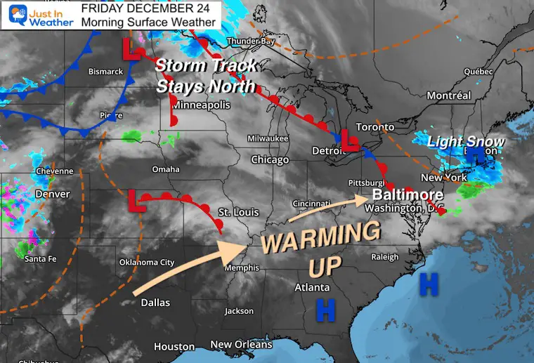
Well, we had our seasonable cold this week, but it’s time to return that. Warmer air is moving in this Christmas Eve and weather will not impact travel. Covid on the other hand has already promoted 430 flight cancellations across the US.
If you are staying in your PJs this morning, then this may not matter much. However, if you have any reason to get out you may want to enjoy what will turn out to be a nice weather day… for March!
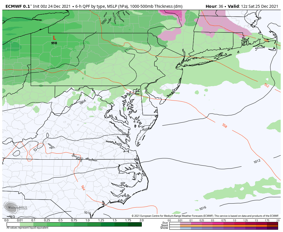
The next weather system will be rain Christmas morning, then a warm afternoon with a small chance of showers.
We are entering drought conditions, so the need gift is rain. We will get that to open and play with most of next week.
If you want or are expecting snow, that is still delayed due to supply chain issues. The backlog is tremendous so I am sorry for vague arrival times.
Morning Surface Weather
There was a Christmas Eve light snow across New York and Southern New England early this morning. Now we get the warm air pushing in today through Christmas Day. It will come with a little rain, but not a washout.
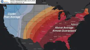
Cooler air will follow next week, but remaining above average with a few rain events.
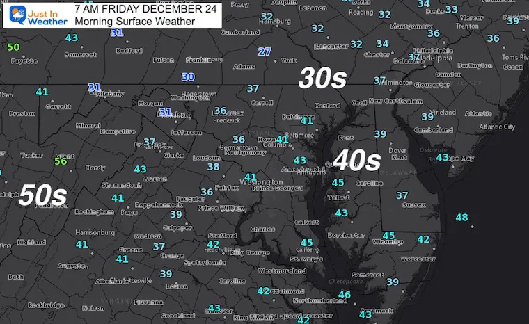
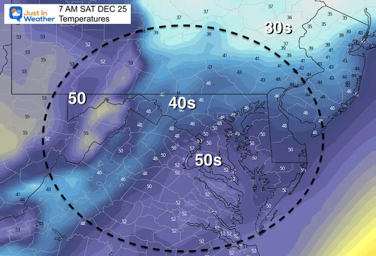
Temperatures Morning
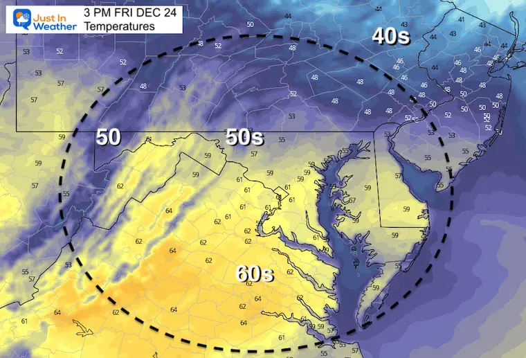
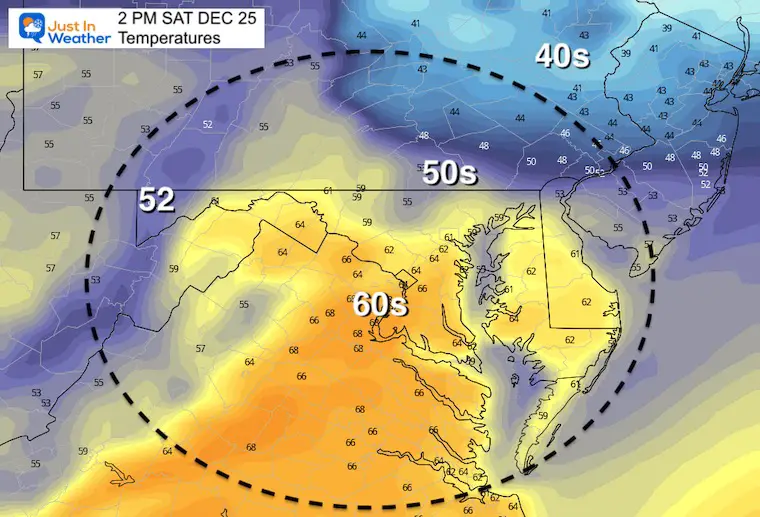
Temperatures Afternoon
Depending on sun breaking through the clouds, temps have potential to push higher than model forecasts.
Weather Almanac: Climate Data
TODAY December 24
Normal Low in Baltimore: 26ºF
Record 4ºF in 1983
Normal High in Baltimore: 43ºF
Record 71ºF 2015
Christmas Day Weather
Here we see rain in the morning, but then breaking up by mid day.
The risk of additional rain showers will be scattered later and mainly in the northern part of our region.
Morning Temperatures
Afternoon Temperatures
Once again, depending on any breaks of sun temperatures can push higher than forecast.
Notice the sharp drop to the 40s in PA… across the boundary in our region.
Looking Ahead:
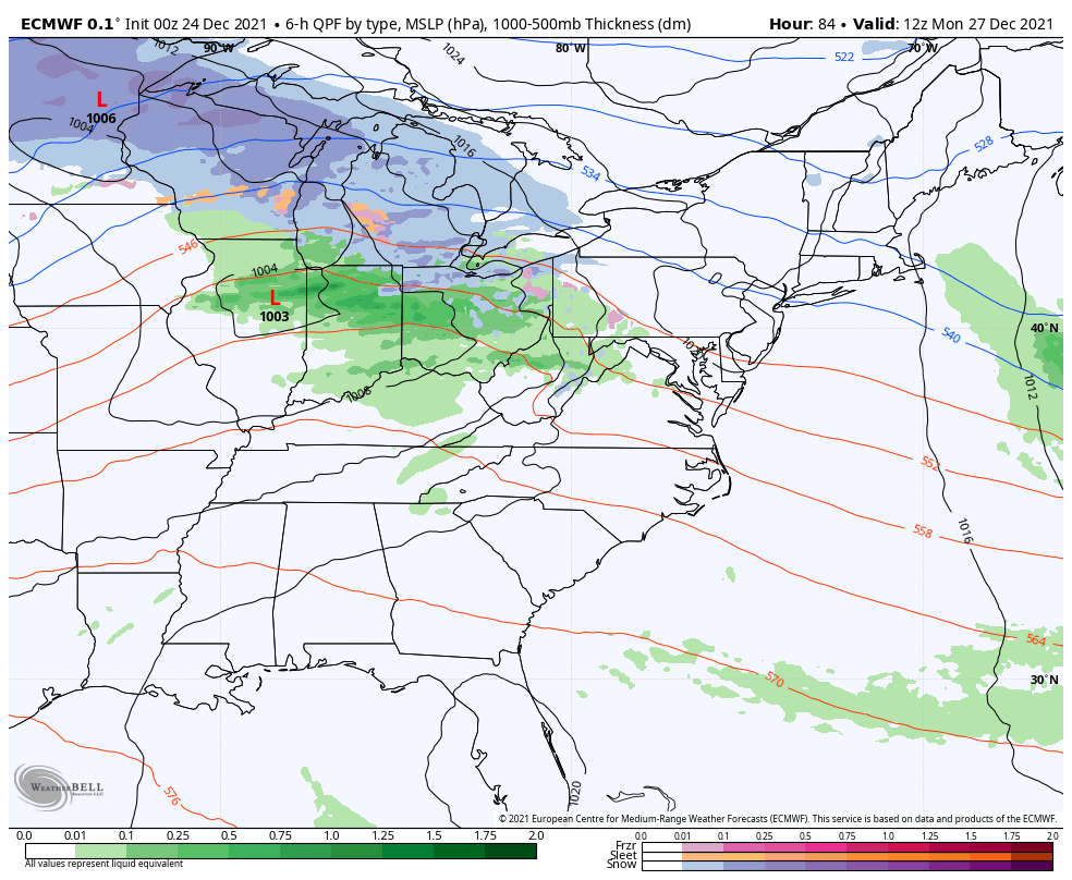
7 AM Monday to 7 AM Thursday
Multiple waves of Low Pressure will track through the central US. Eventually that boundary will drop over our region. This will increase our rain and drop our temps Wednesday and Thursday.
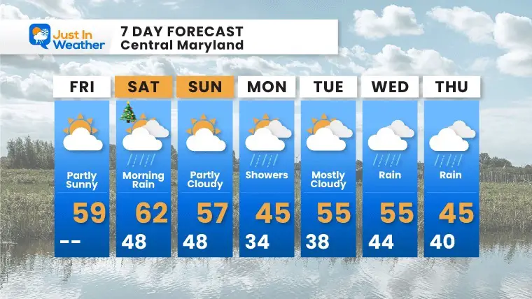
7 Day Forecast
The warmest day will be Christmas Day.
Mild next week, with a trend to turn colder as steady (needed) rain attempt to settle in Wednesday and Thursday.
ALSO SEE
Winter Outlook Series:
My Call For Snowfall

Last Winter Recap: My Old Outlook And Your Grades Of My Storm Forecasts


Please share your thoughts, best weather pics/video, or just keep in touch via social media


