


May 10 Chilly With More Rain Showers Today And Into Mothers Day Weekend
Friday May 10 Morning Report Today is the second day of the year, with sunrise before 6 AM in Baltimore, but like yesterday, we won’t see it. After a high…
Thursday March 24 2022
Night Report
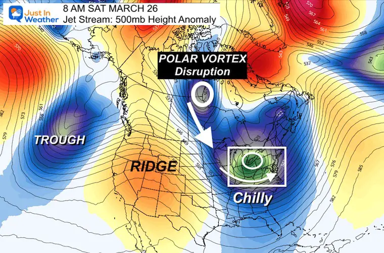
I have shared a few updates on this Polar Vortex disruption on the way this weekend. There has been a lot of activity this week, but with it about to impact us with an abrupt change I thought it was time to show the latest. The pattern may kick off with snow showers, the establish a ‘mostly’ chilly stretch into the start of April.
But First…
COLD AIR DAMMING
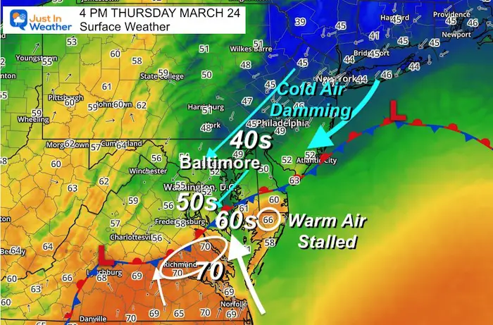
I shared this map from 4 PM on my social media pages… It highlights that the warm air remained stalled in southern Maryland. If you missed it, below was my message:
As weather follower asked why we often get a forecast for warming with a storm that does not happen.
This is why:
Northeast Winds are cool and damp. They lock in a dense air mass close to the surface. This can settle in by the Bay and against the mountains.
Warmer air (less dense) ‘trying’ to move in is forced up and over.
The result by the boundary is clouds, drizzle, and FOG.
The warm air seems to stall, and that is the region where Storms are most likely.
*So the 70ºF forecast for Baltimore from yesterday failed. I mentioned that this morning.. but the air mass was stuck about 60 miles south.
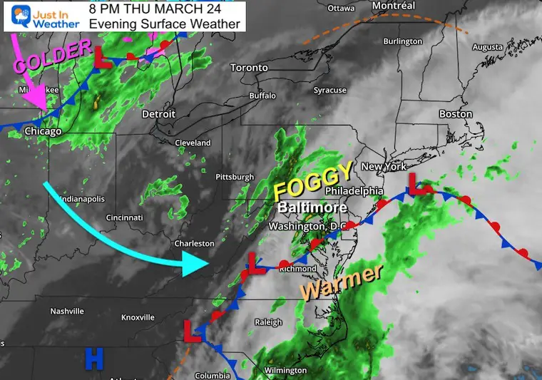
Here is the evening weather map. Rain showers have resurged (as I mentioned in my prior report)
Winds will shift from the west on Friday clearing us out briefly, before the next push of cold air arrives this weekend.
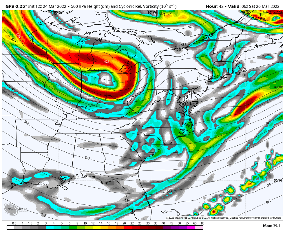
Cold Upper Level Low (at 18,000 Ft)
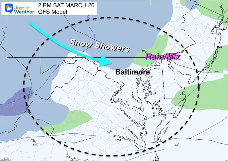
The core will be passing through New York on Saturday. I’ve highlighted the Vort Max, a piece of energy that will pivot through Maryland. This will stimulate instability showers.
It will be cold enough to mix with snow.
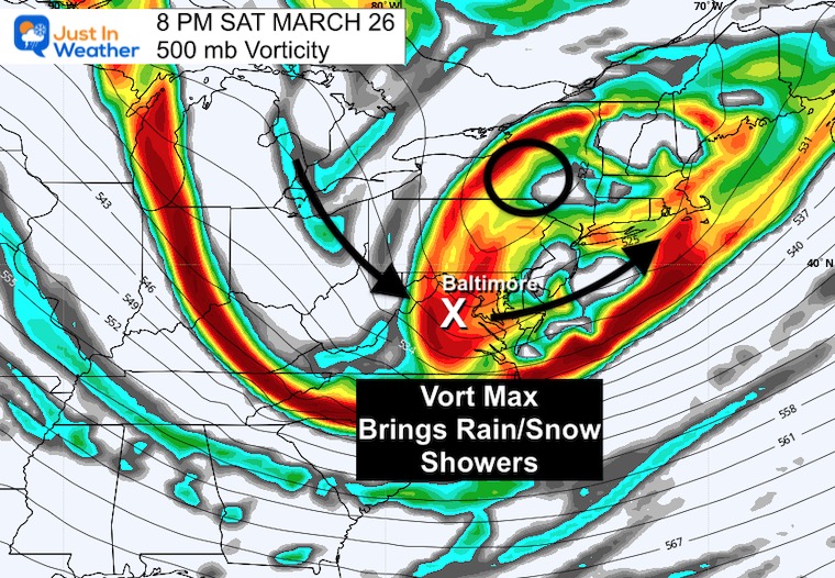
Here we can see the flow of energy aloft continuing to bring in the upper air flow from much colder central Canada…
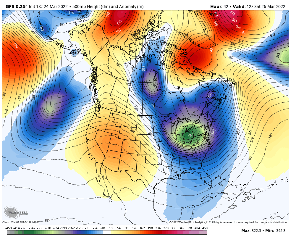
The GFS Model now plotting more snow showers into central Maryland.
The air aloft will be cold enough for flakes to fall. Perhaps a mix with some ice pellets or graupel. The ground will NOT support stickage.
The Upper Low I just showed is NOT the Polar Vortex. That will be located in central Candid west of Hudson Bay… But it will be dropping southward!
Saturday March 26 Morning to April 5
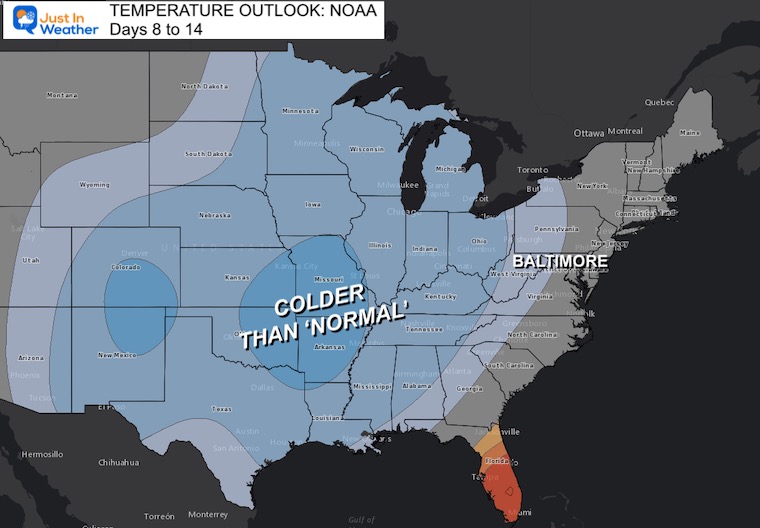
This is 10 Day Look… Overall we see a cold trend , with a couple of warmer days in the middle.
This updated 8 to 16 Day trend shows the large region with cooler than normal temps expected.
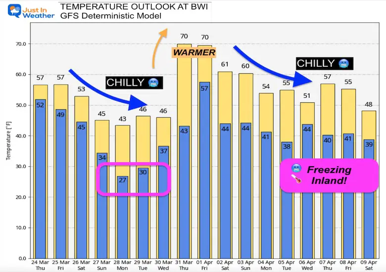
How Cold Will It Be?
Well, here is the GFS Model for Baltimore at BWI.
It is NOT perfect! But I want to note that ‘farther out in time; the model relies more heavily on climatology. So for this to be weighted so cool is a signal that we have a dominant cold force… Also note that inland areas will be colder and have more mornings with deep freezes.
But there will be a few days in the middle that may reach the 70s. Such is the weather that Maryland Memes are made from.


Last Winter Recap: My Old Outlook And Your Grades Of My Storm Forecasts


*Disclaimer due to frequent questions:
I am aware there are some spelling and grammar typos. I have made a few public statements over the years, but if you are new here you may have missed it:
I have dyslexia, and found out at my second year at Cornell. I didn’t stop me from getting my meteorology degree, and being first to get the AMS CBM in the Baltimore/Washington region.
I do miss my mistakes in my own proofreading. The autocorrect spell check on my computer sometimes does an injustice to make it worse.
All of the maps and information are accurate. The ‘wordy’ stuff can get sticky.
There is no editor that can check my work when I need it and have it ready to send out in a newsworthy timeline.
I accept this and perhaps proves what you read is really from me…
It’s part of my charm.
#FITF