


May 9 Cooler With Rain And Severe Storm Risk Tonight South
Thursday May 9 Morning Report Today is the first day of the year with sunrise before 6 AM in Baltimore, but we won’t see it. After a high temperature of…
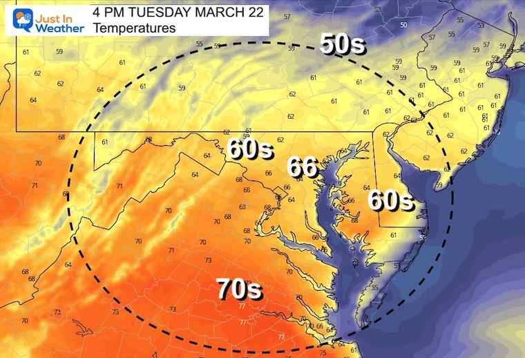
Tuesday March 22
Morning Report
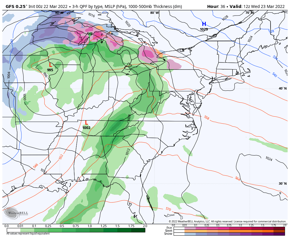
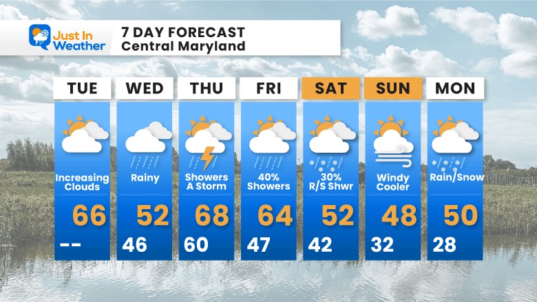
Today will feel cooler as clouds increase. This is ahed of the next storm, which will be with us for a few days. Rain will arrive Wednesday, the warming with possible thunderstorms Thursday. By this weekend, colder air with morning freezes possible.
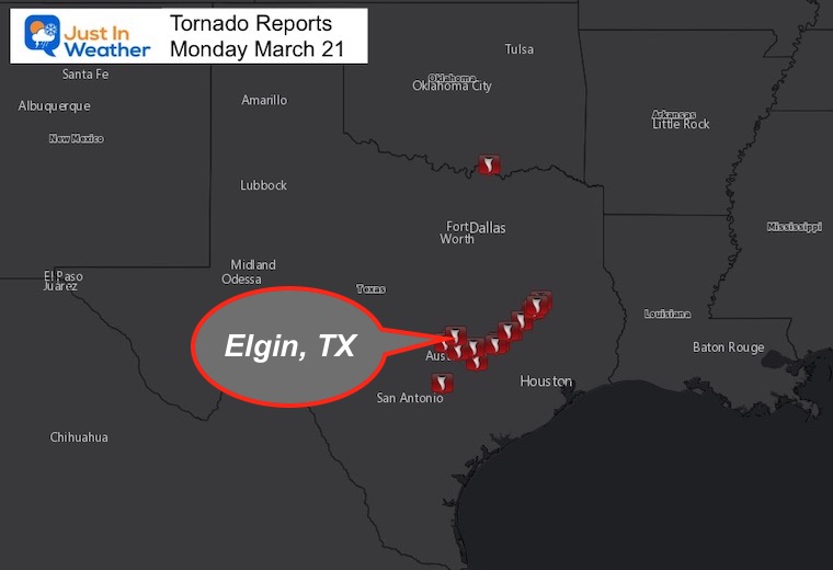
Storm Reports From Monday
Texas was front and center for twisters on Monday. There were 22 reports of tornados. Overall there were also 49 wind damage reports and 25 hail damage reports with some reaching 1.75” in diameter!
I highlighted the spot of the most incredible tornado video you will see below. It was spotted in Elgin, TX just outside of Austin.
Before we get started, check this out from the severe storm outbreak on Monday:
A tornado gets turned over by a tornado, then put back on it’s wheels and the people drive away.
You may not see this on TV unless licensed. It is OK online as they get ad revenue.
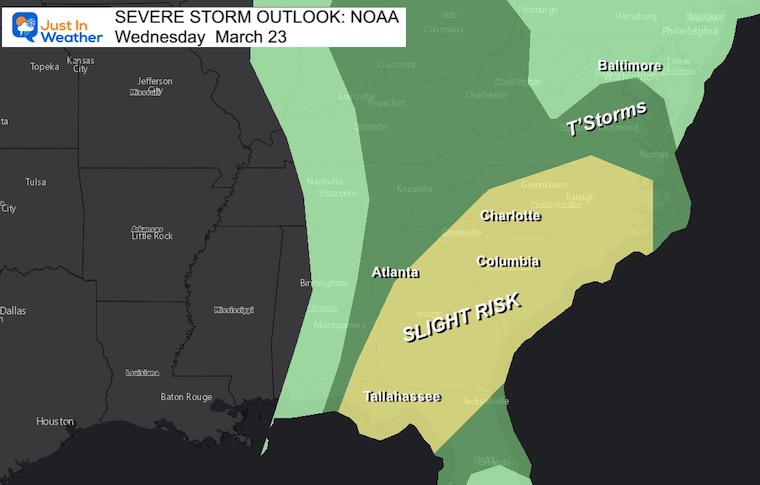
This will shift east, and while we may miss the worst of it, there will be a chance for thunderstorms on Thursday.
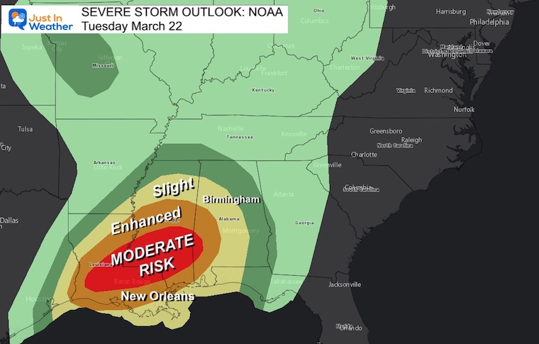
The Moderate Risk is a Level 4 our of 5 for likelihood of severe weather. That is a high chance for tornados, large hail, damaging winds, and local flooding.
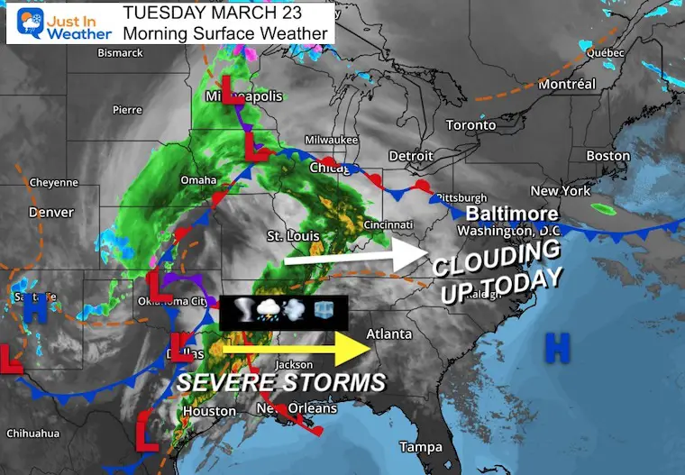
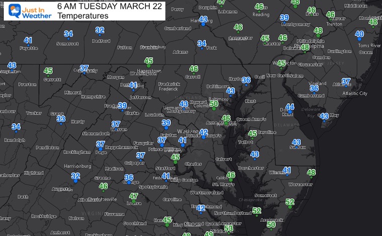
Clouds will be increasing, do you will feel the chill and may need a jacket.
Seasonal Snow: 14.4”
Normal Low in Baltimore: 35ºF
Record 19º F in 1885
Normal High in Baltimore: 56ºF
Record 86ºF 1907
Spring Equinox Already Beyond Equal Daylight
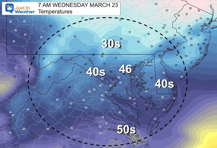
It will remain chilly with rain during the day.
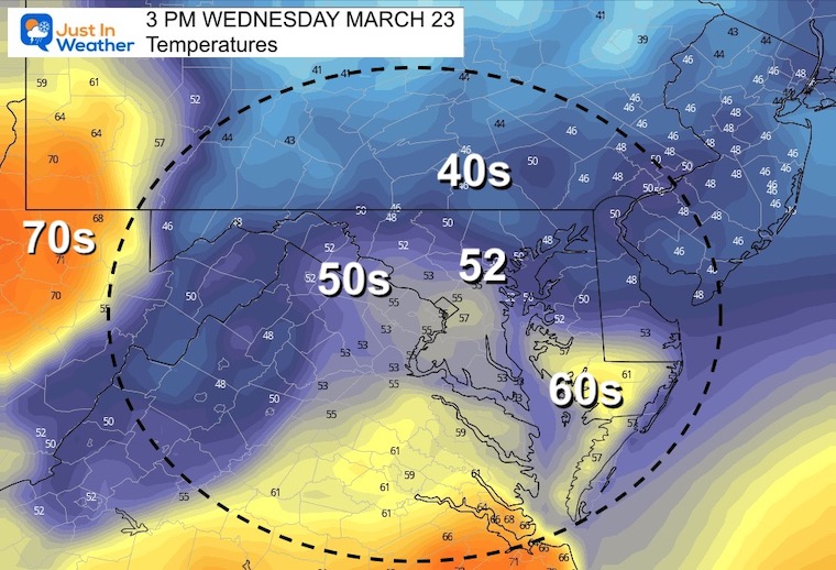
Rain may become moderate to heavy on Wednesday.
On Thursday some thunder possible, but the southern energy will be weaker when it reaches us.
Instability will bring afternoon showers on Friday.
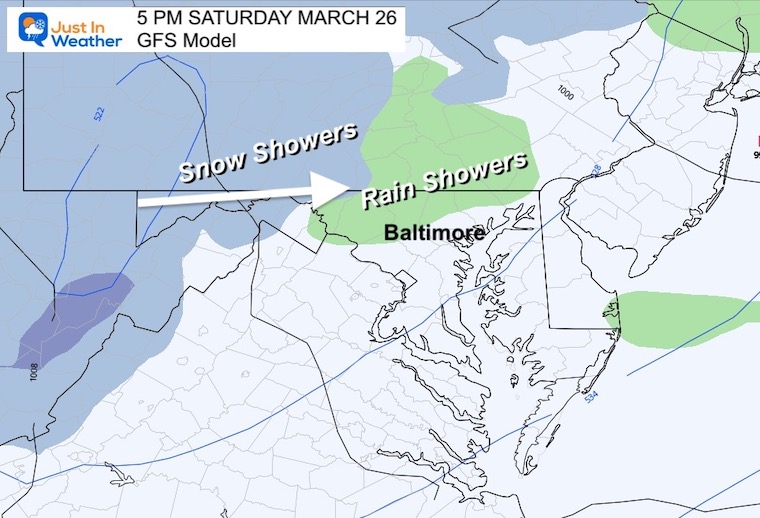
A chance for rain or snow showers in the afternoon, then the cold air arrives with overnight freeze into Sunday morning.


Last Winter Recap: My Old Outlook And Your Grades Of My Storm Forecasts


*Disclaimer due to frequent questions:
I am aware there are some spelling and grammar typos. I have made a few public statements over the years, but if you are new here you may have missed it:
I have dyslexia, and found out at my second year at Cornell. I didn’t stop me from getting my meteorology degree, and being first to get the AMS CBM in the Baltimore/Washington region.
I do miss my mistakes in my own proofreading. The autocorrect spell check on my computer sometimes does an injustice to make it worse.
All of the maps and information are accurate. The ‘wordy’ stuff can get sticky.
There is no editor that can check my work when I need it and have it ready to send out in a newsworthy timeline.
I accept this and perhaps proves what you read is really from me…
It’s part of my charm.
#FITF