


May 12 Mothers Day Showers And Another Aurora Viewing Tonight May Be Better
Sunday May 12 Mother's Day Morning Report Today, we focus on the all-important Mother’s Day weather and the ongoing impact of the latest Solar Storm. We have been stuck in…
Sunday March 20
Morning Report
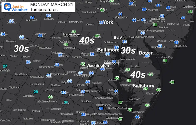
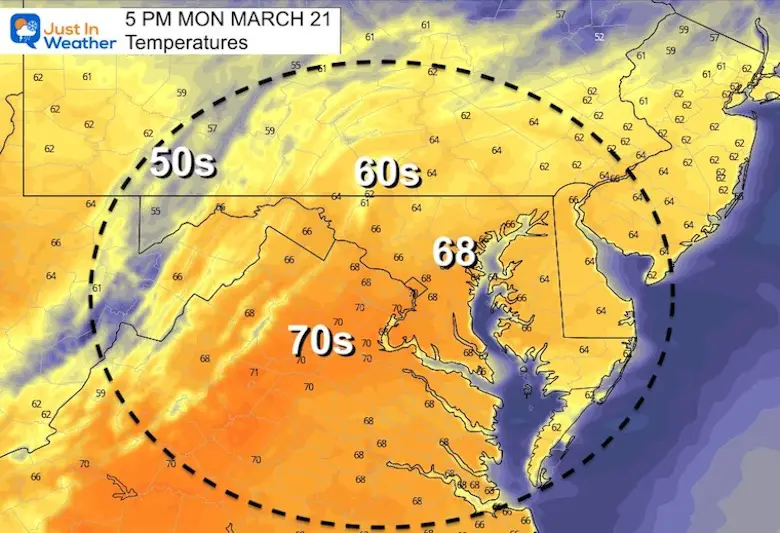
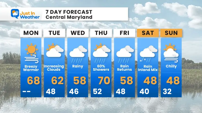
Today is the first ‘full day’ of spring and it should feel a little more like it. With sunshine, there will be a gusty breeze, but temps will be about 10 degrees warmer than yesterday.
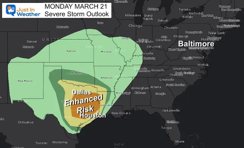
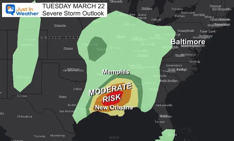
A new storm is forming that will track a few days of severe weather outbreak across the southern US. We get rain from that beginning on Wednesday, and may last for a few days. Then the colder and unsettled pattern lingers next weekend.
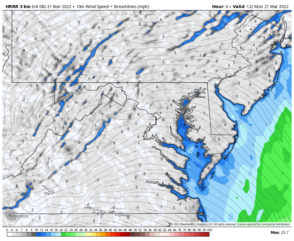
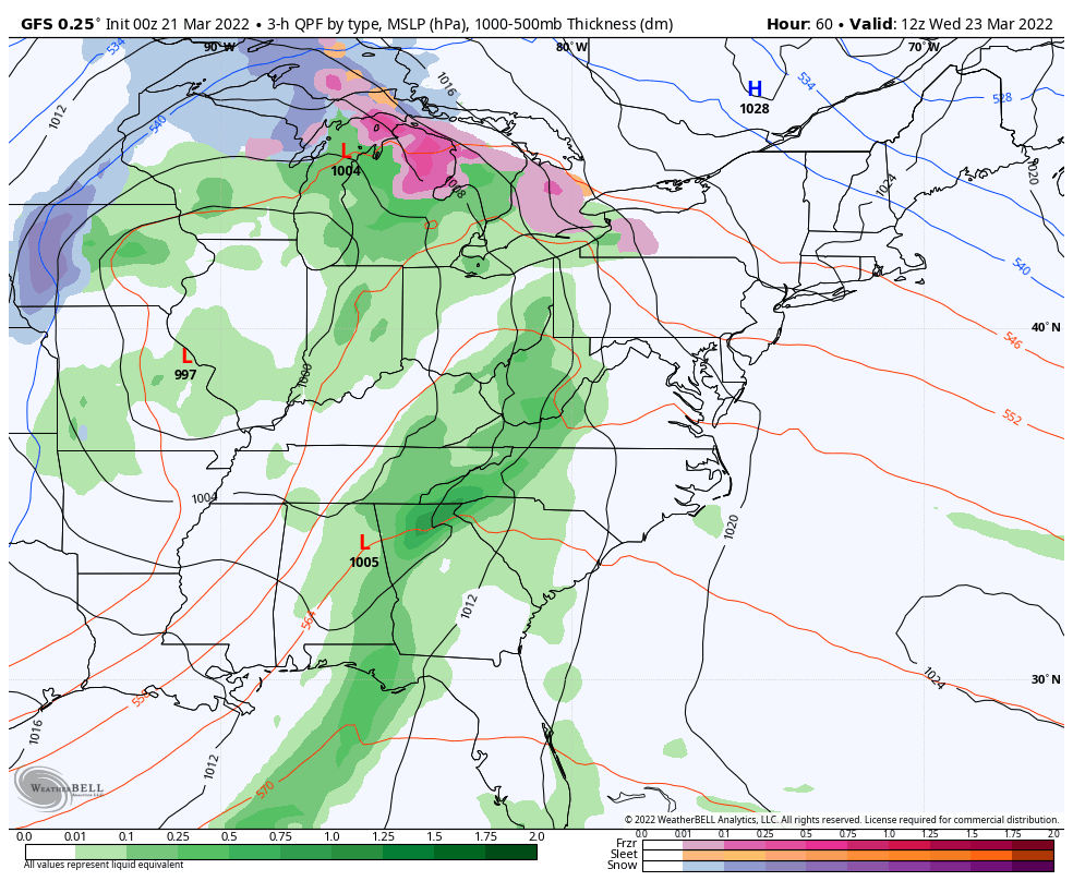
Monday Morning Set Up
Surface Weather
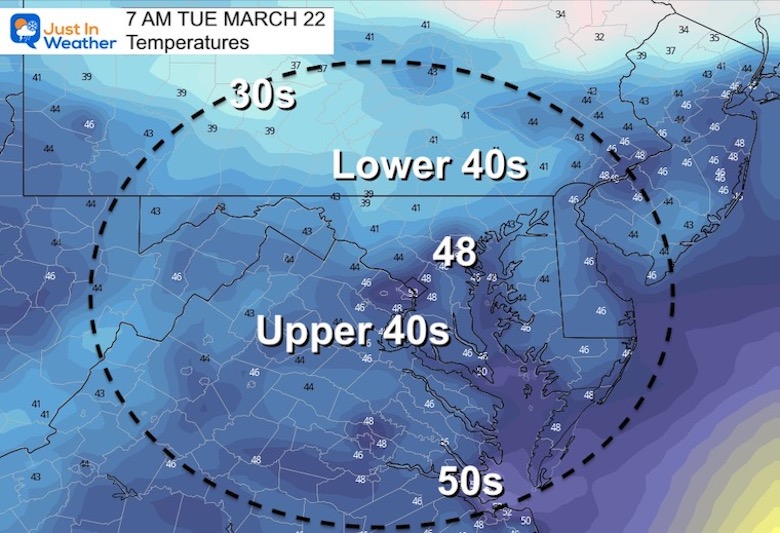
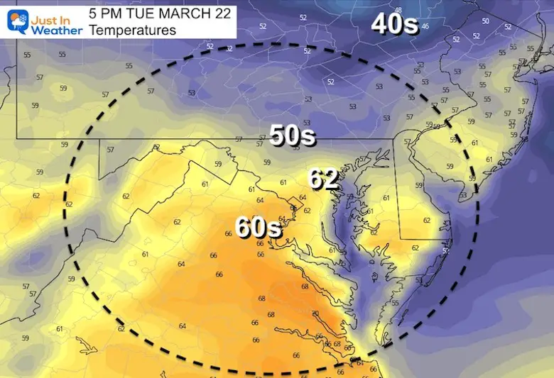
The cooler air moving in will be windy and unsettled. The result will be increasing clouds. So we may start out sunny, then turn cloudy before lunchtime. Just in time for the spring equinox, snow showers will continue to fall in western Maryland.
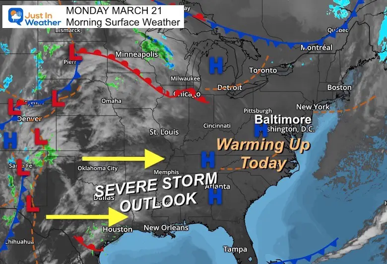
Winds will increase during the day, then settle back this evening. Gusts may push close to 30 mph during the afternoon.
Spring Equinox Already Beyond Equal Daylight
Seasonal Snow: 14.4”
Normal Low in Baltimore: 35ºF
Record 8º F in 1965
Normal High in Baltimore: 55ºF
Record 89ºF 1948
Morning
Afternoon
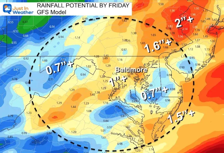
8 AM Wednesday to 10 PM Friday
Rain may become moderate to heavy on Wednesday. Some thunder possible, but the southern energy will be weaker when it reaches us.
A second wave of Low Pressure is expected to develop, reserving rain on Friday.
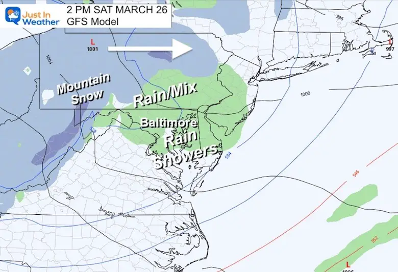
That Polar Vortex Disruption we’ve talked about means a cool and unsettled pattern. The results will be a Clipper with snow in our nearby mountains and up north in PA and NY. Locally chilly rain showers on Saturday may mix with snowflakes inland.
Nothing out of the ordinary, but definitely NOT the spring weather may are ready for….


Last Winter Recap: My Old Outlook And Your Grades Of My Storm Forecasts


*Disclaimer due to frequent questions:
I am aware there are some spelling and grammar typos. I have made a few public statements over the years, but if you are new here you may have missed it:
I have dyslexia, and found out at my second year at Cornell. I didn’t stop me from getting my meteorology degree, and being first to get the AMS CBM in the Baltimore/Washington region.
I do miss my mistakes in my own proofreading. The autocorrect spell check on my computer sometimes does an injustice to make it worse.
All of the maps and information are accurate. The ‘wordy’ stuff can get sticky.
There is no editor that can check my work when I need it and have it ready to send out in a newsworthy timeline.
I accept this and perhaps proves what you read is really from me…
It’s part of my charm.
#FITF