


April 27 Weather Chilly With Showers Then Turning Up The Summer Heat
Saturday, April 27 Morning Report One day to get through before the surge of summer heat. Today, we get clouds and rain showers as a warm front approaches. But on…
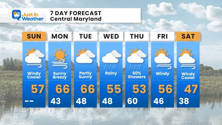
Sunday March 20
Morning Report
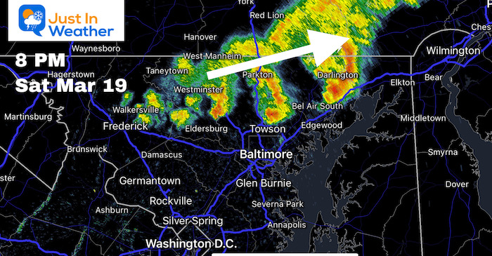
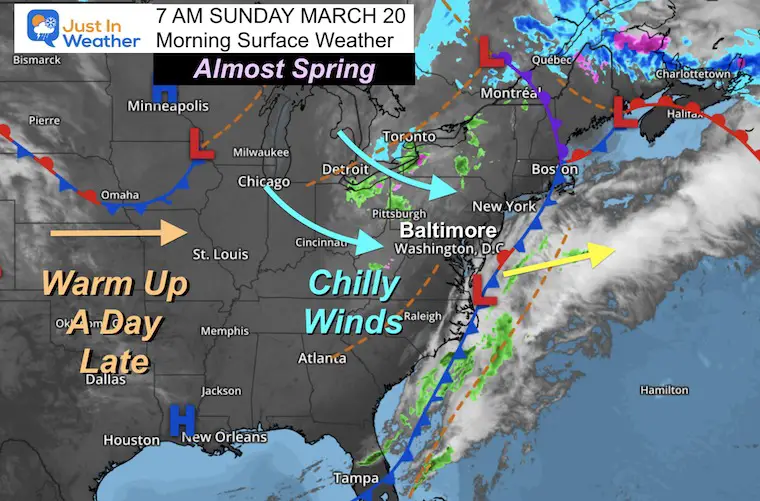
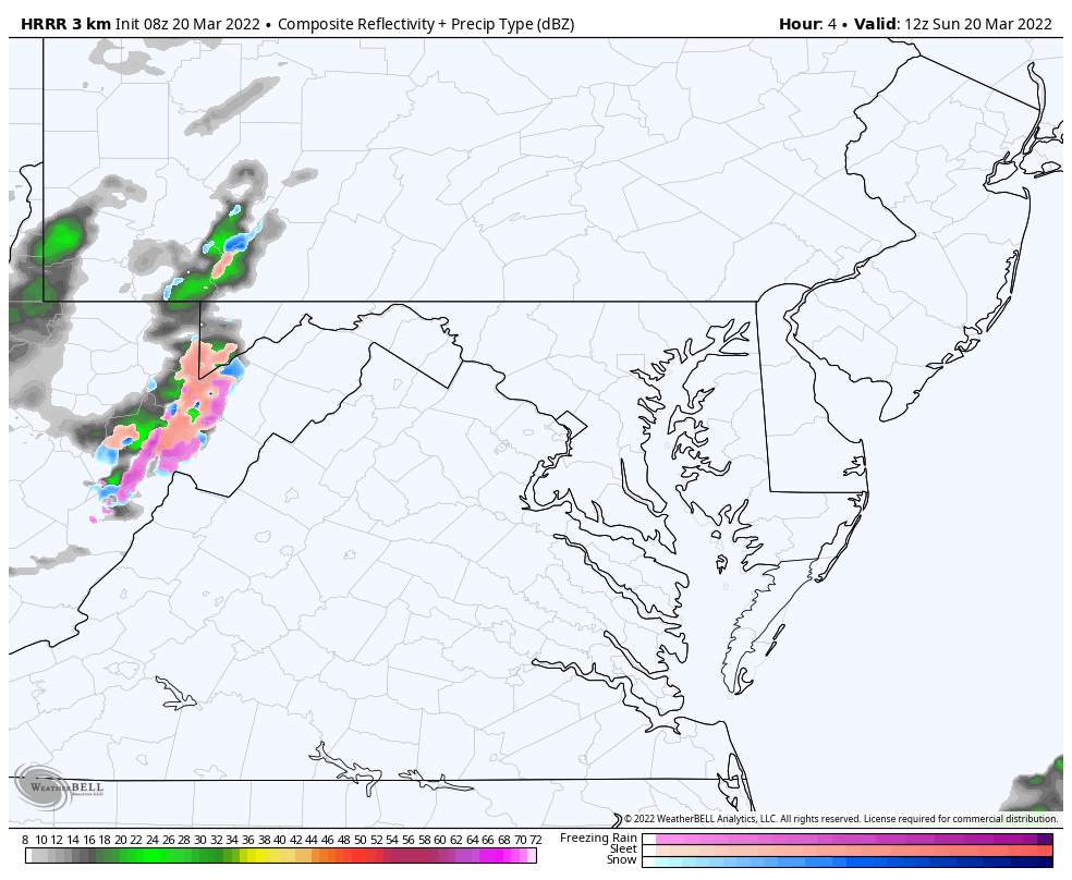
Today will be the official start of spring, but it may take an addition day to feel more like it. Before we get to the equinox and weather forecast, I want to address the rain yesterday. For many around Baltimore and through southern Maryland it may seem like it didn’t happen, but just north they were hit with multiple rounds of heavy rain.
A solid line of storms formed between Frederick York and Lancaster. Some cells produced hail, but many had dangerous lighting and downpours.
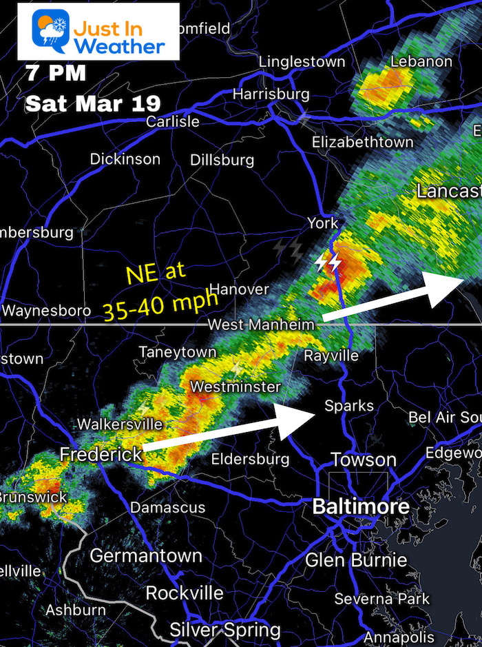
Multiple cells pulsed through Northern Maryland and Southern PA, but remained just north of Baltimore.
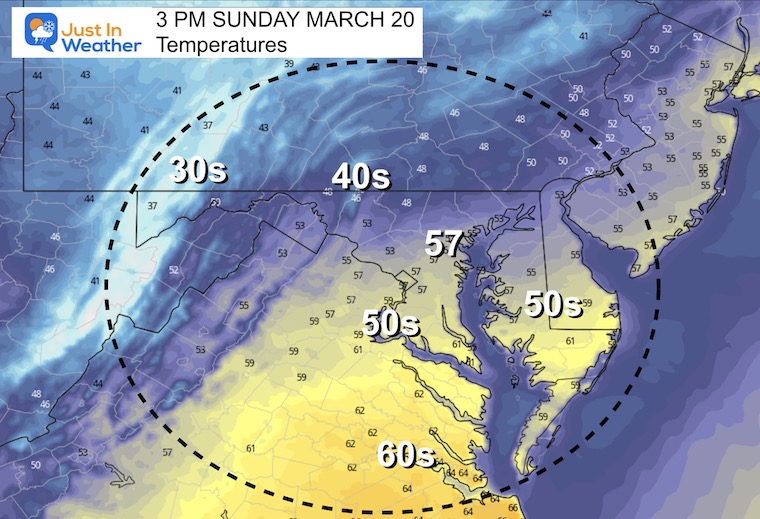
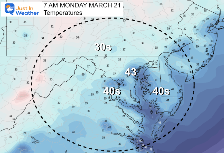
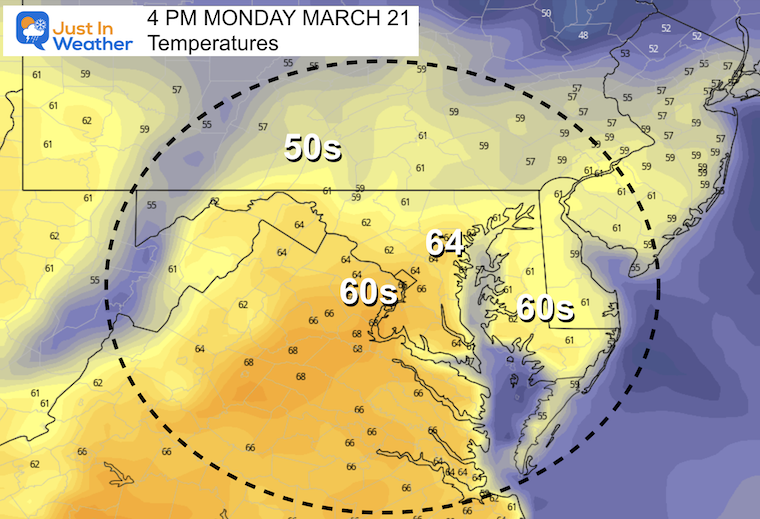
The cooler air moving in will be windy and unsettled. The result will be increasing clouds. So we may start out sunny, then turn cloudy before lunchtime. Just in time for the spring equinox, snow showers will continue to fall in western Maryland.
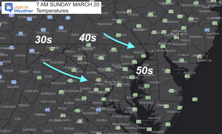
Winds will be averaging 15 to 20 mph with gusts to 30 mph
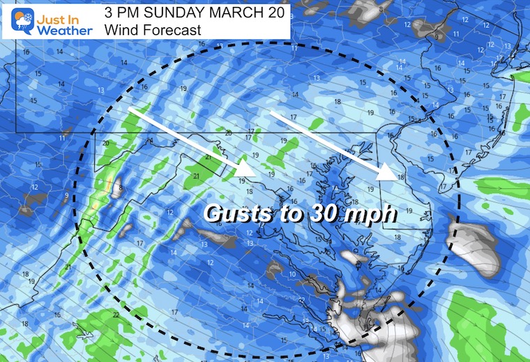
Snow showers in Garrett County. A band of rain may push east into parts of central Maryland by mid afternoon.
Also See:
Spring Equinox Already Beyond Equal Daylight
Seasonal Snow: 14.4”
Normal Low in Baltimore: 35ºF
Record 12º F in 1885
Normal High in Baltimore: 55ºF
Record 85ºF 1945
The next storm will bing in steady rain on Friday and the font may linger along the coast… keeping the chance for rain into Thursday. This my end in central Maryland by mid day, but linger on Delmarva into the evening.
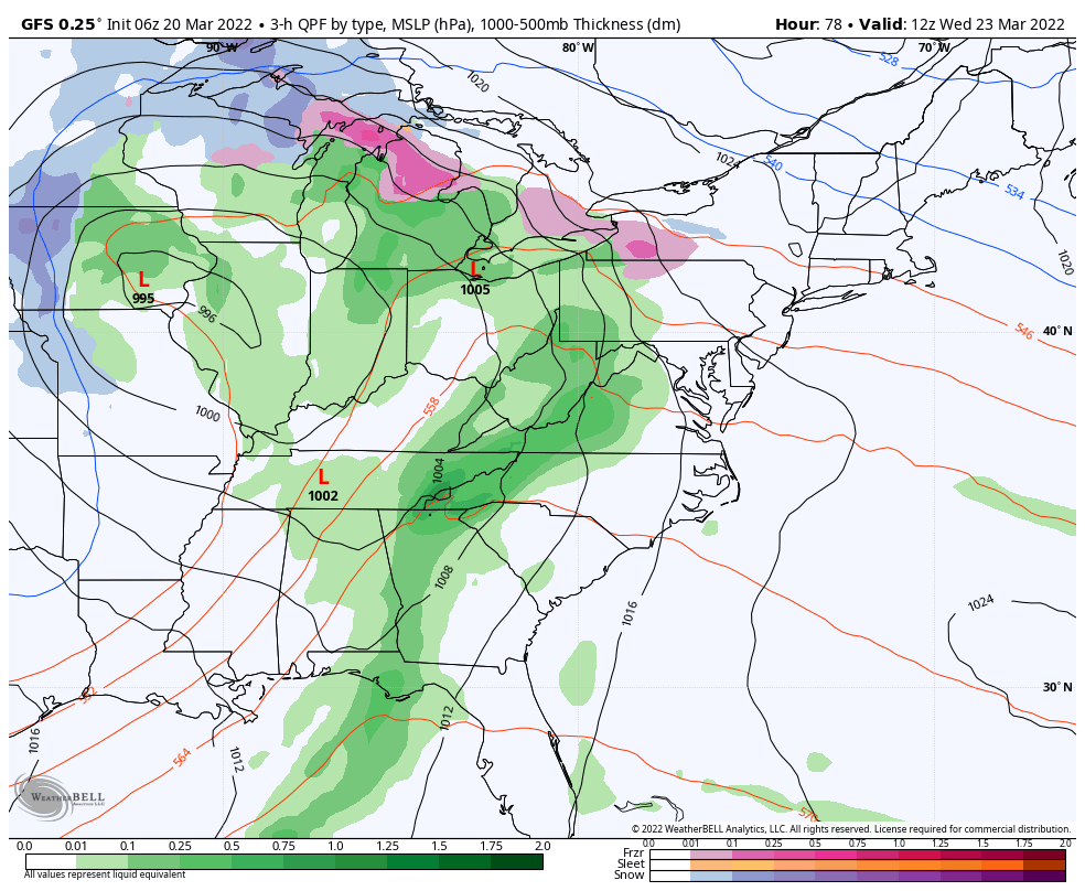
The core of that cold air will reach us next weekend. Considering it is late March, the ‘cold air’ will be relative… This may bring in some snow showers, but let’s save that until we get closer.
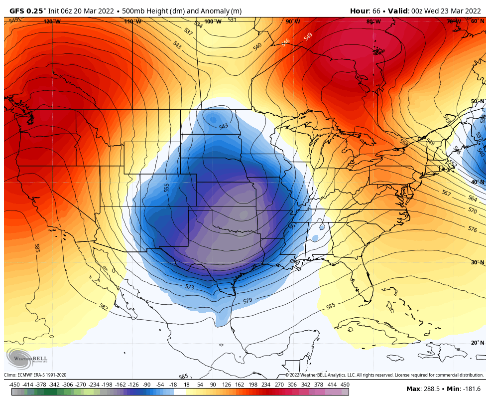
The core of the cold air will reach us just beyond this outlook.
Once agin, the Polar Vortex Disruption is a cold weather pattern, but it does not promise snow. However, the set up may support something to develop through the following week.


Last Winter Recap: My Old Outlook And Your Grades Of My Storm Forecasts


*Disclaimer due to frequent questions:
I am aware there are some spelling and grammar typos. I have made a few public statements over the years, but if you are new here you may have missed it:
I have dyslexia, and found out at my second year at Cornell. I didn’t stop me from getting my meteorology degree, and being first to get the AMS CBM in the Baltimore/Washington region.
I do miss my mistakes in my own proofreading. The autocorrect spell check on my computer sometimes does an injustice to make it worse.
All of the maps and information are accurate. The ‘wordy’ stuff can get sticky.
There is no editor that can check my work when I need it and have it ready to send out in a newsworthy timeline.
I accept this and perhaps proves what you read is really from me…
It’s part of my charm.
#FITF