Wednesday February 16
Morning Report
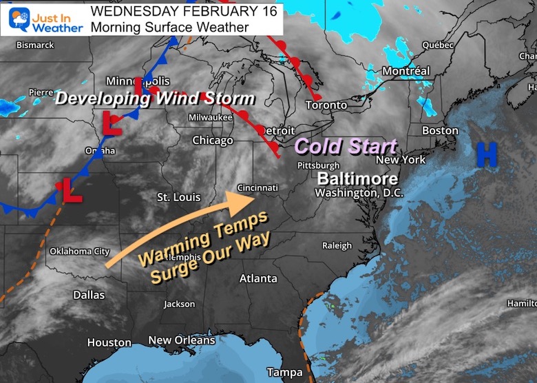
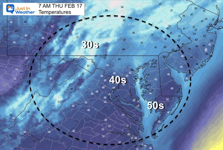
Here we go again. It looks like the patterns continue on both ends. We have had arctic cold and snow on most Sundays since the New Year, but we have also had these mid to late work week warm ups. We will get warming for the next two days, that will carry overnight into Friday morning.
This time we introduce more warm air on the south side of the winter storm, so with snow and ice into the Great Lakes Region, there will be severe storms in the Deep South. Some of that energy could carry some thunder our way in our transition.
Our weekend will be sunny and seasonably cool, then we warm up again. I know it looks like spring is here, and I keep getting questions about it. So I hope this statement reaches you: I still believe winter will throw us another hit.
Headlines
- Today: Cold Morning Then Starting Our Warm Up
- Thursday: Windy And Warmer
- Thursday Night: Warm, Rain, And Maybe A T’Storm
- Friday: Morning Rain Then Clearing
- Weekend: Sunny And Seasonably Cool
Morning Set Up
A cold start for our region, but a surge of warm air pushes in this afternoon through tomorrow. This will be as the winter storm continues to develop across the Northern Plains and Great Lakes.
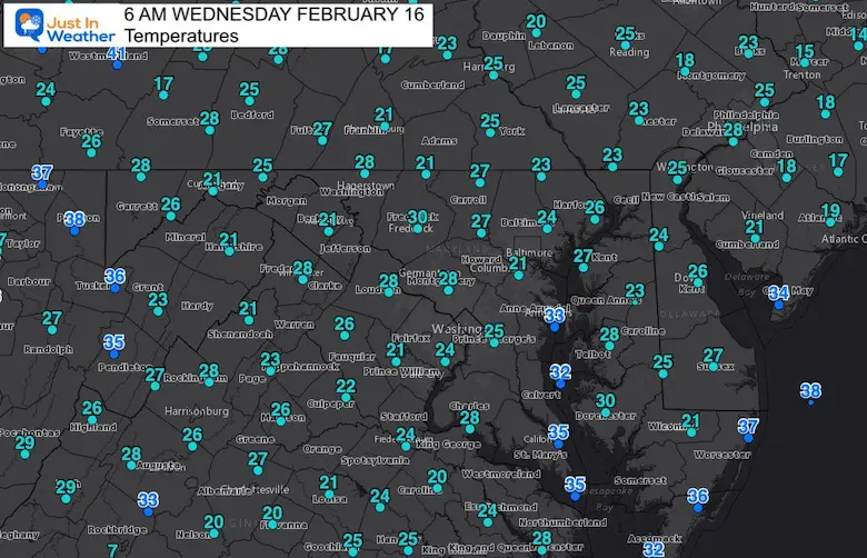
Morning Temperatures
Most of our region starts in the 20s, with the 30s showing up by the water (Bay and Ocean)
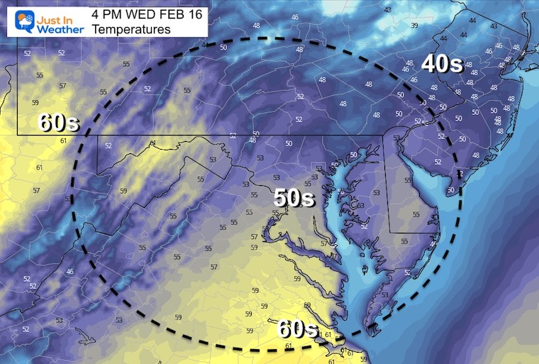
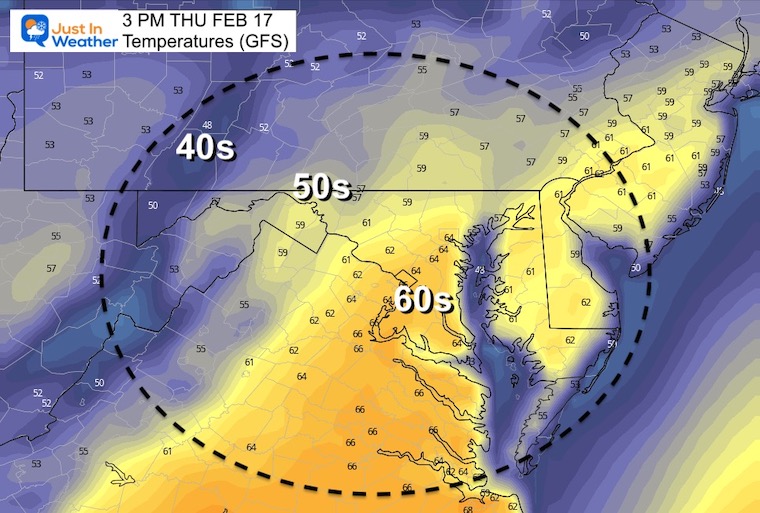
Afternoon Temperatures
Weather Almanac: Climate Data at BWI
TODAY Wednesday February 17
Seasonal Snow: 14”
+0.7” ABOVE AVERAGE
Normal Low in Baltimore: 27ºF
Record +5ºF in 2015
Normal High in Baltimore: 45ºF
Record 75ºF 1954
Thursday Temperatures
Morning
Afternoon
Surge of warm air OFTEN ends up warmer than models forecast. That is why I pushed out number for Baltimore a little higher.
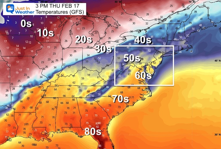
Wider View
Big contrast of temps from the 80s across the Gulf Coast to the 10s and 0s in the Northern Plains.
Storm Snapshot:
- The storm will track up the Ohio Valley, passing to our north. This keeps us on the warm side, while snow and ice cover a large area around the Great Lakes.
- To the south: Severe Storms will break out. The risk will be for tornadoes, large hail, and damaging winds.
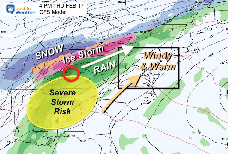
Severe Storm Risk
Some of that energy will push in our direction, but weaken overnight. So we could get a rumble of thunder after midnight, but the worst will be across
Storm Animtaiton
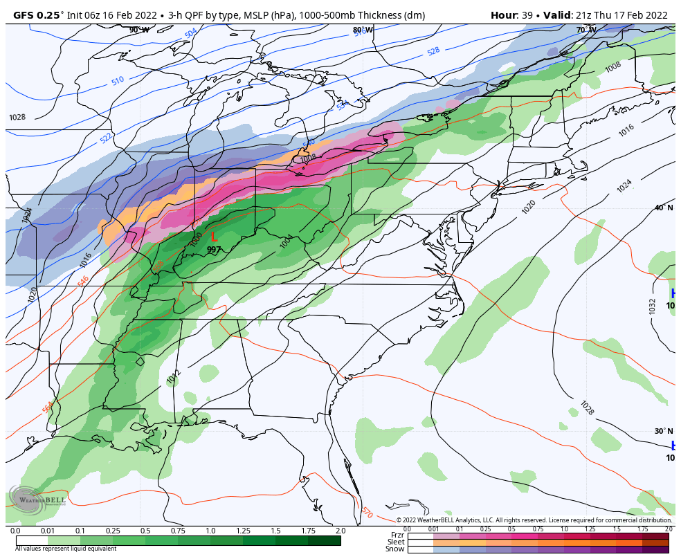
4 PM Thu to 4 PM Fri
The bulk of this storm will reach us overnight, then departing early Friday morning.
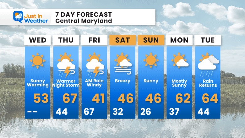
7 Day Forecast
I pushed our high temperature in Baltimore a little higher for Thursday… Once again we may have that high temperature close to midnight on both sides…. Then cooling in the afternoon.
Weekend will be back to seasonable temps with sunshine.
The next weather system will bring warming again, then rain by Tuesday.
ALSO SEE
ALL FITF GEAR

FITF THUNDERSNOW


Winter Outlook Series:
My Call For Snowfall

Last Winter Recap: My Old Outlook And Your Grades Of My Storm Forecasts


Please share your thoughts, best weather pics/video, or just keep in touch via social media
*Disclaimer due to frequent questions:
I am aware there are some spelling and grammar typos. I have made a few public statements over the years, but if you are new here you may have missed it:
I have dyslexia, and found out at my second year at Cornell. I didn’t stop me from getting my meteorology degree, and being first to get the AMS CBM in the Baltimore/Washington region.
I do miss my mistakes in my own proofreading. The autocorrect spell check on my computer sometimes does an injustice to make it worse.
All of the maps and information are accurate. The ‘wordy’ stuff can get sticky.
There is no editor that can check my work when I need it and have it ready to send out in a newsworthy timeline.
I accept this and perhaps proves what you read is really from me…
It’s part of my charm.
#FITF


