


May 7 Warming Up With Only Isolated Showers And Thunderstorms
Tuesday, May 7 Morning Report We are entering a period of warming with less rain for a few days. We will still see some isolated showers and thunderstorms pop up…
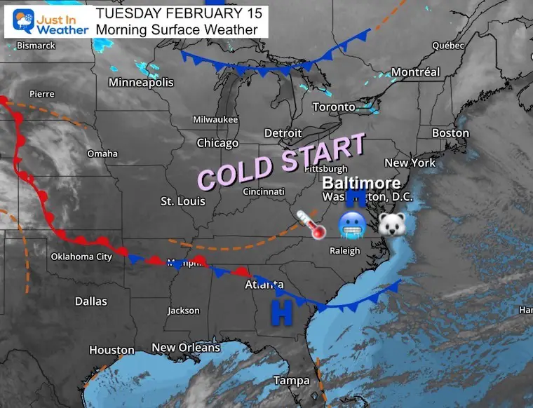
Tuesday February 15
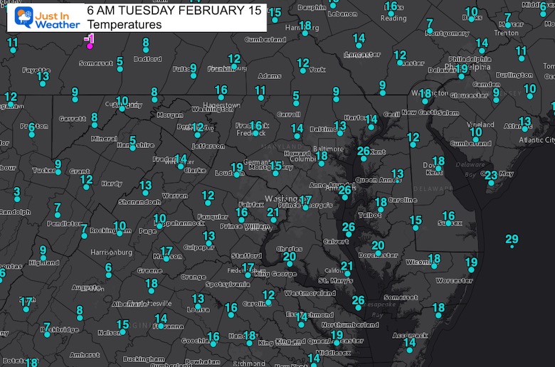
Morning Report
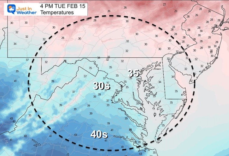
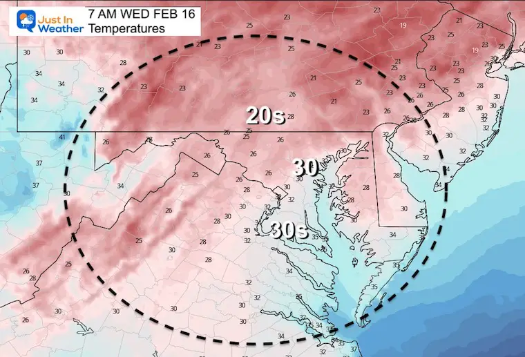
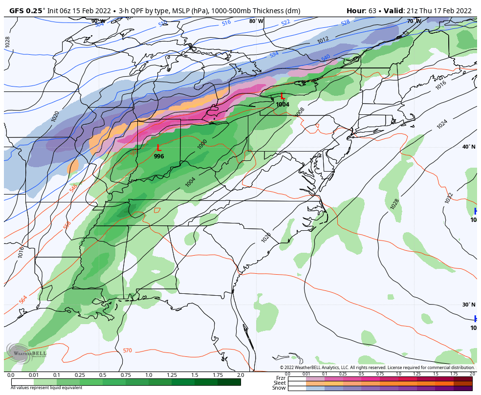
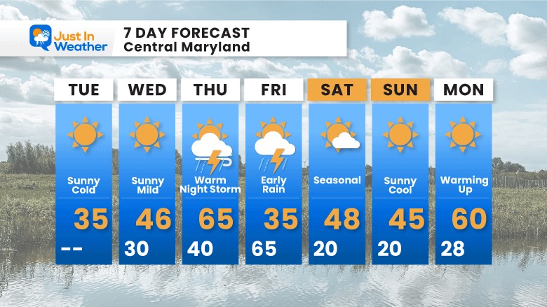
We are going to play a new game with the forecast this week. Winter is not over, but there is not much showing up for the week. In fact, we will have a surge of wind from the south and the new focus will be how warm it may get on Thursday.
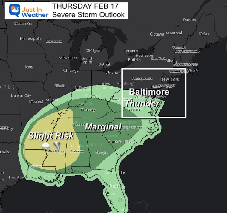
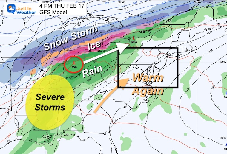
That will be part of a storm that will bring snow and ice to the Great Lakes to the north, and also Severe Storm Risk to the south. We may get some of that thunder overnight into early Friday.
Seasonal Snow: 14”;
+1.0” ABOVE AVERAGE
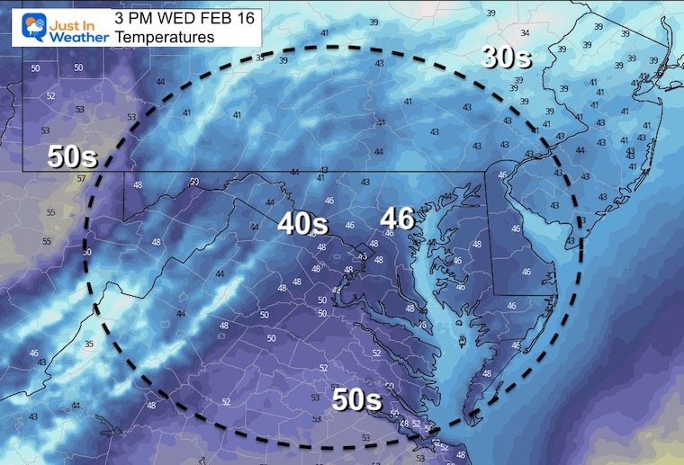
Normal Low in Baltimore: 27ºF
Record +6ºF in 2015
Normal High in Baltimore: 45ºF
Record 77ºF 1949
It is looking like spring with a potential spike of severe storms in the Deep South.
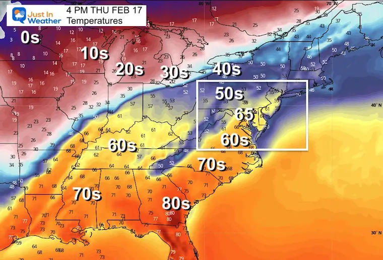
This is the game we get to play. I initial forecasted 65ºF for Baltimore’s high temperature. That was over the model guidance. Now the GFS has caught up, and we OFTEn end up even warmer.
Can we hit 70ºF???
4 PM Thu to 4 PM Fri
We will get the rain overnight Thursday, then ending early Friday morning. Cooler air will follow, but no arctic cold this time.


Last Winter Recap: My Old Outlook And Your Grades Of My Storm Forecasts


*Disclaimer due to frequent questions:
I am aware there are some spelling and grammar typos. I have made a few public statements over the years, but if you are new here you may have missed it:
I have dyslexia, and found out at my second year at Cornell. I didn’t stop me from getting my meteorology degree, and being first to get the AMS CBM in the Baltimore/Washington region.
I do miss my mistakes in my own proofreading. The autocorrect spell check on my computer sometimes does an injustice to make it worse.
All of the maps and information are accurate. The ‘wordy’ stuff can get sticky.
There is no editor that can check my work when I need it and have it ready to send out in a newsworthy timeline.
I accept this and perhaps proves what you read is really from me…
It’s part of my charm.
#FITF