Sunday February 13- Morning Report
Overnight it snowed across much of the region. Considering three days in a row reaching 60ºF or higher, that flip was the correct forecast. When you look outside, it depends on where you are to how much has fallen and if that matched my forecast.
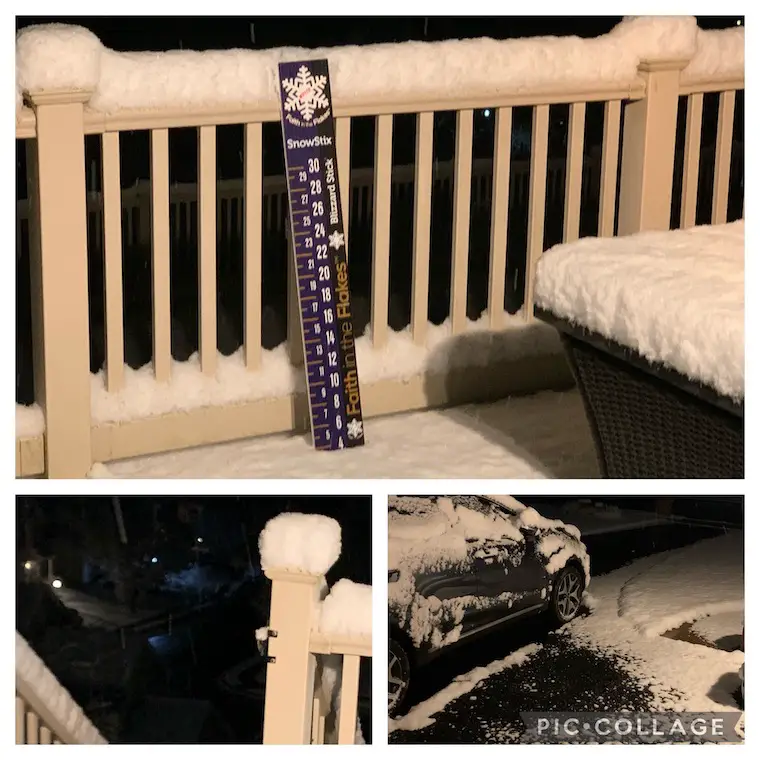
For example, I am in the colder part of our region and overachieved on snowfall. At 5 AM, I took these photos with 4 inches piled up… and it was still falling. I was up at 3 AM and while it was heavy, the roads got covered. When the snow let up, the pavement melted… DESPITE THE TEMPERATURE AT 29ºF
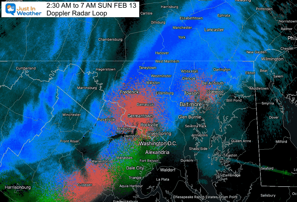
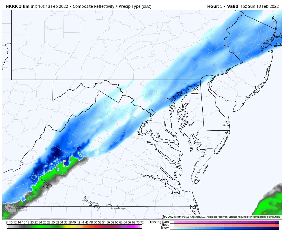
Radar Loop
The band of heavy snow remained just west of I-95 and peaked between 2 AM and 5 AM. As we can see here, there are impulses riding along that line. It faded after 5 AM, only to try and regenerate again now.
What Went Right:
- It snowed! I know there were many doubters.
- There is stickage on the grass, cars, and rooftops.
- Roads were covered (while it was snowing)
- Many areas received 1 inch or more.
What Went Wrong:
- The heavy snow (so far) remained farther west. That followed the Canadian and HRRR Models.
- Some areas overachieved snow
- Some areas will BUST south and on the Eastern Shore.
- Cancelled Winter Weather Advisory on Delmarva!
- Road snow melted when snow rates lowered or stopped. That is despite temps below freezing.
- The freezing line STALLED AGAIN near I-95 and by BWI to Washington.
Headlines
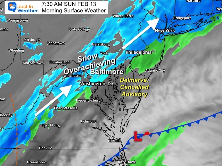
- Snow still falling, and will slowly push east today.
- Roads may look wet, but some icing up still possible near Baltimore and to the west/north through 9 AM.
- Places that are still wet this evening will ice over if not treated. This applies more to southern Maryland and Delmarva.
- Monday: Another snow shower in the morning. The day will remain cold!
- Next Week: Big Warm Up with possible thunderstorms Thursday.
Morning Set Up
Snow overachieved west and north.
SNOW BUST south and east. It will snow, but later…
Cancelled Winter Weather Advisory on Delmarva.
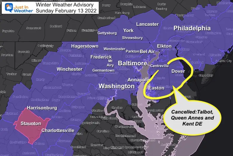
Winter Weather Advisory Updated
Cancelled for Delmarva Counties: Maryland Talbot and Queen Annes, Delaware in Kent.
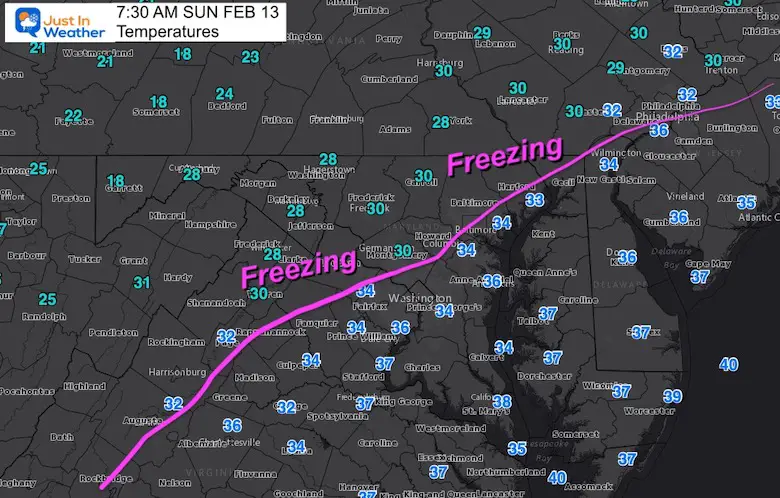
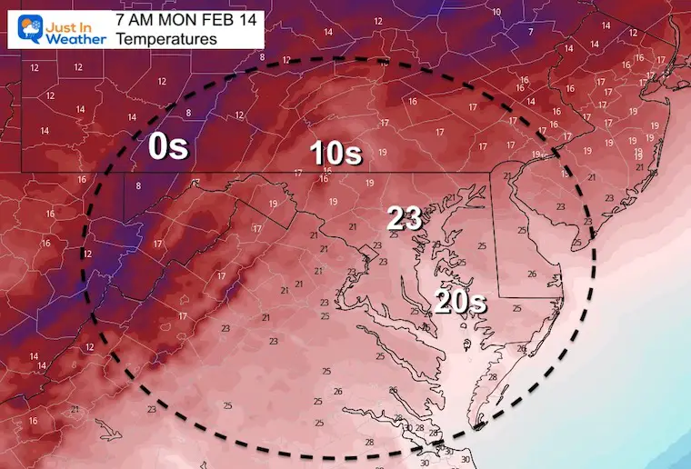
Morning Temperatures
AGAIN the Freezing Line stalled just west and north of I-95.
Radar Simulation
HRRR Model 10 AM to 11 PM
I switched to the HRRR which did the best job with the snow plotting last night.
There will be more snow to track through the evening to the beaches…
But after 9 or 10 AM little to no impact on roads.
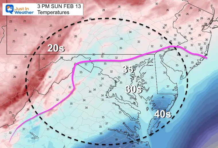
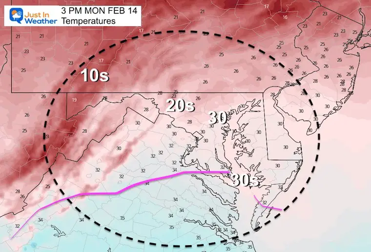
Afternoon Temperatures
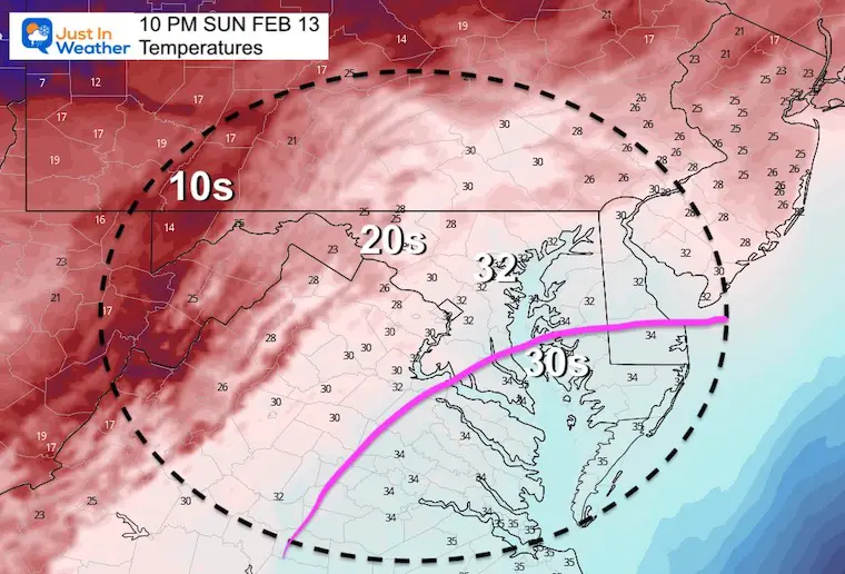
Temperatures Tonight
Weather Almanac: Climate Data at BWI
TODAY February 13
Seasonal Snow: 13.3”;
+4.7″ ABOVE AVERAGE
Normal Low in Baltimore: 26ºF
Record +1ºF in 1983
Normal High in Baltimore: 44ºF
Record 72ºF 1951
Valentine’s Day
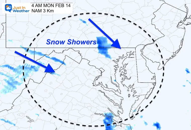
Monday Morning Snow Showers?
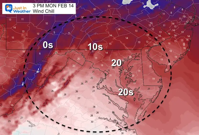
Temperatures
Morning
Afternoon
Wind Chill
Looking Ahead
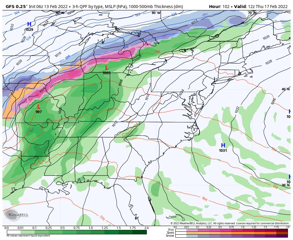
7 AM Thu to 10 AM Fri – GFS Model
The next storm will track well west and north of us. This will allow a surge of very warm air (60s) and also feed into potential thunder with the rain Thursday night.
The colder air that will follow into next weekend will be near average. It is likely we remain relatively mild for anther week to follow.
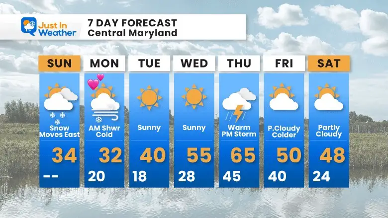
7 Day Forecast
Colder air on Valentine’s Day with morning snow showers. Then we get more sun and a warm up through Thursday.
I don’t foresee anything severe, but it is very possible for rumbles of thunder on Thursday evening.
The colder air next weekend will only be near ‘normal’. Not much arctic air in the next week, but there is still plenty of winter left. I would caution that any big warm ups increase the potential for a return shot of arctic air or snow through March.
ALSO SEE
ALL FITF GEAR

FITF THUNDERSNOW


Winter Outlook Series:
My Call For Snowfall

Last Winter Recap: My Old Outlook And Your Grades Of My Storm Forecasts


Please share your thoughts, best weather pics/video, or just keep in touch via social media
*Disclaimer due to frequent questions:
I am aware there are some spelling and grammar typos. I have made a few public statements over the years, but if you are new here you may have missed it:
I have dyslexia, and found out at my second year at Cornell. I didn’t stop me from getting my meteorology degree, and being first to get the AMS CBM in the Baltimore/Washington region.
I do miss my mistakes in my own proofreading. The autocorrect spell check on my computer sometimes does an injustice to make it worse.
All of the maps and information are accurate. The ‘wordy’ stuff can get sticky.
There is no editor that can check my work when I need it and have it ready to send out in a newsworthy timeline.
I accept this and perhaps proves what you read is really from me…
It’s part of my charm.
#FITF


