


May 19 Weather Sunday Starts Foggy The Warming With Sun And Summer Heat On The Way
Sunday May 19 Morning Report The aftermath of the rainy Saturday is plenty of leftover moisture. This has left us with a bit of humidity and areas of thick fog…
February 9 2022
Wednesday Night Update
Here is where we are less than four days before this next weather event. There is one thing as a forecaster that make me happy, but we are still not firm on the final solution for snow on Super Bowl Sunday.
It looks like giving the GFS model credit so far has been a good call. It has been the most consistent with this event, but we aren’t ‘there yet’. However, my suggestion that the initial error would be corrected to bring this system west, seems to have happened (so far). But the three main models have not treated that correction the same yet. The Euro has been slow to adjust and the Canadian has over corrected too far west.
That story of Goldilocks and the Three Bears does come to mind. The other two main models (Canadian and European) joined the ranks last night, but earlier today split. So what I present below truly shows three possible development solutions. If you want snow, the GFS is in the middle with the porridge just right.
Please note this is NOT a forecast for snow totals, just tracking the trends. The split, there is more support that something will happen and worth paying attention to for any alternate plans (for the big game).
Tomorrow (Thursday) is when we start taking potential snow impact and totals more seriously.
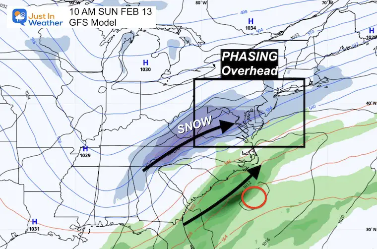
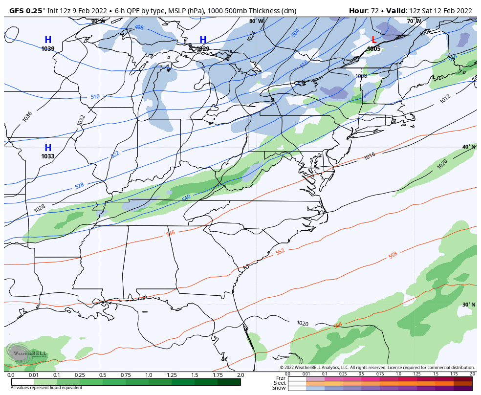
I will save the GFS model plot for last. So if you really want snow, let’s first look at what could happen to derail it for our region.
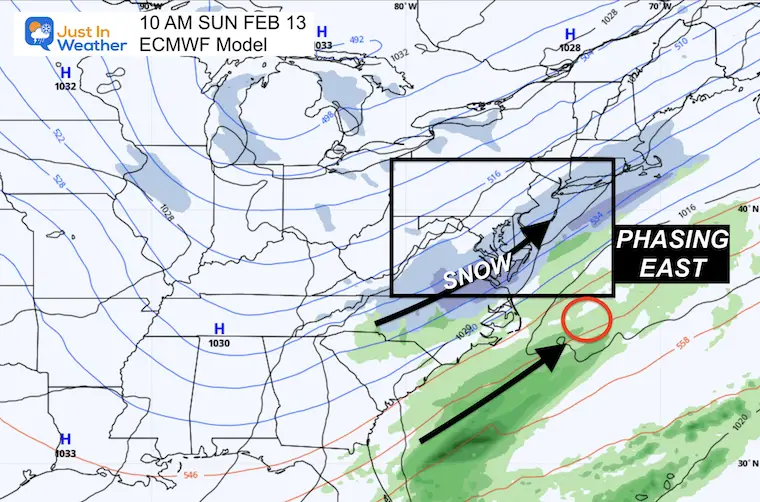
The Canadian GEM is late with the phasing, but brings big snow western Maryland and then pounds New England. The European ECMWF on the other hand, shifts the attention farther south and east bringing the best chance of snow to Delmarva.
Snow in the morning with the Northern Branch of the jet appears to fall over western Maryland.
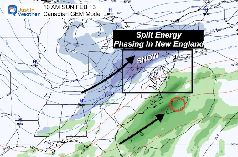
The loop may not be what snow lovers want, but it really helps show the dynamics of the split energy coming together (phasing) to a larger event.
While this missed central Maryland, the phasing occurs to our north in New England.

This shows the northern branch across Delmarva in the morning. The net result is shifting the entire pattern to the east, then off the coast.
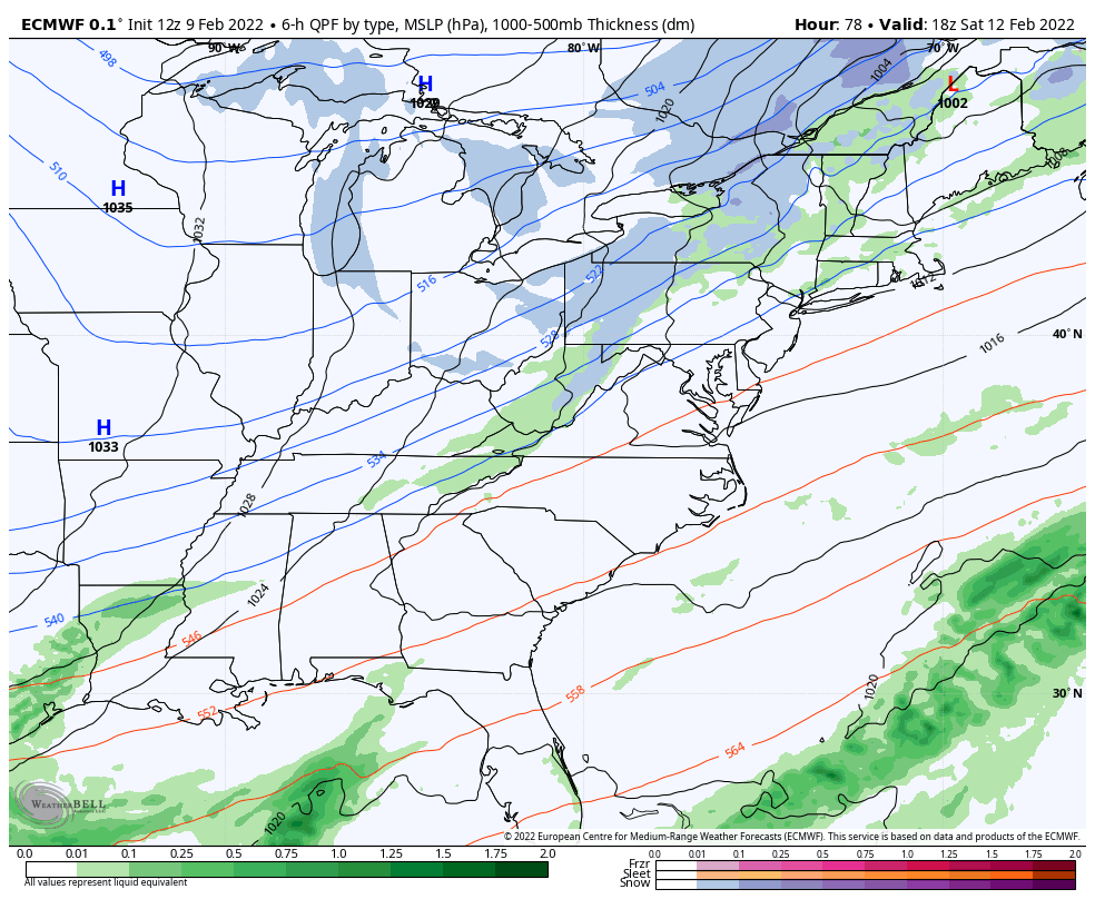
Just because this looks the most impressive, does not mean it is a promise. But what I have seen with this model is that is has been consistent and trending a little stronger.
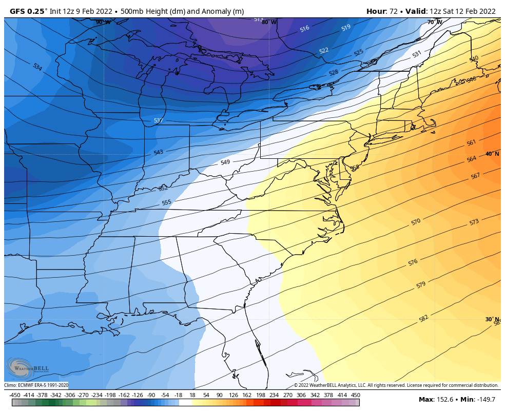
Here is shows snow over central Maryland Sunday morning, but the event (on this run) lasts all day.. Beginning overnight Saturday into early Monday morning.
I must say, this would be a favorable set up with phasing of the jet stream.
Saturday Morning to Wednesday Morning.
This helps shows how the jet stream arrives in two parts with phasing. After it swings through, the ridge that follows (orange) supports a warm up bigger than what we are having this week.
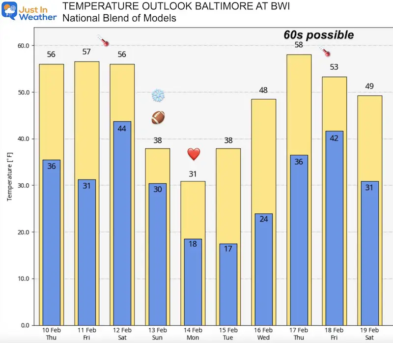
Here is the National Blend of Models showing a cold Valentine’s Day, then a jump to the upper 50s by Wednesday. While this shows 58ºF, I have seen 60s on both the GFS and ECMWF. Considering the tendency for BWI to verify warmer in warm patterns, I would give that a true possibility.


Last Winter Recap: My Old Outlook And Your Grades Of My Storm Forecasts


*Disclaimer due to frequent questions:
I am aware there are some spelling and grammar typos. I have made a few public statements over the years, but if you are new here you may have missed it:
I have dyslexia, and found out at my second year at Cornell. I didn’t stop me from getting my meteorology degree, and being first to get the AMS CBM in the Baltimore/Washington region.
I do miss my mistakes in my own proofreading. The autocorrect spell check on my computer sometimes does an injustice to make it worse.
All of the maps and information are accurate. The ‘wordy’ stuff can get sticky.
There is no editor that can check my work when I need it and have it ready to send out in a newsworthy timeline.
I accept this and perhaps proves what you read is really from me…
It’s part of my charm.
#FITF