


May 19 Weather Sunday Starts Foggy The Warming With Sun And Summer Heat On The Way
Sunday May 19 Morning Report The aftermath of the rainy Saturday is plenty of leftover moisture. This has left us with a bit of humidity and areas of thick fog…
February 9 Spring Like Days This Week Then Snow To Finish Weekend
Wednesday February 9- Morning Report
If you enjoyed yesterday’s weather, you are really going to like the rest of the work week. If you are not ready to let winter go, it will come back like a brief breakup just in time for Valentine’s Day.
Last night I put a little more emphasis on the potential snow for Sunday. Since then, the European Model has joined the Super Bowl Party list and we need to track closer.

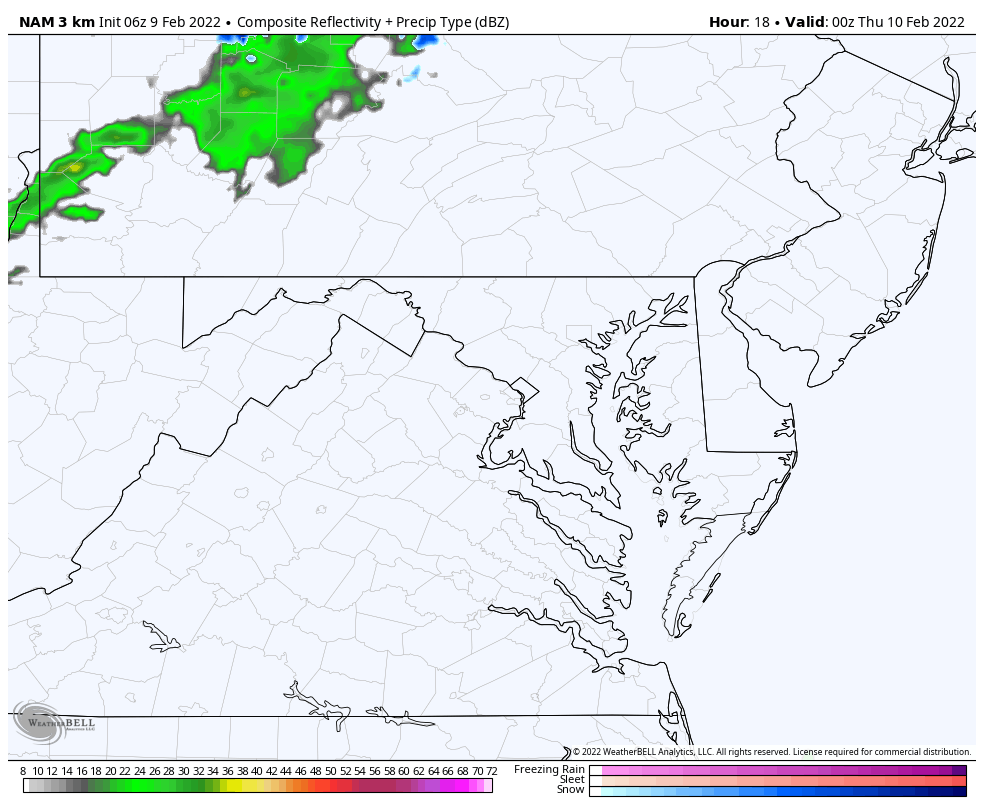
This morning is cold and quiet, and the day will be mild. But that Clipper in the Great Lakes region will swing through overnight. That will bring in showers, but while most of us are sleeping. Then we get back into a few more sunny and mild days.

7 PM Wed to 7 AM Thu
Rain showers across north central Maryland and southern PA with temps safely above freezing. This will arrive long after dark, and be gone long before dawn.
Western Maryland will get in on some snow showers that linger longer.
Seasonal Snow: 13.3”;
+4.7″ ABOVE AVERAGE
Normal Low in Baltimore: 26ºF
Record -7ºF in 1934
Normal High in Baltimore: 44ºF
Record 69ºF 2001
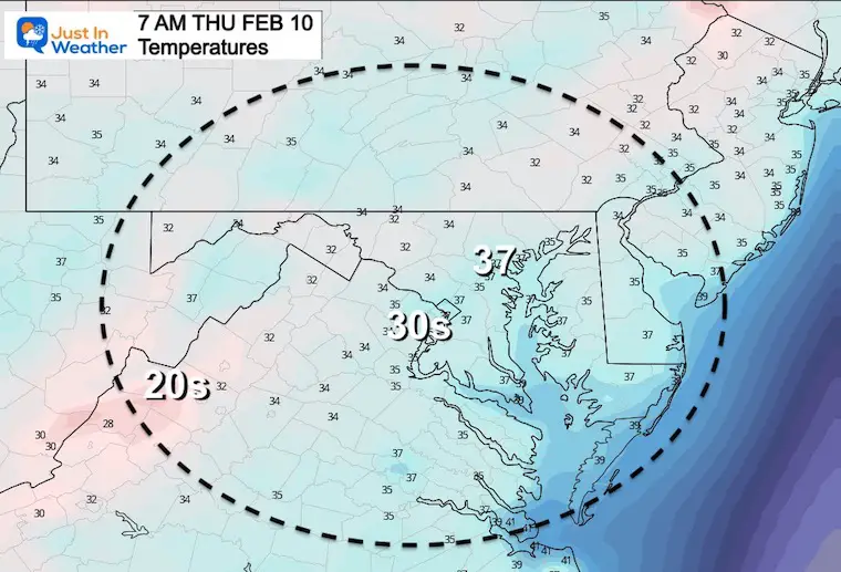
Another cold start.
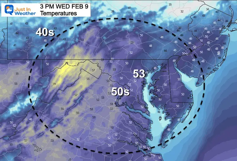
Another mild day in the 50s.

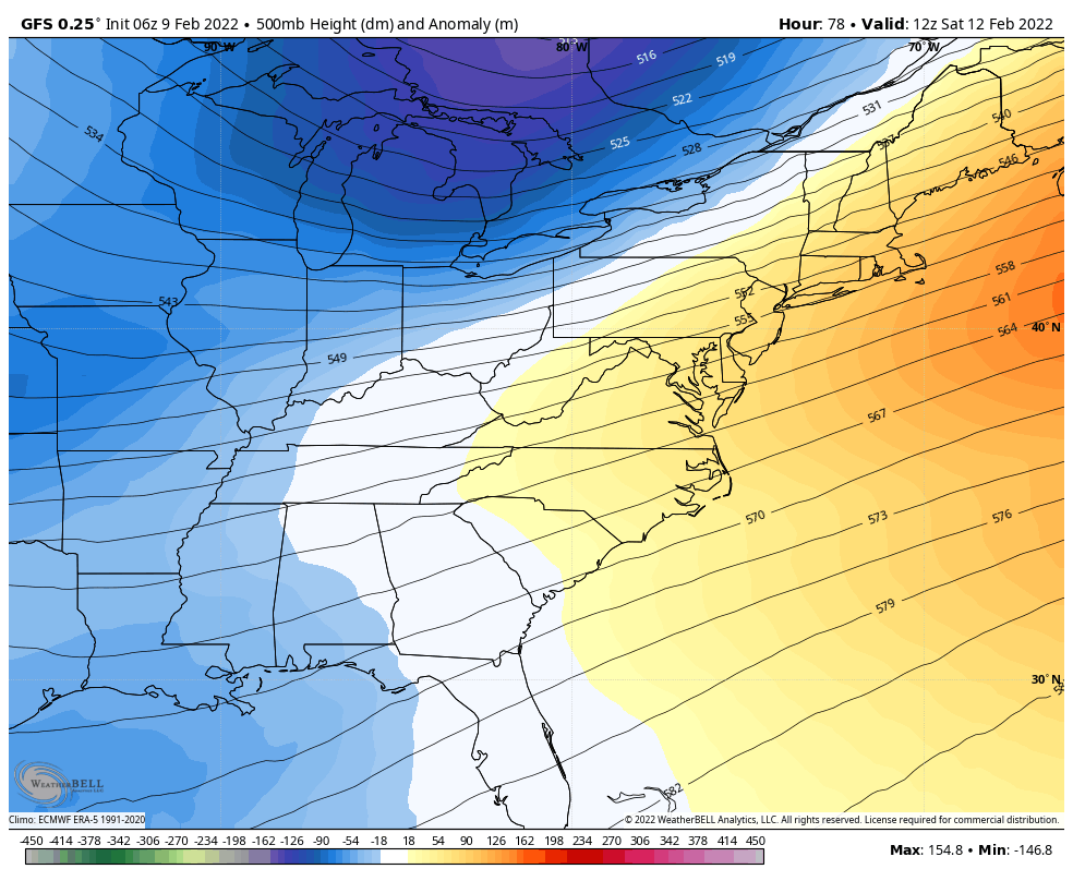
Mild weather develops this week, followed by a trough of cold air this weekend. We will get that push Sunday and Monday, which sets up the next chance for wintry weather.
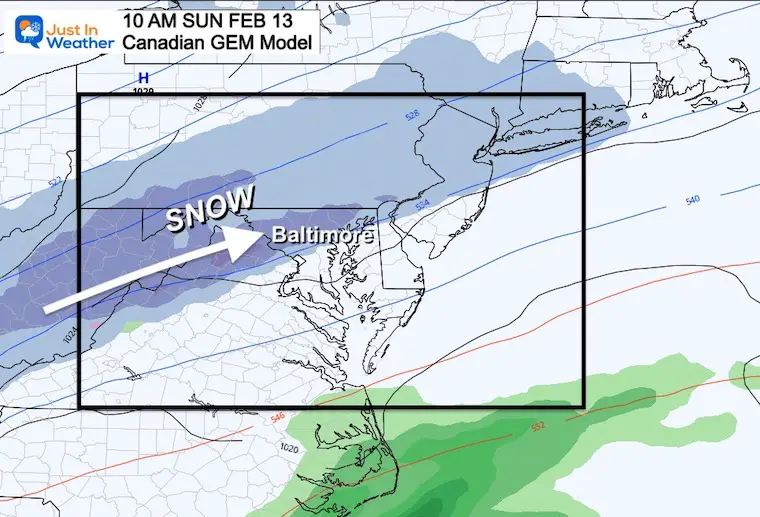
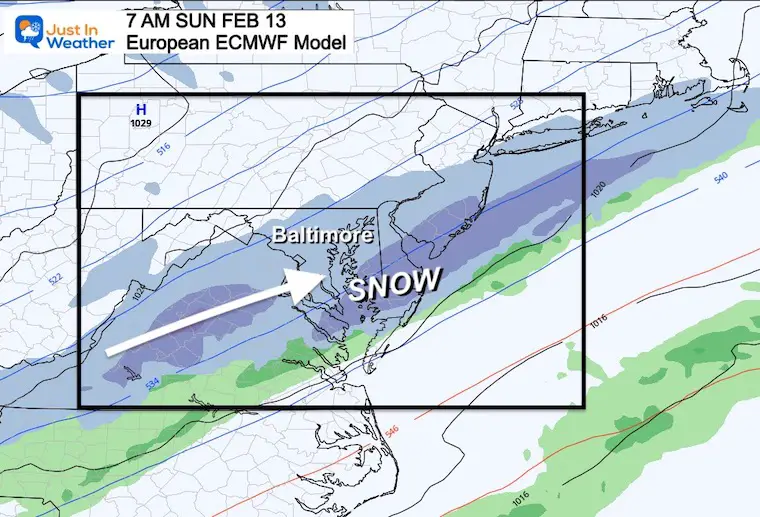
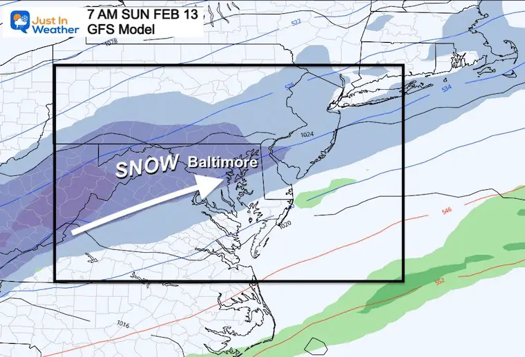
Here is the collection of three main models showing a band of snow developing Sunday morning.
Also Compare to Last Night’s Report
This is my Go-To model with arctic set ups. This has enhanced the snow since I showed in my prior report.
This was the hold out, and has joined the party! Yesterday morning I showed this with just about nothing of interest. Now it is showing expanding snow across our region.
This time stamp is earlier, and shows it farther east… But it is still showing a streak of impact snow in our region.
Once again we must give credit to the American Model leading the way on this event.
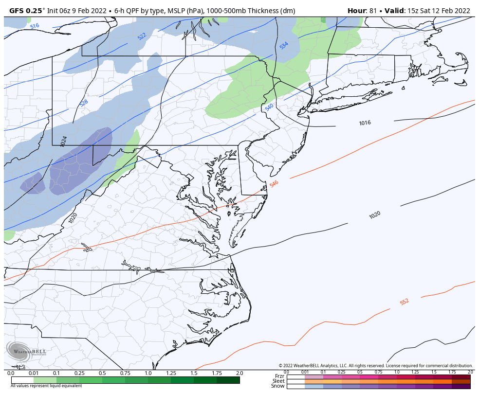
The ribbon of snow is an attempt for phasing of the northern and southern branch of the jet stream. For now the ‘Phasing’ develops a storm offshore.
The reason to watch this is the model bias or error that has displayed itself all winter. Events have mostly verified tracing a little west of the expected path. If that happens again, then that coastal Low will be closer and have an even bigger impact.
I adjusted the big warm up at the end of this stretch all based on the timing of the cold front on Saturday. There still may be 60s that day, most likely in southern Maryland. But if the front can slow down, then it still may include metro Baltimore.
The snow chance and impact on Sunday has been bumped up to 60%.


Last Winter Recap: My Old Outlook And Your Grades Of My Storm Forecasts


*Disclaimer due to frequent questions:
I am aware there are some spelling and grammar typos. I have made a few public statements over the years, but if you are new here you may have missed it:
I have dyslexia, and found out at my second year at Cornell. I didn’t stop me from getting my meteorology degree, and being first to get the AMS CBM in the Baltimore/Washington region.
I do miss my mistakes in my own proofreading. The autocorrect spell check on my computer sometimes does an injustice to make it worse.
All of the maps and information are accurate. The ‘wordy’ stuff can get sticky.
There is no editor that can check my work when I need it and have it ready to send out in a newsworthy timeline.
I accept this and perhaps proves what you read is really from me…
It’s part of my charm.
#FITF