


May 19 Weather Sunday Starts Foggy The Warming With Sun And Summer Heat On The Way
Sunday May 19 Morning Report The aftermath of the rainy Saturday is plenty of leftover moisture. This has left us with a bit of humidity and areas of thick fog…
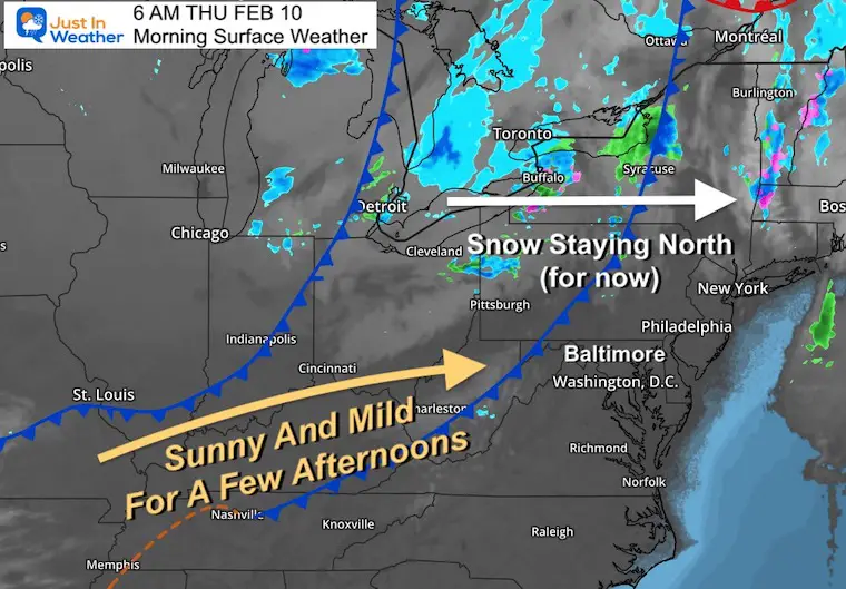
Thursday February 10- Morning Report
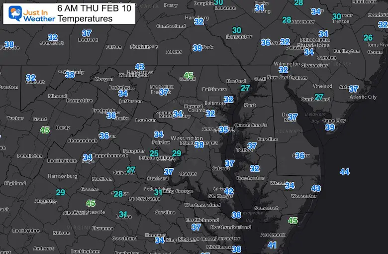
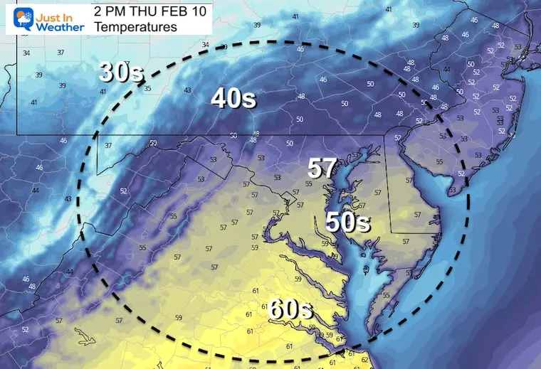
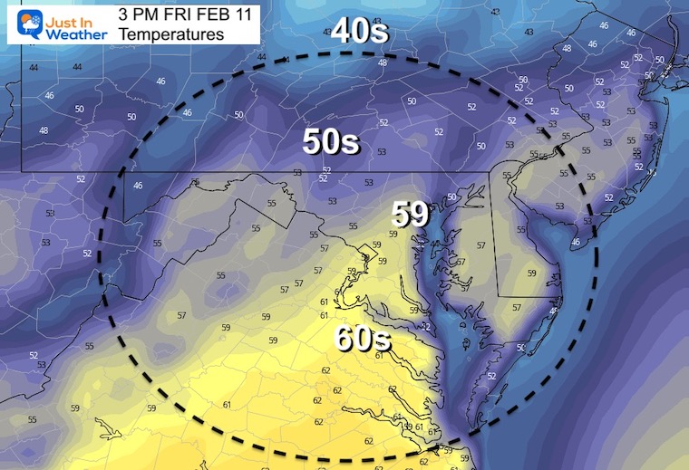
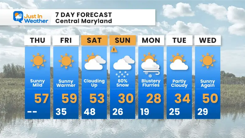
I am a people pleaser and I believe I have it all covered in this report. Today and tomorrow will bring us sunshine and warming temps. While I show 50s in the afternoons, we will have a chance to reach 60ºF in spots. Then, the cold front arrives on Saturday with snow in the mountains, but just clouds in metro areas.
Come Sunday morning, the arctic air will be in place and snow will be developing. There is a high chance for snow, the issue now is plotting the timing and location with most impact. That is that work we get to today.
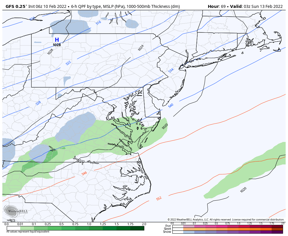
A series of disturbances are passing to our north, and keeping the snow there, for now.
We get into sunshine and a few mild afternoons today, tomorrow, and then changing on Saturday.
The arctic air and snow (not on the map) will arrive Sunday.
TODAY February 10
Seasonal Snow: 13.3”;
+4.7″ ABOVE AVERAGE
Normal Low in Baltimore: 26ºF
Record -7ºF in 1899
Normal High in Baltimore: 44ºF
Record 66ºF 1960
Morning
If we are going to reach 60ºF this week, this may be the best shot!
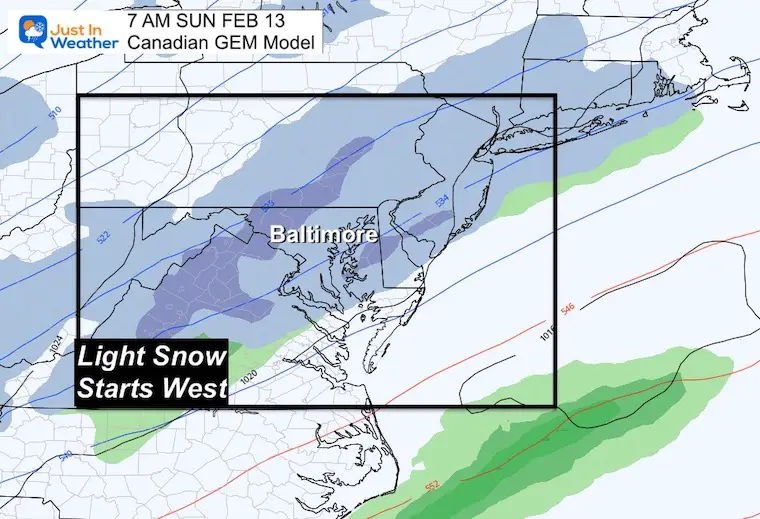
It seems like we are narrowing the target for this event, but there is still a split like I showed in my report last night. The simplest way to think of this with Baltimore in the middle:
Also Compare to Last Night’s Report
More West
More East
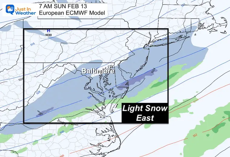
Still the middle of the road…
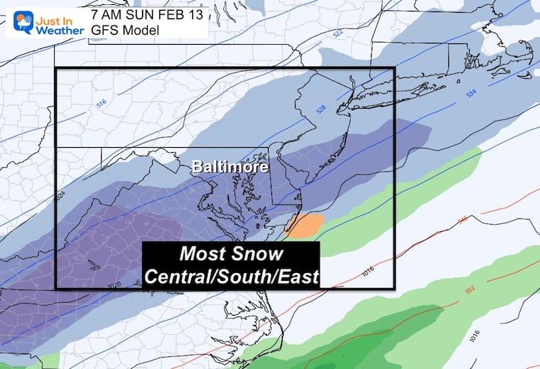
The ribbon of snow is an attempt for phasing of the northern and southern branch of the jet stream. For now the ‘Phasing’ develops a storm offshore.
The reason to watch this is the model bias or error that has displayed itself all winter. Events have mostly verified tracing a little west of the expected path. If that happens again, then that coastal Low will be closer and have an even bigger impact.
West have a few days of warm temps, and I think we have a chance to hit 60ºF in Baltimore.
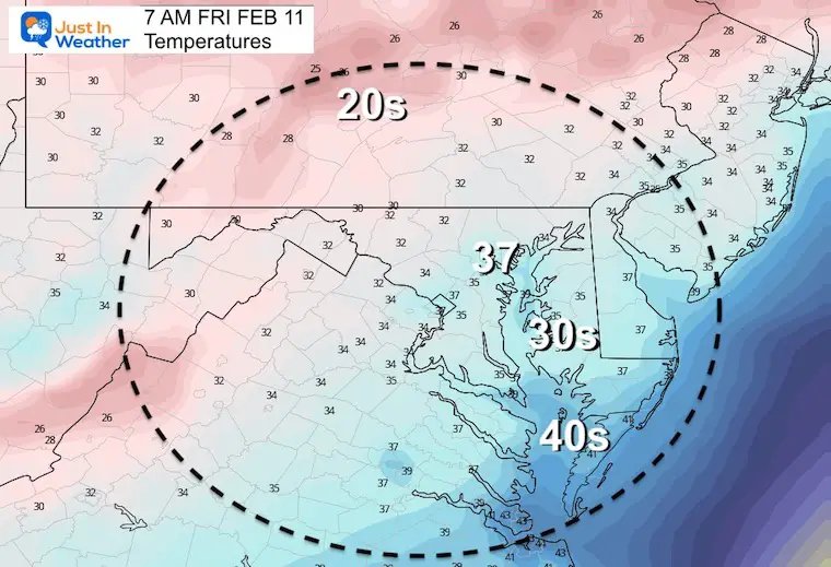
The colder air will arrive late Saturday, then establish with the developing snow on Sunday.
Sunday Snow: There is still a lot to work out with the impact of this system. That will be more tangible during today and then we can narrow the plot for who will get what and what time.
Next week: Cold start, then warming. After Wednesday there may be a better chance to reach the 60s for a few days.


Last Winter Recap: My Old Outlook And Your Grades Of My Storm Forecasts


*Disclaimer due to frequent questions:
I am aware there are some spelling and grammar typos. I have made a few public statements over the years, but if you are new here you may have missed it:
I have dyslexia, and found out at my second year at Cornell. I didn’t stop me from getting my meteorology degree, and being first to get the AMS CBM in the Baltimore/Washington region.
I do miss my mistakes in my own proofreading. The autocorrect spell check on my computer sometimes does an injustice to make it worse.
All of the maps and information are accurate. The ‘wordy’ stuff can get sticky.
There is no editor that can check my work when I need it and have it ready to send out in a newsworthy timeline.
I accept this and perhaps proves what you read is really from me…
It’s part of my charm.
#FITF