


May 9 Cooler With Rain And Severe Storm Risk Tonight South
Thursday May 9 Morning Report Today is the first day of the year with sunrise before 6 AM in Baltimore, but we won’t see it. After a high temperature of…
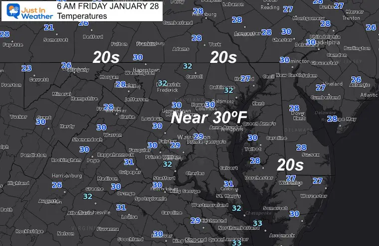
Friday January 28 – Morning Report
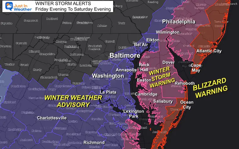
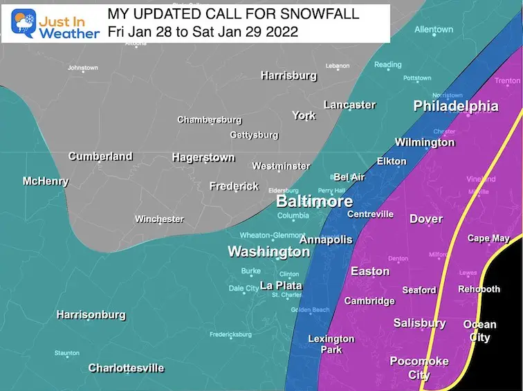
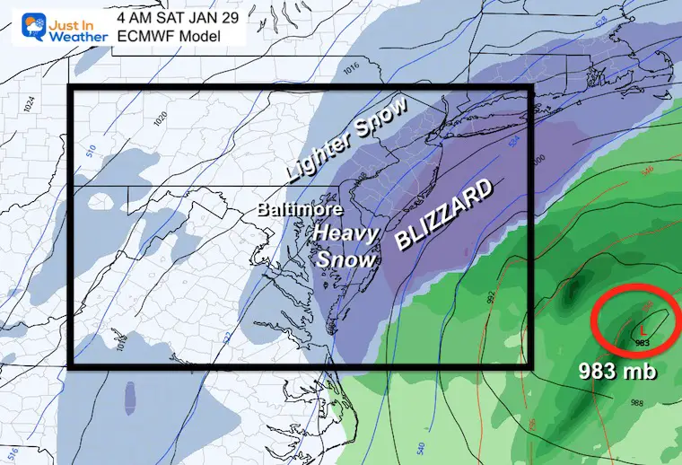
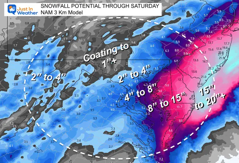
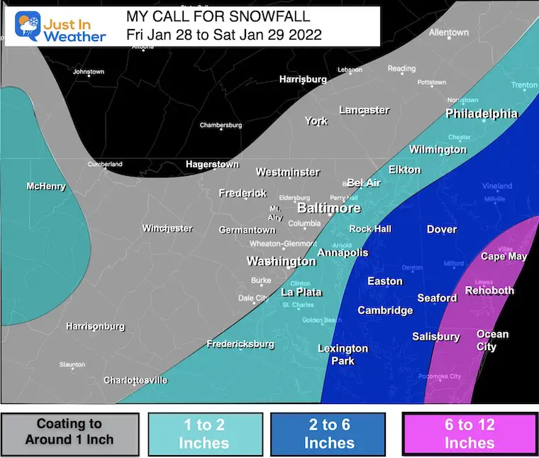
Yesterday I mentioned blizzard conditions for the beaches and now official Blizzard Warnings have been issues. I had also posted my snow map with one caveat: If it busts it will be for more snow. Well, this morning it appears that is the case and there will be a little more snow.
NOAA has commissioned Air Force Hurricane Hunters to fly off the east coast. That ‘additional data’ has been ingested by computer models, resulting in a track a little closer to the coast. That supports the European Model and a little more snow.
I will update my snow map later this morning. But I have a new model snow plot below.
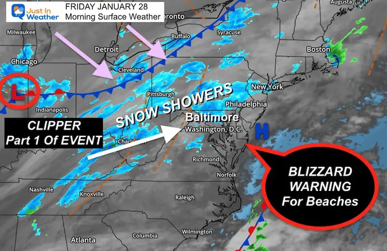
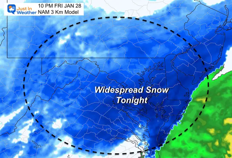
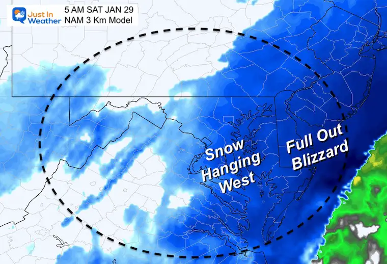
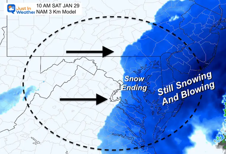
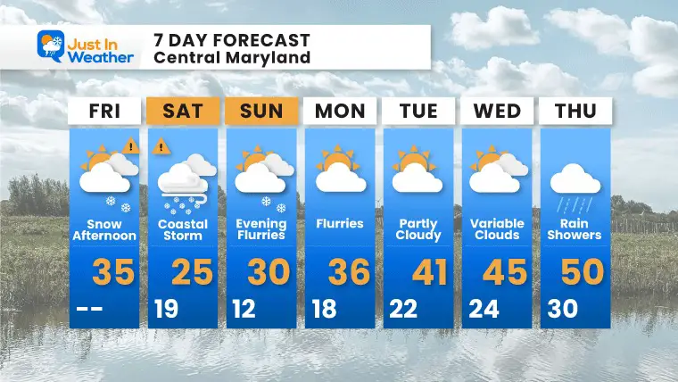
This has been a difficult set up, and we are already seeing some snow well ahead of schedule. Showers continue to today, but the main even develops later this afternoon and tonight. Saturday morning will be more impactful. The storm will rage most of the day on Delmarva. It will end west of the Bay in the morning.
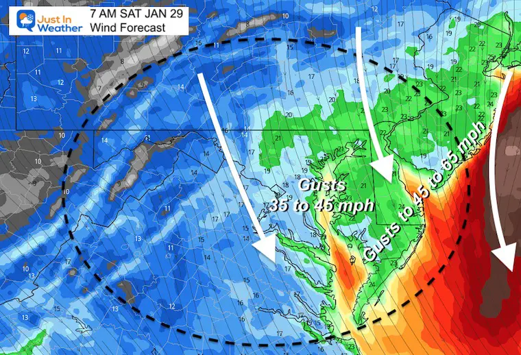
Blizzard Warning And Other Winter Storm Alerts
Morning Set Up
Headlines:
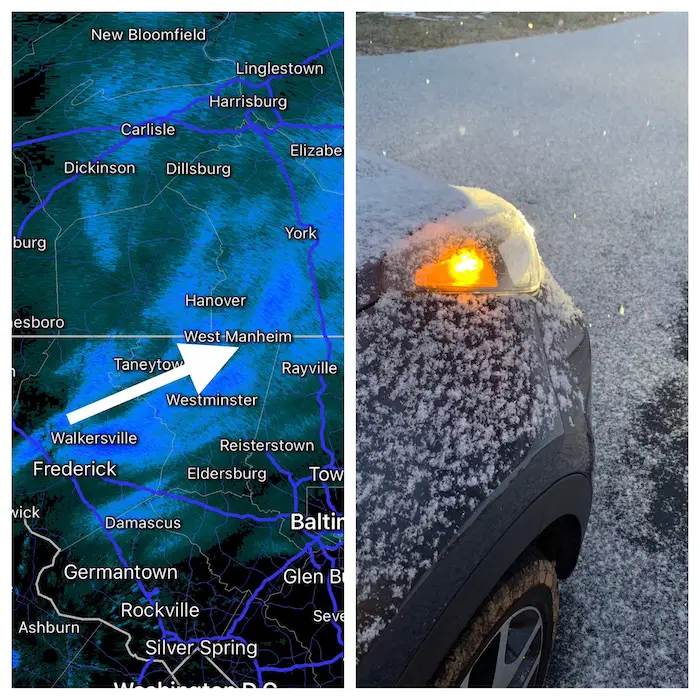
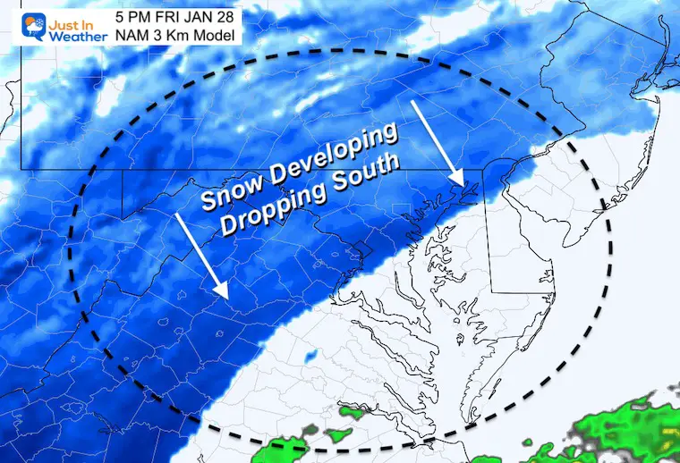
I posted this on social media…. This band of snow and stockage began between 6:30 AM and 7 AM. It has laid a coating or more in the path (northwest of cities). This is WELL AHEAD OF SCHEDULE and tells me there is more energy in the atmosphere the models are missing. Stand by for update this morning… I will be increasing my snow totals, updating the timeline, and waiting on NWS to expand Advisories farther west.
Arctic air is fully in place now.
The clipper is near Chicago and light snow has expanded into our region early… Stand by for updates on possible over achiever.
Note: It will be milder today with temps reaching above freezing afternoon. They will drop this evening and tonight for completed snow stickage.
TODAY January 27
Normal Low in Baltimore: 25ºF
Record -3ºF in 1987
Normal High in Baltimore: 42ºF
Record 70ºF 1949
The latest European Model For Saturday Morning
This model may win this event with the closer track….
Snow Animation: NAM 3 KM
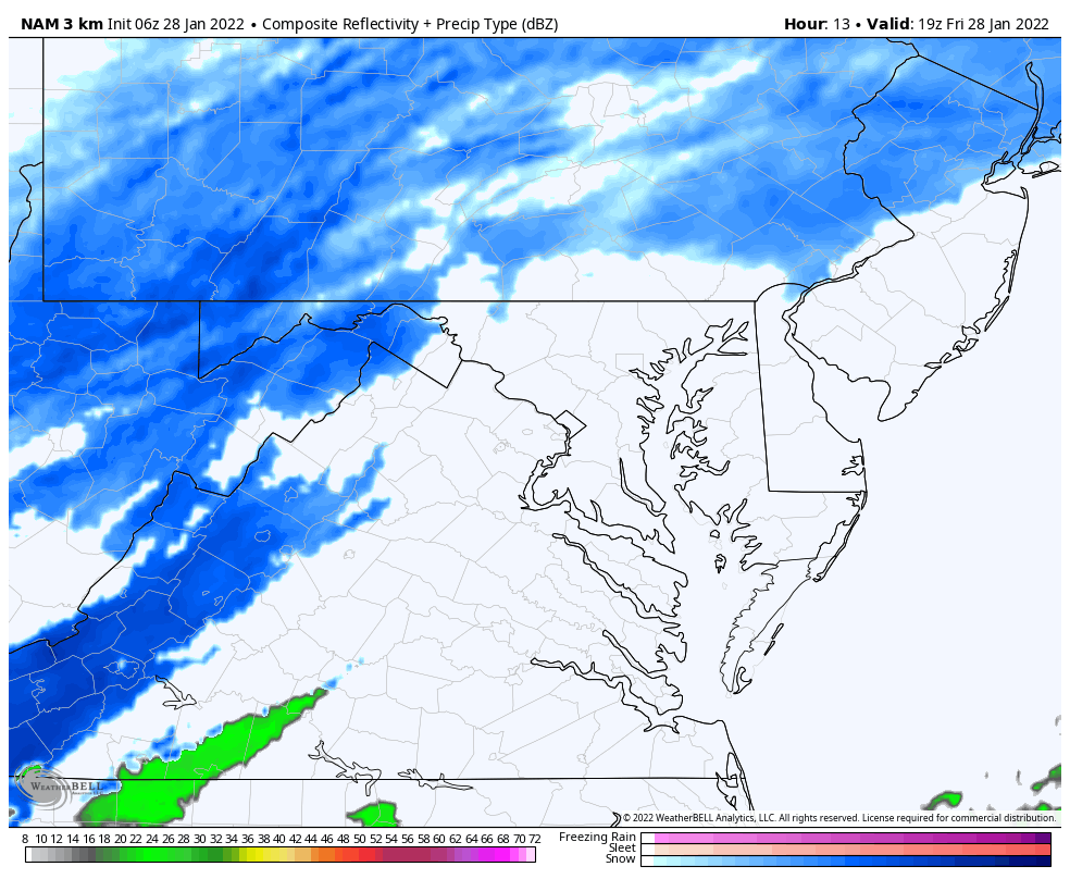
I will be updating my map later this morning.
Based on Baltimore at BWI
Bitter cold will follow this storm, then we have a chance to possibly reach 50ºF or higher by the end of next week.


Last Winter Recap: My Old Outlook And Your Grades Of My Storm Forecasts


