


April 27 Weather Chilly With Showers Then Turning Up The Summer Heat
Saturday, April 27 Morning Report One day to get through before the surge of summer heat. Today, we get clouds and rain showers as a warm front approaches. But on…
Friday January 28 2022
Morning Update
This will be a brief report just to get some new information out. Please note there will be a lot of information today coming your way, and I do not want to overwhelm you. I also do not want to overplay the building anticipation or anxiety with the storm. But we are in a flexible mode now leaning towards over achieving.
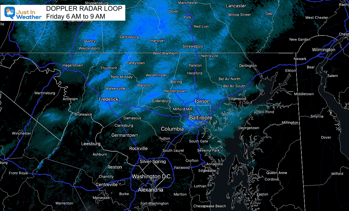
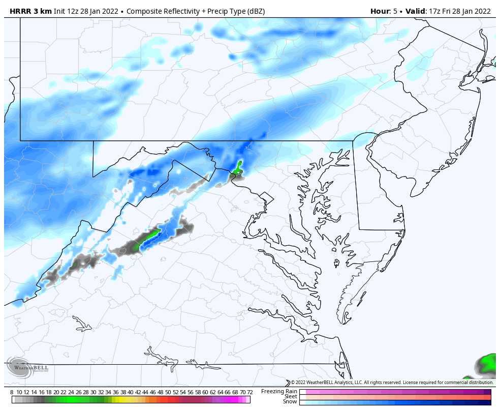
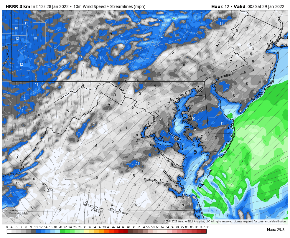
I did my best to share the burst of snow that developed between Frederick and Westminster MD to York PA.
I live near the Maryland/Pennsylvania line and saw this as I was about to drive my son to school…
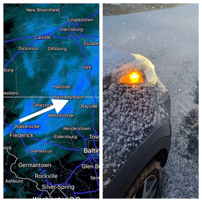
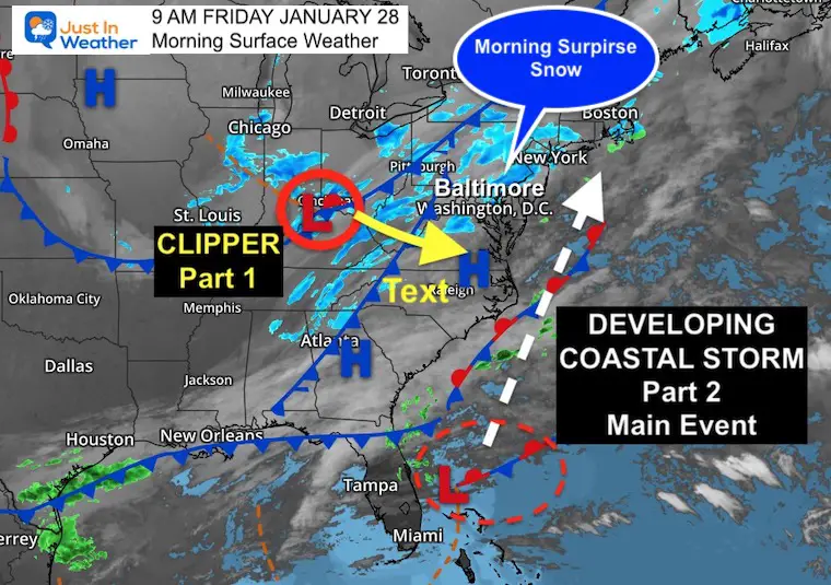
This band of snow and regional snow showers was due to a jet streak. That is a narrow fast pocket of winds, that formed well ahead of the Clipper and cold front (Part 1 of the storm complex).
This tells me there is more energy in the atmosphere than models see. We get additional data form Air Force Reconnaissance Hurricane Hunters. They have flight plans continuing off the coast to feed into models. The first batch is what pulled data to line up with the European Model and bring the storm closer to the coast. That moves all of the region into high snow potential…
STILL MUCH MORE AT THE COAST!
12 PM Fri to 12 PM Sat
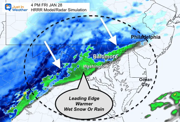
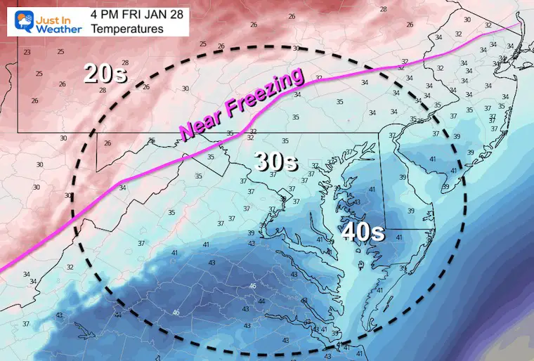
Radar AND Temperatures
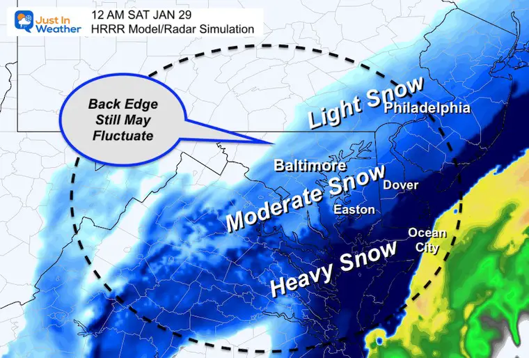
The impact region-wide will be late evening to early morning. So this midnight time frame supports who will be in on the accumulating snow.
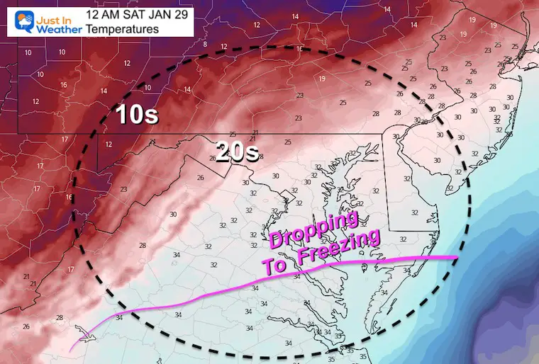
Cold enough for full sticks, even with blowing snow over treated areas.
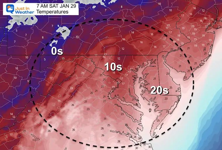
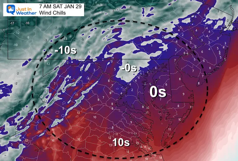
At 7 AM Saturday, most of our region will ‘FEEL LIKE’ near or below ZERO!
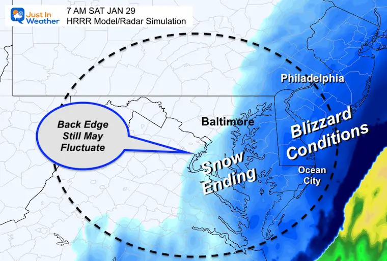
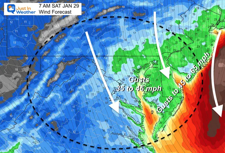
7 PM FRI to 7 PM Sat
Increasing at the end of the storm through most of Saturday AFTER the storm move away.
BLOWING AND DRIFTING!
It is possible for SNOW DRIFTS in on Delmarva near the coast to be 2 to 3 Feet!
Wind Forecast NAM 3 Km
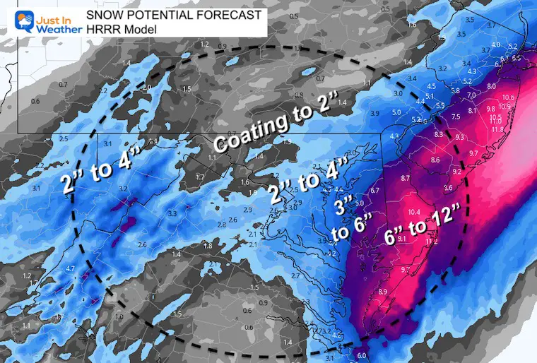
This is one of many model to consider for snow totals.
The beaches in the blizzard zone could earlier reach 1 Foot, but it will be blowing and drifting a lot. Drifts up to 2 or 3 feet are very plausible.
Farther west, the main boost is the 2 to 4 inches for metro Baltimore and Washington.
I will be upping my map shortly. This is criteria for the Winter Weather Advisory from NWS to be expanded west. I will let you know when they make that call.
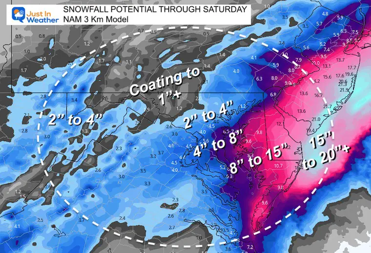
This is what I shared in my first morning report.
Obviously these are MUCH HIGHER for the beaches.
Regardless, it will be hard to measure with the blowing and drifting.
Stay tuned…
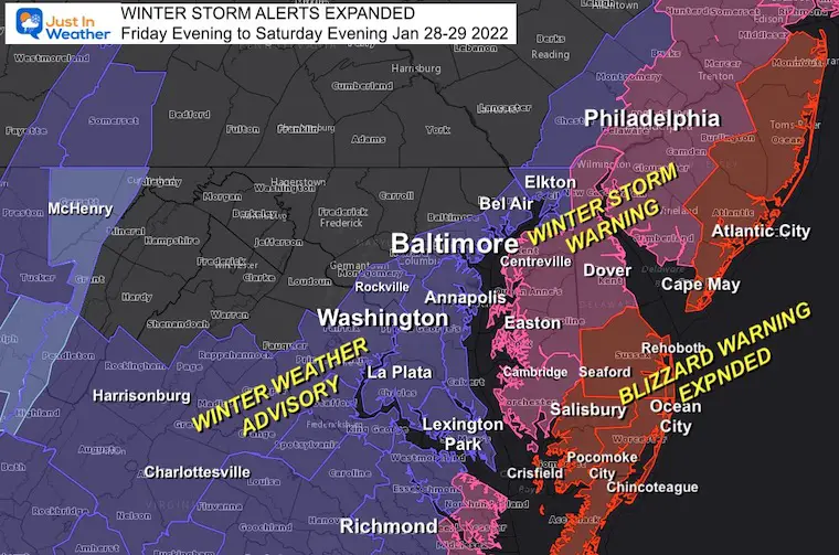
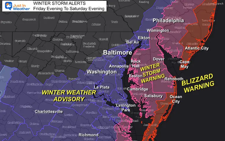
Blizzard Warning And Other Winter Storm Alerts
Stay tuned to see if Winter Weather Advisories get expanded west.
I will have my new snow total map later this morning.
Faith in the Flakes!
*Disclaimer due to frequent questions:
I am aware there are some spelling and grammar typos. I have made a few public statements over the years, but if you are new here you may have missed it:
I have dyslexia, and found out at my second year at Cornell. I didn’t stop me from getting my meteorology degree, and being first to get the AMS CBM in the Baltimore/Washington region.
I do miss my mistakes in my own proofreading. The autocorrect spell check on my computer sometimes does an injustice to make it worse.
All of the maps and information are accurate. The ‘wordy’ stuff can get sticky.
There is no editor that can check my work when I need it and have it ready to send out in a newsworthy timeline.
I accept this and perhaps proves what you read is really from me…
It’s part of my charm.
#FITF


Last Winter Recap: My Old Outlook And Your Grades Of My Storm Forecasts


