Wednesday January 19 2022
Evening Update
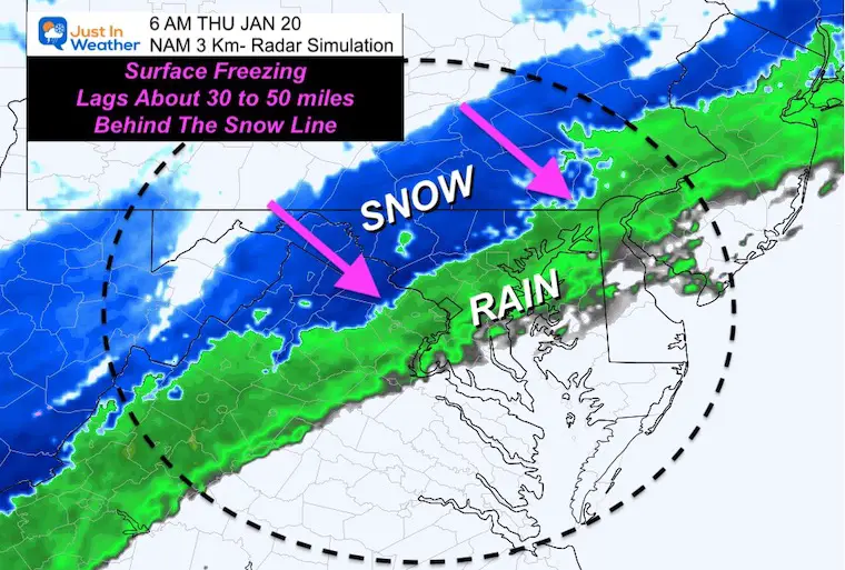
In this report I wanted to elaborate on the expectations with more detail. My call for snowfall and the breakdown of zones can be found below. This event will bring rain to snow for most if not all of us. The main component will be the timing of the transition and then the surface freezing line that will allow slush to freeze on the roads. This is more likely farther north where it will get colder AND arrive earlier in the morning before any help from the sun angle.
I have family among the many others that will be traveling during the snow time, so I have added incentive to get this right and help them be aware and best prepare.
I hope you have seen my prior reports with the timeline for snow and temps. Below is an update on the temps.
Reminder: Winter Weather Advisories
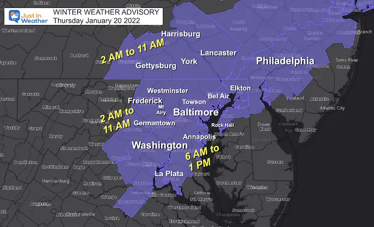
Timing Is Key
- Yes, just about all of our region will have rain, turning to snow during the morning. But the impact will not be the same.
- Colder areas, there may be snow falling for an hour or two before temps reach freezing, and lead to icy roads. There will be a Flash Freeze!
- The timing and placement of the actual surface freezing line farther south will determine if you get snow to stick just on the grass, or the roads.
- My snow map and notes has a break down where roads may stay slushy or turn icy.
- If you live my the water, you are less likely to have full on icing, but you will get snow falling and more on the grass.
Travel Impacts
I have personal stake in this because my wife will be flying out from BWI in the morning for work. I tried to encourage her to go early and stay ahead of the slop. Better than to be stuck in traffic, or worse.
Flights: I DO NOT KNOW. I have learned that airlines sometimes fly when I can’t imagine how, and the times delay when I think they should be OK. You are best to check with them (good luck).
Schools: It is reasonable to expect delays simply for the timing and anticipation of slushy snow freezing during the morning ride. Going beyond to a closing or virtual day is also up to each local district.
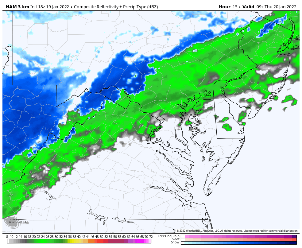
Radar Animation
4 AM to 8 PM
Rain will start, then change to snow. Snow will fall in southern Maryland as well, but later in the morning into the afternoon. However, they are not in the advisory because temps are expected to remain above freezing, keeping roads mostly wet.
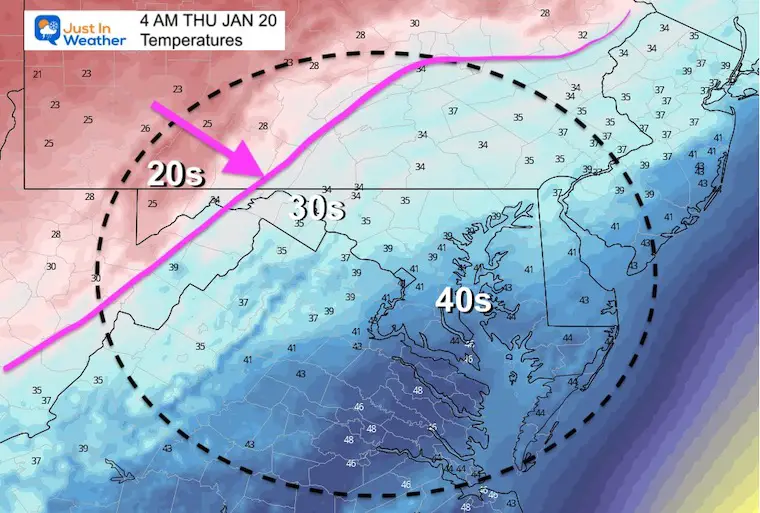
Early Morning Highlight
Southern PA to Central Maryland
Transition to snow between 6 AM and 9 AM.
Temps falling below freezing west/north of Baltimore 1 to 2 hours after snow begins. Slushy stickage will lead to icing on roads.
If you want an hourly look at the radar plots please click here for my prior report.
It’s All About The Temps
Updated Forecast Maps
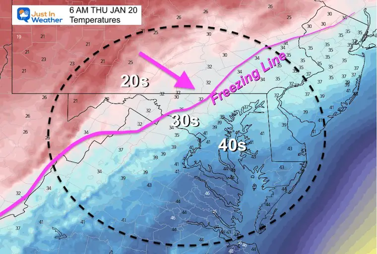
4 AM
6 AM
I am only showing the radar snapshot for this time slot due to time contains. Please see my previous post for a more detailed breakdown of the hourly expectations.
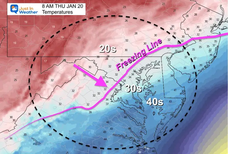
8 AM
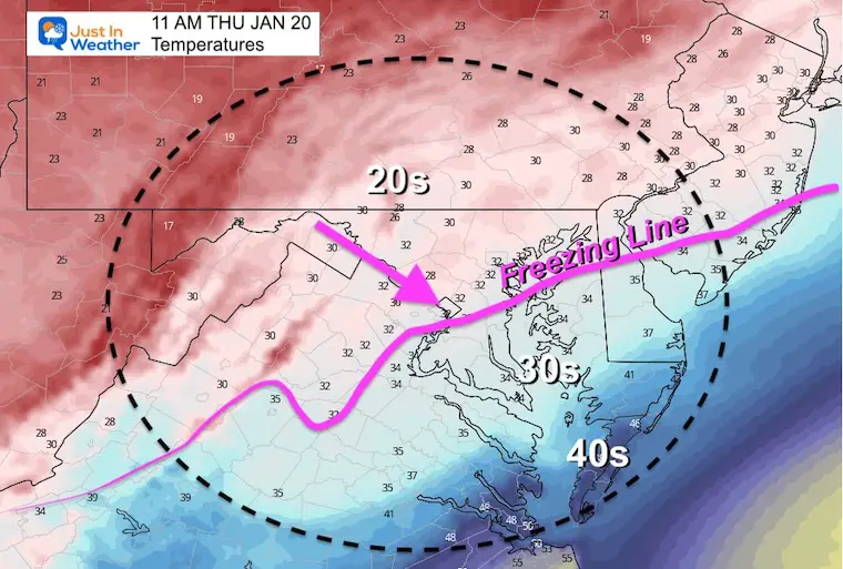
11 AM
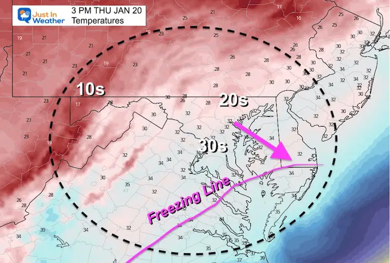
3 PM
Southern Maryland where it is still snowing, it may being to stick more at this point.
My Call For Snowfall
Zone breakdown below
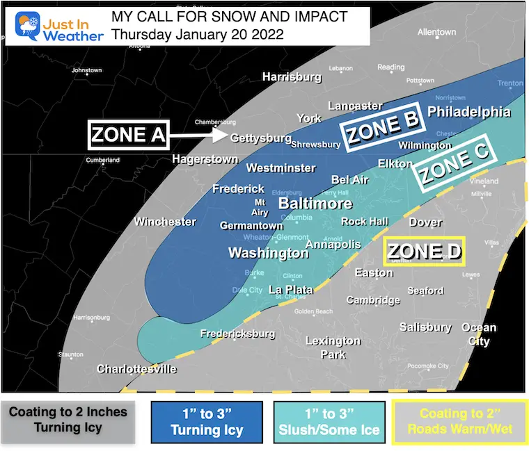
Zone A:
- Freezing line arrives earlier.
- Less snow but roads will turn icy before sunrise.
Zone B:
- Snow will fall before sunrise.
- Temps drop to freezing within 1 to 2 hours of change over, and expected to be icy through the morning commute.
Zone C:
- Transition to snow during the morning commute 7 to 9 AM.
- Temp near freezing, but marginal.
- Slushy roads. Some colder spot turn icy, especially farther inland.
- Places by the water (Havre de Grace, Sparrows Point, Cape St. Claire) less likely to have road impact due to slightly warmer temps.
Zone D:
- It will snow late morning and afternoon.
- Temps likely to stay above freezing, so most snow stickage will be on the grass.
- Some roads may get slushy, but most should remain wet.
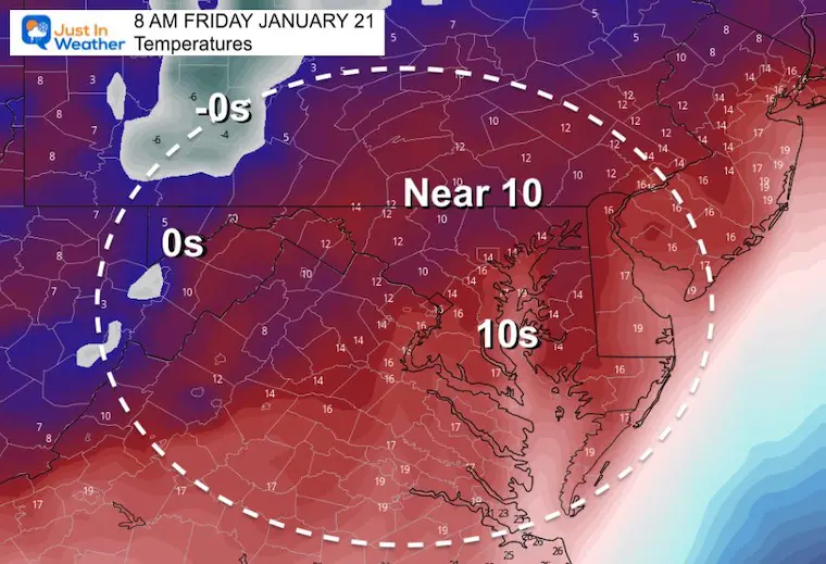
Friday Morning Temperatures
Here’s a look at the arctic air that will follow.
ALSO SEE
ALL FITF GEAR

FITF THUNDERSNOW


Winter Outlook Series:
My Call For Snowfall

Last Winter Recap: My Old Outlook And Your Grades Of My Storm Forecasts


Please share your thoughts, best weather pics/video, or just keep in touch via social media


