


May 7 Warming Up With Only Isolated Showers And Thunderstorms
Tuesday, May 7 Morning Report We are entering a period of warming with less rain for a few days. We will still see some isolated showers and thunderstorms pop up…
Wednesday January 19 2022
Competed Advisory Update
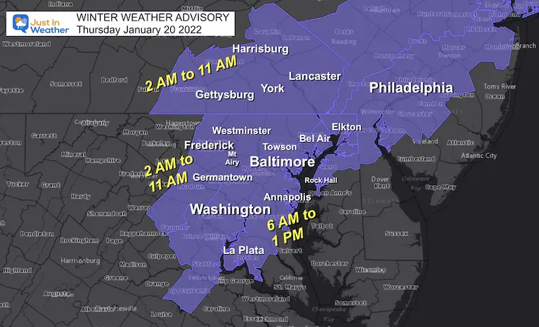
The Winter Weather Advisory for Thursday morning to includes central Maryland, Southern Pennsylvania, and parts of Virginia around Washington DC.
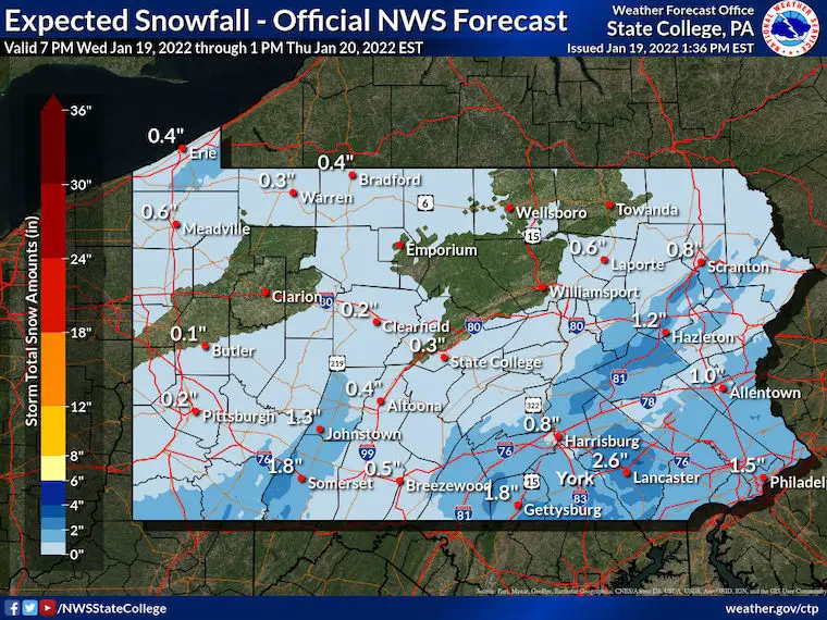
This post is to complete the regional coverage that was missing in the prior report. As expected the snow and icy roads will be an issue between Gettysburg, York, Harrisburg, and Lancaster in PA as well in the morning.
As for the schools, there is a narrow window Thursday morning when rain will change to slushy snow, then that may ice up all during the commute. I see at least a delay potential for region wide schools, if not going virtual.
See the latest timeline breakdown for radar and temps below.
Click Here For: Full package of NWS snow maps
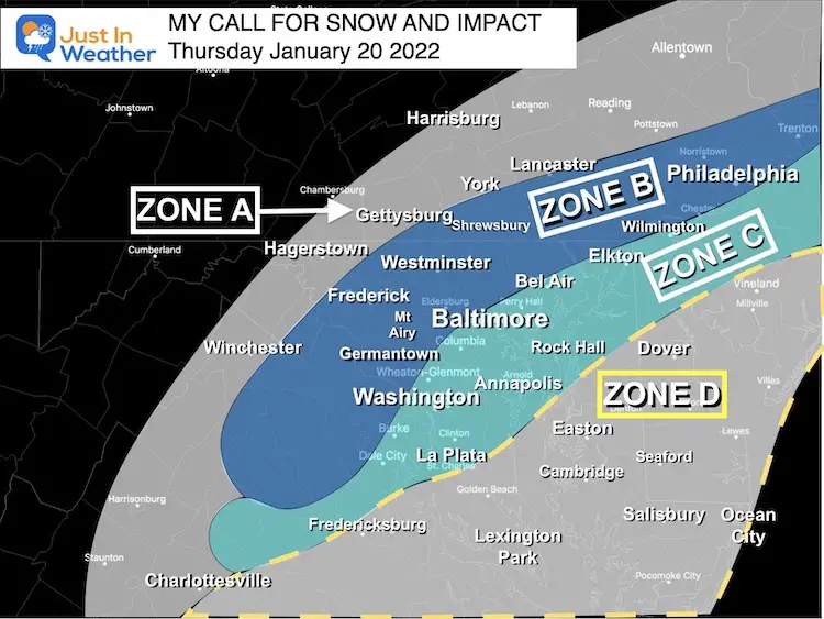
*My call is very similar to this. I will work on my personalized map in a bit.
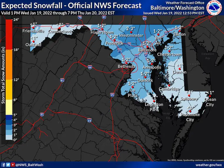
Notice the NWS forecast has Southern PA with up to 2 inches of snow. They should be added to the Advisory.
Rain will transition to snow in central Maryland between 6 AM and 10 AM. The wave of Low Pressure may sent the northern edge of snow back north into Pennsylvania for additional snow coating there for a couple of hours.
Snow will linger in southern Maryland and The Lower Eastern Shore during the afternoon.
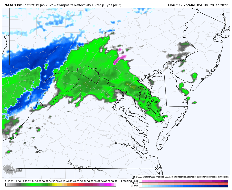
Closer look at this snow development.
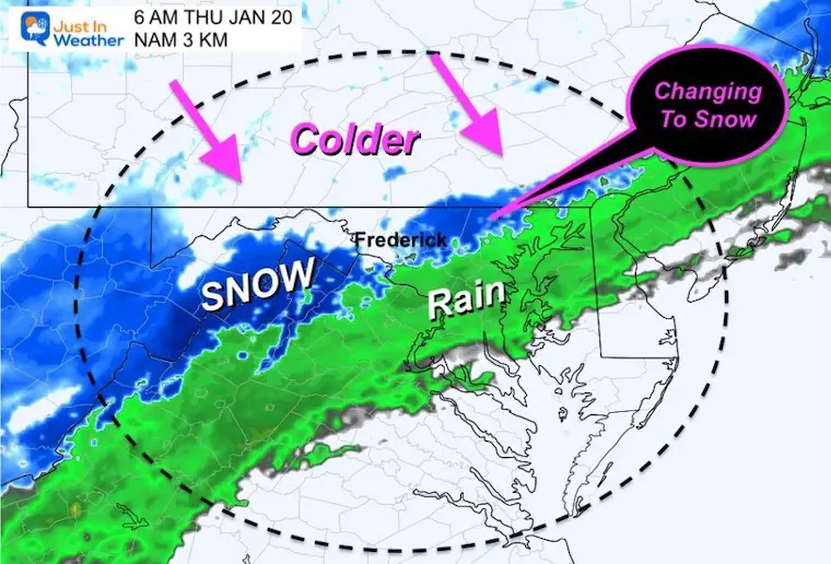
Rain showers tonight, then turns to snow during Thursday morning. Snow will fall with slushy stickage on roads… THEN temps drop to freezing west and north 1 to 2 hours after the change to snow. This will be during the morning commute and could lead to an icy mess.
Please note the time stamps. Should this arrive an hour or two faster then even more impact on the metro commute is likely.
6 AM
Watching the snow develop near Frederick and the PA line in Baltimore County.
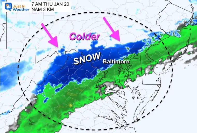
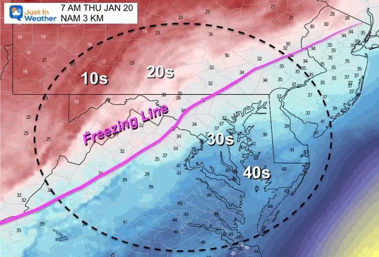
7 AM
Snow should expand to Baltimore. Steady snow expected between Frederick, Westminster, and perhaps Bel Air.
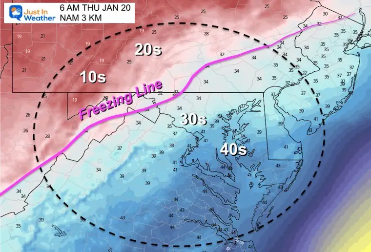
The Freezing Line will reach 1 to 2 hours after the snow begins.
This should reach Frederick to Westminster and York PA at this time.
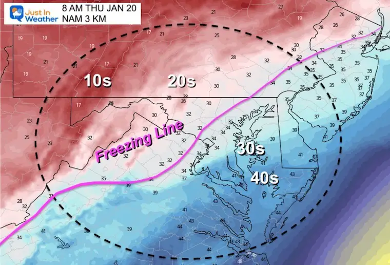
8 AM
Snow will expand south to near Annapolis.
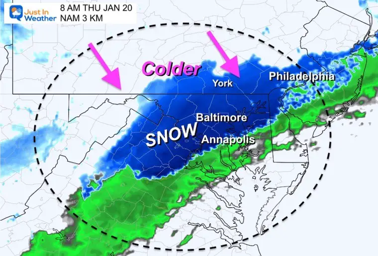
The freezing line should reach Germantown, Westminster, and northeast to Forest Hill.
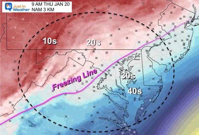
9 AM
Snow should arrive in Kent Inland and Easton. Also close to Dover.
A brief north push into southern PA may expand the coating on the roads.
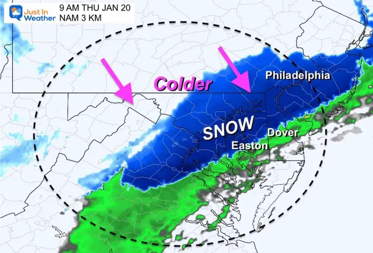
Temps down to the 20s in Carroll County will accelerate the chance for icing on the roads.
The freezing line will be close to the Baltimore AND Washington Beltways.
10 AM
Snow should be ending in metro Baltimore, but expanding to southern Maryland.
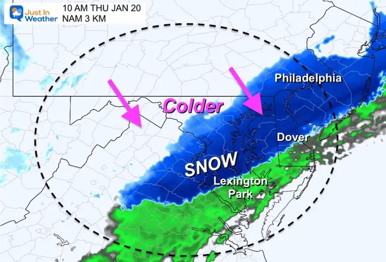
The freezing line will be close to I-95 and remain nearly stationary during the day.
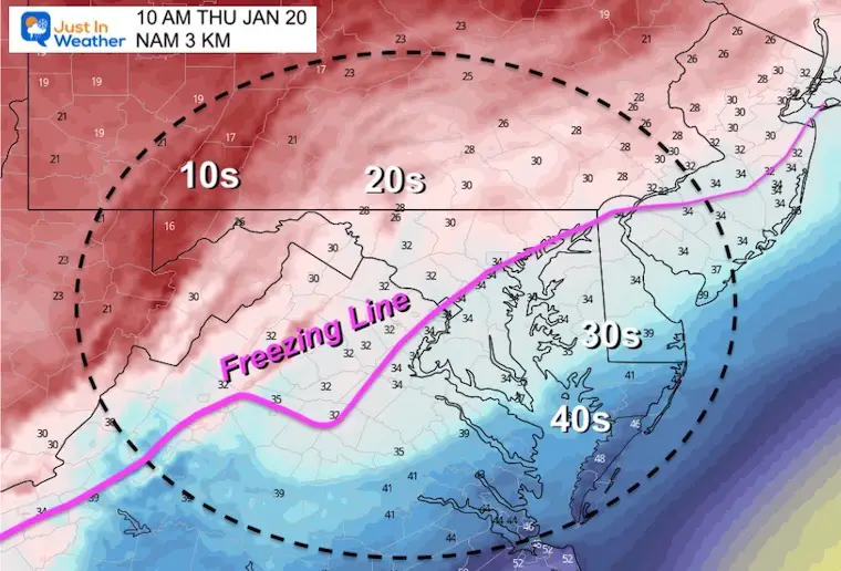
The freezing line will still be draped across Rt 50/Bay Bridge areas. So the snow in Southern Maryland may be melting on the pavement.
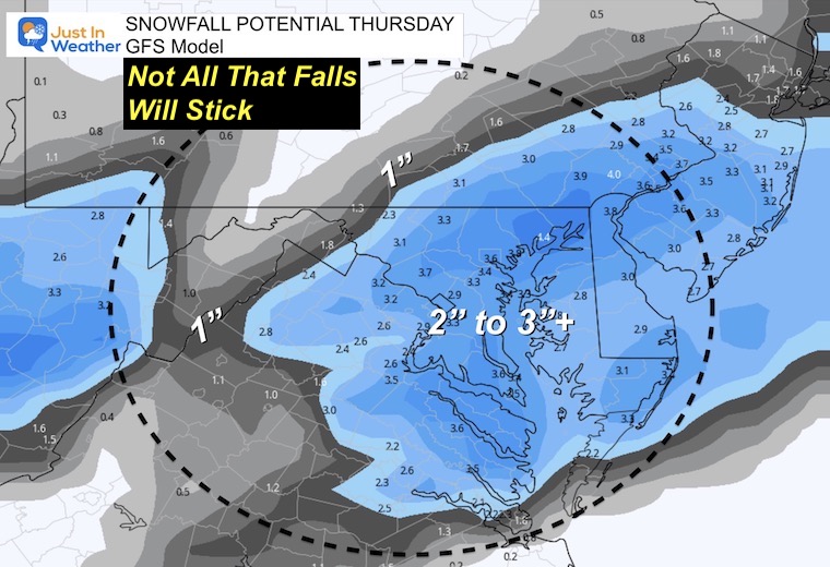
Please note this is the NAM forecast, not mine. I am showing you because I think the general expectation of 1 to 3 inches is a good starting point.
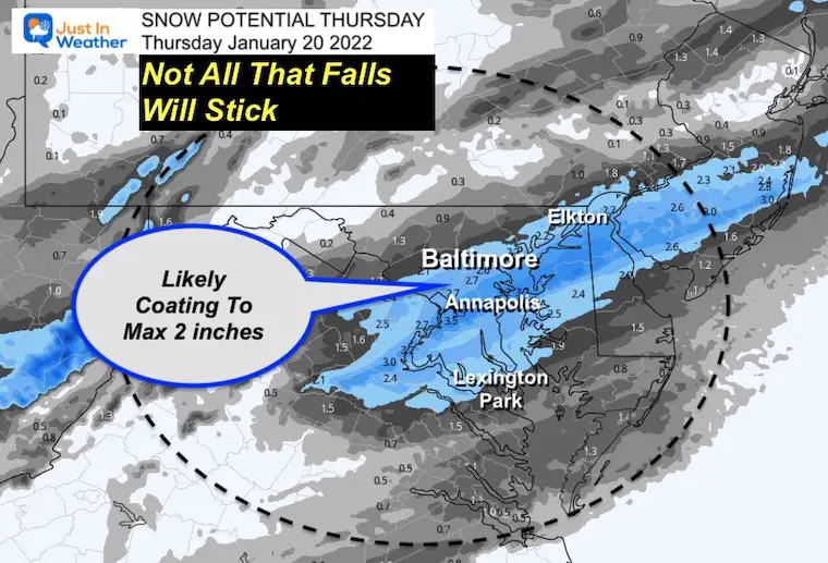
This is very aggressive with snow totals. However I still think not all that falls with stick due to some initial melting.
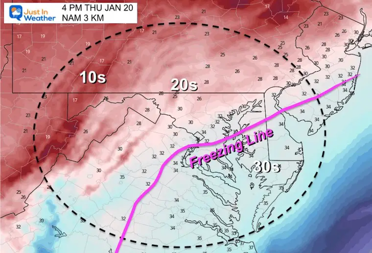
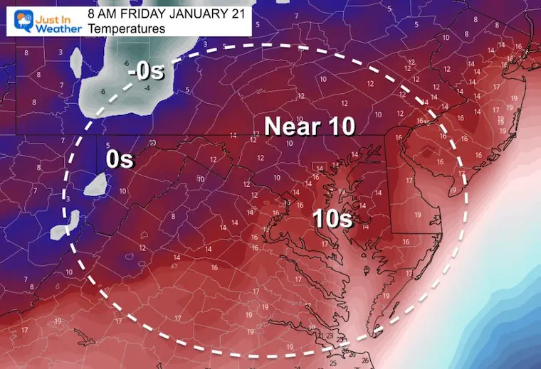
Here’s a look at the arctic air that will follow.


Last Winter Recap: My Old Outlook And Your Grades Of My Storm Forecasts


