


Severe Thunderstorm Watch and Flood Watch Tuesday
Tuesday Afternoon Update July 1 2024 The atmosphere is juicy! Dew points are high in the mid to upper 70s, which means there is the potential for heavy rainfall and…
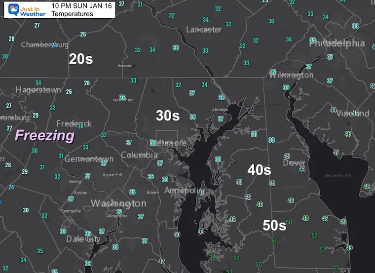
Sunday January 16 2022
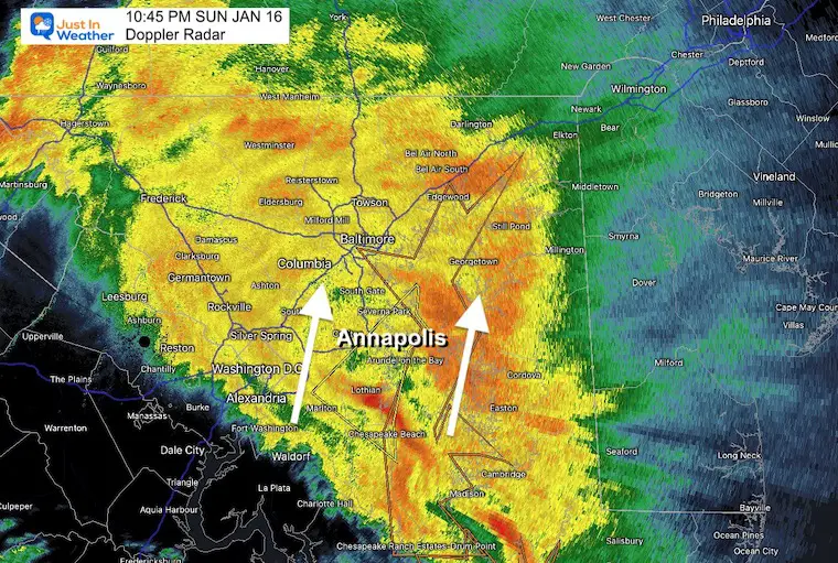
Update at 10:45 PM
So far the storm has behaved very close to expectations. The warm air and thaw has spread north, changing the ice to rain quickly. The ice concerns are lingering from Frederick and westward. But the storm has more to throw at us.
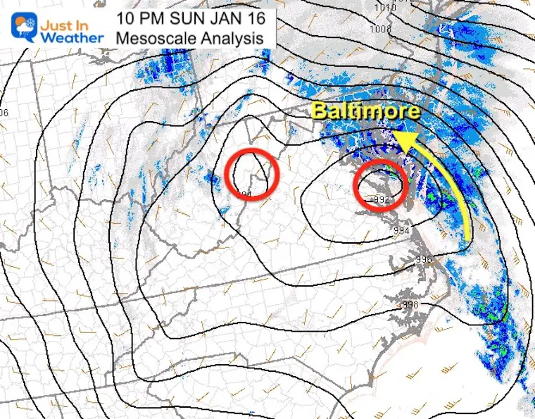
On Monday morning, Low pressure will be doing north into Pennsylvania and the wrap around will bring in two things:
Until 11:30 PM
Southeastern Anne Arundel County in central Maryland…
Northwestern Calvert County in southern Maryland…
East central Prince Georges County in central Maryland
Winds may reach 60 mph along with very heavy rain!
The secondary Low we tracked earlier is taking over, but this is still considered a ‘double barrel system. The rapid drop in pressure is causing winds to increase. We will feel some of it tonight form the southeast, then get whiplash with the southwest to west surge Monday.
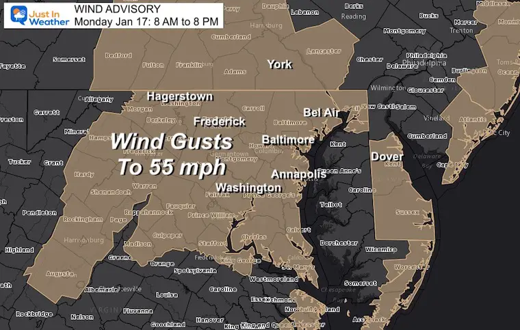
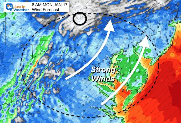
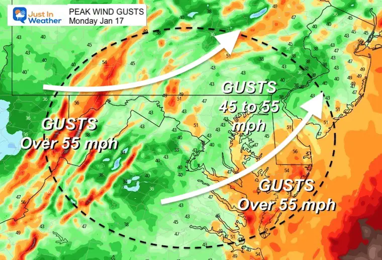
Winds will be gusting most of the day on Monday.
Peak winds could reach 55 mph in many areas, higher by the coast and in the mountains.
Eastern Shore: You have not been included, but should be. That is an issue you can take up with with NWS Mount Holly Office.
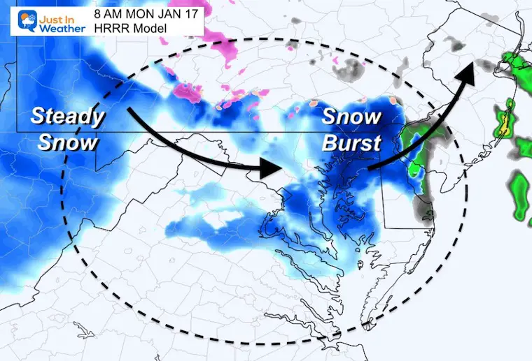
The wrap around will bring us a burst of snow early in the morning.
This may be enough for a fresh coating on the ground.
Snow will briefly swing through early Monday. This may burst with heavy squalls that can recover the ground.
Any icing an a lot of snow will melt overnight, but we could still have power outages.
The winds will be FROM the west and southwest. This will take any flooding high water on the Bay and SLOSH it to the Eastern Shore, where they may have flooding in Rock Hall, Easton, and Cambridge.


Last Winter Recap: My Old Outlook And Your Grades Of My Storm Forecasts


