


Average Last Frost or Freeze Dates And Map For Maryland
There is a good reason why many gardeners suggest NOT to plan tomatoes until after Mother’s Day. Early surges of warm air in spring can be deceiving. Just because the…
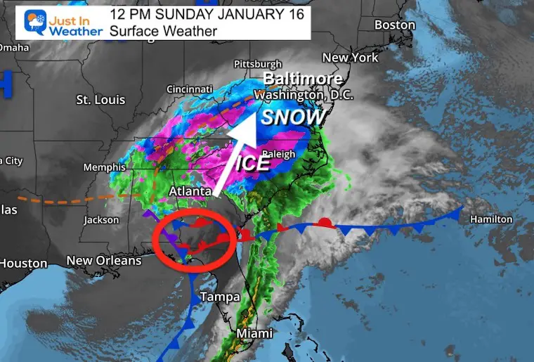
Sunday January 16 2022
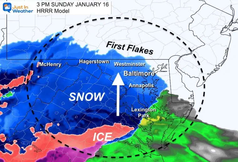
The storm is on our doorstep and will be spreading in over the next few hours. The timeline below shows it reaching metro Baltimore around 3 PM, give or take a little. There is a small window for kids to play in it this afternoon and early evening, before the change to ice and rain. I have been asked many questions about this storm, but most common two are these:
Q: Is there a chance this can still shift and give us more snow?
A: Not really. The snow will fall for most areas between 2 to 4 hours in duration. A little longer farther north and west. There will be some snow showers Monday morning as the cold air returns.
Q: How much icing will there be?
A: This is where there is a little variation among the models. It breaks down to the time for turn over to sleet and freezing rain, and how ling that may linger.
Below is a comparison of models to show the the spread of expectations.
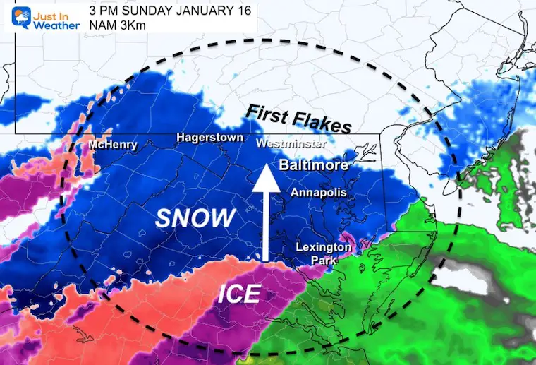
Snow will be moving into Maryland shortly. There may be some time it shows on radar, but does not reach the ground (virga). I will start Live Updates after 2 PM.
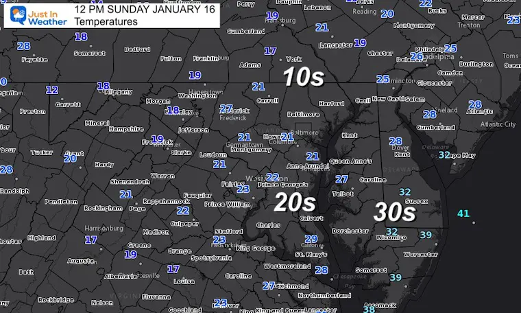
Deep layer of arctic air still in place with many teens and low 20s.

Sunday 1 PM to Monday 7 AM
Plotting the snow, then ice, then rain transition across the region. Snapshots are below.
Once it breaks through, it should become heavy within the first hour.
I wanted to also show the change back to snow showers with the return of colder air early Monday morning.
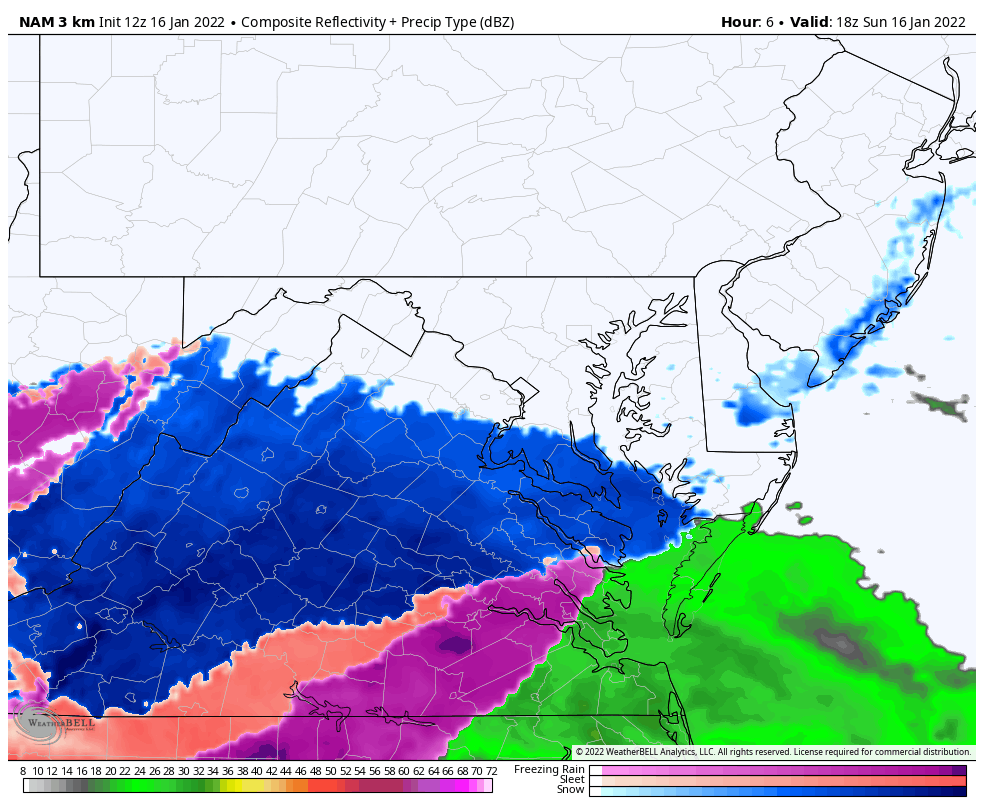
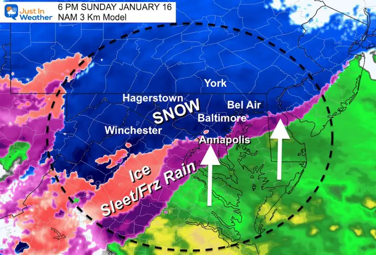
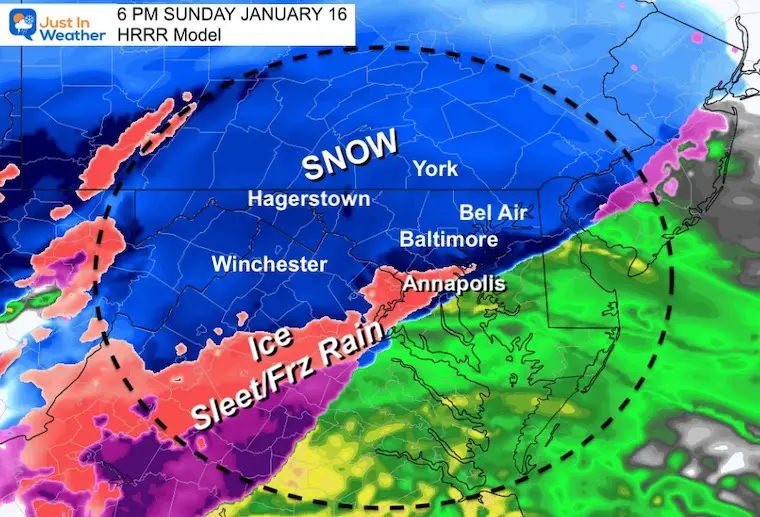
Comparing the NAM 3 Km to HRRR (High Resolution Models)
Both model show the first flakes reaching metro Baltimore at this time with some wiggle room of about 30 minutes
It may show on radar before reaching the ground through the very cold and dry air.
The NAM is showing a wider band/loner period of ice with the transition to Annapolis.
The HRRR has less ice, and a quicker change over entering Washington and Annapolis at this time.
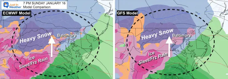
Global Model Comparisons
European ECMWF Vs GFS
7 PM
Fairly good agreement that mixing will be reaching Baltimore and Washington at this time.
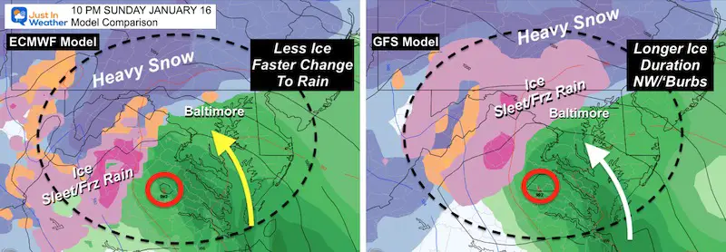
10 PM
Most of the region will be rain, but GFS keeps the icing another few hours for the inland suburbs of Maryland. I agree with the solution (on the right) as icing tends to last longer with arctic air displacement like we have in this storm.
This is the time Bay Coastal Flooding will become an issue.
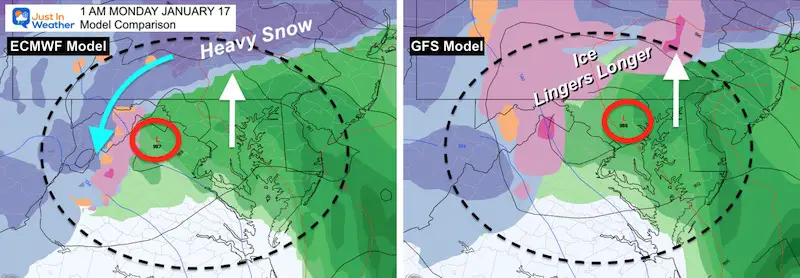
1 AM
Most of the region will be rain, but GFS keeps the icing another few hours in southern PA, with more ice in western Maryland. I agree with the solution (on the right) as icing tends to last longer with arctic air displacement like we have in this storm.
Bay Coastal Flooding will be at its worst between this time and daybreak.
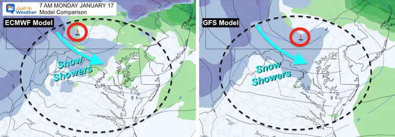
7 AM
Agreement with snow showers Monday morning… Temps will be close to freezing in western and northern suburbs.
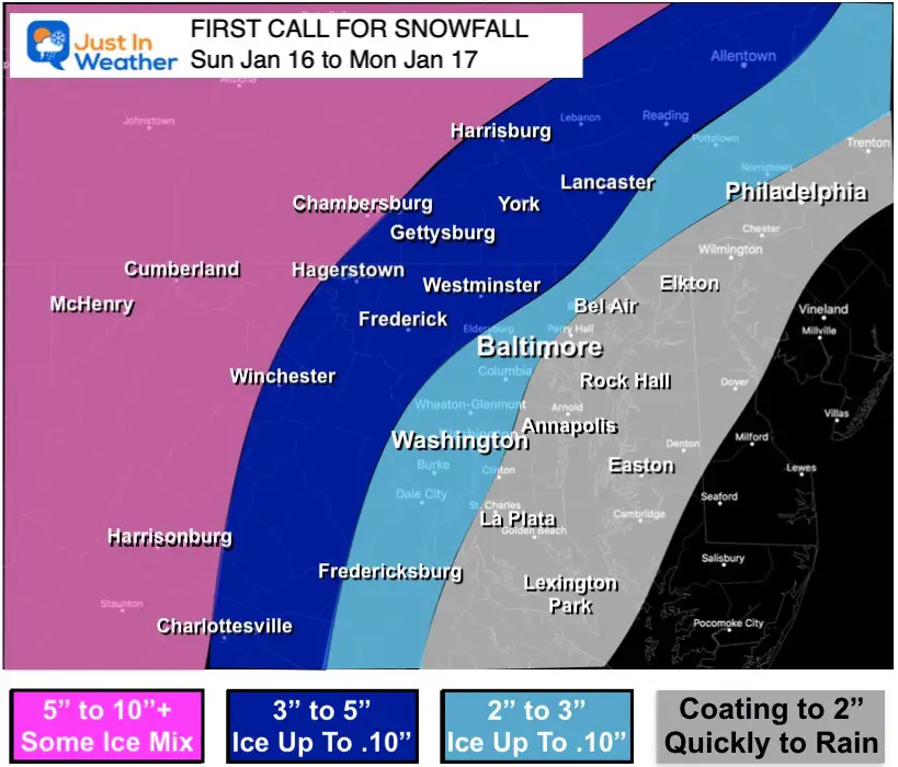
This is similar to my initial call. I adjusted the top end down an inch, simply because of the faster change over.
Mountains: There will be spots that could get over 10 inches, but there will be mixing of sleet that will could push even into Garrett County at times.


Last Winter Recap: My Old Outlook And Your Grades Of My Storm Forecasts


