Today is our storm day. Forgive me for making this personal, but today is my son’s 16th birthday. It was 10 years ago that he came up with the idea of Kid Weather, so this is an appropriate celebration.At least the storm and the holiday weekend will delay his drivers permit just a little.
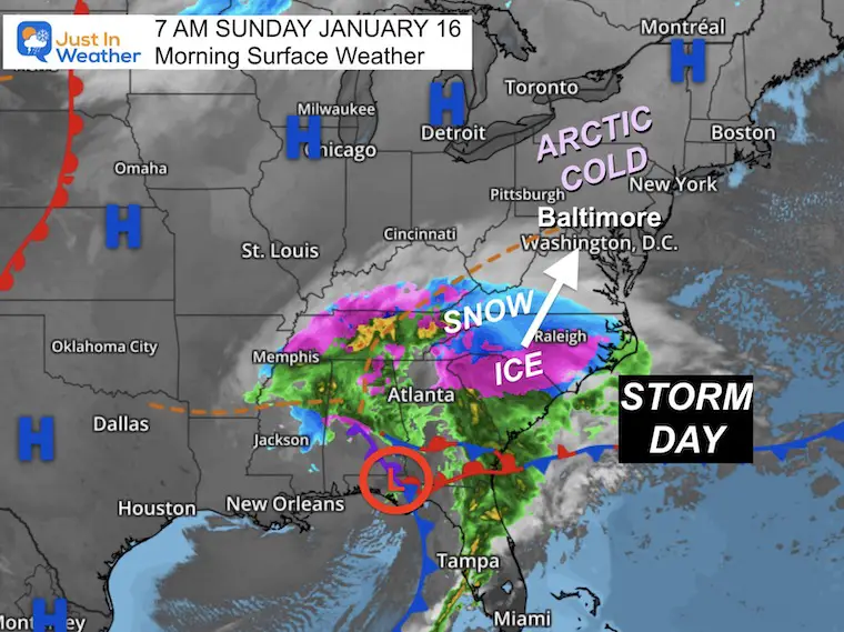
The winter storm that will move in to our region had arctic air that has helped establish a cold ground. When it begins it will easily stick, and and come down heavy in a hurry.
The specifics of the event are highlighted below. Timing is key! It will snow for a few hours.
Morning Surface Weather
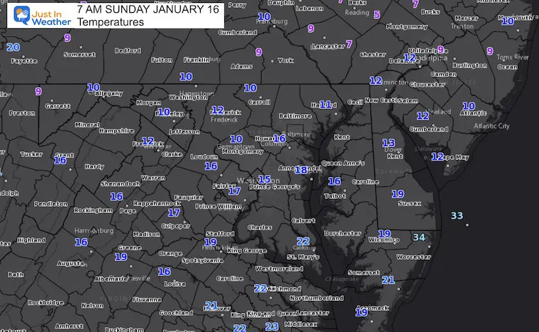
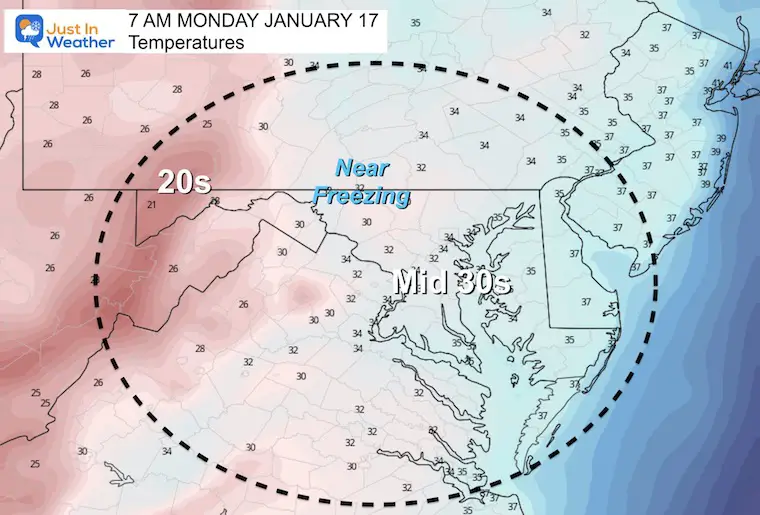
Morning Temperatures
Very cold start with most in the teens, and a few single digits. This has sufficiently chilled the roads ahead to the snow later.
Winter Storm Warning
Storm Headlines
Quick Stickage– Due to arctic air, the ground will support flakes laying and staying right away.
Heavy in a Hurry- Soon after the snow begins, it will intensify. This will lead to quick rates of 1/2” to 1” snow per hour.
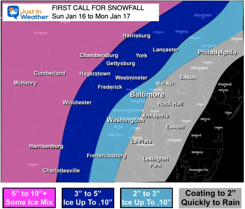
Thumping Dumping – Snow totals on the map below will take place between 2 to 4 hours in most areas. Snow totals need to be measured quickly, as rain will wash a lot away tonight.
Icing: Transition to sleet and freezing rain will be faster south and by the water. Inland will last longer, on top of deeper snow. This will cause a layer of ice on top.
Change to Rain: Fast push of warmer air in the south and by the water will reach Annapolis and Baltimore between 5 PM and 8 PM. Then spreading across the northern counties of Maryland into southern PA before midnight.
Heavy rain will melt a lot of the snow and ice overnight.
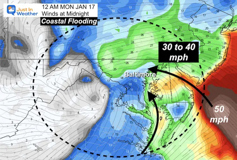
Winds will gusts OVER 40 mph. This is expected to lead to power outages, especially in areas with moderate snow and ice.
Coastal Flooding Tonight: Western Shore of the Bay and on the ocean front plan for high water. Baltimore City is already allowing free parking for vehicles garages and lots inland.Annapolis ‘docks’ will be submerges.
Monday morning: The main storm will be out of here, but leftover snow showers will fall. Temps will be around freezing, so impact should be minimal.
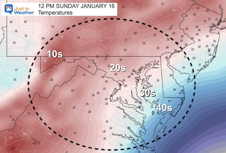
Temperatures At Noon
Before the snow arrives, roads will remain cold!
Radar Simulation —> slider
HRRR Model
*In my next report I will post a comparison of change over timing across the models. Consider a buffer of 1 to 2 hours form this forecast.
This is why warmer air will be taking over AND the expectation for flooding. Winds will be pushing/sloshing Bay water to the western Shore. This will impact Havre de Grace to Baltimore and Annapolis!
This may also knock out power for places with a few inches of snowcaked with ice as well.
My Call For Snowfall
This is similar to my initial call. I adjusted the top end down an inch, simply because of the faster change over.
Mountains: There will be spots that could get over 10 inches, but there will be mixing of sleet that will could push even into Garrett County at times.
Weather Almanac: Climate Data
TODAY January 16
Normal Low in Baltimore:24ºF
Record 1ºF in 1893
Normal High in Baltimore: 41ºF
Record 71ºF 1953
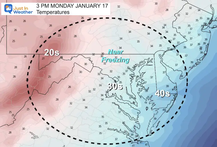
Monday Temperatures
Morning
Temps will push the 40s in the cities overnight, then cool back down by sunrise.
Afternoon
Nearly steady temps into the afternoon.
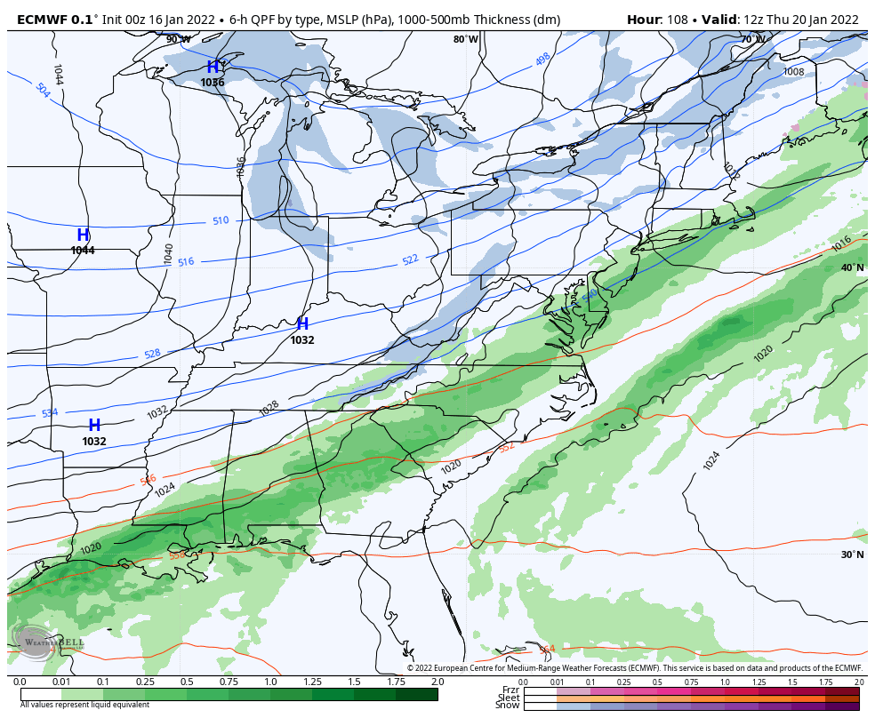
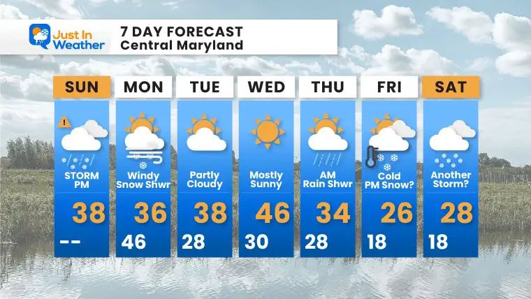
Looking Ahead: Thursday to Next Saturday
There may be another storm next weekend
7 Day Forecast
Mid week will be mild. We can explore the next potential storm closer after this first one passes.