


July 18 Flood Watch In The Mountains Then Storms Expand Back This Weekend
Friday, July 18 2025 Morning Report There is some relief in sight, but I remain cautious. For the short term, today remains muggy, while the focus of strong storms and…
Saturday January 15 2022 – Evening Update
It seems we have a good handle on the winter storm heading our way. I saw that because there is only a slight adjustment in this update to my thinking yesterday. I do want to break down the headlines which is what helps me categorize the storm for myself and clients.
The easy part is that most of us will see snow fall as this begins Sunday afternoon. Also, most of us will have it turn to rain along with STRONG WINDS overnight. In between are the details I note below with a new timeline slider.
To be blunt: If you do not have to travel or clear pavement, it is possible that:
But you still may want to work it and avoid spotty packed ice. Also, commercial properties should definitely work and stay ahead of the storm.
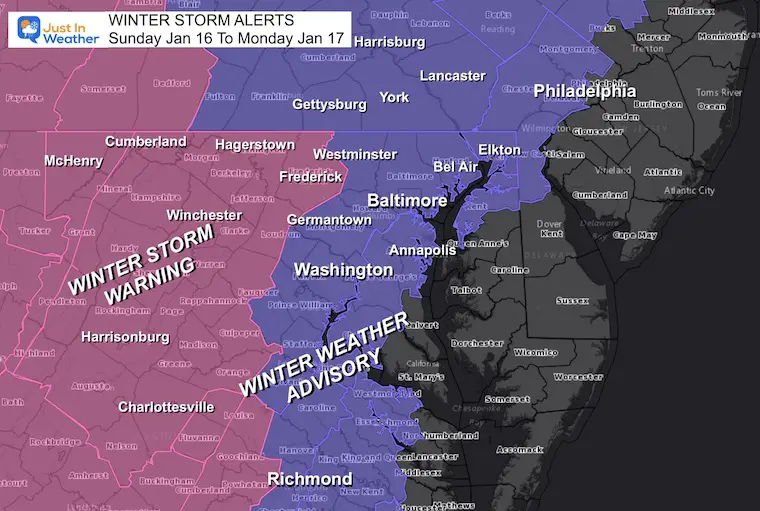
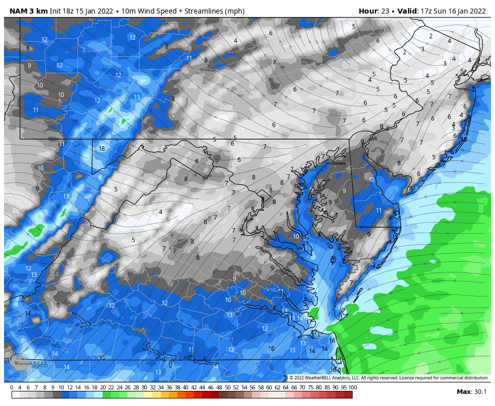
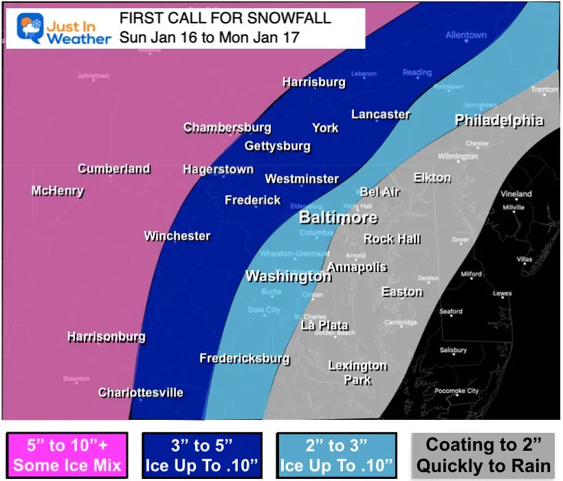
The new weather alerts fit the expectation with who will get a quick thump of snow and ice, compared to more snow farther inland.
My new snow map is below.
Winter Storm Warning (pink) separated by the mountains. This is where snow will last longer, and ice on top in some areas may lead to additional problems.
Winter Weather Advisory (purple) is where a quick thump of snowily impact travel. On average snow will fall for 2 to 4 hours. Then mixing to some sleet and freezing rain, and eventually rain by midnight!
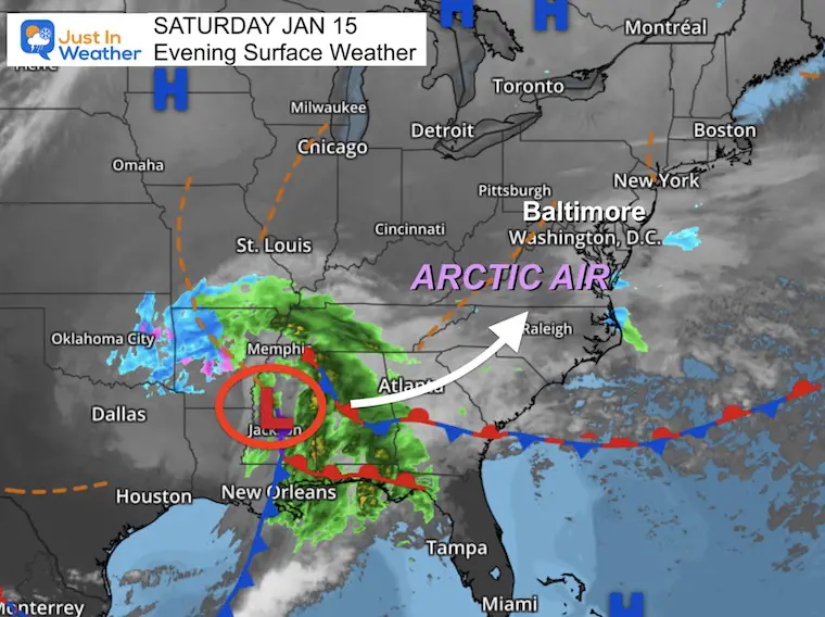
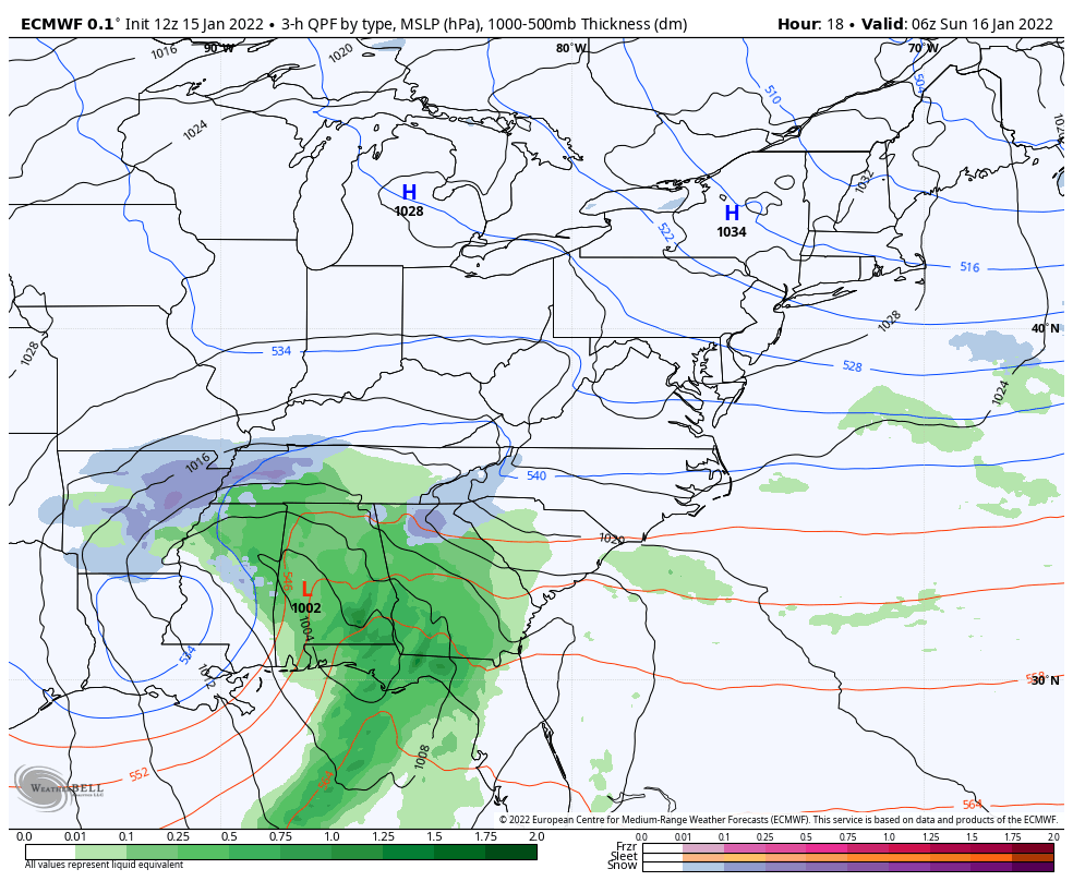
Low Pressure is located in central Mississippi. This is a little farther south than models had suggested. Arctic air has pushed deep into the Southeast US. This is going to set up a major ice storm for places like Charlotte, NC.
Saturday Night to Monday Afternoon
While in normal conditions that would have allowed the storm to then track south and east… this time the upper level ‘pull’ (I described yesterday) will direct the Low Pressure over central Maryland.
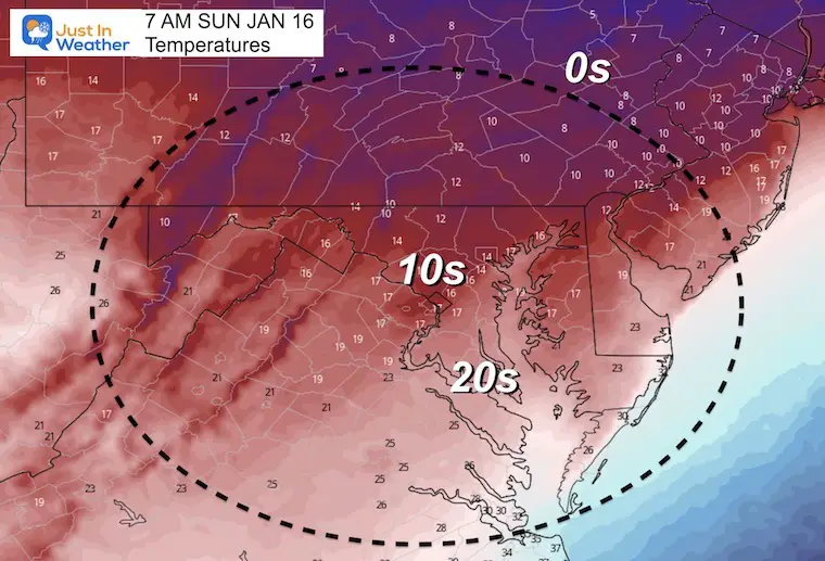
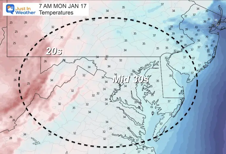
Most of our region will be own into the teens to lower 20s.
This sets up frozen ground that will allow quick stickie when the storm arrives.
I know it’s hard to imagine how we can start so cold, and then end up with rain. It is all based on the winds that will increase in speed and shift direction to the east and southeast. That will allow warmer air from the ocean to move into the Piedmont. But farther inland in the mountains is where the cold will hold.
Sunday 2 PM to 11 PM
*This is NOT perfect, but should help within an an hour or so of the arrival for the snow, then change to ice and rain.


*Slight adjustment of snow down on top edge of each zone.
*I did lower the potential icing to max at 0.10”
The tough thing is that if you do not measure right at the moment this turns to sleet and freezing rain, the end results will be packed down and melted when you wake up in the morning.
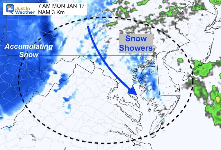
Behind the storm there will be colder winds and snow showers. We may get near freezing, with snow showers at daybreak. But this should not be too much of an impact.
Sign up and be the first to know!


Last Winter Recap: My Old Outlook And Your Grades Of My Storm Forecasts


