


May 3 Cooler Today Then More Rain Expected This Weekend
Friday May 3 Morning Report Another record high of 90ºF was reached yesterday at BWI. This tied the mark set in 2018. Today, a cooler wind will bring us closer…
Tuesday Afternoon Update
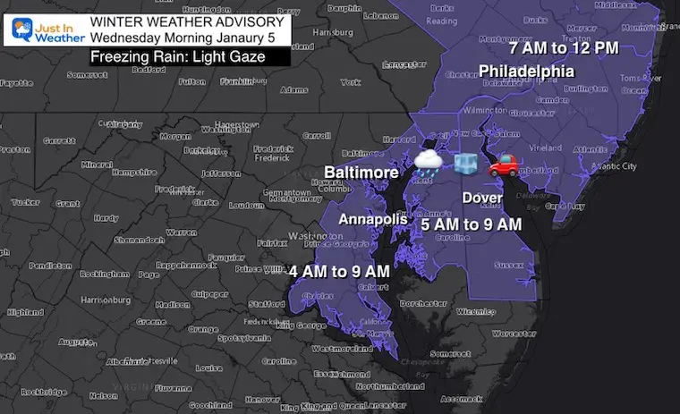
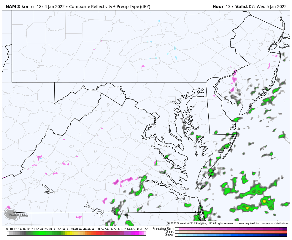
A light band of precipitation will be developing along the coast early Wednesday morning. The concern is that temperatures will be near or below freezing, but snow has chilled the ground in many areas that got hit on Monday.
The cloud should be mild enough to drop light rain, but it may freeze on contact to form a light glaze.
This includes most of the same counties near and east of I-95 that were under a Winter Storm Warning yesterday.
I’ve included the time for each region to show the impact from southern Maryland, anyone traveling between Baltimore to Philadelphia and New York up I-95. There it will be an issue a little later.
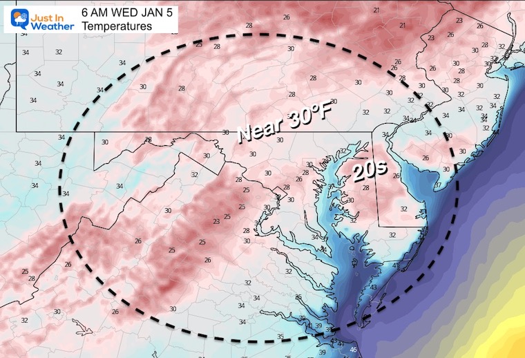
The HRRR Model shows the coldest potential readings in the morning.
The ground has cooled sufficiently, and will have time tonight for the surface to be colder than the air.
It is important to note that the models DO NOT tend to perform well with light precipitation. So this product can be deceiving. That is why I want to show a few plots for contrast.
Light precipitation can fall with temps near freezing, and land on ground that can be colder. This is more common in the early morning hours.
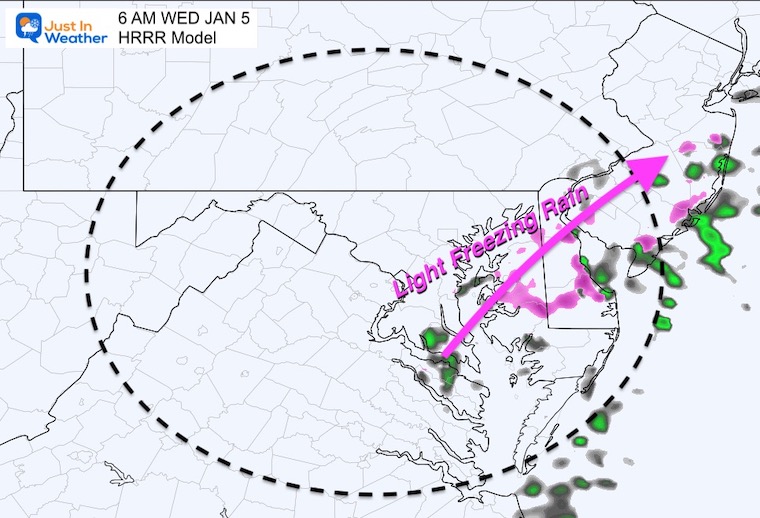
The back edge of this icing event will be cutting through metro Baltimore. This plot is west of the Advisory area. It is worth paying close attention to allow a buffer for where this sets up…
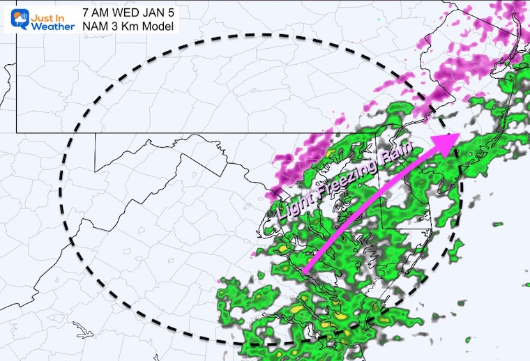
This shifted the band of precipitation a little farther east. Again, I do not want to lock in on this as being the final track. There still may be some impact in the areas shown in the earlier image.
Please see my notes below this loop.
I am not a fan of off hour runs… That is the model generation not using the full suite of weather balloon data at 7 AM and 7 PM. These intermediate plots can miss or shift something and then bump back… So I will be sharing another update this evening.
This will be a light event. With ice it can be the little ones that can cause a big problem. That is what I want to make sure you pay attention.
Next Snow Friday: My Thoughts From This Afternoon


Last Winter Recap: My Old Outlook And Your Grades Of My Storm Forecasts


