


January 13 Mild Ahead Of Arctic Front That Will Bring Rain To Snow Later Wednesday
Tuesday January 13 We are once again back to mild afternoons with sunshine. But that will change. The next cold front will lead the way for a series of arctic…
Tuesday December 28
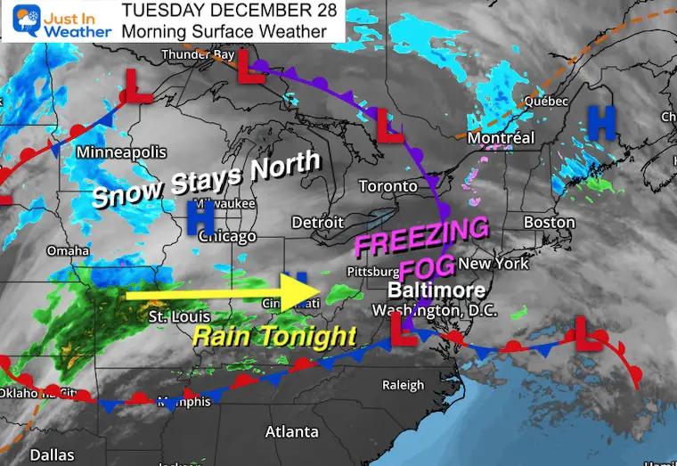
Many of the same areas that got snow with a coating on the grass yesterday, have temps near freezing with fog this morning. The result could be a glaze of ice on sidewalks, steps, and some side roads.
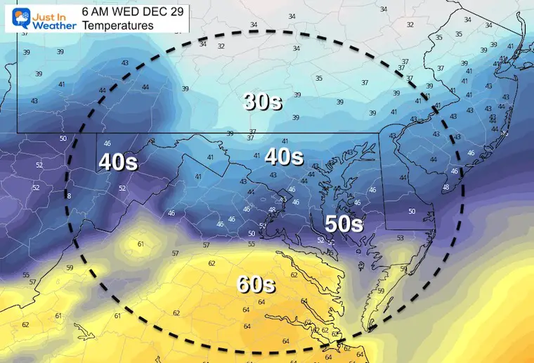
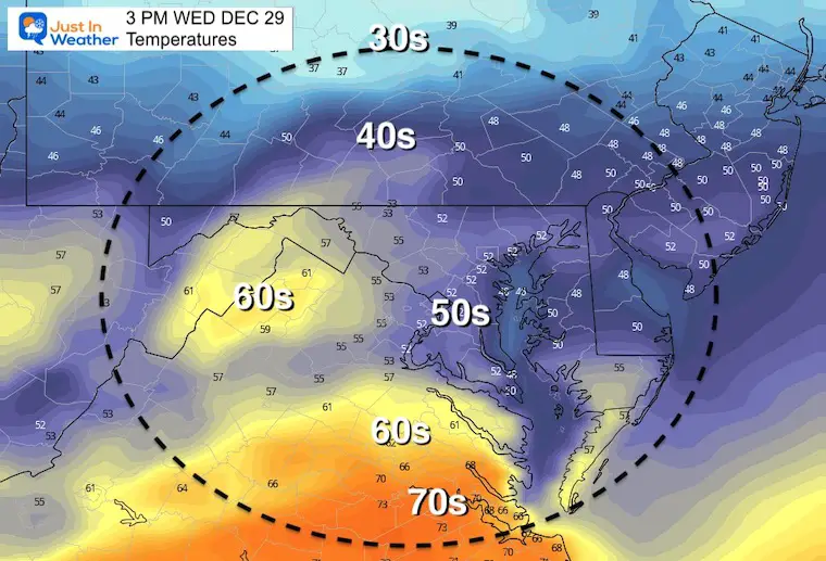
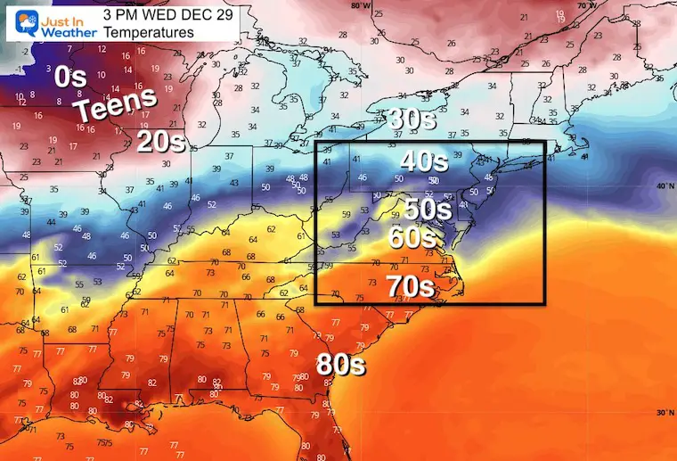
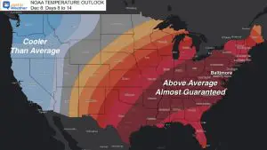
We will thaw today and remain above freezing for the rest of the week/year. The wide map of temperatures show a dramatic contrast of temps, with plenty of arctic air just north. We stay in the mild and active rainy side with a system almost every day.
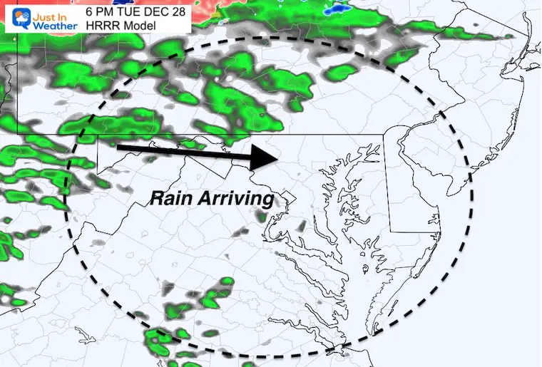
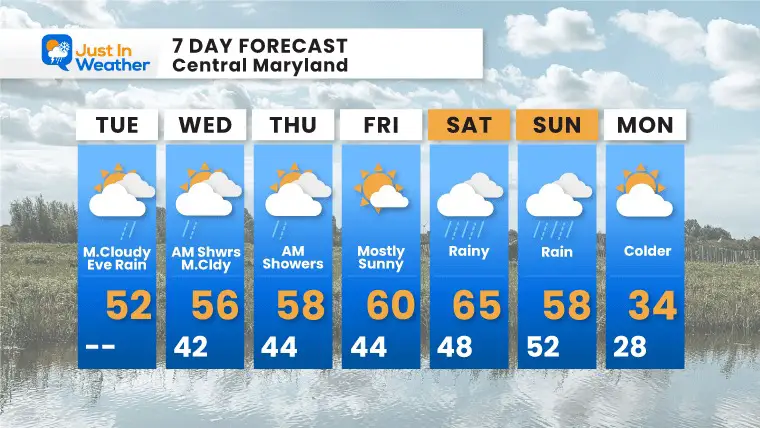
Note: The next two days will bring us rain mostly overnight. However, a larger rain event is expected this weekend/New Year’s Day.
Our outlook does dangle that carrot of a pattern change in early January. I must confess, this looks familiar to what we had last year. We then did have a very busy January into February (hint-hint).
I am showing a closer view to highlight the local temps below freezing north of Baltimore. This comes with areas of fog. Surfaces are icy, but that does not promise roads… Just worth considering it may. If you can hold off until 8 AM to drive, it will be safer.

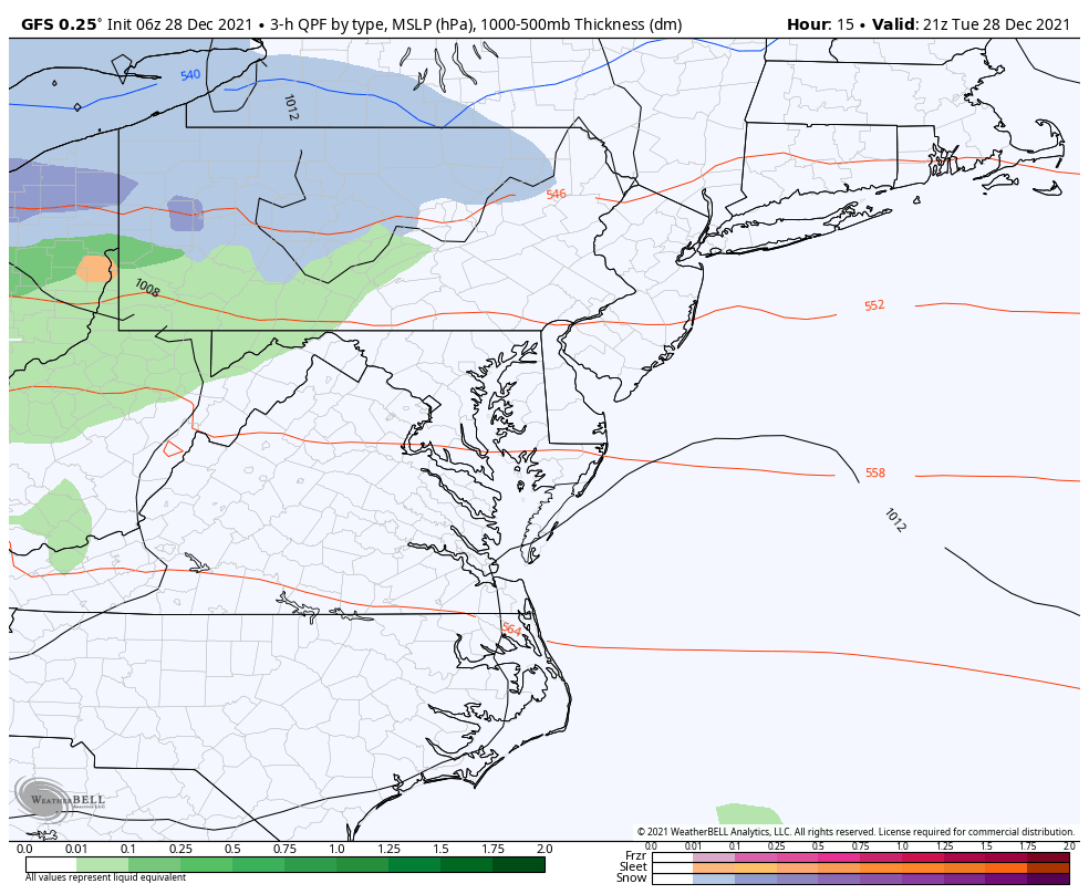
Beyond the morning issue with ice, look west to our next weather systems. This will arrive with rain this evening and overnight. The snow will remain well north of our region.

Normal Low in Baltimore: 26ºF
Record 10ºF in 2017
Normal High in Baltimore: 42ºF
Record 74ºF 1946
Rain Ends

Morning
Afternoon
You can drive 2 hours in either direction from Baltimore and either be in the 30s or 70s!
Tuesday Afternoon To Saturday Afternoon
January 1 to January 8
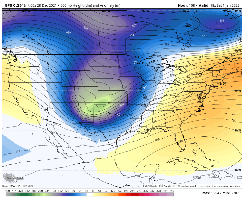
The upper level pattern is more reliable than any surface weather features in this time frame. Here we do see a push of colder air following the New Year’s Day rain storm. But it is short lived.
The big change now looks to be the second week of January. There is plenty of arctic air to spill our way… This should be the abrupt change similar to last winter. That is when it got pretty busy for us with frequent ice and snow events.
The driest day of the week will be Friday, New Year’s Eve. Rain and chilly temps expected New Year’s Day.
Sign up and be the first to know!

Last Winter Recap: My Old Outlook And Your Grades Of My Storm Forecasts


