Monday December 27
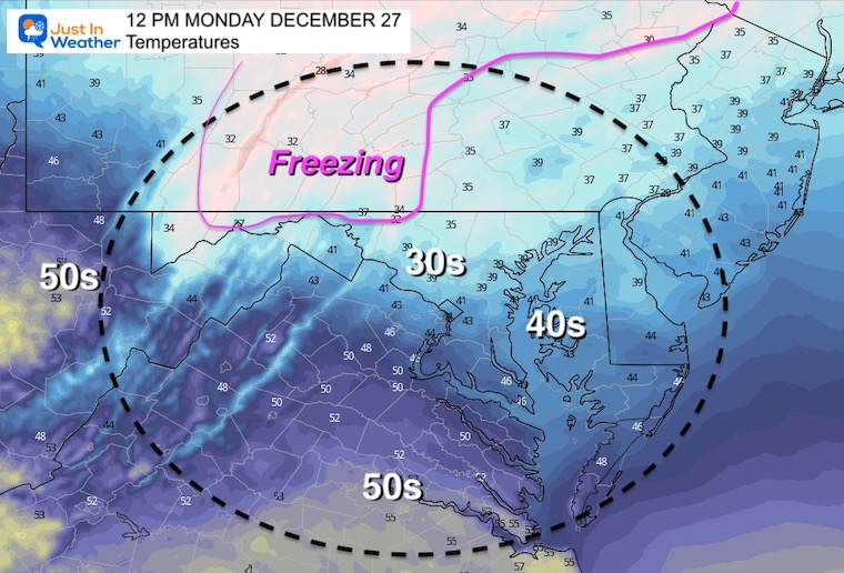
We may end up with one of the warmest Decembers on record, but winter is trying to fight its way in. Just cold enough for a mix of slushy snow and sleet this morning, but surface temps are marginal at best.
Below is a round up of temps this morning and through the day, travel issues will be north in Central PA to the Poconos.
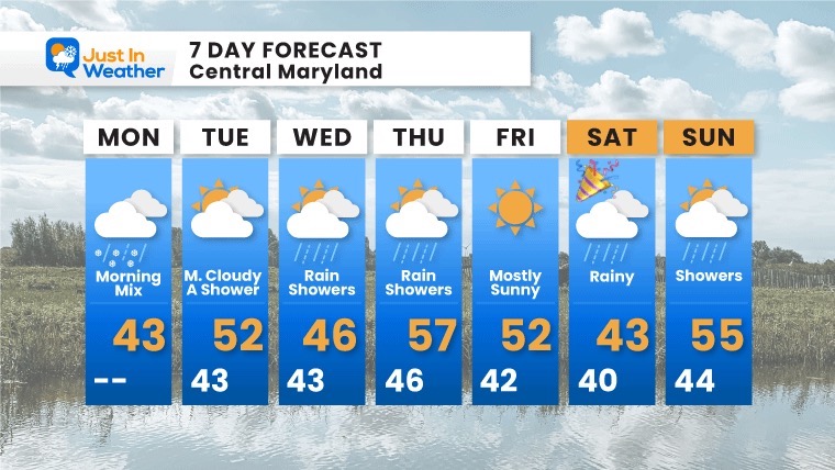
Most of the week will be mild with rain showers, starting with the afternoon.
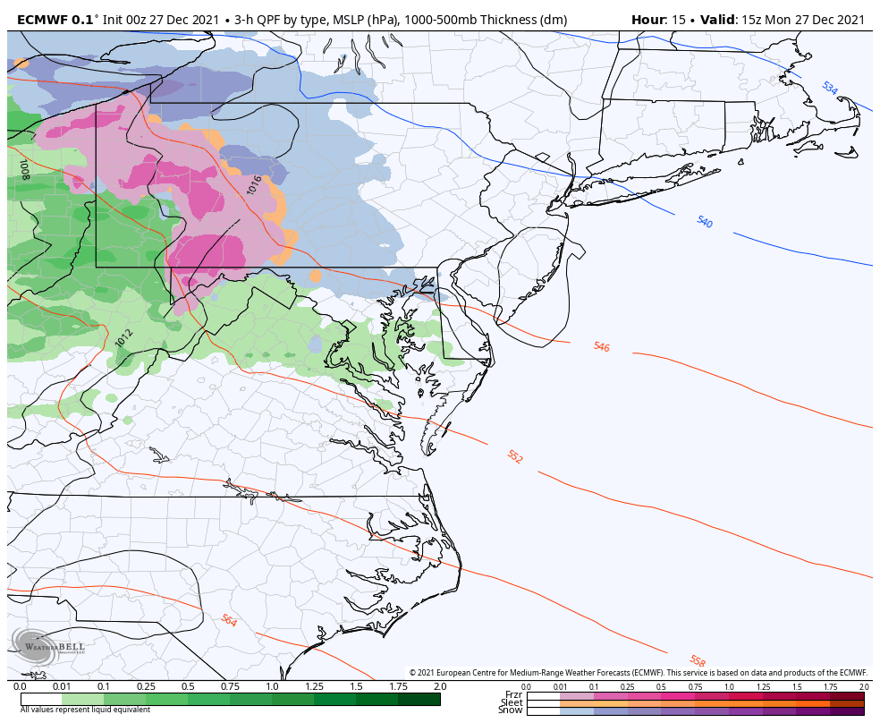
Morning Surface Weather
This narrow band of wintry weather is in the process of developing. So the precipitation will be enhancing and it spreads east.
At first, it may show on radar then dry up on the way to the ground… This will actually cool the atmosphere through evaporation and sublimation.
The result, if you begin with rain, it should mix with sleet and snow. But the warm air will win, and turn it back to rain after a couple of hours.
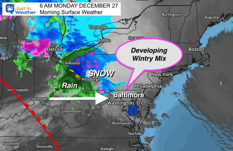
Note: We can expect central Maryland to central PA to begin to see this between 8 AM and 10 AM
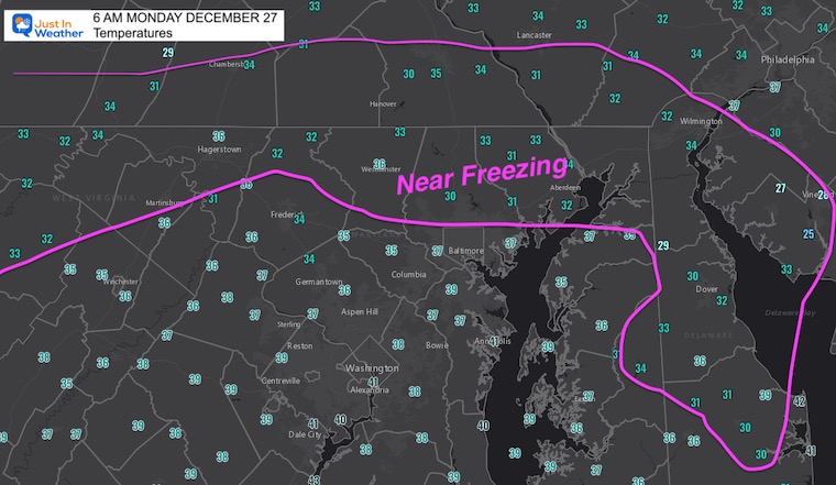
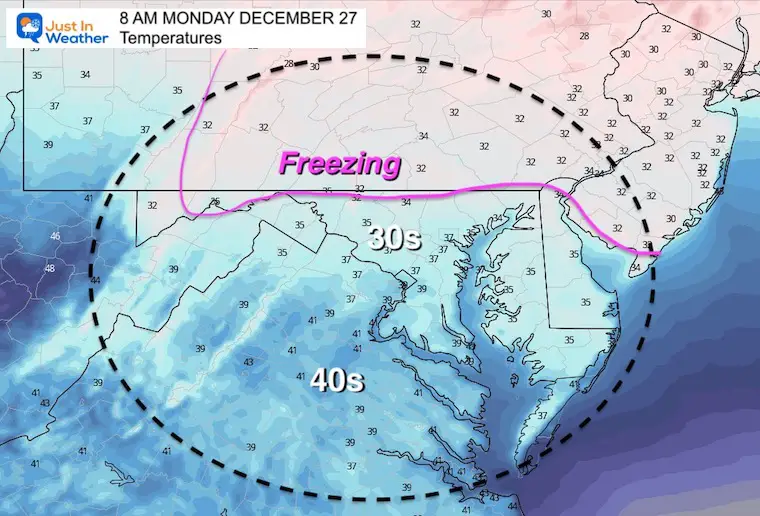
Temperatures Morning
Wintry Mix Animation
7 AM to 7 PM
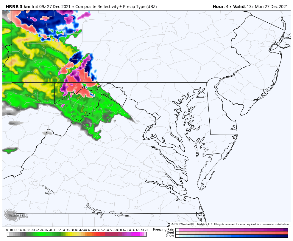
The HRRR Model shows the anticipated radar. A barrow band of snow and sleet may last 1 to 3 hours.
There will likely be more coverage than shown here. This product has a flaw to under-represent. That is why I include metro Baltimore and more of central Maryland.
Metro areas may begin with rain, then mix with sleet and snow, then back to rain by noon.
Monday Weather Notes:
- There is a good chance most of the region sees snow and or sleet falling.
- Any stickage is more likely on grass and elevated surfaces.
- Traveling up I-95, there should be some slushy snow, but roads will stay wet. They had warm days this weekend as well.
- Parts of I-70 to I-68 may have some slick spots over the mountains.
- Traveling north on I-81, west on I-76 to Pittsburgh, or northeast on I-78 into the Poconos this may impact roads.
- Winter Weather Advisory in central PA.
Temperature Forecast
7 AM
Noon
4 PM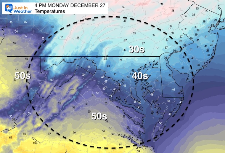
Weather Almanac: Climate Data
TODAY December 27
Normal Low in Baltimore: 26ºF
Record 5ºF in 1914
Normal High in Baltimore: 43ºF
Record 69ºF 2015
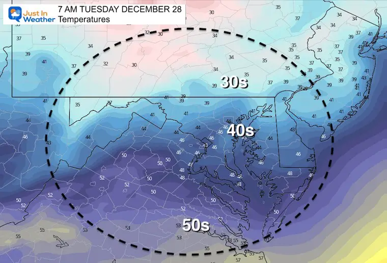
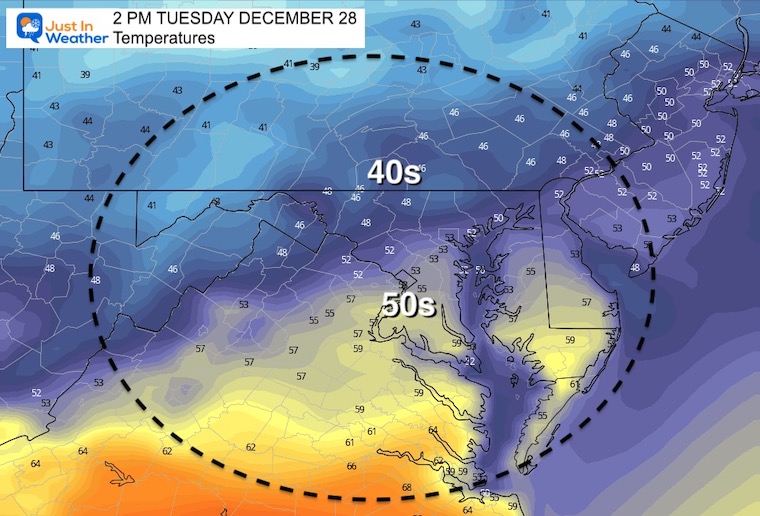
Tuesday Temperatures
Morning
Afternoon
Looking Ahead:
Monday Afternoon to Thursday Afternoon
An active pattern with mild air will keep the risk of rain showers with us most of the week. After a break on. Tuesday, showers return Tuesday night. The bulk of the rain is expected Wednesday night into Thursday morning.
7 Day Forecast
The driest day of the week will be Friday, New Year’s Eve. Rain and chilly temps expected New Year’s Day
ALSO SEE
Winter Outlook Series:
My Call For Snowfall

Last Winter Recap: My Old Outlook And Your Grades Of My Storm Forecasts


Please share your thoughts, best weather pics/video, or just keep in touch via social media


