


May 3 Cooler Today Then More Rain Expected This Weekend
Friday May 3 Morning Report Another record high of 90ºF was reached yesterday at BWI. This tied the mark set in 2018. Today, a cooler wind will bring us closer…
Wednesday December 29
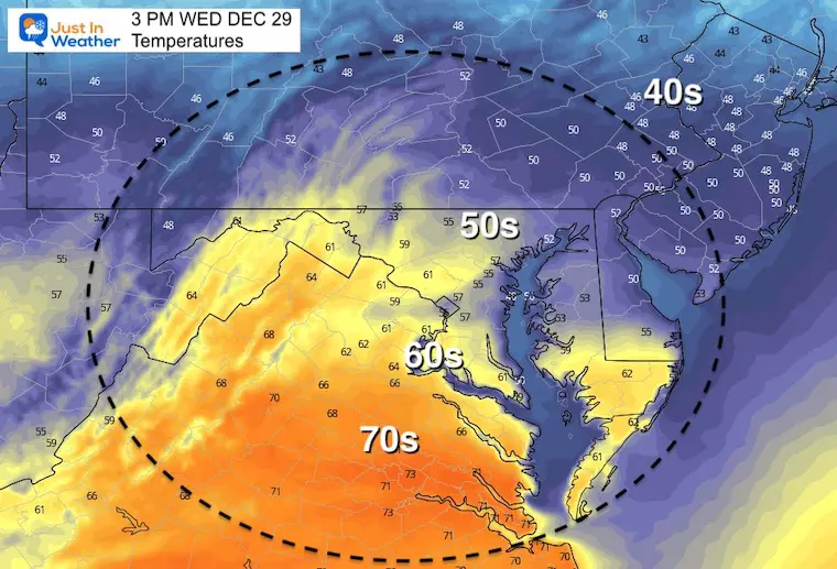
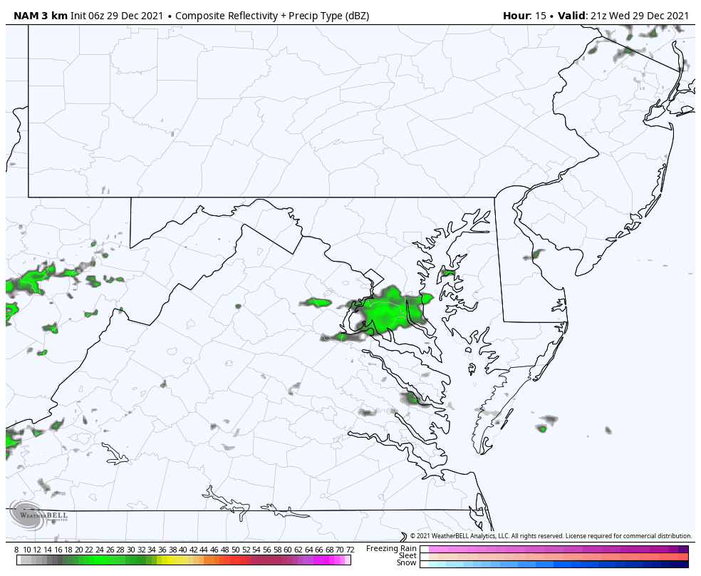
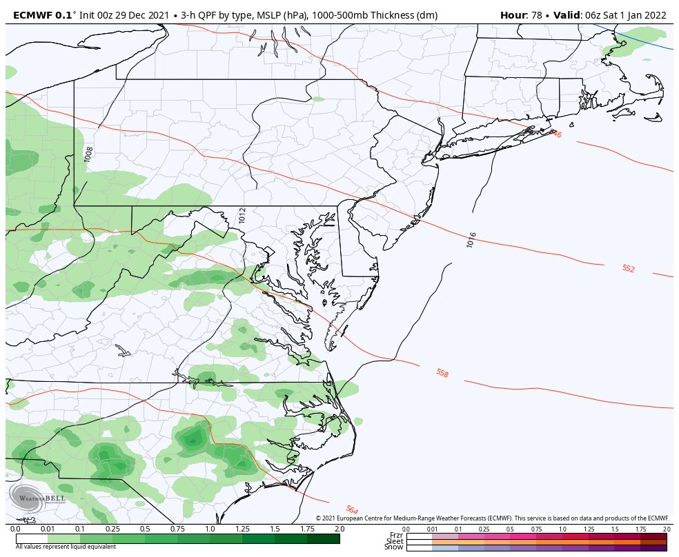
We remain in this pattern with rain at night, but dry breaks during the day. This morning we watch the latest round departing, but the roads are wet. The next push will start as showers this evening and rain tonight.
Our more pronounce rain will be Saturday- New Year’s Day.
Across the US we see as dramatic a contrast of temps, which will fuel a severe storm outbreak in the South today!
The boundary separating winter Vs. summer air is draped across the Mid Atlantic. That is the reason for our showers, and will establish the next rainy push later today.
The risk for severe storm will be just south of our region, along the very edge of the warm air. The energy is being fueled by the contrast of Bitter Cold to the North and a taste of summer to the south.

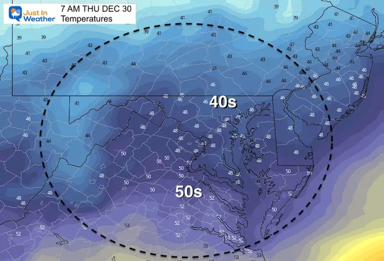
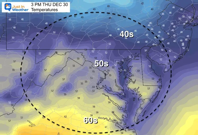
Locally we are mild in the 40s…
Northern Plains: Below Zero! These are actually readings (not wind chill) in the -20s across North Dakota!
Southern US/ Gulf Coast: Mornings temps into the 70s, feeling like summer!
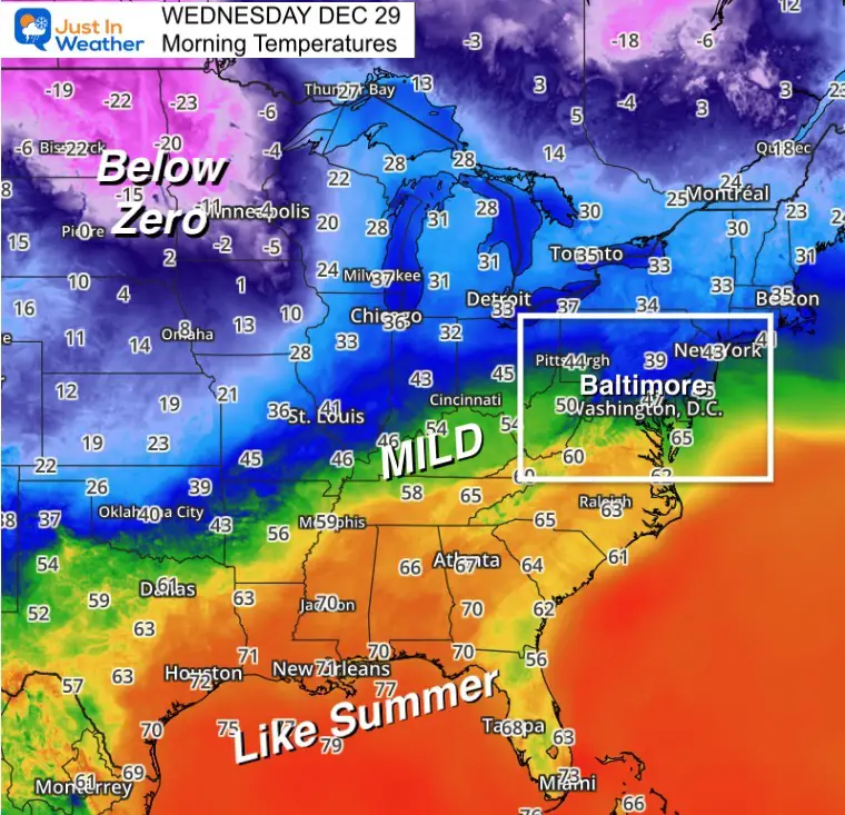
This may be the 3rd eruption of destructive weather this month.
Tornado Threat along with large hail and damaging winds are most likely across eastern Arkansas, northern Mississippi and Alabama, into central Tennessee.
There may be thunderstorms as far north as central Virginia where afternoon temps will reach the 70s.

4 PM Wed to 2 PM Thu
Rain returns by evening. Most falls overnight, but showers will linger through tomorrow morning.
Normal Low in Baltimore: 25ºF
Record 2ºF in 1917
Normal High in Baltimore: 42ºF
Record 77ºF 1946
Morning
Afternoon
1 AM Sat to 4 PM Sun
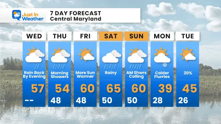
We remain warm for a few days. New Years Day will be the warmest, reaching the mid to upper 60s. However, that will come with periods of rain.
Some cold air will push back to start next week, and may bring flurries. No significant is expected in this time frame, but the colder pattern will be shifting to the eastern US during January.

Last Winter Recap: My Old Outlook And Your Grades Of My Storm Forecasts


